File:Hurricane katrina damage gulfport mississippi.jpg

Tập tin gốc (3.008×2.000 điểm ảnh, kích thước tập tin: 2,64 MB, kiểu MIME: image/jpeg)
Chú thích
Chú thích
Miêu tả[sửa]
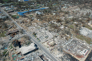
Long Beach, Mississippi, September 6, 2005 -- Destroyed businesses and municipal buildings on Jeff Davis Avenue in Long Beach, Mississippi from Hurricane Katrina (Long Beach is west of Gulfport and east of Pass Christian.) This photo shows the street at an angle but Jeff Davis actually runs North (upper left edge of the picture) to South (lower right) with the South part of the street at the photo's edge being approximately 200 yards from the Gulf of Mexico to approximately half-a-mile from the Gulf on the North end. The long, blue building is Harper McCaughan Elementary School, which appears to be shifted off of its foundation. To the north of that is Long Beach Public Library, with Long Beach City Hall to the north of the library. Although these building appear to be standing, upon closer inspection, they were heavily damaged and most had to be destroyed and re-built or re-located. The East-West streets showing are (going north) 5th Street, 4th St., and 3rd St. (the school and library intersection), 2nd St., then a little of the railroad tracks. There used to be as many houses on 4th and 5th streets as on 3rd St. and all the roads used to have a heavy cover of trees. The debris piles do not show very much in this photo because a lot of debris had been cleared from the area during the week between when the storm hit and this photo was taken, but the water-line debris piles created by the storm surge were at least 10-15 feet high in places (the debris line is more noticeable if you look at the roofs of the buildings.) Many of the businesses never came back but the City of Long Beach has done a very nice job of rebuilding the street much nicer than it was before.
The area in this photo is a fairly low-lying area. Hurricane Katrina caused extensive damage all along the Mississippi Gulf Coast with Waveland, Mississippi taking the strongest hit of the entire storm as it was right along the Northeast edge of the eye wall where the strongest winds of a hurricane reside.
From a long-time Beach resident... (edit by K. Dubuisson on 8/30/2011 not completed due to time constraint)
The section of Long Beach north of the railroad tracks is making a very speedy recovery, thanks to the diligence of City workers and all of the many volunteers in the area. The outpouring of support from all over the country has been incredible and greatly appreciated.
The section of Long Beach south of the tracks is a different story, although debris removal is coming along and a very few people have moved back into their homes. All (but one) of the people on Highway 90 lost their homes completely (gone with no trace), almost all on 5th and 4th streets have lost their homes completely, and most of the homes on 2nd and 3rd streets are heavily damaged, either by wind or by water. Most did not have flood insurance, except on Highway 90.
Some of us are having to get structural engineers to tell us whether or not it is feasible to repair our home or better to tear it down and start over. People have also hired structural engineers to try to prove that the wind took their home before the tidal surge brought all of the damaging water. If they can prove the wind took it, then their homeowner's insurance should pay. Otherwise ... FEMA is supposed to help with either low interest loans or grants. Most of us have not gone that far yet. Everything is still up-in-the-air (Oct 15, 2005), even after all of this time. (Volunteer structural engineers would be a blessing!)
Source[sửa]
Photo courtesy FEMA/Mark Wolfe
This image is from the FEMA Photo Library (obsolete as of 2019).
An archived copy may be found at the Wayback Machine (note: link may be permanently dead, as not all photos were backed up in this way).
If the FEMA link is permanently dead, the photo can be found at NARA Access to Archival Databases (only works if photo was taken between 1989 and October 2004), or at City-data.com.
Giấy phép[sửa]
This image is a work of a Federal Emergency Management Agency employee, taken or made as part of that person's official duties. As works of the U.S. federal government, all FEMA images are in the public domain in the United States. Additional media usage information may be found at https://www.fema.gov/photo-video-audio-use-guidelines
|
Lịch sử tập tin
Nhấn vào ngày/giờ để xem nội dung tập tin tại thời điểm đó.
| Ngày/Giờ | Hình xem trước | Kích cỡ | Thành viên | Miêu tả | |
|---|---|---|---|---|---|
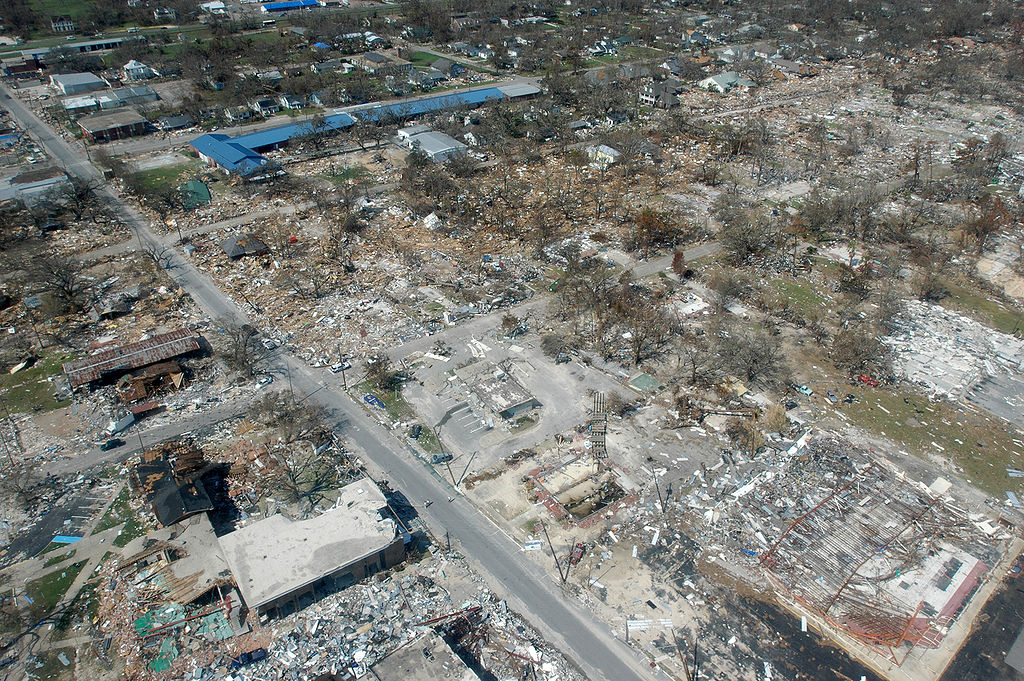
| hiện tại | 03:42, ngày 7 tháng 9 năm 2005 | | 3.008×2.000 (2,64 MB) | Tom (thảo luận | đóng góp) | {{PD-USGov}} http://www.photolibrary.fema.gov/photodata/original/14801.jpg Gulfport, Miss., September 6, 2005 -- Destroyed houses in Gulfport, Miss. Hurricane Katrina caused extensive damage all along the Mississippi gulf coast. New Orleans is being eva |
Bạn không được phép ghi đè tập tin này.
Trang sử dụng tập tin
3 trang sau sử dụng tập tin này:
Sử dụng tập tin toàn cục
Những wiki sau đang sử dụng tập tin này:
- Trang sử dụng tại ar.wikipedia.org
- Trang sử dụng tại ast.wikipedia.org
- Trang sử dụng tại bn.wikipedia.org
- Trang sử dụng tại de.wiktionary.org
- Trang sử dụng tại el.wikipedia.org
- Trang sử dụng tại en.wikipedia.org
- Geography of the United States
- Actuary
- Portal:Mathematics
- Hurricane Katrina
- Wikipedia:Today's featured article/September 10, 2006
- Hurricane Katrina effects by region
- Effects of Hurricane Katrina in Mississippi
- Tropical cyclone preparedness
- Portal:Tropical cyclones
- Wikipedia:Today's featured article/September 2006
- Effects of tropical cyclones
- User:Alex1996Ne/Neat Pictures
- User:E. Brown/Hurricane Hall of Fame, continued
- List of costliest Atlantic hurricanes
- Portal:Business/Selected article
- Portal:Business/Selected article/6
- Trang sử dụng tại en.wikiversity.org
- Trang sử dụng tại es.wikipedia.org
- Trang sử dụng tại es.wikinews.org
- Trang sử dụng tại he.wikipedia.org
- Trang sử dụng tại hi.wikipedia.org
- Trang sử dụng tại hr.wikipedia.org
- Trang sử dụng tại ia.wikipedia.org
- Trang sử dụng tại id.wikipedia.org
- Trang sử dụng tại it.wikipedia.org
- Trang sử dụng tại ja.wikipedia.org
- Trang sử dụng tại kk.wikipedia.org
- Trang sử dụng tại kn.wikipedia.org
- Trang sử dụng tại kw.wikipedia.org
- Trang sử dụng tại li.wiktionary.org
- Trang sử dụng tại lv.wikipedia.org
- Trang sử dụng tại mn.wikipedia.org
- Trang sử dụng tại ms.wikipedia.org
- Trang sử dụng tại mwl.wikipedia.org
- Trang sử dụng tại nl.wikibooks.org
Xem thêm các trang toàn cục sử dụng tập tin này.