Category:A104 road (England)
Jump to navigation
Jump to search
trunk road in London and Essex   | |||||
| Upload media | |||||
| Instance of | |||||
|---|---|---|---|---|---|
| Location | |||||
| Transport network |
| ||||
| Connects with | |||||
| Length |
| ||||
 | |||||
Subcategories
This category has the following 4 subcategories, out of 4 total.
D
E
L
W
Media in category "A104 road (England)"
The following 23 files are in this category, out of 23 total.
-
 A104 Essex Road - geograph.org.uk - 5986531.jpg 1,024 × 768; 290 KB
-
 A104 Essex Road - geograph.org.uk - 5986610.jpg 1,024 × 768; 268 KB
-
 A104, Lea Bridge Rd - geograph.org.uk - 5809112.jpg 1,024 × 681; 196 KB
-
 Bakers Arms, Leyton, E10.jpg 3,000 × 2,000; 2.11 MB
-
 Balls Pond Road - geograph.org.uk - 1092018.jpg 640 × 480; 66 KB
-
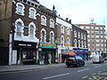
 Business Units on Lea Bridge Road - geograph.org.uk - 403575.jpg 640 × 480; 97 KB
-
 Dalston Lane - geograph.org.uk - 1507092.jpg 480 × 640; 91 KB
-
 Dalston Lane at Amhurst Road crossing - geograph.org.uk - 655203.jpg 640 × 480; 89 KB
-
 Dalston Lane, London E8 - geograph.org.uk - 1768724.jpg 3,072 × 2,304; 2.48 MB
-
 Dalston Lane, London E8 - geograph.org.uk - 1768730.jpg 3,072 × 2,304; 2.26 MB
-
 Essex Road, Islington - geograph.org.uk - 1588251.jpg 480 × 640; 91 KB
-
 Frosty morning, Woodford Green - geograph.org.uk - 92356.jpg 640 × 480; 150 KB
-

-
 High Road, Woodford Bridge, Essex - geograph.org.uk - 79098.jpg 480 × 640; 109 KB
-
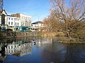
 Lea Bridge - geograph.org.uk - 3296976.jpg 640 × 430; 74 KB
-
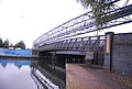
 Lea Bridge Road - geograph.org.uk - 102798.jpg 640 × 480; 62 KB
-
 Lea Bridge Road looking towards Clapton - geograph.org.uk - 403549.jpg 640 × 480; 141 KB
-
 Lea Bridge Road looking towards Leyton - geograph.org.uk - 403551.jpg 640 × 480; 135 KB
-
 Shops, Dalston Lane, London E8 - geograph.org.uk - 1768769.jpg 3,072 × 2,304; 2.4 MB
-
 The Lea Bridge - geograph.org.uk - 403560.jpg 640 × 480; 160 KB
-
 The Robin Hood - geograph.org.uk - 99306.jpg 640 × 480; 95 KB
-
 UK road A104.PNG 597 × 184; 7 KB
-
 UK road A104.svg 445 × 190; 2 KB


