Category:London Borough of Hackney
Jump to navigation
Jump to search
Boroughs of London: City of London · City of Westminster · Barking and Dagenham · Barnet · Bexley · Brent · Bromley · Camden · Croydon · Ealing · Enfield · Greenwich · Hackney · Hammersmith and Fulham · Haringey · Harrow · Havering · Hillingdon · Hounslow · Islington · Kensington and Chelsea · Kingston · Lambeth · Lewisham · Merton · Newham · Redbridge · Richmond · Southwark · Sutton · Tower Hamlets · Waltham Forest · Wandsworth
borough in the London Region in England  Rådhuset i Hackney   | |||||
| Upload media | |||||
| Instance of | |||||
|---|---|---|---|---|---|
| Location | Greater London, London, England | ||||
| Legislative body |
| ||||
| Executive body |
| ||||
| Head of government |
| ||||
| Inception |
| ||||
| Population |
| ||||
| Area |
| ||||
| Replaces | |||||
| official website | |||||
 | |||||
Subcategories
This category has the following 23 subcategories, out of 23 total.
Media in category "London Borough of Hackney"
The following 200 files are in this category, out of 2,281 total.
(previous page) (next page)-
 "Footloose", narrowboat on Regent's Canal, Hackney - geograph.org.uk - 5762876.jpg 3,648 × 2,736; 2.88 MB
-
 "Ilion", narrowboat on Regent's Canal, Hackney - geograph.org.uk - 5762912.jpg 3,648 × 2,736; 3.22 MB
-
-
 "Old King's Head" public house, Holywell Row - geograph.org.uk - 4200271.jpg 1,600 × 1,060; 380 KB
-
 "The Duke of Wellington" public house, Nile Street - geograph.org.uk - 4156860.jpg 1,600 × 1,513; 583 KB
-
 "The Hop Pole" public house, Pitfield Street - geograph.org.uk - 3666924.jpg 1,800 × 1,348; 2.13 MB
-
 "The Kings Stores" public house sign, Widegate Street - geograph.org.uk - 5262051.jpg 1,128 × 1,600; 389 KB
-
 "The Plough" public house, Homerton High Street - geograph.org.uk - 5041564.jpg 2,169 × 2,750; 836 KB
-
 "The Star at Hackney Downs" public house - geograph.org.uk - 3880224.jpg 3,936 × 2,624; 1.51 MB
-
 "Tintagel" narrowboat goes under Wharf Road bridge - geograph.org.uk - 5763813.jpg 3,648 × 2,736; 2.95 MB
-
 'Hallowed Ground' ,South Millfields Park - geograph.org.uk - 3314420.jpg 4,288 × 3,216; 5.51 MB
-

-
 'Oliekop' on the Regent's Canal - geograph.org.uk - 1923388.jpg 1,280 × 960; 183 KB
-
 'The Water Jugglers', Hackney Marsh - geograph.org.uk - 5203988.jpg 3,072 × 2,048; 2.54 MB
-

-
 130 Tabernacle Street - geograph.org.uk - 2682315.jpg 446 × 640; 210 KB
-
 17-18 Clere Street - geograph.org.uk - 2683514.jpg 487 × 640; 177 KB
-
 171 Glenarm Road, Lower Clapton - geograph.org.uk - 3314483.jpg 3,722 × 2,884; 4.57 MB
-
 174 - 8 Albion Rd - geograph.org.uk - 5376563.jpg 640 × 426; 65 KB
-
 2016, a year on Geograph (Day 93) - geograph.org.uk - 4890537.jpg 640 × 480; 128 KB
-
 22 Cowper Street - geograph.org.uk - 2683536.jpg 562 × 640; 209 KB
-
 3-11 Westland Place - geograph.org.uk - 2599602.jpg 640 × 504; 171 KB
-
 30 Crown Place and Broadgate Tower - geograph.org.uk - 4338331.jpg 1,280 × 960; 304 KB
-
 69-85 Tabernacle Street - geograph.org.uk - 2684771.jpg 640 × 490; 175 KB
-
 86, Albion Rd - geograph.org.uk - 5376616.jpg 640 × 426; 62 KB
-
 A Child of the Jago - geograph.org.uk - 2856642.jpg 1,024 × 768; 145 KB
-
-
 A frozen Regent's Canal - geograph.org.uk - 2791157.jpg 2,386 × 1,790; 743 KB
-
 A frozen Regent's Canal ^2 - geograph.org.uk - 2791162.jpg 3,456 × 2,592; 2.98 MB
-
 A leafy corner of Manhattan - geograph.org.uk - 5464378.jpg 480 × 640; 113 KB
-
 A lion on Green Lanes - geograph.org.uk - 4390714.jpg 4,000 × 3,000; 4.05 MB
-
 A Lock on the Lea or Lee.jpg 2,560 × 1,920; 1.1 MB
-
 A lot of scaffolding at the front of a house - geograph.org.uk - 4925578.jpg 6,000 × 4,000; 4.34 MB
-
 A partially submerged yacht - geograph.org.uk - 3907236.jpg 3,456 × 2,592; 3.14 MB
-
 A rainy day on Walthamstow Marshes - geograph.org.uk - 5343829.jpg 1,600 × 1,067; 249 KB
-
 A small green area, Hackney - geograph.org.uk - 2193837.jpg 640 × 480; 107 KB
-
 A speedboat on the West Reservoir - geograph.org.uk - 3907267.jpg 3,456 × 2,592; 3.02 MB
-
 A Sunny Day on the Lea or Lee.jpg 2,560 × 1,920; 2.45 MB
-
 A Walk by the River - geograph.org.uk - 4830666.jpg 3,369 × 2,694; 2.45 MB
-
 A104 - A107 junction - geograph.org.uk - 5798711.jpg 640 × 426; 67 KB
-
 A105, B105 junction - geograph.org.uk - 3839373.jpg 640 × 430; 59 KB
-
 A106 bridge, Lea Navigation - geograph.org.uk - 3304648.jpg 640 × 430; 44 KB
-
 A107 - geograph.org.uk - 5358118.jpg 640 × 426; 61 KB
-
 A107 Bridge, Regents Canal - geograph.org.uk - 2899502.jpg 640 × 430; 75 KB
-
 A107, Amhurst Rd - geograph.org.uk - 3320806.jpg 640 × 430; 44 KB
-
 A107, Hackney - geograph.org.uk - 3320813.jpg 640 × 430; 57 KB
-
 A12 - geograph.org.uk - 3119782.jpg 640 × 427; 72 KB
-
 A12 going through Olympic Park - geograph.org.uk - 4389921.jpg 1,600 × 1,200; 525 KB
-
 A12 over the Lea Navigation - geograph.org.uk - 3304623.jpg 640 × 430; 52 KB
-
 A1202 - geograph.org.uk - 3863347.jpg 640 × 430; 63 KB
-
 A1207 - geograph.org.uk - 5354696.jpg 640 × 426; 59 KB
-
 A1207 in Hackney - geograph.org.uk - 3863432.jpg 640 × 430; 48 KB
-
 Abandoned Building, Englefield Road, Salston.jpg 5,212 × 3,474; 14.98 MB
-
 Access road near Copper Box - geograph.org.uk - 3118416.jpg 640 × 427; 71 KB
-
 Access to the A106, Eastway - geograph.org.uk - 5526023.jpg 5,184 × 3,456; 6.51 MB
-

-
 Albion Grove - geograph.org.uk - 5376576.jpg 640 × 426; 74 KB
-
 Alcester Crescent - geograph.org.uk - 5803063.jpg 640 × 426; 69 KB
-
 Alexandra Trust dining rooms, EC1 - geograph.org.uk - 2051793.jpg 3,504 × 2,336; 1.96 MB
-

-
 Alive and dead pubs - geograph.org.uk - 4747267.jpg 640 × 480; 102 KB
-
 Alkham Rd - geograph.org.uk - 5366043.jpg 640 × 426; 71 KB
-
 Alkham Rd - geograph.org.uk - 5366052.jpg 640 × 426; 74 KB
-
 Allerton Road, N16 - geograph.org.uk - 4577696.jpg 640 × 480; 91 KB
-
 Alley to Kayani Avenue - geograph.org.uk - 3833429.jpg 640 × 430; 63 KB
-
-
-
-
 Allpress Espresso Roastery ^ Cafe, Dalston Lane - geograph.org.uk - 5591757.jpg 4,896 × 3,672; 6.06 MB
-
 Along the A10 - geograph.org.uk - 4908992.jpg 640 × 427; 85 KB
-
 Along the New River.jpg 1,280 × 960; 275 KB
-
 Alongside Regent's Canal - geograph.org.uk - 6218978.jpg 1,024 × 678; 786 KB
-
 Amhurst Park (A107), N16 - geograph.org.uk - 4579845.jpg 640 × 480; 83 KB
-
 Amhurst Park, Stamford Hill - geograph.org.uk - 2763408.jpg 4,320 × 3,240; 4.34 MB
-
 Anchor ^ Hope public house, River Lea, Clapton - geograph.org.uk - 1918801.jpg 3,264 × 2,448; 2.95 MB
-
-
 Another capsized yacht - geograph.org.uk - 3907232.jpg 3,456 × 2,592; 3.11 MB
-
 Another capsized yacht ^2 - geograph.org.uk - 3907247.jpg 3,456 × 2,592; 3.23 MB
-
 Another closed pub^ - geograph.org.uk - 3341208.jpg 1,024 × 691; 151 KB
-
 Apartment block, Hackney - geograph.org.uk - 3320814.jpg 640 × 430; 56 KB
-
 Apartment blocks - geograph.org.uk - 3294225.jpg 640 × 430; 57 KB
-
-
 Apartments blocks, Seven Sisters Rd - geograph.org.uk - 3832014.jpg 640 × 430; 52 KB
-
 Apartments, Albion Rd - geograph.org.uk - 5376537.jpg 640 × 425; 56 KB
-
 Apartments, Amhurst Park - geograph.org.uk - 3832021.jpg 640 × 430; 67 KB
-
 Appold Street - geograph.org.uk - 5162732.jpg 640 × 425; 184 KB
-
 Approach to Lea Bridge roundabout, Upper Clapton Road - geograph.org.uk - 2303178.jpg 1,600 × 1,200; 618 KB
-
 Approaching Shoreditch Fire Station - geograph.org.uk - 5747607.jpg 5,184 × 3,888; 6.51 MB
-
 Approaching Sturt's Lock - geograph.org.uk - 3443676.jpg 959 × 1,280; 420 KB
-
 Approaching the River Lea - geograph.org.uk - 5354723.jpg 640 × 426; 76 KB
-
 Arch to Mother's Square - geograph.org.uk - 5798705.jpg 640 × 425; 49 KB
-
 Ardleigh Rd - geograph.org.uk - 5385420.jpg 640 × 426; 77 KB
-
 Art wall on Wenlock Road - geograph.org.uk - 2354472.jpg 3,456 × 2,592; 2.86 MB
-
 Art wall on Wenlock Road ^2 - geograph.org.uk - 2354488.jpg 3,456 × 2,592; 3.02 MB
-
 Ashpitel Tomb, St John Churchyard, Hackney.jpg 1,152 × 864; 179 KB
-
 Athackneystadium.jpg 1,477 × 1,141; 488 KB
-
 Atherden Rd - geograph.org.uk - 5798318.jpg 640 × 425; 63 KB
-
 Avebury Court - geograph.org.uk - 2908066.jpg 640 × 430; 78 KB
-
 Ayrsome Rd - geograph.org.uk - 5373005.jpg 640 × 426; 73 KB
-
 B112 bridge, Lea Navigation - geograph.org.uk - 3299016.jpg 640 × 430; 62 KB
-
 Bakers Hill - geograph.org.uk - 5803090.jpg 640 × 425; 80 KB
-
 Balls Pond Road at the junction of Kingsland Road - geograph.org.uk - 5146521.jpg 2,048 × 1,536; 955 KB
-
 Barbauld Rd - geograph.org.uk - 5376565.jpg 640 × 426; 52 KB
-
 Barcham House, Riversdale Road, N5 - geograph.org.uk - 4577609.jpg 640 × 480; 104 KB
-
 Barges, Lea Navigation - geograph.org.uk - 3297039.jpg 640 × 430; 96 KB
-
 Barn St - geograph.org.uk - 5373018.jpg 640 × 426; 73 KB
-
 Barton House Health Centre - geograph.org.uk - 5376530.jpg 640 × 426; 55 KB
-
 Baxter's Court - geograph.org.uk - 4925595.jpg 6,000 × 4,000; 3.48 MB
-
 Beatty Road entrance, Newstoke House - geograph.org.uk - 5529146.jpg 1,067 × 1,600; 511 KB
-
 Beaumont Court - geograph.org.uk - 5798348.jpg 640 × 425; 85 KB
-
 Beck Road, Bethnal Green - geograph.org.uk - 4857072.jpg 4,000 × 3,000; 2.08 MB
-
 Beck Road, Hackney - geograph.org.uk - 4324789.jpg 2,272 × 1,704; 742 KB
-
 Beck Road, Hackney - geograph.org.uk - 4324795.jpg 2,272 × 1,704; 741 KB
-
 Beck Road.jpg 1,280 × 960; 325 KB
-
 Bedford House, Spitalfields - geograph.org.uk - 5656626.jpg 1,043 × 1,600; 566 KB
-
 Below the A12 - geograph.org.uk - 3304635.jpg 640 × 430; 38 KB
-
 Bethnal Green Gas Holder - geograph.org.uk - 4760732.jpg 960 × 1,280; 439 KB
-
 Bethnal Green Gas Holders by Regent's Canal - geograph.org.uk - 5409088.jpg 3,801 × 4,935; 4.15 MB
-
 Bethnal Green gasholders - geograph.org.uk - 5496955.jpg 3,264 × 2,448; 2.41 MB
-
 Bethnal Green, gasometers - geograph.org.uk - 3121306.jpg 1,024 × 743; 188 KB
-
 Bevenden Street at the junction of East Road - geograph.org.uk - 3105395.jpg 2,048 × 1,536; 1.52 MB
-
 Big Screen - Olympic Park - geograph.org.uk - 3118906.jpg 1,600 × 1,200; 398 KB
-
 Bikes for hire - geograph.org.uk - 2241742.jpg 640 × 480; 135 KB
-
 Bilney Lodge - geograph.org.uk - 5373007.jpg 640 × 426; 59 KB
-
 Block B, Timber Wharf - geograph.org.uk - 6219094.jpg 1,024 × 678; 775 KB
-
 Blossom on Green Lanes - geograph.org.uk - 4390709.jpg 4,000 × 3,000; 4.05 MB
-
 Blue Plaque, Regents Canal, Islington, London - geograph.org.uk - 5158617.jpg 1,400 × 1,050; 1.43 MB
-
 Boat lined River Lea - geograph.org.uk - 3290079.jpg 640 × 430; 66 KB
-

-
 Boats moored near Whitmore Road - geograph.org.uk - 4909080.jpg 640 × 427; 101 KB
-
 Boats on the canal - geograph.org.uk - 4909083.jpg 640 × 427; 98 KB
-
 Boats on the Lea - geograph.org.uk - 3292301.jpg 1,024 × 768; 181 KB
-
 Boats, West Reservoir - geograph.org.uk - 3839342.jpg 640 × 430; 43 KB
-
 Boleyn Rd - geograph.org.uk - 5393582.jpg 640 × 426; 69 KB
-
 Boscobel House, Hackney - geograph.org.uk - 1975470.jpg 640 × 480; 76 KB
-
 Boundary marker, Blackstock Road, Finsbury Park - geograph.org.uk - 2153693.jpg 1,518 × 1,536; 710 KB
-
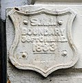
 Boundary Street Estate, 1989 - geograph.org.uk - 3466378.jpg 1,066 × 1,600; 320 KB
-
 Bouverie Rd - geograph.org.uk - 5373000.jpg 640 × 426; 59 KB
-
 Bowling Green Walk, London - geograph.org.uk - 2958803.jpg 4,288 × 3,216; 6.25 MB
-
 Box junction, Balls Pond Rd - geograph.org.uk - 5387963.jpg 640 × 426; 56 KB
-
-
 Braydon Road, Stamford Hill - geograph.org.uk - 4189543.jpg 2,486 × 1,818; 1.05 MB
-
 Brett Passage - geograph.org.uk - 2258814.jpg 640 × 480; 136 KB
-
 Brewery plaque, Hackney Wick - geograph.org.uk - 5038305.jpg 2,400 × 2,325; 1,010 KB
-
 Bridge 49, Regent's Canal - geograph.org.uk - 5851000.jpg 1,024 × 768; 325 KB
-
 Bridge at Kingsland Basin - geograph.org.uk - 4909006.jpg 640 × 427; 110 KB
-
 Bridge carrying A12 across River Lea (or Lee) - geograph.org.uk - 5634595.jpg 1,600 × 1,067; 546 KB
-
 Bridge carrying A12 slip road across River Lea (or Lee) - geograph.org.uk - 5634593.jpg 1,600 × 1,067; 361 KB
-
 Bridge Carrying Overground, Stratford, London - geograph.org.uk - 4713053.jpg 788 × 1,050; 697 KB
-
 Bridge over Lee Navigation - geograph.org.uk - 4944702.jpg 6,000 × 4,000; 4.42 MB
-
 Bridge over Middleton Road, Kingsland - geograph.org.uk - 4178166.jpg 3,264 × 2,448; 1.95 MB
-
 Bridge over Regents Canal, london - geograph.org.uk - 5158686.jpg 1,400 × 1,050; 1.52 MB
-
 Bridge over River Lea, Olympic Park - geograph.org.uk - 3119808.jpg 640 × 427; 86 KB
-
 Bridge over River Lea, Olympic Park - geograph.org.uk - 3119810.jpg 640 × 427; 62 KB
-
 Bridge over River Lee - geograph.org.uk - 5764657.jpg 4,896 × 3,672; 5.89 MB
-
 Bridge over the New River - geograph.org.uk - 3832028.jpg 640 × 430; 105 KB
-
 Bridge over the New River - geograph.org.uk - 3832030.jpg 640 × 430; 121 KB
-

-

-

-

-
 Bridge, Regent's Canal - geograph.org.uk - 2249962.jpg 640 × 480; 89 KB
-
 Bridges over the Regent's Canal - geograph.org.uk - 5685077.jpg 1,600 × 1,067; 259 KB
-
 Bridges, Lea Navigation - geograph.org.uk - 3298978.jpg 640 × 430; 59 KB
-
 Bridgeside Lodge Specialist Care Centre, Wharf Road - geograph.org.uk - 5762860.jpg 3,648 × 2,736; 2.45 MB
-
 Broadgate, cycle hire - geograph.org.uk - 3049624.jpg 1,024 × 755; 160 KB
-
 Brooke Rd - geograph.org.uk - 5798346.jpg 640 × 426; 69 KB
-
 Brooke Road - geograph.org.uk - 3585225.jpg 3,648 × 2,736; 4.14 MB
-
 Brooksby's Walk, London E9 - geograph.org.uk - 1978704.jpg 3,072 × 2,304; 2.25 MB
-
 Brownswood Road, N4 - geograph.org.uk - 4577445.jpg 640 × 480; 102 KB
-
 Brunswick Place - geograph.org.uk - 5027605.jpg 3,000 × 4,000; 1.66 MB
-
 Brunswick Wharf ^ Kent Wharf - geograph.org.uk - 5479564.jpg 1,024 × 683; 221 KB
-
 BSIX Sixth Form College - geograph.org.uk - 5798334.jpg 640 × 426; 74 KB
-
 Buckingham Road, Islington - geograph.org.uk - 4341825.jpg 2,272 × 1,704; 861 KB
-
 Builders on the Roof - geograph.org.uk - 4857275.jpg 3,939 × 2,969; 2.91 MB
-
 Building (14106719985).jpg 2,532 × 4,655; 5.77 MB
-
 Building by the Lea Bridge Weir - geograph.org.uk - 3297025.jpg 640 × 430; 68 KB
-
 Building by the Lea navigation - geograph.org.uk - 3304707.jpg 640 × 375; 45 KB
-
 Building the Eagle, City Road - geograph.org.uk - 4155942.jpg 1,060 × 1,600; 429 KB
-
 Building under construction at the end of Wharf Road - geograph.org.uk - 2354521.jpg 3,456 × 2,592; 877 KB
-
 Buildings by Regent's Canal - geograph.org.uk - 2250042.jpg 640 × 446; 71 KB
-
 Burbage House - geograph.org.uk - 1054500.jpg 640 × 480; 82 KB
-
 Bus Art, 'English Herbaceous Border' - geograph.org.uk - 4262068.jpg 1,024 × 682; 155 KB
-
 Bus Art, 'English Herbaceous Border' - geograph.org.uk - 4262069.jpg 800 × 800; 193 KB
-
 Bus Art, 'Hold Tight' - geograph.org.uk - 4262062.jpg 1,024 × 682; 209 KB
-
 Bus Art, 'Hold Tight' - geograph.org.uk - 4262064.jpg 1,024 × 682; 140 KB
-
 Bus Art, 'Union Jack' - geograph.org.uk - 4262052.jpg 1,024 × 682; 134 KB
-
 Bus on Balls Pond Road - geograph.org.uk - 4908981.jpg 427 × 640; 110 KB
-
 Bus Station, Lea Bridge Roundabout - geograph.org.uk - 5798337.jpg 640 × 426; 53 KB
-

-

-
 Buses in the Yard - geograph.org.uk - 4857068.jpg 1,600 × 1,200; 395 KB
-
 Busy junction on the A12 - geograph.org.uk - 4711450.jpg 6,000 × 4,000; 7.06 MB
-
 By Lea Bridge Weir - geograph.org.uk - 3297032.jpg 640 × 430; 99 KB
-
 Cadogan Terrace, Hackney - geograph.org.uk - 4324670.jpg 2,272 × 1,704; 752 KB
-
 Cafe, Woodberry Wetlands - geograph.org.uk - 5079566.jpg 1,600 × 1,117; 515 KB
-

-
 Calvert Avenue corner with Virginia Road - geograph.org.uk - 4264250.jpg 569 × 800; 145 KB
-
 Canal approaching Whitmore Road - geograph.org.uk - 4909078.jpg 640 × 427; 115 KB
-
 Canal Basin - geograph.org.uk - 2907977.jpg 640 × 430; 82 KB


_Barnes_Motors,_Petherton_Road,_N5_-_geograph.org.uk_-_4518753.jpg)


_-_geograph.org.uk_-_4890537.jpg)


_-_geograph.org.uk_-_4518802.jpg)
_-_geograph.org.uk_-_4518807.jpg)


,_N16_-_geograph.org.uk_-_4579845.jpg)


_-_geograph.org.uk_-_5634595.jpg)
_-_geograph.org.uk_-_5634593.jpg)


_-_geograph.org.uk_-_4580945.jpg)
,_N16_-_geograph.org.uk_-_4579839.jpg)


.jpg)


_-_geograph.org.uk_-_6206305.jpg)
_-_geograph.org.uk_-_6216371.jpg)


