Category:Butler County, Pennsylvania
Vai alla navigazione
Vai alla ricerca
Counties of Pennsylvania : Adams · Allegheny · Armstrong · Beaver · Bedford · Berks · Blair · Bradford · Bucks · Butler · Cambria · Cameron · Carbon · Centre · Chester · Clarion · Clearfield · Clinton · Columbia · Crawford · Cumberland · Dauphin · Delaware · Elk · Erie · Fayette · Forest · Franklin · Fulton · Greene · Huntingdon · Indiana · Jefferson · Juniata · Lackawanna · Lancaster · Lawrence · Lebanon · Lehigh · Luzerne · Lycoming · McKean · Mercer · Mifflin · Monroe · Montgomery · Montour · Northampton · Northumberland · Perry · Philadelphia · Pike · Potter · Schuylkill · Snyder · Somerset · Sullivan · Susquehanna · Tioga · Union · Venango · Warren · Washington · Wayne · Westmoreland · Wyoming · York
contea statunitense della Pennsylvania   | |||||
| Carica un file multimediale | |||||
| Istanza di | |||||
|---|---|---|---|---|---|
| Prende il nome da | |||||
| Luogo | Pennsylvania, Stati Uniti d'America | ||||
| Capitale | |||||
| Data di fondazione o creazione |
| ||||
| Popolazione |
| ||||
| Superficie |
| ||||
| Distinto da | |||||
| sito web ufficiale | |||||
 | |||||
Sottocategorie
Questa categoria contiene le 14 sottocategorie indicate di seguito, su un totale di 14.
*
H
M
N
P
R
S
File nella categoria "Butler County, Pennsylvania"
Questa categoria contiene 68 file, indicati di seguito, su un totale di 68.
-

-
 20th century history of Butler and Butler County, Pa., and respresentative citizens (IA 20thcenturyhisto01mcke).pdf 677 × 895, 1 482 pagine; 96,39 MB
-
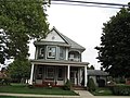
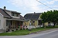 Argyle Street houses in Petrolia.jpg 6 016 × 4 000; 5,74 MB
-
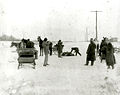 BiddleBrothers Capture 1902Jan31.jpg 600 × 477; 132 KB
-
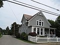
 Boyers.JPG 2 272 × 1 704; 1,24 MB
-
 Broadway in East Butler.jpg 6 016 × 4 000; 5,98 MB
-
 Callery fields and factory.jpg 6 016 × 4 000; 5,86 MB
-
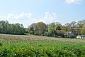
 Centertown Road pastures.jpg 6 016 × 4 000; 5,44 MB
-
 Cherry Valley open fields and woods.jpg 6 016 × 4 000; 5,03 MB
-
 Chicora Main Street.jpg 6 016 × 4 000; 6,86 MB
-
 Church from West Liberty in West Liberty.jpg 6 016 × 4 000; 6,39 MB
-
 Conniquenessing, Pennsylvania (8480032169).jpg 3 072 × 2 304; 1,13 MB
-
 Conniquenessing, Pennsylvania (8480032475).jpg 3 072 × 2 304; 739 KB
-
 Conniquenessing, Pennsylvania (8480033067).jpg 3 072 × 2 304; 723 KB
-
 Conniquenessing, Pennsylvania (8480033693).jpg 3 072 × 2 304; 880 KB
-
 Conniquenessing, Pennsylvania (8480034297).jpg 3 072 × 2 304; 912 KB
-
 Conniquenessing, Pennsylvania (8480034559).jpg 3 072 × 2 304; 744 KB
-
 Conniquenessing, Pennsylvania (8480034807).jpg 3 072 × 2 304; 682 KB
-
 Conniquenessing, Pennsylvania (8480035473).jpg 3 072 × 2 304; 1,08 MB
-
 Conniquenessing, Pennsylvania (8480036609).jpg 3 072 × 2 304; 637 KB
-
 Conniquenessing, Pennsylvania (8480036935).jpg 3 072 × 2 304; 812 KB
-
 Conniquenessing, Pennsylvania (8481124000).jpg 3 072 × 2 304; 753 KB
-
 Conniquenessing, Pennsylvania (8481124578).jpg 3 072 × 2 304; 693 KB
-
 Conniquenessing, Pennsylvania (8481125716).jpg 3 072 × 2 304; 685 KB
-
 Conniquenessing, Pennsylvania (8481126400).jpg 3 072 × 2 304; 887 KB
-
 Conniquenessing, Pennsylvania (8481126604).jpg 3 072 × 2 304; 654 KB
-
 Conniquenessing, Pennsylvania (8481126922).jpg 3 072 × 2 304; 891 KB
-
 Cranberry Mall parking lots and buildings.jpg 6 016 × 4 000; 5,49 MB
-
 Dick Road stubble field.jpg 6 016 × 4 000; 6,27 MB
-
 Five Below - Cranberry TWP, PA - panoramio.jpg 2 048 × 1 536; 718 KB
-
 Flag of Butler County, Pennsylvania.svg 1 546 × 928; 134 KB
-
 Ghost ramp I-79.jpg 1 840 × 3 264; 1,6 MB
-
 Giant Eagle GetGo - Seven Fields, PA - panoramio.jpg 960 × 720; 263 KB
-
 HarmonySocietyCemeteryinHarmonyPA.jpg 600 × 377; 102 KB
-
 Hillvue at Castle Creek in Seven Fields.jpg 6 016 × 4 000; 6,38 MB
-
 History of Butler County, Pennsylvania. (IA historyofbutlerc00inbrow).pdf 804 × 1 137, 1 514 pagine; 88,54 MB
-
 Hooker Road southeast of West Sunbury.jpg 6 016 × 4 000; 5,7 MB
-
 Jennings Environmental Education Center.jpg 3 264 × 2 448; 4,27 MB
-
 Jiffy Lube - Cranberry TWP, PA - panoramio.jpg 2 048 × 1 536; 826 KB
-
 Jimmy Wan's - Cranberry TWP, PA - panoramio.jpg 2 048 × 1 536; 753 KB
-
 Kohl's - Cranberry TWP, PA - panoramio.jpg 2 048 × 1 536; 786 KB
-
 Lane Bryant - Cranberry TWP, PA - panoramio.jpg 2 048 × 1 536; 913 KB
-
 Lowe's - Cranberry TWP, PA - panoramio.jpg 2 048 × 1 536; 752 KB
-
 Main near Washington, West Sunbury.jpg 6 016 × 4 000; 7,09 MB
-
 Map of Pennsylvania highlighting Butler County.svg 1 980 × 1 138; 96 KB
-
 Marriott - Cranberry TWP, PA - panoramio.jpg 2 048 × 1 536; 779 KB
-
 Mayfield from Beechwood in Shanor.jpg 6 016 × 4 000; 6,9 MB
-
 McGinnis Sisters - Cranberry TWP, PA - panoramio.jpg 2 048 × 1 536; 751 KB
-
 Moe's - Cranberry TWP, PA - panoramio.jpg 1 536 × 2 048; 682 KB
-
 Northwest Bank - Cranberry TWP, PA - panoramio.jpg 2 048 × 1 536; 852 KB
-
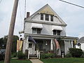
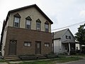
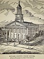 Old Butler County, Pennsylvania, Courthouse.jpg 694 × 915; 249 KB
-
 Olive Garden - Cranberry TWP, PA - panoramio.jpg 2 048 × 1 536; 758 KB
-
 On The Border - Cranberry TWP, PA - panoramio.jpg 2 048 × 1 536; 799 KB
-

-
 Pet Smart - Cranberry TWP, PA - panoramio.jpg 2 048 × 1 536; 886 KB
-
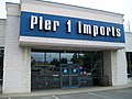 Pier 1 Imports - panoramio.jpg 2 048 × 1 536; 799 KB
-
 Planet stadium.JPG 2 272 × 1 704; 1,17 MB
-
 Pullman Park2.JPG 2 272 × 1 704; 873 KB
-
 Pullman Park3.JPG 2 272 × 1 704; 780 KB
-
 Seal of Butler County, Pennsylvania.svg 805 × 805; 126 KB
-
 St. Andrews Court, Glen Eden, Pa..JPG 2 048 × 1 536; 947 KB
-
 USA Butler County, Pennsylvania age pyramid.svg 520 × 600; 8 KB
-
 View of Fairview 1870.jpg 3 299 × 2 550; 908 KB
-
 View of Fairview 1900.jpg 2 329 × 1 769; 1,11 MB
-
 View of Main Street Fairview around 1900.jpg 1 925 × 1 633; 830 KB
-
 Wintertime at Wick, Pa., near Sutherland.JPG 4 000 × 3 000; 4,82 MB
-
 Worth Township, PA, USA - panoramio (1).jpg 1 600 × 1 200; 926 KB
-
 WRSK Contour Map.gif 700 × 700; 40 KB


.jpg)
.jpg)
.jpg)
.jpg)
.jpg)
.jpg)
.jpg)
.jpg)
.jpg)
.jpg)
.jpg)
.jpg)
.jpg)
.jpg)
.jpg)
.jpg)


.jpg)
