Category:County Wicklow
Перейти до навігації
Перейти до пошуку
Counties of the Republic of Ireland: Carlow · Cavan · Clare · Cork(1) · Donegal · Dún Laoghaire-Rathdown(2) · Fingal(2) · Galway(3) · Kerry · Kildare · Kilkenny · Laois · Leitrim · Limerick · Longford · Louth · Mayo · Meath · Monaghan · Offaly · Roscommon · Sligo · South Dublin(2) · Tipperary(4) · Waterford · Westmeath · Wexford · Wicklow – Separate cities: Cork(1) · Dublin(2) · Galway(3) – Former counties: Dublin(2) · South Tipperary(4) Former counties of Northern Ireland: Antrim · Armagh · Down · Fermanagh · Londonderry · Tyrone
графство в Ірландії    | |||||
| Завантажити медіафайл | |||||
| Є одним із | |||||
|---|---|---|---|---|---|
| Місце розташування |
| ||||
| Столиця | |||||
| Законодавчий орган |
| ||||
| Виконавча влада |
| ||||
| Кількість населення |
| ||||
| Площа |
| ||||
| офіційний сайт | |||||
 | |||||
Підкатегорії
Показано 25 підкатегорій із 25.
A
C
E
G
- Glen of Imaal (301 F)
- Glendalough, Wicklow (4 F)
H
- Holy wells in County Wicklow (1 F)
L
- Lemonstown Motte (15 F)
M
N
P
- Parks in County Wicklow (4 F)
S
T
W
- Wicklow Way (155 F)
Файли в категорії «County Wicklow»
Показано 200 файлів цієї категорії (із 755).
(попередня сторінка) (наступна сторінка)-
 County colors of Longford and Wicklow (1x2 ratio).svg 600 × 300; 213 байтів
-
 TippWicklowRosc col.png 87 × 54; 5 КБ
-
 20120830 03 Ireland - Co. Wicklow - Glendalough (7961544864).jpg 3648 × 2736; 1,98 МБ
-
 20120830 08 Ireland - Co. Wicklow - Glendalough (7961543342).jpg 3648 × 2736; 2,02 МБ
-
 20120830 10 Ireland - Co. Wicklow - Glendalough (7961541596).jpg 3648 × 2736; 1,89 МБ
-
 20120830 18 Ireland - Co. Wicklow - Glendalough (7961540076).jpg 3648 × 2736; 2,18 МБ
-
 20120830 23 Ireland - Co. Wicklow - Glendalough (7961538422).jpg 3648 × 2736; 1,18 МБ
-
 20120830 24 Ireland - Co. Wicklow - Glendalough (7961537472).jpg 3648 × 2736; 1,89 МБ
-
 20120830 27 Ireland - Co. Wicklow - Laragh (7961535970).jpg 3648 × 2736; 1,88 МБ
-
 20120831 05 Ireland - Co. Wicklow - Greystones (7961534496).jpg 3648 × 2736; 1,19 МБ
-

-

-
-
-
 Abandoned railway course - geograph.org.uk - 2944880.jpg 1024 × 768; 312 КБ
-
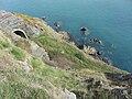 Abandoned railway tunnel near Bray Head - geograph.org.uk - 5350802.jpg 4000 × 3000; 4,17 МБ
-
 Above Glenmacnass Waterfall - geograph.org.uk - 6024451.jpg 1024 × 681; 129 КБ
-
 Aghowle - geograph.org.uk - 6045966.jpg 777 × 1024; 206 КБ
-
 Aghowle - geograph.org.uk - 6053490.jpg 1024 × 979; 165 КБ
-
 Aghowle - geograph.org.uk - 6053499.jpg 806 × 1024; 254 КБ
-
 Aghowle - geograph.org.uk - 6053527.jpg 1024 × 991; 169 КБ
-
 Aghowle - geograph.org.uk - 6053531.jpg 1024 × 561; 107 КБ
-
 Aghowle Church - geograph.org.uk - 6045971.jpg 1024 × 681; 165 КБ
-
 Aghowle Church - geograph.org.uk - 6045972.jpg 1024 × 681; 167 КБ
-
 Aghowle Church - geograph.org.uk - 6045974.jpg 1024 × 681; 202 КБ
-
 Aghowle Church - geograph.org.uk - 6045977.jpg 1024 × 681; 224 КБ
-
 Aghowle Church - geograph.org.uk - 6045979.jpg 1024 × 681; 158 КБ
-
 Along the Track - geograph.org.uk - 2463737.jpg 3456 × 2304; 4,01 МБ
-
 Altidore, county Wicklow - geograph.org.uk - 2005781.jpg 5826 × 4176; 1,64 МБ
-
 Ammonia train near Rathdrum - geograph.org.uk - 3329763.jpg 640 × 367; 111 КБ
-
 Approaching Lockstown Bridge (1) - geograph.org.uk - 5530586.jpg 4320 × 3240; 2,65 МБ
-
 Approaching Lockstown Bridge (2) - geograph.org.uk - 5530609.jpg 4320 × 3240; 2,45 МБ
-
 Arklow, County Wicklow COA.png 2157 × 2108; 611 КБ
-
 Art's Cross - geograph.org.uk - 2359220.jpg 800 × 299; 65 КБ
-
 Arts Lough - Co Wicklow - geograph.org.uk - 12248.jpg 640 × 482; 118 КБ
-
 Avondale House - geograph.org.uk - 3336344.jpg 2074 × 1415; 835 КБ
-
 Avonmore river Co. Wicklow - geograph.org.uk - 1886153.jpg 640 × 480; 118 КБ
-
 Ballinacor townland, County Wicklow - geograph.org.uk - 1809481.jpg 2592 × 1944; 1,45 МБ
-
 Ballinatone Church erected 1834, Ballinaclash Parish - geograph.org.uk - 2007272.jpg 4500 × 6000; 1,58 МБ
-
 Ballyknocken House.jpg 1181 × 894; 474 КБ
-
 Ballyknocken townland, County Wicklow - geograph.org.uk - 1807013.jpg 3882 × 2257; 6,16 МБ
-
 Ballyknocken-sitting room.jpg 945 × 774; 234 КБ
-
 Ballynamuddagh Triangulation Pillar - geograph.org.uk - 4893278.jpg 640 × 415; 74 КБ
-
 Ballynamuddagh Triangulation Pillar - geograph.org.uk - 4893284.jpg 640 × 390; 88 КБ
-
 Ballysmuttan Bridge 2010 - geograph.org.uk - 1925055.jpg 640 × 480; 97 КБ
-
 Barley field and hogweed at Roscath - geograph.org.uk - 1439300.jpg 640 × 428; 93 КБ
-
 Barn at Castlekevin - geograph.org.uk - 6230609.jpg 6000 × 4000; 7,19 МБ
-
 Beef cattle at Tomcoyle Upper - geograph.org.uk - 6233742.jpg 6000 × 4000; 6,81 МБ
-
 Bellevue Conservatory, Delgany, Co. Wicklow (32051618584).jpg 2000 × 1525; 1,93 МБ
-
 Bend in the road - geograph.org.uk - 6034321.jpg 1024 × 628; 88 КБ
-
 Bend, The Military Road - geograph.org.uk - 6036111.jpg 1024 × 736; 98 КБ
-
-
-
 Black Hill - geograph.org.uk - 730990.jpg 640 × 480; 90 КБ
-
 Bracken and Lake - geograph.org.uk - 5890135.jpg 800 × 600; 265 КБ
-
 Bray Beach, Ireland (2018).jpg 2048 × 1536; 2,22 МБ
-
 Bray bypass, County Wicklow - geograph.org.uk - 1919371.jpg 3885 × 2028; 4,12 МБ
-
 Bray Esplanade c. 1900.png 1035 × 596; 693 КБ
-
 Bray Head Cliff Walk - geograph.org.uk - 6241001.jpg 800 × 600; 687 КБ
-
 Bray Head, County Wicklow, Ireland - geograph.org.uk - 2533900.jpg 1024 × 683; 188 КБ
-
 Bray seen from Bray Head, 1963 - geograph.org.uk - 2225947.jpg 640 × 480; 73 КБ
-
 Bridge over the River Avonmore at Oldbridge - geograph.org.uk - 6220475.jpg 6000 × 4000; 7,16 МБ
-
 Brittas Bay (1) - geograph.org.uk - 5533535.jpg 4320 × 3240; 2,91 МБ
-
 Brittas Bay (2) - geograph.org.uk - 5533540.jpg 4320 × 3240; 2,92 МБ
-
 Brittas Bay (3) - geograph.org.uk - 5534125.jpg 4320 × 3240; 4,25 МБ
-
 Brittas Bay - geograph.org.uk - 6171238.jpg 2028 × 1305; 655 КБ
-
 Bus Stop on Vevay Road - geograph.org.uk - 6243355.jpg 800 × 533; 585 КБ
-
 Camara Hill - geograph.org.uk - 1864358.jpg 600 × 450; 80 КБ
-
 Camara Hill Summit - geograph.org.uk - 1864351.jpg 600 × 450; 59 КБ
-
 Camenabologue Shoulder - geograph.org.uk - 1850488.jpg 600 × 450; 79 КБ
-
 Car Park - geograph.org.uk - 1850166.jpg 600 × 450; 82 КБ
-
 Car park and church in Avoca - geograph.org.uk - 5574138.jpg 4000 × 2250; 2,27 МБ
-
 Car park, Glendalough - geograph.org.uk - 6030476.jpg 1024 × 681; 186 КБ
-
 Castles of Leinster, Kindlestown, Co. Wicklow - geograph.org.uk - 5029653.jpg 1024 × 698; 1,17 МБ
-

-

-

-
 Cheers (Unsplash).jpg 5472 × 3648; 10 МБ
-
 Church of St Mary - geograph.org.uk - 6034277.jpg 1024 × 616; 100 КБ
-
 Circular structure in a field near greystones - geograph.org.uk - 5350183.jpg 3475 × 2606; 2,88 МБ
-
 Cleared forest by Military Road - geograph.org.uk - 6034103.jpg 1024 × 773; 117 КБ
-
 Cleared forest by R115 - geograph.org.uk - 6024365.jpg 1024 × 681; 166 КБ
-
 Clearfell and Stream - geograph.org.uk - 1850240.jpg 450 × 600; 120 КБ
-
 Cliff Road (1) - geograph.org.uk - 5532197.jpg 4320 × 3240; 2,52 МБ
-
 Cliff Road (2) - geograph.org.uk - 5532206.jpg 4320 × 3240; 2,89 МБ
-
 Cliff-walk path near Greystones - geograph.org.uk - 5350165.jpg 4000 × 3000; 3,68 МБ
-
 Climbing out of Glenmalure - geograph.org.uk - 6034083.jpg 1004 × 1024; 275 КБ
-
 Clogga, Co. Wicklow.jpg 4128 × 2322; 3,44 МБ
-
 Coastal path near Bray - geograph.org.uk - 4896523.jpg 640 × 432; 110 КБ
-
 Coastline and railway tunnels near Bray Head - geograph.org.uk - 5350229.jpg 3000 × 4000; 3,23 МБ
-
 Coastline near Bray Head - geograph.org.uk - 5350218.jpg 4000 × 3000; 3,41 МБ
-
 Coastline near Bray Head - geograph.org.uk - 5350224.jpg 4000 × 3000; 3,96 МБ
-
 Coat of arms of Wicklow town.png 2157 × 2108; 860 КБ
-
 Col summit, Military Road - geograph.org.uk - 6034105.jpg 1024 × 651; 65 КБ
-
-

-
 Coolalingo Bridge - geograph.org.uk - 1928762.jpg 3000 × 4000; 3,25 МБ
-
 Country lane near White Hall, Glasnamullen - geograph.org.uk - 6220698.jpg 6000 × 4000; 6,55 МБ
-
 County Wicklow Population Density Map (2016).png 2808 × 2464; 970 КБ
-
 Croaghan Kinsella with winter snow - geograph.org.uk - 2223500.jpg 1296 × 864; 484 КБ
-
 Croneybyrne area, County Wicklow - geograph.org.uk - 1812240.jpg 3888 × 2592; 6,32 МБ
-
 Croneybyrne, County Wicklow - geograph.org.uk - 1804412.jpg 1600 × 1200; 411 КБ
-
 Cushbawn Hill - geograph.org.uk - 2278132.jpg 640 × 426; 58 КБ
-
 DART train near Bray Head - geograph.org.uk - 5350242.jpg 3000 × 4000; 3,55 МБ
-
 DART train near Bray Head - geograph.org.uk - 5350822.jpg 3000 × 4000; 3,15 МБ
-
 Deer Stone - geograph.org.uk - 6027604.jpg 1024 × 681; 233 КБ
-
 Deer Stone - geograph.org.uk - 6027708.jpg 1024 × 681; 238 КБ
-

-
 Derralossary Parish Church - geograph.org.uk - 2002841.jpg 2411 × 1486; 216 КБ
-
 Derralossary Parish Church, left side churchyard - geograph.org.uk - 2002850.jpg 2426 × 1616; 237 КБ
-
 Deutscher-Soldatenfriedhof-Glencree,-Wicklow,-Ireland----August-2014 01.jpg 34 174 × 5635; 98,69 МБ
-
 Deutscher-Soldatenfriedhof-Glencree,-Wicklow,-Ireland----August-2014 02.jpg 8387 × 5730; 28,88 МБ
-
 Disused building alongside the R760 road - geograph.org.uk - 5594245.jpg 640 × 480; 129 КБ
-
 Disused gateway on the R760 road - geograph.org.uk - 5594235.jpg 640 × 480; 123 КБ
-
 Djouce Woods - geograph.org.uk - 2365349.jpg 732 × 572; 310 КБ
-

-

-
 Donard, County Wicklow - geograph.org.uk - 1774366.jpg 2592 × 1944; 1,83 МБ
-
 Doorway, Aghowle Church - geograph.org.uk - 6045975.jpg 681 × 1024; 245 КБ
-
 Down by the Sea (38368153236).jpg 2000 × 1529; 1,74 МБ
-
 Downstream from Sheepbanks Bridge - geograph.org.uk - 5574123.jpg 4000 × 3000; 3,61 МБ
-
 Drainage Channel - geograph.org.uk - 1850458.jpg 450 × 600; 129 КБ
-
-
 Dublin-Wicklow railway at Bray Head - geograph.org.uk - 2944869.jpg 1024 × 768; 266 КБ
-
 Ennereilly Beach (1) - geograph.org.uk - 5534415.jpg 4320 × 3240; 2,02 МБ
-
 Ennereilly Beach (5) - geograph.org.uk - 5534564.jpg 4143 × 3106; 2,24 МБ
-
 Ennereilly Beach (6) - geograph.org.uk - 5534569.jpg 4320 × 3240; 3,78 МБ
-
 Erratic Boulder - geograph.org.uk - 5889832.jpg 800 × 600; 419 КБ
-
 Farm buildings - geograph.org.uk - 714147.jpg 640 × 480; 107 КБ
-
 Farmland at Ballinvalla - geograph.org.uk - 6220578.jpg 5651 × 3767; 4,2 МБ
-
 Farmland at Prospect Lower - geograph.org.uk - 6252038.jpg 5699 × 3799; 3,68 МБ
-
 Farmyard at Bloomfield, Glasnamullen Townland - geograph.org.uk - 6220693.jpg 6000 × 4000; 6,08 МБ
-
 Fassaroe Bridge, County Wicklow - geograph.org.uk - 1919185.jpg 3888 × 2592; 3,89 МБ
-
 Field above Lough Dan - geograph.org.uk - 6220469.jpg 6000 × 4000; 6,64 МБ
-
 Fields beside Avondale Road - geograph.org.uk - 5618531.jpg 640 × 480; 120 КБ
-
 FionnRegan.jpg 3072 × 2304; 3,32 МБ
-
-

-

-
-
 Foot crossing near Greystones - geograph.org.uk - 5350163.jpg 4000 × 3000; 3,61 МБ
-
 Footbridge - geograph.org.uk - 1850231.jpg 600 × 450; 155 КБ
-
 Footbridge at Glenda - geograph.org.uk - 6027561.jpg 1024 × 681; 201 КБ
-
 Footbridge over the stream - geograph.org.uk - 2349526.jpg 3456 × 2304; 4,61 МБ
-
 Footbridge, Greystones - geograph.org.uk - 4896495.jpg 640 × 372; 107 КБ
-
 Footpath to the Zig Zags - geograph.org.uk - 2349510.jpg 3456 × 2304; 3,93 МБ
-
 Forest alongside Ballyremon Commons - geograph.org.uk - 6220714.jpg 6000 × 4000; 6,29 МБ
-
 Forest by a minor road - geograph.org.uk - 6034271.jpg 1024 × 604; 91 КБ
-
 Forest by Military Road - geograph.org.uk - 6034050.jpg 1024 × 895; 159 КБ
-
 Forest by Minor road, Wicklow Mountains - geograph.org.uk - 6034159.jpg 1024 × 889; 136 КБ
-
 Forest by R115 - geograph.org.uk - 6024400.jpg 1024 × 944; 282 КБ
-
 Forest edge and track near Laragh - geograph.org.uk - 6220418.jpg 6000 × 4000; 6,85 МБ
-
 Forest Entrance - geograph.org.uk - 1850177.jpg 600 × 450; 134 КБ
-
 Forest Track - geograph.org.uk - 1850190.jpg 600 × 450; 122 КБ
-
 Forest Track Junction - geograph.org.uk - 1850196.jpg 600 × 450; 125 КБ
-
 Forest Tracks - geograph.org.uk - 1850219.jpg 600 × 450; 138 КБ
-
 Former toll gate on Bray Head Walk - geograph.org.uk - 5350817.jpg 3795 × 2846; 3,44 МБ
-

-
-
-

-
 From Bray To Greystones Ireland Landscape Photography (114586483).jpeg 1200 × 675; 397 КБ
-
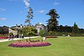
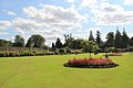
 Garden, Powerscourt, County Wicklow, Ireland - geograph.org.uk - 2534023.jpg 1024 × 683; 333 КБ
-
 Garden, Powerscourt, County Wicklow, Ireland - geograph.org.uk - 2534039.jpg 1024 × 683; 334 КБ
-
 Garden, Powerscourt, County Wicklow, Ireland - geograph.org.uk - 2534043.jpg 683 × 1024; 328 КБ
-
 Gate posts, Green Lane - geograph.org.uk - 6030373.jpg 1024 × 681; 228 КБ
-

-
 Gate ^ Lane - geograph.org.uk - 1864356.jpg 600 × 450; 85 КБ
-
 Gates to Altidore Castle - geograph.org.uk - 1999542.jpg 2628 × 1980; 690 КБ
-
 Gateway and drive at Oldbridge - geograph.org.uk - 6220461.jpg 6000 × 4000; 6,5 МБ
-
 Gateway to the courtyard Russborough House - geograph.org.uk - 3358227.jpg 1390 × 2106; 875 КБ
-
 Glanmalure - Landslide - geograph.org.uk - 12299.jpg 480 × 640; 119 КБ
-
 Glashina, County Wicklow - geograph.org.uk - 1884672.jpg 3885 × 2270; 4,28 МБ
-
 Glen Mhuire - geograph.org.uk - 2463726.jpg 2304 × 3456; 4,82 МБ
-
 Glen of Imaal, Co. Wicklow (36777795223).jpg 2000 × 1514; 1,95 МБ
-
 Glen of the Downs, County Wicklow (2) - geograph.org.uk - 1919313.jpg 3464 × 2149; 2,41 МБ
-
 Glen of the Downs, County Wicklow - geograph.org.uk - 1919301.jpg 3888 × 2359; 4,28 МБ
-

-
 Glencree - geograph.org.uk - 1825750.jpg 800 × 1046; 979 КБ
-
 Glencree in 1985 - geograph.org.uk - 3044074.jpg 927 × 661; 131 КБ
-
 Glendalough - geograph.org.uk - 2833965.jpg 1201 × 900; 476 КБ
-
 Glendalough Monastic Site - geograph.org.uk - 5909444.jpg 768 × 1024; 229 КБ
-
 Glendalough Monastic Site - geograph.org.uk - 6027581.jpg 1024 × 681; 165 КБ
-
 Glendalough Round Tower - geograph.org.uk - 6027562.jpg 1024 × 680; 142 КБ
-
 Glendalough Round Tower - geograph.org.uk - 6027594.jpg 681 × 1024; 237 КБ
-
 Glendalough Upper Lake 2014.jpg 6000 × 4000; 7,97 МБ
-
 Glendalough Visitor Centre - geograph.org.uk - 6027557.jpg 1024 × 681; 211 КБ
-
 Glendalough Visitor Centre - geograph.org.uk - 6027565.jpg 1024 × 681; 212 КБ
-
 Glendalough Wicklow Ireland Landscape Photography (196367841).jpeg 2048 × 1152; 598 КБ
-
 Glendalough, RIAC Hotel sign - geograph.org.uk - 1968090.jpg 480 × 640; 44 КБ
-
 Glendalough, the Round Tower - geograph.org.uk - 1968014.jpg 480 × 640; 55 КБ
-
 Glendalough, the Round Tower - geograph.org.uk - 1968084.jpg 480 × 640; 74 КБ
-
 Glendasan River - geograph.org.uk - 6027571.jpg 1024 × 681; 241 КБ
-
 Glendasan River - geograph.org.uk - 6027573.jpg 1024 × 681; 232 КБ
-
 Glendelough Walkpath.jpg 4032 × 3024; 2,53 МБ
-
 Glenealo River - geograph.org.uk - 6027608.jpg 1024 × 681; 310 КБ
-
 Glenealo River - geograph.org.uk - 6027611.jpg 1024 × 681; 291 КБ
-
 Glenmacnass - geograph.org.uk - 627290.jpg 640 × 480; 92 КБ
-
 Glenmacnass in the Wicklow Mountains - geograph.org.uk - 2424960.jpg 640 × 480; 89 КБ
-
 Glenmacnass valley below waterfall - geograph.org.uk - 6024468.jpg 1024 × 681; 206 КБ
.svg)

.jpg)
.jpg)
.jpg)
.jpg)
.jpg)
.jpg)
.jpg)
.jpg)


_-_geograph.org.uk_-_5530586.jpg)
_-_geograph.org.uk_-_5530609.jpg)


.jpg)


_-_geograph.org.uk_-_5029978.jpg)
_-_geograph.org.uk_-_5029981.jpg)


.jpg)


_-_geograph.org.uk_-_5533535.jpg)
_-_geograph.org.uk_-_5533540.jpg)
_-_geograph.org.uk_-_5534125.jpg)


_-_geograph.org.uk_-_5029631.jpg)
_-_geograph.org.uk_-_5029636.jpg)
_-_geograph.org.uk_-_5029637.jpg)
.jpg)


_-_geograph.org.uk_-_5532197.jpg)
_-_geograph.org.uk_-_5532206.jpg)


.png)


.jpg)


_-_geograph.org.uk_-_5534415.jpg)
_-_geograph.org.uk_-_5534564.jpg)
_-_geograph.org.uk_-_5534569.jpg)


.jpeg)


.jpg)
_-_geograph.org.uk_-_1919313.jpg)


.jpeg)


