Category:Maps of Acadia National Park
Jump to navigation
Jump to search
United States national parks: Acadia · American Samoa · Arches · Badlands · Big Bend · Biscayne · Black Canyon of the Gunnison · Bryce Canyon · Canyonlands · Capitol Reef · Carlsbad Caverns · Channel Islands · Congaree · Crater Lake · Cuyahoga Valley · Death Valley · Denali · Dry Tortugas · Everglades · Gateway Arch · Gates of the Arctic · Glacier · Glacier Bay · Grand Canyon · Grand Teton · Great Basin · Great Smoky Mountains · Guadalupe Mountains · Haleakalā · Hawaii Volcanoes · Hot Springs · Indiana Dunes · Isle Royale · Joshua Tree · Kenai Fjords · Kings Canyon · Kobuk Valley · Lake Clark · Lassen Volcanic · Mammoth Cave · Mesa Verde · Mount Rainier · North Cascades · Olympic · Petrified Forest · Pinnacles · Redwood · Rocky Mountain · Saguaro · Sequoia · Shenandoah · Theodore Roosevelt · Virgin Islands · Voyageurs · White Sands · Wind Cave · Wrangell-St. Elias · Yellowstone · Yosemite · Zion
English: Maps, satellite images, and brochures of Acadia National Park
Wikimedia category | |||||
| Upload media | |||||
| Instance of | |||||
|---|---|---|---|---|---|
| Category combines topics | |||||
| Acadia National Park | |||||
national park in the US state of Maine   | |||||
| Instance of | |||||
| Named after | |||||
| Location |
| ||||
| Visitor center | |||||
| Operator | |||||
| IUCN protected areas category | |||||
| Inception |
| ||||
| Highest point | |||||
| Area |
| ||||
| Visitors per year |
| ||||
| official website | |||||
 | |||||
Subcategories
This category has the following 3 subcategories, out of 3 total.
Media in category "Maps of Acadia National Park"
The following 46 files are in this category, out of 46 total.
-
 Acadia National Park - Flickr - NASA Goddard Photo and Video.jpg 2,400 × 2,400; 6.1 MB
-
 Acadia National Park and vicinity, Hancock Co., Maine. 1971. LOC 78692599.jpg 7,972 × 8,663; 11.31 MB
-
 Acadia National Park and vicinity, Hancock Co., Maine. 1971. LOC 78692599.tif 7,972 × 8,663; 197.59 MB
-
 Acadia National Park and vicinity, Hancock Co., Maine. LOC 73690158.jpg 6,640 × 7,066; 9.51 MB
-
 Acadia National Park and vicinity, Hancock Co., Maine. LOC 76695084.jpg 6,682 × 6,896; 9.57 MB
-
 Acadia National Park LOC 78695287.jpg 3,895 × 5,038; 3.84 MB
-
 Acadia National Park LOC 79695170.jpg 3,887 × 5,018; 3.98 MB
-
 Acadia National Park LOC 80694958.jpg 3,923 × 5,050; 3.05 MB
-
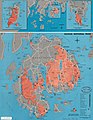
 Acadia national park map.png 1,200 × 1,285; 995 KB
-
 Acadia National Park, Maine, official map and guide LOC 89696762.jpg 4,928 × 6,906; 10.02 MB
-
 Acadia National Park, Maine, official map and guide LOC 89696762.tif 4,928 × 6,906; 97.37 MB
-
 Acadia National Park, Maine, official map and guide LOC 95683262.jpg 5,400 × 14,400; 10.03 MB
-
 Acadia National Park, Maine, official map and guide LOC 95683262.tif 5,400 × 14,400; 222.47 MB
-
 Acadia National Park. LOC 75692041.jpg 3,857 × 5,027; 4.01 MB
-
 Acadia National Park.svg 1,000 × 1,000; 121 KB
-
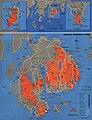
 Acadianpmap.jpg 1,768 × 2,399; 714 KB
-
 Acadianpmap.png 1,768 × 2,399; 2.37 MB
-
 Evangeline-1896-0056.jpg 1,299 × 2,306; 777 KB
-
 File-Bubble Pond Road Reconnoisance -sic- Plan (657616da240543539abd2523b9893e2b).tif 4,132 × 5,768; 136.4 MB
-
 Guide Map of Acadia National Park. LOC 98687169.jpg 6,938 × 5,488; 7.12 MB
-
 Guide Map of Acadia National Park. LOC 98687169.tif 6,938 × 5,488; 108.94 MB
-
 Isle au Haut trail map.pdf 1,650 × 2,550; 146 KB
-
 Map of the Wabanaki Confederacy Range.png 965 × 507; 166 KB
-
 NPS acadia-carriage-road-map.gif 2,199 × 3,399; 736 KB
-
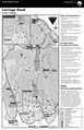 NPS acadia-carriage-road-map.pdf 1,650 × 2,550, 2 pages; 783 KB
-
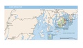
 NPS acadia-context-map.jpg 2,105 × 973; 207 KB
-
 NPS acadia-context-map.pdf 1,262 × 583; 907 KB
-
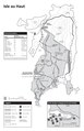
 NPS acadia-hiking-info.gif 2,799 × 1,699; 427 KB
-
 NPS acadia-hiking-info.pdf 2,100 × 1,275; 53 KB
-
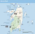 NPS acadia-isle-au-haut-map.jpg 1,011 × 971; 112 KB
-
 NPS acadia-isle-au-haut-map.pdf 606 × 581; 578 KB
-
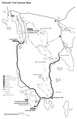
 NPS acadia-isle-au-haut-trail-map.gif 1,265 × 1,955; 226 KB
-
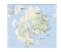
 NPS acadia-map.jpg 2,940 × 2,660; 840 KB
-
 NPS acadia-map.pdf 2,518 × 2,279; 15.16 MB
-
 NPS acadia-named-features-map.jpg 1,179 × 1,679; 427 KB
-
 NPS acadia-named-water-features-map.jpg 833 × 1,191; 263 KB
-
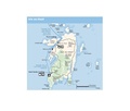
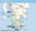
 NPS acadia-schoodic-map.jpg 1,091 × 974; 114 KB
-
 NPS acadia-schoodic-map.pdf 654 × 583; 537 KB
-
 NPS acadia-schoodic-trail-map.pdf 1,650 × 2,550; 154 KB
-
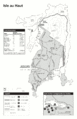
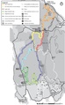
 NPS acadia-ski-map.jpg 1,195 × 1,924; 286 KB
-
 NPS acadia-ski-map.pdf 1,025 × 1,650; 205 KB
-
 NPS acadia-vegetation-map.jpg 4,994 × 3,232; 3.26 MB
-
 NPS acadia-winter-use-map.gif 1,404 × 1,632; 271 KB
-
 Sieur de Monts National Monument, Mount Desert Island, Maine. LOC 98687174.tif 3,207 × 3,770; 34.59 MB
-
 Topographic Map, Acadia National Park, Hancock County, Maine. LOC 99446118.jpg 7,855 × 6,429; 11.81 MB
-
 Topographic Map, Acadia National Park, Hancock County, Maine. LOC 99446118.tif 7,855 × 6,429; 144.48 MB


