Category:Maps of Kenai Fjords National Park
Jump to navigation
Jump to search
United States national parks: Acadia · American Samoa · Arches · Badlands · Big Bend · Biscayne · Black Canyon of the Gunnison · Bryce Canyon · Canyonlands · Capitol Reef · Carlsbad Caverns · Channel Islands · Congaree · Crater Lake · Cuyahoga Valley · Death Valley · Denali · Dry Tortugas · Everglades · Gateway Arch · Gates of the Arctic · Glacier · Glacier Bay · Grand Canyon · Grand Teton · Great Basin · Great Smoky Mountains · Guadalupe Mountains · Haleakalā · Hawaii Volcanoes · Hot Springs · Indiana Dunes · Isle Royale · Joshua Tree · Kenai Fjords · Kings Canyon · Kobuk Valley · Lake Clark · Lassen Volcanic · Mammoth Cave · Mesa Verde · Mount Rainier · North Cascades · Olympic · Petrified Forest · Pinnacles · Redwood · Rocky Mountain · Saguaro · Sequoia · Shenandoah · Theodore Roosevelt · Virgin Islands · Voyageurs · White Sands · Wind Cave · Wrangell-St. Elias · Yellowstone · Yosemite · Zion
English: Maps of Kenai Fjords National Park
Wikimedia category | |||||
| Upload media | |||||
| Instance of | |||||
|---|---|---|---|---|---|
| Category combines topics | |||||
| Kenai Fjords National Park | |||||
United States national park in Alaska  | |||||
| Instance of | |||||
| Location | Kenai Peninsula Borough, Alaska | ||||
| Operator | |||||
| IUCN protected areas category | |||||
| Inception |
| ||||
| Highest point |
| ||||
| Area |
| ||||
| Visitors per year |
| ||||
| official website | |||||
 | |||||
Subcategories
This category has the following 3 subcategories, out of 3 total.
M
- Maps of Exit Glacier (3 F)
- Maps of Harding Icefield (4 F)
Media in category "Maps of Kenai Fjords National Park"
The following 16 files are in this category, out of 16 total.
-
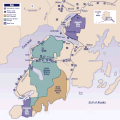
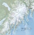
 KEFJ-Park-map1-2012.png 1,525 × 1,552; 3.5 MB
-
 LocMap Kenai Fjords National Park.png 280 × 183; 22 KB
-
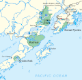
 Map of Alaska, kenai peninsula.gif 500 × 500; 72 KB
-
 Map of four Alaskan National Parks.gif 450 × 436; 20 KB
-
 NPS kenai-fjords-exit-glacier-aerial-map.jpg 3,228 × 2,024; 1.27 MB
-
 NPS kenai-fjords-exit-glacier-map.jpg 1,021 × 900; 257 KB
-
 NPS kenai-fjords-exit-glacier-map.pdf 850 × 750; 3.58 MB
-
 NPS kenai-fjords-exit-glacier-retreat-map.jpg 3,228 × 1,955; 1.4 MB
-
 NPS kenai-fjords-exit-glacier-trail-map.jpg 1,530 × 1,980; 818 KB
-
 NPS kenai-fjords-exit-glacier-trail-map.pdf 1,275 × 1,650; 746 KB
-
 NPS kenai-fjords-food-storage-locker-map.jpg 1,822 × 1,248; 357 KB
-
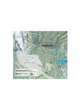
 NPS kenai-fjords-harding-icefield-trail-map.jpg 1,530 × 1,980; 576 KB
-
 NPS kenai-fjords-harding-icefield-trail-map.pdf 1,275 × 1,650; 548 KB
-
 NPS kenai-fjords-kayaking-map.jpg 1,530 × 2,096; 737 KB
-
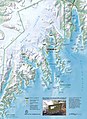
 NPS kenai-fjords-map.jpg 3,050 × 3,102; 2.1 MB
-
 NPS kenai-fjords-map.pdf 2,541 × 2,585; 8.73 MB


