Category:Marlborough District
Zur Navigation springen
Zur Suche springen
Regions of New Zealand: Auckland · Bay of Plenty · Canterbury · Gisborne · Hawke's Bay · Manawatu-Whanganui · Marlborough · Nelson · Otago · Northland · Southland · Taranaki · Tasman · Waikato · Wellington · West Coast
Outlying islands, territories and dependencies: Antipodes Islands · Auckland Islands · Bounty Islands · Chatham Islands · Kermadec Islands · Snares Islands · Three Kings Islands · Tokelau – Territory with specific status: Ross Dependency
Associated countries: Cook Islands · Niue
Outlying islands, territories and dependencies: Antipodes Islands · Auckland Islands · Bounty Islands · Chatham Islands · Kermadec Islands · Snares Islands · Three Kings Islands · Tokelau – Territory with specific status: Ross Dependency
Associated countries: Cook Islands · Niue
eine als Distrikt und Region zählende Verwaltungseinheit auf der Südinsel von Neuseeland  Vista de les Marlborough Sounds   | |||||
| Medium hochladen | |||||
| Ist ein(e) | |||||
|---|---|---|---|---|---|
| Ort | Neuseeland | ||||
| Hauptstadt | |||||
| Datum der Gründung, Erstellung, Entstehung, Erbauung |
| ||||
| Einwohnerzahl |
| ||||
| Fläche |
| ||||
| Ersetzt |
| ||||
| offizielle Website | |||||
 | |||||
Unterkategorien
Es werden 25 von insgesamt 25 Unterkategorien in dieser Kategorie angezeigt:
In Klammern die Anzahl der enthaltenen Kategorien (K), Seiten (S), Dateien (D)
!
*
A
C
E
F
M
- Molesworth Station (5 D)
N
P
S
- Stephens Island Lighthouse (4 D)
W
- Waihopai Valley (1 D)
Medien in der Kategorie „Marlborough District“
Folgende 152 Dateien sind in dieser Kategorie, von 152 insgesamt.
-
 Marlborough nz location.png 405 × 590; 7 KB
-
 NZ-Marlborough plain map.png 378 × 423; 10 KB
-
 005 Logging industry in New Zealand - tree trunk piles, timber logs stockpile.jpg 1.440 × 2.160; 1,82 MB
-

-

-
 Anakiwa, New Zealand.jpg 2.560 × 1.707; 2,39 MB
-
 Autumn vineyards, Marlborough, New Zealand, 14 May 2006 (147481215).jpg 3.030 × 2.116; 5,22 MB
-
 Awatere River.jpg 4.033 × 3.168; 11,32 MB
-
 Beat4 mus farm.jpg 1.438 × 932; 136 KB
-
 Cattle stop sign - New Zealand.jpg 3.507 × 2.409; 5,55 MB
-
 Chroicocephalus scopulinus -Picton, Marlborough, New Zealand -upper body-8.jpg 1.080 × 792; 140 KB
-
 Cloudy Bay - Marlborough.jpg 3.450 × 2.348; 7,17 MB
-
 Cloudy Bay Vineyard.jpg 3.660 × 2.663; 3,85 MB
-
 Club Room 13.jpg 3.507 × 2.232; 3,61 MB
-
 Coast of Marlborough Region from Cook Strait 01.jpg 2.938 × 1.540; 3,24 MB
-
 Coast of Marlborough Region from Cook Strait 02.jpg 2.728 × 1.602; 3,48 MB
-
 David Herd (Established Marlbrough's first winery in the 1870's) - panoramio.jpg 1.880 × 2.816; 2 MB
-
 DucknearPicton20100209.jpg 3.072 × 2.304; 3,55 MB
-
 Edwin Fox Maritime Museum in Picton Harbour.jpg 4.592 × 2.955; 8,3 MB
-
 Entrance of Tory Channel.jpg 1.024 × 768; 357 KB
-
 Erosion in the Upper Awatere Valley.jpg 3.872 × 2.592; 6,41 MB
-
 Fairhall Downs.jpg 3.264 × 2.448; 2,88 MB
-
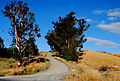 Farm road in Marlborough.jpg 3.694 × 2.503; 8,86 MB
-
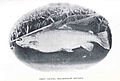 FMIB 34984 Trout Caught, Marlborough District.jpeg 930 × 631; 101 KB
-
 Green amoungest the black - panoramio.jpg 3.264 × 2.448; 2,02 MB
-
 Harbour Pattern (7519185590).jpg 1.152 × 864; 862 KB
-
 HVDC Inter-Island pylon with great view - panoramio.jpg 1.880 × 2.816; 2,25 MB
-
 Kaikoura Peninsula.jpg 3.264 × 2.176; 5,96 MB
-
 Kaikouras as seen from Grassmere - Marlborough.jpg 3.872 × 2.592; 5,45 MB
-
 Koru (6657682695).jpg 1.152 × 1.008; 498 KB
-
 Landscape of Marlborough Region 01.jpg 3.054 × 1.262; 3,03 MB
-
 Lochmara Bay, Marlborough, New Zealand, 11 May 2011 - Flickr - PhillipC (1).jpg 3.810 × 2.367; 2,29 MB
-
 Lochmara Bay, Marlborough, New Zealand, 11 May 2011 - Flickr - PhillipC.jpg 3.858 × 2.405; 1,31 MB
-

-
 Lochmara workshop project C, Shot 1 - Flickr - PhillipC.jpg 3.868 × 2.487; 1,52 MB
-
 Lochmara workshop project C, Shot 10 - Flickr - PhillipC.jpg 4.288 × 2.848; 1,71 MB
-
 Lochmara workshop project C, Shot 11 - Flickr - PhillipC.jpg 4.288 × 2.848; 2,84 MB
-
 Lochmara workshop project C, Shot 12 - Flickr - PhillipC.jpg 4.288 × 2.848; 2,33 MB
-
 Lochmara workshop project C, Shot 13 - Flickr - PhillipC.jpg 4.288 × 2.848; 6,9 MB
-
 Lochmara workshop project C, Shot 14 - Flickr - PhillipC.jpg 3.810 × 2.367; 1,29 MB
-
 Lochmara workshop project C, Shot 15 - Flickr - PhillipC.jpg 3.141 × 2.232; 923 KB
-
 Lochmara workshop project C, Shot 16 - Flickr - PhillipC.jpg 4.288 × 2.848; 2,85 MB
-
 Lochmara workshop project C, Shot 2 - Flickr - PhillipC.jpg 4.288 × 2.848; 4,56 MB
-
 Lochmara workshop project C, Shot 3 - Flickr - PhillipC.jpg 3.810 × 2.367; 1,28 MB
-
 Lochmara workshop project C, Shot 4 - Flickr - PhillipC.jpg 4.288 × 2.848; 1,1 MB
-
 Lochmara workshop project C, Shot 5 - Flickr - PhillipC.jpg 4.288 × 2.848; 2,46 MB
-
 Lochmara workshop project C, Shot 6 - Flickr - PhillipC.jpg 4.288 × 2.848; 1,99 MB
-
 Lochmara workshop project C, Shot 7 - Flickr - PhillipC.jpg 3.810 × 2.367; 2,06 MB
-
 Lochmara workshop project C, Shot 8 - Flickr - PhillipC.jpg 2.848 × 4.288; 1,61 MB
-
 Lochmara workshop project C, Shot 9 - Flickr - PhillipC.jpg 4.288 × 2.848; 1,29 MB
-
 Lochmara, Marlborough, New Zealand, May 2011 - Flickr - PhillipC.jpg 4.288 × 2.848; 2,73 MB
-
 Lochmara, May 2011 (Sally Mason) - Flickr - PhillipC.jpg 4.288 × 2.848; 3,04 MB
-
 Lochmara, May 2011 - Flickr - PhillipC (1).jpg 4.288 × 2.848; 1,7 MB
-
 Lochmara, May 2011 - Flickr - PhillipC (2).jpg 4.288 × 2.848; 2,8 MB
-
 Lochmara, May 2011 - Flickr - PhillipC (3).jpg 4.288 × 2.848; 2,41 MB
-
 Lochmara, May 2011 - Flickr - PhillipC.jpg 2.848 × 4.288; 2,82 MB
-
 Logging tracks - Marlborough.jpg 3.264 × 2.176; 6,12 MB
-
 Mahau Sound looking towards Havelock - panoramio.jpg 640 × 480; 90 KB
-
 Manuka or Tea Tree (6626947997).jpg 1.080 × 864; 280 KB
-
 Marlborough DC.PNG 289 × 375; 27 KB
-
 Marlborough district in NZ 2017.svg 853 × 1.173; 569 KB
-
 Marlborough dusk.jpg 3.872 × 2.592; 3,32 MB
-
 Marlborough Region landscape from Highway No 1-2.jpg 4.628 × 2.999; 10,8 MB
-
 Marlborough Region landscape from Highway No 1-3.jpg 4.752 × 3.168; 10,39 MB
-
 Marlborough Region landscape from Highway No 1.jpg 4.752 × 3.168; 11,85 MB
-
 Marlborough Rock Daisy (6480809771).jpg 864 × 1.080; 324 KB
-
 Marlborough Rock Daisy - Nature Pattern (5501770086).jpg 1.080 × 810; 313 KB
-
 Marlborough Rock Daisy and Friends (6480809573).jpg 1.080 × 864; 302 KB
-
 Marlborough Sounds, New Zealand, 26th. Nov. 2010 - Flickr - PhillipC.jpg 4.288 × 2.848; 2,93 MB
-
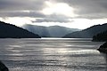
 Marlborough Sounds.jpg 6.209 × 3.523; 4,18 MB
-
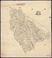
 Marlborough Territorial Authority.png 520 × 677; 13 KB
-
 MarlboroughRegionPopulationDensity.png 904 × 1.236; 117 KB
-
 Medway Bridge, Awatere Valley.jpg 3.872 × 2.592; 5,41 MB
-
 Medway River, Marlborough, New Zealand.jpg 3.872 × 2.592; 7,18 MB
-
 Molesworth Station Fence Gate.jpg 3.072 × 2.304; 2,03 MB
-
 Monarch Butterfly (6693851453).jpg 1.080 × 864; 571 KB
-
 Near Awatere Bridge (4670329967).jpg 3.008 × 2.000; 1,92 MB
-
 Northern Wattle Moth (7207670386).jpg 1.152 × 864; 825 KB
-
 NZ-Wairau R.png 1.234 × 1.395; 257 KB
-
 Old sheep shed - panoramio.jpg 2.816 × 1.880; 2,07 MB
-
 Outer Marlborough Sounds, New Zealand, 22nd. Nov. 2010 - Flickr - PhillipC.jpg 4.288 × 2.848; 5,03 MB
-
 Pauline and Georgie, Bay of Many Coves, Marlborough, New Zealand, 1970.jpg 3.088 × 1.927; 1,6 MB
-
 Pelorus Sound in 1970.jpg 2.278 × 1.543; 3,46 MB
-
 Picton Harbour (6724479431).jpg 1.152 × 864; 552 KB
-
 Picton Harbour, Marlborough Sounds.jpg 4.096 × 2.159; 3,29 MB
-
 Piripaua Neck connecting Kenny's Isle.jpg 1.024 × 768; 378 KB
-
 Pou whenua at Lochmara Lodge.jpg 1.024 × 768; 312 KB
-
 Preserved and Restored Whale Chaser - panoramio.jpg 2.816 × 1.880; 2,36 MB
-

-
 Prosthemadera novaeseelandiae -Waikawa, Marlborough, New Zealand-8 (2).jpg 1.080 × 864; 318 KB
-
 Red Hills Route parking area - panoramio.jpg 1.024 × 768; 427 KB
-
 Red-Billed Gull or Akiaki (7540093664).jpg 1.152 × 864; 434 KB
-
 Redwood Pass 7274, New Zealand - panoramio (1).jpg 3.554 × 1.332; 2,03 MB
-
 Redwood Pass 7274, New Zealand - panoramio.jpg 2.834 × 1.592; 2,4 MB
-
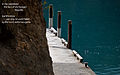
 Resolution Bay Wharf - panoramio.jpg 1.024 × 768; 620 KB
-
 Riverlands Olive Grove.jpg 3.264 × 2.448; 3 MB
-
 Rose1111.jpg 4.032 × 3.024; 1,84 MB
-
 Saint Clair Cellar Door in Marlborough (4670845635).jpg 2.000 × 3.008; 2,21 MB
-
 Save the unborn child sign in New Zealand.jpg 479 × 466; 46 KB
-
 Seddon, New Zealand - panoramio (1).jpg 3.492 × 1.962; 2,86 MB
-
 Seddon, New Zealand - panoramio.jpg 3.648 × 2.052; 2,63 MB
-
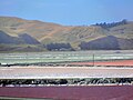
 Solar salt ponds NZ. (8107345639).jpg 2.000 × 1.418; 685 KB
-
 Solar salt. (14) (8107357696).jpg 2.000 × 1.500; 831 KB
-
 South Island Tour 207.jpg 2.048 × 1.536; 838 KB
-
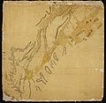
 Survey Office - Mt Arthur-Wangapeka-Motueka-Wai-iti (2).jpg 1.080 × 1.093; 88 KB
-
 Survey Office - Pakawau - Aorere - Waitapu.jpg 1.080 × 1.043; 92 KB
-
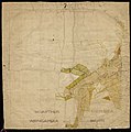
 Survey Office - Province of Nelson & Marlborough.jpg 1.080 × 1.057; 89 KB
-
 Survey Office - Provisional Survey of the Howard Block.jpg 1.080 × 1.198; 95 KB
-
 Survey Office - Takaka - Kai-teri-teri - Motueka (2).jpg 1.080 × 1.061; 99 KB
-
 Survey Office - Totara-nui (2).jpg 1.080 × 1.059; 67 KB
-
 Survey Office - Totara-nui.jpg 1.080 × 1.082; 69 KB
-
 Survey Office - Waitapu.jpg 1.080 × 1.095; 73 KB
-
 T.S.S. Kennedy (1864-1929) at the Wairau Bar (6997694120).jpg 1.080 × 864; 814 KB
-
 Taitook Pah Pelorus, watercolour by J. P. Murray, ca 1880.jpg 1.079 × 732; 81 KB
-
 The 'Punt Rails' - panoramio - DB Thats-Me (1).jpg 1.360 × 2.048; 1,22 MB
-
 The 'Punt Rails' - panoramio - DB Thats-Me.jpg 2.048 × 1.360; 2,19 MB
-
 The 'Punt Rails' - panoramio.jpg 2.048 × 1.360; 1,83 MB
-
 The 'Punt Rails' looking toward Allen Strait - panoramio.jpg 2.048 × 1.360; 1,31 MB
-
 The Brothers - panoramio.jpg 3.888 × 2.592; 2,27 MB
-
 The new Red Hills hut (opened April 2010) - panoramio.jpg 1.024 × 768; 267 KB
-
 The South Island from Tory Channel 01.jpg 4.239 × 2.826; 6,21 MB
-
 The South Island from Tory Channel 02.jpg 3.000 × 2.000; 3,09 MB
-
 The South Island from Tory Channel 03.jpg 3.000 × 2.000; 3,45 MB
-
 The South Island from Tory Channel 04.jpg 3.832 × 2.555; 5,15 MB
-
 Titirangi Bay, Marlborough - panoramio.jpg 1.024 × 768; 279 KB
-
 Top of the South Island (26608482854).jpg 1.600 × 1.200; 564 KB
-
 Tory Channel - panoramio.jpg 2.048 × 1.360; 1,67 MB
-
 Tory Channel Leads (Inbound from ferry) - panoramio.jpg 2.048 × 1.360; 1,01 MB
-
 Upper Awatere Valley.jpg 3.211 × 2.241; 5,42 MB
-
 Vines and wires - panoramio.jpg 3.888 × 2.592; 5,2 MB
-
 Vinyards during winter near Omaka, Blenheim - panoramio.jpg 1.024 × 768; 220 KB
-
 Waihopai Valley base (2005).jpg 350 × 231; 20 KB
-
 Waikawa, New Zealand - panoramio.jpg 4.160 × 3.120; 2,11 MB
-
 WaikawaBayPano.jpg 1.024 × 219; 177 KB
-
 Waimaru Bay Gannet Colony - panoramio.jpg 1.950 × 1.300; 693 KB
-
 Wairau Bar.png 516 × 361; 14 KB
-
 Wairau Valley - Marlborough.jpg 3.264 × 2.176; 4,35 MB
-
 Wairau Valley.jpg 1.280 × 853; 388 KB
-
 Ward Beach, Marlborough, New Zealand.jpg 3.888 × 2.592; 4,56 MB
-
 Wave interference, South Island, NZ (309494512).jpg 2.592 × 1.944; 1,4 MB
-
 West Head of Tory Channel entrance.jpg 1.024 × 768; 391 KB
-
 WestHead NZ.jpg 1.600 × 1.200; 536 KB
-
 Wetland at Wairau Lagoons after rain.jpg 3.264 × 4.896; 6,37 MB
-
 Wetland at Wairau Lagoons Walkway.jpg 4.896 × 3.264; 5,78 MB
-
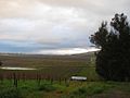
 Wharanui Farmland.jpg 2.048 × 1.536; 3,95 MB
-
 Wharariki Buds (6520034169).jpg 864 × 1.080; 189 KB
-
 Wharariki flowers (6645972787).jpg 1.080 × 864; 339 KB
-
 Whenuanui Bay 7281, New Zealand - panoramio.jpg 3.264 × 2.448; 2,07 MB
-
 Wiki-9976.jpg 4.735 × 2.771; 9,84 MB
-
 Wreck of the Tiroa (as of 2005) - panoramio.jpg 2.048 × 1.360; 2,71 MB
-
 Young Parries (2312943789).jpg 1.152 × 864; 577 KB
-
 Прощай Пыхтон - panoramio.jpg 1.600 × 960; 493 KB


.jpg)


_-_panoramio.jpg)


.jpg)


.jpg)

.jpg)


_-_Flickr_-_PhillipC.jpg)
.jpg)
.jpg)
.jpg)


.jpg)


.jpg)
.jpg)
.jpg)


.jpg)
.jpg)
.jpg)


.jpg)


_(cropped).jpg)
.jpg)

.jpg)


.jpg)

.jpg)

.jpg)
_(8107357696).jpg)

.jpg)


.jpg)
.jpg)


_at_the_Wairau_Bar_(6997694120).jpg)

.jpg)


_-_panoramio.jpg)


.jpg)

_-_panoramio.jpg)


.jpg)


.jpg)


.jpg)
.jpg)


_-_panoramio.jpg)
.jpg)

.jpg)