Category:Mountain ranges of the Alps
Jump to navigation
Jump to search
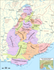
- English: The Mountain ranges of the Alps — including chains and individual mountains and peaks — of the Alps mountain system.
- Français : Massif des Alpes.
- Italiano: Sezioni alpine.
- See also: overviews of all ranges of the Alps, at: Category: Maps of the Alps; and Category: Satellite pictures of the Alps.
Classification[edit]
There is no international convention on classification of the Mountain ranges of the Alps.
- The mountain ranges of the Alps are classified by various 'non-international' criteria:
- Traditional mountain range names, including sub-ranges defining valleys.
- Range subdivision schemes, which include: the SOUISA (Suddivisione Orografica Internazionale Unificata del Sistema Alpino) or ISMSA (International Standardized Mountain Subdivision of the Alps), the AVE (Alpenvereinseinteilung der Ostalpen), and the Partizione delle Alpi (1926).
Category and subcategory sorting use[edit]
Use subcategories of major mountain ranges or of 'lesser' mountain subsystems. With images and subcategories, please take care to sort mountains (peaks) to the most precise mountain range, and to sort mountain subranges—subsystems only to the mountain range division they are completely lying within (and alphabetically here).
- Location: Category: Alps by country.
- Commons: Mountain puzzle, a project to identify and classify all mountain-related images.
[edit]
Close (open) with triangle on the right
| Upload media | |||||
| Instance of |
| ||||
|---|---|---|---|---|---|
| Subclass of | |||||
| Part of |
| ||||
| |||||
Subcategories
This category has the following 32 subcategories, out of 32 total.
- SOIUSA (56 F)
*
A
F
- Fatlarspitze (2 F)
G
H
L
M
- Monte Cum (2 F)
N
P
- Cima Portule (2 F)
R
- Reiting (35 F)
S
U
V
- Colle di Valcavera (4 F)
Media in category "Mountain ranges of the Alps"
The following 39 files are in this category, out of 39 total.
-
02751 Monti le punte Patrì Cogne (20-05-2004).jpg 1,001 × 574; 468 KB
-
Brün-Valendas.jpg 2,175 × 850; 1.04 MB
-
Cima Plische.JPG 1,536 × 2,048; 1.22 MB
-
Cime d'Auta 2.JPG 2,560 × 1,920; 1.67 MB
-
Cime d'Auta 3.JPG 2,448 × 3,264; 2.53 MB
-
Dalfazerwand.jpg 1,000 × 667; 129 KB
-
Elferspitze.jpg 3,072 × 2,304; 441 KB
-
Ferdinand Georg Waldmüller - Der Taubensee mit dem Steinberg in der Ramsau.jpg 6,315 × 5,009; 3.83 MB
-
Gamsjoch310507phr.jpg 396 × 607; 52 KB
-
Hirzerspitze.jpg 2,240 × 1,680; 1.31 MB
-
Il monte S. Martino.jpg 442 × 663; 227 KB
-
IMG Riebenkofel.jpg 3,264 × 2,448; 3.11 MB
-
Jont.jpg 2,592 × 3,872; 2.93 MB
-
Karte Tessiner Alpen.png 2,855 × 3,041; 3.21 MB
-
La dorsale del Colovrat vista da Clodig.jpg 269 × 204; 33 KB
-
La sagra di S. Martino.jpg 793 × 554; 321 KB
-
Lach dei Negher.JPG 3,264 × 2,448; 2.61 MB
-
Malser haide.jpg 250 × 187; 18 KB
-
Moiazza.jpg 1,600 × 1,200; 841 KB
-
Moiazzadaest.JPG 2,048 × 1,536; 666 KB
-
Moiazzaovest1.JPG 2,048 × 1,536; 582 KB
-
Monte Altissimo di Nago innevato.JPG 4,000 × 3,000; 2.31 MB
-
Monti Curogna-Ganna-Ditto 4 agosto 2009 006.jpg 2,048 × 1,536; 1.24 MB
-
Panorama Dent de Nendaz Summer.jpg 4,096 × 567; 543 KB
-
Pesarina.JPG 2,304 × 1,728; 1.2 MB
-
Pizzo Föisc.jpg 3,072 × 2,304; 1.1 MB
-
Pizzo Sole panoramica.JPG 4,224 × 968; 1.04 MB
-
Plische strada.JPG 1,536 × 2,048; 1.34 MB
-
Rauhkopf Blick Nord.JPG 1,844 × 1,229; 943 KB
-
Rauhkopf Blick Süd.JPG 1,844 × 1,229; 902 KB
-
Rauhkopf160221.JPG 3,264 × 2,448; 3.33 MB
-
ReichenbachBegin3.jpg 800 × 600; 124 KB
-
Rifugio Föisc.jpg 1,745 × 1,145; 537 KB
-
San Domenico Vallè.jpg 1,024 × 450; 171 KB
-
Sassograssa.JPG 3,648 × 2,736; 4.79 MB
-
Taminagebirge-Gebiet.jpg 331 × 222; 29 KB
-
Tessiner Alpen.JPG 956 × 685; 385 KB
-
Vue sur le Grand Bérard.png 1,280 × 960; 2.52 MB
-
Wv Valle del Biois banner.JPG 2,541 × 363; 867 KB


