Category:Southland Region
Перейти до навігації
Перейти до пошуку
Regions of New Zealand: Auckland · Bay of Plenty · Canterbury · Gisborne · Hawke's Bay · Manawatu-Whanganui · Marlborough · Nelson · Otago · Northland · Southland · Taranaki · Tasman · Waikato · Wellington · West Coast
Outlying islands, territories and dependencies: Antipodes Islands · Auckland Islands · Bounty Islands · Chatham Islands · Kermadec Islands · Snares Islands · Three Kings Islands · Tokelau – Territory with specific status: Ross Dependency
Associated countries: Cook Islands · Niue
Outlying islands, territories and dependencies: Antipodes Islands · Auckland Islands · Bounty Islands · Chatham Islands · Kermadec Islands · Snares Islands · Three Kings Islands · Tokelau – Territory with specific status: Ross Dependency
Associated countries: Cook Islands · Niue
один з регіонів Нової Зеландії   | |||||
| Завантажити медіафайл | |||||
| Є одним із | |||||
|---|---|---|---|---|---|
| Місце розташування | Нова Зеландія | ||||
| Столиця | |||||
| Дата створення / заснування |
| ||||
| Кількість населення |
| ||||
| Площа |
| ||||
| Не плутати з | |||||
 | |||||
Підкатегорії
Показано 22 підкатегорії з 22.
- Streets in Southland Region (11 F)
!
*
A
B
C
- Croydon bush, New Zealand (1 F)
E
M
O
P
- Percy Burn Viaduct (4 F)
S
T
U
- Unwin Radar (6 F)
Файли в категорії «Southland Region»
Показано 161 файл цієї категорії (із 161).
-
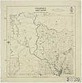
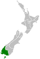 Position of Southland Region.png 405 × 590; 7 КБ
-
 00 1453 New Zealand, Southland Region - Blackmount Redcliff- Rd.jpg 3300 × 2200; 7,66 МБ
-
 00 1456 New Zealand, Southland Region - Blackmount- Redcliff Rd.jpg 3300 × 2200; 6,39 МБ
-
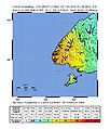 2009 New Zealand earthquake.jpg 612 × 716; 88 КБ
-
 45 South.jpg 940 × 487; 148 КБ
-
 637.132 Brydone Dairy Factory Ltd. - Southland.jpg 2448 × 1647; 2,24 МБ
-
 7th (Southland) Mounted Rifles.jpg 1290 × 967; 296 КБ
-
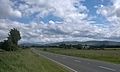
 Athol-Five Rivers Hwy, South Island (482973) (24301143214).jpg 3404 × 1135; 1,27 МБ
-
 Athol-Five Rivers Hwy, South Island (482974) (9482099481).jpg 3852 × 2164; 2,34 МБ
-
 Athol-Five Rivers Hwy, South Island - panoramio.jpg 2048 × 1151; 470 КБ
-
 Autumn foliage in Clifden - Southland.jpg 640 × 427; 158 КБ
-
 Awarua nasa.JPG 421 × 634; 93 КБ
-
 Beautiful Area - Flickr - Jocey K.jpg 1000 × 669; 146 КБ
-
 Beautiful Valley - Flickr - Jocey K.jpg 669 × 1000; 249 КБ
-
 Big Surfer riding a wave Colac Bay.jpg 4000 × 2248; 1,8 МБ
-
 Blechnum NZ Fern. (11263686834).jpg 2400 × 1729; 2,61 МБ
-
 Boyd Creek Waterfall.jpg 712 × 533; 104 КБ
-
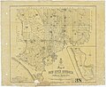
 Centre Hill Survey District.jpg 3868 × 4047; 5,34 МБ
-
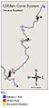 Clifden Caves Map.JPG 359 × 788; 30 КБ
-
 Cosy Nook entrance - panoramio.jpg 2816 × 1880; 3,16 МБ
-
 Crookston Survey District.jpg 3938 × 3948; 5,24 МБ
-

-

-
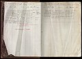 Deeds Index A - Folio 1 to 946.jpg 3020 × 2156; 1,72 МБ
-
 Deeds Index B.jpg 3020 × 2179; 1,63 МБ
-
 Deeds Index D.jpg 3020 × 2245; 1,63 МБ
-
 Deeds Index E.jpg 3020 × 2197; 1,66 МБ
-
 Deeds Index F.jpg 3020 × 2188; 1,68 МБ
-
 Deeds Index G.jpg 3020 × 2084; 1,61 МБ
-
 Deeds Local Index - Hundreds, Survey Districts and Towns.jpg 3020 × 2418; 1,12 МБ
-
 Deeds Nominal Index c.1899-c.1924.jpg 3020 × 2103; 1,27 МБ
-
 Earl Mountains.JPG 3608 × 2604; 2,8 МБ
-
 Eglinton River.JPG 2616 × 3276; 2,69 МБ
-
 Elevator at mine, Round Hill, Southland, February 1900 (3876442760).jpg 10 184 × 4950; 16,26 МБ
-
 Eyre Creek with Mid Dome.jpg 3264 × 2448; 2,57 МБ
-
 Eyre Mountains NZ 01.jpg 3852 × 1486; 3,57 МБ
-
 F Grant's traction engine at "Foresters", Lime Hills, Soutland, New Zealand.JPG 1200 × 1803; 187 КБ
-
 Fiordland NP.svg 442 × 600; 167 КБ
-
 FMIB 34977 Catch of Trout, Southland District.jpeg 803 × 575; 170 КБ
-
 Garston-Athol Hwy, South Island (482971) (9482095073).jpg 3960 × 2224; 2,19 МБ
-
 Going to Mavora Lakes.jpg 1024 × 768; 416 КБ
-
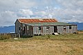
 Grants house at Foresters, Lime Hills, Southland, New Zealand.JPG 1803 × 1200; 297 КБ
-
 Grants house. Foresters 1957. Lime Hills, Southland, New Zealand.JPG 1806 × 1200; 272 КБ
-
 Greenvale Survey District.jpg 3740 × 3757; 3,58 МБ
-
 Highway 94.jpg 621 × 501; 61 КБ
-
 Kepler Track Tramper with Lake Te Anau.jpg 3264 × 2448; 1,6 МБ
-
 Knobs Flat view.JPG 3648 × 2736; 3,61 МБ
-
 Knobs Flat Visitor Center.JPG 3648 × 2736; 3,63 МБ
-
 Knobs Flat.JPG 3648 × 2736; 4,25 МБ
-
 Knobs Sign.jpg 946 × 438; 86 КБ
-
 Land Transfer Sectional Index (c.1871 - c.1902).jpg 4272 × 2848; 1,66 МБ
-
 Land Transfer Sectional Index.jpg 4272 × 2848; 2,38 МБ
-
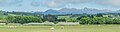
 Landscape in Southland 01.jpg 4080 × 2720; 8,84 МБ
-
 Landscape in Southland 02.jpg 4079 × 2380; 8,98 МБ
-
 Landscape in Southland 03.jpg 4080 × 1914; 5,93 МБ
-
 Landscape in Southland 04.jpg 4080 × 2720; 8,91 МБ
-
 Landscape in Southland Region 02.jpg 3921 × 1808; 5,21 МБ
-
 Landscape in Southland Region 03.jpg 3974 × 2246; 6,55 МБ
-
 Landscape in Southland Region 04.jpg 3894 × 1790; 5,42 МБ
-
 Landscape in Southland Region 05.jpg 3959 × 1515; 3,87 МБ
-
 Landscape in Southland Region 06.jpg 3955 × 2637; 8,31 МБ
-
 Landscape in Southland Region 07.jpg 3943 × 1695; 5,18 МБ
-
 Landscape in Southland Region 08.jpg 3985 × 1320; 3,02 МБ
-
 Landscape of Southland NZ 01.jpg 3824 × 1234; 2,88 МБ
-
 Landscape of Southland NZ 02.jpg 3878 × 1546; 4,39 МБ
-
 Landscape of Southland NZ 03.jpg 3878 × 1482; 3,96 МБ
-
 Landscape of Southland NZ 04.jpg 3720 × 681; 1,44 МБ
-
 Landscape of Southland NZ 05.jpg 3720 × 2480; 4,7 МБ
-
 Landscape of Southland NZ 06.jpg 3718 × 994; 2,25 МБ
-
 Lawrence-Roxburgh Railway - Proclamation Plan Defining Centre Line.jpg 40 634 × 10 308; 52,8 МБ
-

-
-

-
 Looking east from Slope Point.jpg 1280 × 952; 362 КБ
-
 Looking north from Slope Point.jpg 2048 × 1536; 617 КБ
-
 Looking south from Slope Point.jpg 2048 × 1536; 636 КБ
-
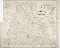
 Lothian and Mataura Hundreds.jpg 3795 × 2782; 3,29 МБ
-
 Lowther 2015.jpg 830 × 498; 114 КБ
-
 Manapouri Road.jpg 1280 × 853; 345 КБ
-
 Map of Forest Hill Hundred.jpg 3840 × 5182; 5,14 МБ
-
 Map of Invercargill Hundred and Part of New River Hundred.jpg 16 703 × 11 209; 14,79 МБ
-
 Map of Lindhurst Hundred.jpg 4057 × 3687; 4,52 МБ
-
 Map of New River Hundred.jpg 4770 × 3907; 6,92 МБ
-
 Map of Taringatura Survey District.jpg 3707 × 5587; 5,66 МБ
-
 Map of Wendon, Wendonside and of Greenvale Survey Districts.jpg 5359 × 3635; 6,56 МБ
-
 Mataura Paper Mill, New Zealand.jpg 692 × 277; 90 КБ
-
 Milford Sound Hwy, South Island (483015) (13493327963).jpg 2248 × 4000; 1,84 МБ
-
 Milford Sound Hwy, South Island (483018) (9482244155).jpg 4000 × 2248; 2,3 МБ
-
 Milford Sound Hwy, South Island (483028) (9482261289).jpg 2248 × 4000; 1,75 МБ
-
 Milford Sound Hwy, South Island (483032) (9485072786).jpg 4000 × 2248; 2,47 МБ
-
 MossGarden.JPG 1196 × 1692; 428 КБ
-
 Mount Burns - Burnt Ridge Track.jpg 4444 × 3333; 2,75 МБ
-
 Mowog Creek.jpg 859 × 644; 150 КБ
-
 Mpr Corner.JPG 1973 × 1318; 532 КБ
-
 Mt Aspiring NP.svg 442 × 600; 150 КБ
-
 NASA fiordland 2009 earthquake.png 720 × 480; 363 КБ
-
 New Zealand NZ7 2976.jpg 8019 × 4010; 16,61 МБ
-
 New Zealand NZ7 2981.jpg 8067 × 5378; 18,54 МБ
-
 New Zealand The Sheep Country (146413259).jpeg 2048 × 1152; 1,22 МБ
-
 NZ Fern.(Blechnum chambersii) (11263534936).jpg 2400 × 1621; 3,81 МБ
-
 NZ-L Hauroko.png 617 × 697; 81 КБ
-
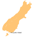 NZ-Slope P.png 440 × 497; 32 КБ
-
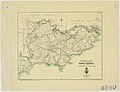
 NZ-Southland P.png 1234 × 1395; 54 КБ
-
 NZ-Te Waewae B.png 440 × 497; 33 КБ
-
 NZL-mossburn-sh94.jpg 1326 × 881; 448 КБ
-
 NZStewardIslandAreaMap.png 911 × 579; 64 КБ
-
 Ohai.JPG 2592 × 1944; 1,26 МБ
-
 On the way to Milford Sound 4 (31441552002).jpg 5184 × 3456; 14,1 МБ
-
 OT 135 - Waipahi Survey District.jpg 3912 × 4740; 4,51 МБ
-
 OT 136 - Pomahaka Survey District.jpg 3539 × 4155; 3,98 МБ
-
 OT 159 - Woodland Survey District.jpg 4657 × 3574; 4 МБ
-
 Otago (OT) 143 - Kuriwao Survey District.jpg 3617 × 3769; 2,83 МБ
-
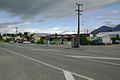
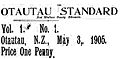 Otautau Standard.JPG 719 × 355; 45 КБ
-
 Pahia Hill.jpg 1000 × 750; 141 КБ
-
 Primary Deeds Index - 1 to 7792.jpg 3020 × 2368; 1,97 МБ
-
 Primary Deeds Index - 19870 to 28537.jpg 3020 × 2314; 1,88 МБ
-
 Primary Deeds Index - 28538 to 36911.jpg 3020 × 2289; 1,76 МБ
-
 Primary Deeds Index - 7793 to 19869.jpg 3020 × 2344; 2,5 МБ
-
 Princes Street, Round Hill, Southland, February 1900 (3057506656).jpg 10 134 × 4906; 15,42 МБ
-
 Rainforest (6090175553).jpg 667 × 1000; 602 КБ
-
 Rakatu Wetlands looking north.JPG 2816 × 2112; 2,56 МБ
-
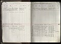
 Record Book of Instruments Received 1942.jpg 3020 × 2017; 1,6 МБ
-
 Rocks at Waipapa Point.jpg 1024 × 768; 401 КБ
-
 SD 36 - Map of Hokonui Survey District.jpg 6069 × 4920; 9,57 МБ
-
 SD 70 - Map of Campbelltown Hundred.jpg 4744 × 3877; 5,64 МБ
-
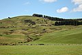
 Sheep and lamb grazing in Southland.jpg 3072 × 1852; 3,62 МБ
-
 Sheep Country - Flickr - GregTheBusker.jpg 8538 × 2098; 5,42 МБ
-
 Sluicing for gold at Round Hill, Southland, February 1900 (3666858966).jpg 10 120 × 4981; 18,42 МБ
-
 Solander Islands 1770 020102-13.jpg 500 × 166; 12 КБ
-
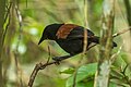 South Island Saddleback - New Zealand (38600162864).jpg 1080 × 720; 590 КБ
-
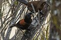 South Island Saddleback with juv - New Zealand (38600165394).jpg 1080 × 720; 626 КБ
-
 South Island Tour 635.jpg 2048 × 1536; 754 КБ
-
 Southland (SD) 44 - Wairio Survey District.jpg 4756 × 3728; 4,49 МБ
-
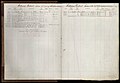
 Southland Register of Surveyors' Field Books 1 to 329.jpg 4726 × 3874; 2,02 МБ
-
 SouthlandRegionPopulationDensity.png 1391 × 2052; 242 КБ
-

-

-
 Te Anau glacial erratic New Zealand.jpg 3096 × 4128; 6,23 МБ
-
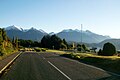
 Te Anau-Milford Hwy, South Island (482979) (9482105709).jpg 3820 × 2146; 1,66 МБ
-
 Te Anau-Milford Hwy, South Island (482981) (9482113949).jpg 3752 × 2108; 2,03 МБ
-
 Te Anau-Milford Hwy, South Island (482982) (9482118223).jpg 4000 × 2248; 2,28 МБ
-
 Te Anau-Milford Hwy, South Island (482983) (9484914372).jpg 3590 × 2018; 1,88 МБ
-
 Te Anau-Milford Hwy, South Island (482987) (9484923852).jpg 4887 × 2364; 2,35 МБ
-
 Te Anau-Milford Hwy, South Island (482988) (9484927736).jpg 3960 × 2224; 1,89 МБ
-
 Te Anau-Milford Hwy, South Island - panoramio (10).jpg 2048 × 1151; 640 КБ
-
 Te Anau-Milford Hwy, South Island - panoramio (19).jpg 2048 × 1536; 693 КБ
-
 Te Anau-Milford Hwy, South Island - panoramio (20).jpg 2048 × 1536; 650 КБ
-
 Te Anau-Milford Hwy, South Island - panoramio (5).jpg 2048 × 1150; 587 КБ
-
 Te Anau-Milford Hwy, South Island - panoramio (6).jpg 2048 × 1151; 729 КБ
-
 Te Anau-Milford Hwy, South Island - panoramio.jpg 2048 × 1151; 545 КБ
-
 The Lake Clinton Valley - panoramio.jpg 1600 × 1200; 181 КБ
-
 Transit Station.jpg 949 × 651; 87 КБ
-
 Unwin75.JPG 2112 × 2816; 2,12 МБ
-
 Unwin76.JPG 2112 × 2816; 1,8 МБ
-
 Waikaka Survey District.jpg 3714 × 3777; 3,52 МБ
-
 Wairio Survey District.jpg 4740 × 3730; 4,32 МБ
-
 Waitutu tracks (11937889134).jpg 2048 × 1536; 528 КБ
-
 Water race at a gold mine, Round Hill, Southland, February 1900 (3876442388).jpg 10 008 × 4932; 14,98 МБ
-
 Winter Landscape in Western Southland.jpg 1600 × 1200; 747 КБ
-
 Yellowhammer - New Zealand (25439848508).jpg 720 × 1080; 776 КБ
-
 Верьте или нет, но это паровой грузовик - panoramio.jpg 1600 × 960; 476 КБ


_Mounted_Rifles.jpg)
_(9482099481).jpg)


.jpg)


.jpg)


_(9482095073).jpg)


_(13493327963).jpg)
_(9482244155).jpg)
_(9482261289).jpg)
_(9485072786).jpg)


.jpeg)
_(11263534936).jpg)


.jpg)


_143_-_Kuriwao_Survey_District.jpg)


.jpg)
.jpg)


.jpg)
.jpg)
.jpg)

_44_-_Wairio_Survey_District.jpg)


_(9482105709).jpg)
_(9482113949).jpg)
_(9482118223).jpg)
_(9484914372).jpg)
_(9484923852).jpg)
_(9484927736).jpg)
.jpg)
.jpg)
.jpg)
.jpg)
.jpg)


.jpg)
.jpg)
.jpg)

_(24301143214).jpg)
.jpg)