Category:West Oxfordshire District
Направо към навигацията
Направо към търсенето
local government district in north west Oxfordshire, England   | |||||
| Качване на файл | |||||
| Екземпляр на | |||||
|---|---|---|---|---|---|
| Местоположение | Оксфордшър, Югоизточна Англия, Англия | ||||
| Столица | |||||
| Законодателен орган |
| ||||
| Дата на създаване |
| ||||
| Население |
| ||||
| Площ |
| ||||
| официален уебсайт | |||||
 | |||||
Подкатегории
Показани са 86 от общо 86 подкатегории на тази категория.
- Maps of West Oxfordshire District (0 К, 0 С, 19 Ф)
- Postcards of West Oxfordshire District (0 К, 0 С, 4 Ф)
*
- West Oxfordshire Community Transport (0 К, 0 С, 6 Ф)
A
B
C
D
F
G
H
I
K
L
- Lyneham, Oxfordshire (0 К, 0 С, 108 Ф)
M
N
O
R
S
T
W
Файлове в категория „West Oxfordshire District“
Показани са 70 от общо 70 файла в тази категория.
-
 Across the Valley - May 2012 - panoramio.jpg 4000 × 3000; 3,75 МБ
-
 Across the Valley to Churchill - May 2012 - panoramio.jpg 4000 × 3000; 3,21 МБ
-
 B-47 BN-2. Late 1950's. - panoramio.jpg 1467 × 541; 476 КБ
-
 Barns Plantation - May 2012 - panoramio.jpg 3000 × 4000; 4,57 МБ
-
 Beech Avenue at end of Sarsgrove Wood - May 2012 - panoramio.jpg 4000 × 3000; 3,81 МБ
-
 Beech Avenue ^ Stone Walls - May 2012 - panoramio.jpg 3000 × 4000; 5,46 МБ
-
 Beech branches - May 2012 - panoramio.jpg 4000 × 3000; 3,74 МБ
-
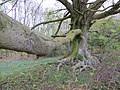
 Beech tree - May 2012 - panoramio.jpg 3000 × 4000; 4,11 МБ
-
 Big beech tree in the evening sun - May 2012 - panoramio.jpg 3000 × 4000; 4,67 МБ
-
 Bluebells and lots more - May 2012 - panoramio.jpg 3000 × 4000; 4,65 МБ
-
 Boeing B-47 Serial BN-1 c1958 - panoramio.jpg 1541 × 627; 752 КБ
-
 Chipping Norton Caravan ^ Camping site - May 2012 - panoramio.jpg 4000 × 3000; 3,43 МБ
-
 Church tower - beyond the trees - May 2012 - panoramio.jpg 4000 × 3000; 2,38 МБ
-
 Churchill - Evening - May 2012 - panoramio.jpg 4000 × 3000; 2,69 МБ
-
 Downs Hollow on a May evening - 2012 - panoramio.jpg 4000 × 3000; 4,38 МБ
-
 Downs Hollow ^ Horse - May 2012 - panoramio.jpg 4000 × 3000; 4,68 МБ
-
 Edge of the Barns Plantation - May 2012 - panoramio.jpg 4000 × 3000; 3,34 МБ
-
 End of Sarsgrove Wood - May 2012 - panoramio.jpg 3000 × 4000; 7,61 МБ
-
 Evening light - May 2012 - panoramio.jpg 3000 × 4000; 5,73 МБ
-
 Evening trees - May 2012 - panoramio.jpg 3000 × 4000; 3,64 МБ
-
 Falkland Arms Inn, Great Tew. - panoramio.jpg 2449 × 1685; 1,44 МБ
-
 Foxholes Nature Reserve - May 2012 - panoramio.jpg 3000 × 4000; 4,6 МБ
-
 G'SG 8.jpg 1280 × 1232; 367 КБ
-
 G'SG 9.jpg 950 × 1280; 330 КБ
-
 Green Horse Paddock - May 2012 - panoramio.jpg 4000 × 3000; 5,11 МБ
-
 Green lane beside Nursery Plantation - May 2012 - panoramio.jpg 3000 × 4000; 5,19 МБ
-
 GUG 1.jpg 2996 × 992; 659 КБ
-
 Hoar Stone - panoramio.jpg 1068 × 1608; 744 КБ
-
 Iron Buildings across a stony field - May 2012 - panoramio.jpg 4000 × 3000; 4,26 МБ
-
 Iron Buildings from under the massive beech tree - May 2012 - panoramio.jpg 4000 × 3000; 3,22 МБ
-
 Iron buildings on a grey evening - May 2012 - panoramio.jpg 4000 × 3000; 3,32 МБ
-
 Iron Buildings on a stormy evening - May 2012 - panoramio.jpg 4000 × 3000; 3,12 МБ
-
 KENTISH 2.jpg 2082 × 1416; 1,13 МБ
-
 KENTISH 3.jpg 2378 × 1592; 1,19 МБ
-
 KENTISH TOWN, LONDON.jpg 2273 × 1537; 1,17 МБ
-
 Lane between the woods - May 2012 - panoramio.jpg 3000 × 4000; 5,32 МБ
-
 Lane near Parsonage Farm - May 2012 - panoramio.jpg 4000 × 3000; 4,25 МБ
-
 Lone tree, dark sky - May 2012 - panoramio.jpg 2666 × 1997; 2,63 МБ
-
 Massive beech tree - May 2012 - panoramio.jpg 4000 × 3000; 4,1 МБ
-
 MEDWAY WATER CITY 8.jpg 2228 × 2236; 1,23 МБ
-
 Muddy lane between the trees - May 2012 - panoramio.jpg 3000 × 4000; 6,92 МБ
-
 Nature reclaiming - May 2012 - panoramio.jpg 4000 × 3000; 4,31 МБ
-
 Not so a lone trees - dark sky - May 2012 - panoramio.jpg 4000 × 3000; 3,55 МБ
-
 Oxfordshire West Oxfordshire Council 2024.svg 360 × 185; 4 КБ
-
 Philip Hoy.jpg 1332 × 1305; 1,02 МБ
-
 RAF Brize Norton, c Dec 1957 - panoramio.jpg 998 × 768; 307 КБ
-
 RAF Brize Norton, c Dec 1965 - panoramio.jpg 987 × 768; 324 КБ
-
 RAF Brize Norton, c Jan 1975 - panoramio.jpg 897 × 768; 282 КБ
-
 RAF Brize Norton, c July 1989 - panoramio.jpg 906 × 768; 282 КБ
-
 River Evenlode - May 2012 - panoramio.jpg 3000 × 4000; 4,58 МБ
-
 River Evenlode passing Foxholes - May 2012 - panoramio.jpg 3000 × 4000; 4,02 МБ
-
 Rolling Cotswold Hills - May 2012 - panoramio.jpg 4000 × 3000; 4,03 МБ
-
 Ruined Building - Foxholes - May 2012 - panoramio.jpg 4000 × 3000; 4,74 МБ
-
 SCHLOSS 2.jpg 2353 × 1543; 886 КБ
-
 Squires Clump (^) near Sarsden - May 2012 - panoramio.jpg 4000 × 3000; 4,27 МБ
-
 Sunny caravan site in May 2012 - panoramio.jpg 4000 × 3000; 3,87 МБ
-
 Svgfiles 2018-06-06-11-49-38-114747-15515997483391045527.svg 360 × 185; 3 КБ
-
 The Devils Quoits ditch and its inhabitants (geograph 5554280).jpg 640 × 360; 83 КБ
-
 THEATRE 2.jpg 2498 × 1681; 819 КБ
-
 Top row of the Chipping Norton camp site - May 2012 - panoramio.jpg 3000 × 4000; 2,88 МБ
-
 Track to the Iron Buildings - Sarsden - May 2012 - panoramio.jpg 4000 × 3000; 2,82 МБ
-
 Trees and sky - May 2012 - panoramio.jpg 4000 × 3000; 2,62 МБ
-
 Trees, sky and field - May 2012 - panoramio.jpg 4000 × 3000; 2,7 МБ
-
 UK West Oxfordshire District Council 2022.svg 360 × 185; 4 КБ
-
 UK West Oxfordshire District Council 2023.svg 360 × 185; 4 КБ
-
 UNIT ONE 2.jpg 1280 × 886; 518 КБ
-
 West Oxfordshire UK ward map 2023.svg 1187 × 1266; 1,6 МБ
-
 West Oxfordshire UK ward map 2024.svg 1187 × 1266; 672 КБ
-
 Woodland edge, Foxholes - May 2012 - panoramio (1).jpg 4000 × 3000; 2,86 МБ
-
 Woodland edge, Foxholes - May 2012 - panoramio.jpg 4000 × 3000; 3,31 МБ


_near_Sarsden_-_May_2012_-_panoramio.jpg)


.jpg)


.jpg)
