File:1801 - 20 - 26(C) 1802 Kurungotte District.jpg
Jump to navigation
Jump to search

Size of this preview: 478 × 600 pixels. Other resolutions: 191 × 240 pixels | 383 × 480 pixels | 612 × 768 pixels | 816 × 1,024 pixels | 1,633 × 2,048 pixels | 6,213 × 7,793 pixels.
Original file (6,213 × 7,793 pixels, file size: 16.29 MB, MIME type: image/jpeg)
Captions
Captions
Add a one-line explanation of what this file represents
| Description |
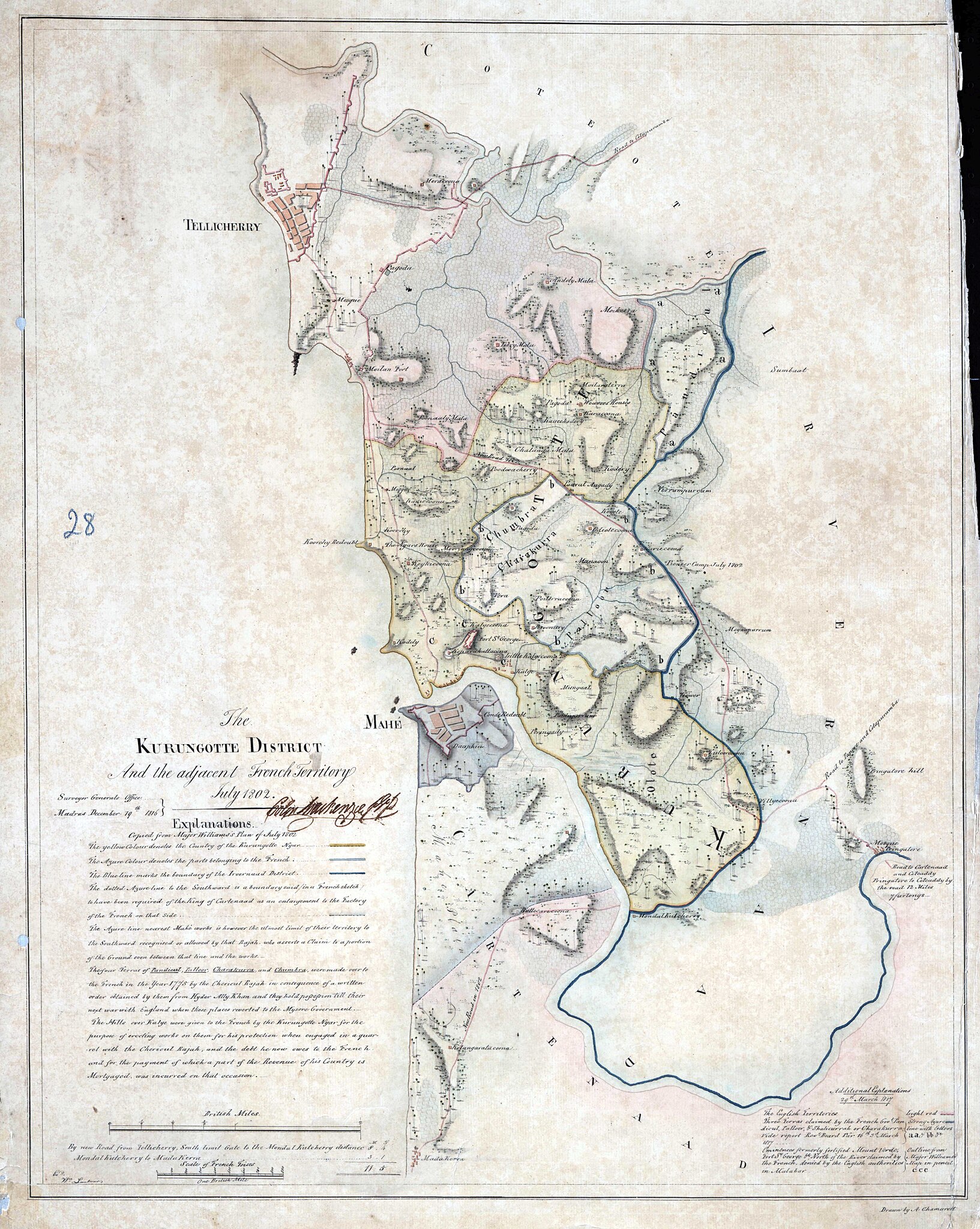
Kurungotte District and the adjacent French territory, July 1802 |
||||
| Date | |||||
| Source | MRIO - Miscellaneous Maps of the Survey of India (1742-1872) | ||||
| Creator |
Survey of India |
||||
| Permission (Reusing this file) |
|
||||
| Georeferencing | If inappropriate please set warp_status = skip to hide. | ||||
File history
Click on a date/time to view the file as it appeared at that time.
| Date/Time | Thumbnail | Dimensions | User | Comment | |
|---|---|---|---|---|---|
| current | 15:50, 3 January 2022 | | 6,213 × 7,793 (16.29 MB) | Shyamal (talk | contribs) | c:User:Rillke/bigChunkedUpload.js: {{map |description=Kurungotte District and the adjacent French territory, July 1802 | date = 1816 | source = [https://zenodo.org/record/3596441/files/1801%20-%2020%20-%2026%28C%29%201802%20Kurungotte%20District.jpg?download=1 MRIO - Miscellaneous Maps of the Survey of India (1742-1872)] | author= Survey of India | permission = {{pd-old-100}} }} |
You cannot overwrite this file.
File usage on Commons
There are no pages that use this file.
_1802_Kurungotte_District.jpg&oldid=882455861)