File:Germany location map.svg

মূল ফাইল (এসভিজি ফাইল, সাধারণত ১,০৭৩ × ১,২৭২ পিক্সেল, ফাইলের আকার: ৪৫২ কিলোবাইট)
ক্যাপশনসমূহ
ক্যাপশন
সারাংশ
| বিবরণ |
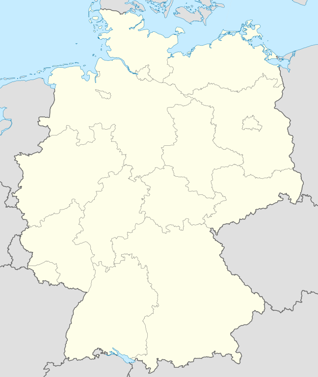
Quadratische Plattkarte, N-S-Streckung 150 %. Geographische Begrenzung der Karte:
Equirectangular projection, N/S stretching 150 %. Geographic limits of the map:
Français : Carte de l'Allemagne |
||
| তারিখ | |||
| উৎস | নিজের কাজ, using United States National Imagery and Mapping Agency data | ||
| লেখক | NordNordWest | ||
| অন্যান্য সংস্করণ |
এই ফাইলের উপজাত কর্মসমূহ:
Bundesrepublik Deutschland (vor 1990 nur West-Deutschland):
Deutsche Demokratische Republik (mit BRD im Ausschnitt):
Ostdeutschland (vor 1990 Deutsche Demokratische Republik):
Deutschland zwischen Mai 1945 und Oktober 1949:
Thematisch:
Deutsches Reich (1918–1945) (best used with this template (de)):
|
||
| SVG genesis | এই W3C-অবৈধ মানচিত্রটি Adobe Illustrator দিয়ে তৈরি করা হয়েছে।
|


_23_May_1949_-_6_Oct_1949.svg)


_location_map.svg)
_location_map_2013.svg)


_location_map.svg)
লাইসেন্স প্রদান

|
এই নথি অনুলিপি, বিতরণ এবং/বা পরিবর্তন করার অনুমতি ফ্রি সফটওয়্যার ফাউন্ডেশন কর্তৃক প্রকাশিত গনু ফ্রি ডকুমেন্টেশন লাইসেন্স, সংস্করণ ১.২ বা তার পরবর্তী সংস্করণের আওতায় অনুমতিপ্রাপ্ত; যে কোনো রকম অনুচ্ছেদ পরিবর্তন, সম্মুখ-প্রচ্ছদের লেখা, পিছন-প্রচ্ছদের লেখা পরিবর্তন করা ছাড়াই। এই লাইসেন্সের একটি অনুলিপি গনু ফ্রি ডকুমেন্টেশন লাইসেন্স শিরোনামের অনুচ্ছেদে অন্তর্ভুক্ত করা আছে। |
- আপনি স্বাধীনভাবে:
- বণ্টন করতে পারেন – এ কাজটি অনুলিপি, বিতরণ এবং প্রেরণ করতে পারেন
- পুনঃমিশ্রণ করতে পারেন – কাজটি অভিযোজন করতে পারেন
- নিম্নের শর্তাবলীর ভিত্তিতে:
- স্বীকৃতিপ্রদান – আপনাকে অবশ্যই যথাযথ স্বীকৃতি প্রদান করতে হবে, লাইসেন্সের একটি লিঙ্ক সরবরাহ করতে হবে এবং কোনো পরিবর্তন হয়েছে কিনা তা নির্দেশ করতে হবে। আপনি যেকোনো যুক্তিসঙ্গত পদ্ধতিতে এটি করতে পারেন। কিন্তু এমন ভাবে নয়, যাতে প্রকাশ পায় যে লাইসেন্সধারী আপনাকে বা আপনার এই ব্যবহারের জন্য অনুমোদন দিয়েছে।
- একইভাবে বণ্টন – আপনি যদি কাজটি পুনঃমিশ্রণ, রুপান্তর, বা এর ওপর ভিত্তি করে নতুন সৃষ্টিকর্ম তৈরি করেন, তবে আপনাকে অবশ্যই আপনার অবদান একই লাইসেন্স বা একই রকমের লাইসেন্সের আওতায় বিতরণ করতে হবে।
ফাইলের ইতিহাস
যেকোনো তারিখ/সময়ে ক্লিক করে দেখুন ফাইলটি তখন কী অবস্থায় ছিল।
| তারিখ/সময় | সংক্ষেপচিত্র | মাত্রা | ব্যবহারকারী | মন্তব্য | |
|---|---|---|---|---|---|
| বর্তমান | ১২:৫১, ১৬ সেপ্টেম্বর ২০১৩ | | ১,০৭৩ × ১,২৭২ (৪৫২ কিলোবাইট) | SokoWiki (আলোচনা | অবদান) | Clearer borders. |
| ০৮:৩৪, ১৬ সেপ্টেম্বর ২০১৩ |  | ১,০৭৩ × ১,২৭২ (৪৫২ কিলোবাইট) | NordNordWest (আলোচনা | অবদান) | Reverted to version as of 12:32, 2 October 2012; didn't make anything better | |
| ০৮:৩৪, ১৬ সেপ্টেম্বর ২০১৩ |  | ১,০৭৩ × ১,২৭২ (৪৫২ কিলোবাইট) | NordNordWest (আলোচনা | অবদান) | Reverted to version as of 12:32, 2 October 2012; didn't make anything better | |
| ২০:০৮, ১৫ সেপ্টেম্বর ২০১৩ |  | ১,০৭৩ × ১,২৭২ (৪৫১ কিলোবাইট) | SokoWiki (আলোচনা | অবদান) | * | |
| ১২:৩২, ২ অক্টোবর ২০১২ |  | ১,০৭৩ × ১,২৭২ (৪৫২ কিলোবাইট) | Palosirkka (আলোচনা | অবদান) | Reverted to version as of 20:14, 5 August 2012 Location maps must remain very accurate | |
| ০৫:৪০, ২ অক্টোবর ২০১২ |  | ১,০৭৩ × ১,২৭২ (৩৯৬ কিলোবাইট) | Palosirkka (আলোচনা | অবদান) | Scrubbed with http://codedread.com/scour/ | |
| ২০:১৪, ৫ আগস্ট ২০১২ |  | ১,০৭৩ × ১,২৭২ (৪৫২ কিলোবাইট) | NordNordWest (আলোচনা | অবদান) | upd | |
| ১০:০৩, ১৯ জানুয়ারি ২০১০ |  | ১,০৭৩ × ১,২৭২ (৪৯০ কিলোবাইট) | NordNordWest (আলোচনা | অবদান) | update | |
| ০৮:৩৩, ২২ জুলাই ২০০৯ |  | ১,০৭৫ × ১,২৭৩ (৬০৮ কিলোবাইট) | NordNordWest (আলোচনা | অবদান) | c | |
| ১৪:৩৬, ১৩ অক্টোবর ২০০৮ |  | ১,০৭৫ × ১,২৭৩ (৬০৬ কিলোবাইট) | NordNordWest (আলোচনা | অবদান) |
আপনি এই ফাইলটি প্রতিস্থাপন করতে পারবেন না।
ফাইলের ব্যবহার
এই ফাইলের সাথে ১০০টির বেশি পাতার লিংক রয়েছে। নিচের তালিকায় ফাইলের সাথে যুক্ত প্রথম ১০০টি পাতার লিংক দেখানো হচ্চে। এছাড়া একটি পূর্ণাঙ্গ তালিকাও রয়েছে।
- Bad Hersfeld
- Billigheim
- Deutschland
- Helmstedt
- Info:Kusterdingen
- Info:Mössingen
- Kusterdingen
- Mosbach
- Nentershausen
- Oberpleis
- Ruppichteroth
- Wilhelmsstift Tübingen
- User:Antonyrobin02
- User:Daniel Mietchen/Category:Images used by media organizations but violating license terms
- User:NordNordWest/Gallery/Location maps
- User:PMMKALYAN
- User:Sekamor
- User talk:Mmh
- User talk:NordNordWest/Archive
- User talk:Sting/Archive 01
- Commons:Overwriting existing files
- Commons:Overwriting existing files/cs
- Commons:Overwriting existing files/de
- Commons:Overwriting existing files/en
- Commons:Overwriting existing files/es
- Commons:Overwriting existing files/fr
- Commons:Overwriting existing files/ja
- Commons:Overwriting existing files/pl
- Commons:Overwriting existing files/pt
- Commons:Overwriting existing files/ru
- Commons talk:Project Mapmaking Wiki Standards
- File:Ambulante Kinderhospizdienste in Deutschland.PNG
- File:Auerbach (Karlsbad) location map.svg
- File:Bahnhoefe Wuerzburg.png
- File:Dat-das-Linie.png
- File:Deutschland.svg
- File:Deutschland Autobahnen.svg
- File:Deutschland Lage von Baden.svg
- File:Deutschland Lage von Württemberg-Baden.svg
- File:Deutschland Lage von Württemberg-Hohenzollern.svg
- File:East-West-Germany-October 1949-July 1952.svg
- File:East Germany location map.svg
- File:Germany, Federal Republic of location map 23 May 1949 - 6 Oct 1949.svg
- File:Germany, Federal Republic of location map April 1952 - August 1955.svg
- File:Germany, Federal Republic of location map December 1950 - April 1952.svg
- File:Germany, Federal Republic of location map January 1957 - October 1990.svg
- File:Germany, Federal Republic of location map October 1949 - November 1950.svg
- File:Germany, Federal Republic of location map September 1955 - December 1956.svg
- File:Germany, German Democratic Republic location map January 1957 - October 1990.svg
- File:Germany, German Democratic Republic location map July 1952 - January 1957.svg
- File:Germany, German Democratic Republic location map October 1949 - July 1952.svg
- File:Germany, German Democratic Republic location map w·o FRG July 1952 - October 1990.svg
- File:Germany, German Democratic Republic location map w·o FRG October 1949 - June 1952.svg
- File:Germany, location map (SBZ perspective) 23 May 1949 - 6 Oct 1949.svg
- File:Germany2 location map.svg
- File:Germany (+districts +municipalities) location map.png
- File:Germany (+districts +municipalities) location map current.svg
- File:Germany Eishockey Oberliga 2008-09.svg
- File:Germany location map-bundesliga1.png
- File:Germany location map.svg
- File:Germany location map 23 April 1949 - 22 May 1949.svg
- File:Germany location map 8 Jun 1947 - 22 Apr 1949.svg
- File:Germany location map April 1992 - July 1992.svg
- File:Germany location map August 1992 - June 1993.svg
- File:Germany location map July 1993 - December 2009.svg
- File:Germany location map October 1990 - March 1992.svg
- File:Germany location map labeled 8 Jun 1947 - 22 Apr 1949.svg
- File:Germany location map neustadt waldnaab.svg
- File:Glacis Minden.svg
- File:Glacis Minden cropped.jpg
- File:Glacis Minden cropped neu.jpg
- File:Häfen Minden.svg
- File:JWP-Karte-Deutschland.svg
- File:KRB location map.png
- File:Karte Deutschland.png
- File:Karte Deutschland.svg
- File:Karte konstanz in deutschland.png
- File:Lage Freiberg in Deutschland.png
- File:Locator map Corvey.svg
- File:Position der Analytischen Task Forces des Bundes.svg
- File:Reg-sparkassenverbaende-dtl.png
- File:Relief Map of Germany.png
- File:Relief Map of Germany.svg
- File:Salt mining in germany.png
- File:Senne-Bahn.png
- Template:Germany location map/other versions
- Template:Infobox settlement
- Template:Positionskarte
- Category:Ammerbuch
- Category:Bad Niedernau
- Category:Baisingen
- Category:Bodelshausen
- Category:Dußlingen
- Category:Gomaringen
- Category:Gütersloh
- Category:Hirrlingen
- Category:Königslutter am Elm
- Category:Neustetten
- Category:Ofterdingen
- Category:Rottenburg am Neckar
_location_map.png)
_location_map_current.svg)
এই ফাইলের আরও লিঙ্ক দেখাও।
ফাইলের বৈশ্বিক ব্যবহার
নিচের অন্যান্য উইকিগুলো এই ফাইলটি ব্যবহার করে:
- af.wikipedia.org-এ ব্যবহার
- als.wikipedia.org-এ ব্যবহার
- Weil der Stadt
- Schopfheim
- Rheinfelden (Baden)
- Rümmingen
- Lörrach
- Kehl
- Steinen (Baden)
- Weil am Rhein
- Bad Säckingen
- Freiburg im Breisgau
- Schwörstadt
- Augsburg
- Zell im Wiesental
- Maulburg
- Offenburg
- Ötigheim
- Hamburg
- Renchen
- Konstanz
- Furtwangen im Schwarzwald
- Görwihl
- Ebringen
- Müllheim im Markgräflerland
- Pfaffenweiler
- Calw
- Au (Breisgau)
- Merzhausen
- Sölden (Schwarzwald)
- Schallstadt
- Bollschweil
- Ehrenkirchen
- Wittnau (Breisgau)
- Vörstetten
- Achern
- Wehr (Baden)
- Vogtsburg im Kaiserstuhl
এই ফাইলের অন্যান্য বৈশ্বিক ব্যবহার দেখুন।