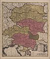
File:Pregledni zemljevid Kranjske in Štajerske leta 1702.jpg
From Wikimedia Commons, the free media repository
Jump to navigation
Jump to search

Size of this preview: 504 × 600 pixels. Other resolutions: 202 × 240 pixels | 403 × 480 pixels | 645 × 768 pixels | 860 × 1,024 pixels | 1,721 × 2,048 pixels | 12,704 × 15,118 pixels.
Original file (12,704 × 15,118 pixels, file size: 27.43 MB, MIME type: image/jpeg)
File information
Structured data
Captions
Captions
Add a one-line explanation of what this file represents
Summary
[edit]| Warning | The original file is very high-resolution. It might not load properly or could cause your browser to freeze when opened at full size. | Open in ZoomViewer |
|---|
| DescriptionPregledni zemljevid Kranjske in Štajerske leta 1702.jpg |
Slovenščina: Pregledni zemljevid Kranjske in Štajerske leta 1702 |
|||||||||||||||||||||||||
| Date | ||||||||||||||||||||||||||
| Source |
|
|||||||||||||||||||||||||
| Author |
creator QS:P170,Q2107767 |
|||||||||||||||||||||||||
| Permission (Reusing this file) |
|
|||||||||||||||||||||||||
File history
Click on a date/time to view the file as it appeared at that time.
| Date/Time | Thumbnail | Dimensions | User | Comment | |
|---|---|---|---|---|---|
| current | 06:08, 11 February 2014 |  | 12,704 × 15,118 (27.43 MB) | Sporti (talk | contribs) | res |
| 23:12, 17 December 2011 |  | 746 × 886 (370 KB) | Cropbot (talk | contribs) | upload cropped version, operated by User:M0tty. Summary: cropped | |
| 07:24, 30 July 2010 |  | 800 × 952 (281 KB) | Sporti (talk | contribs) | {{Information |Description={{sl|Pregledni zemljevid Kranjske in Štajerske leta 1702}} |Source=http://www.dlib.si/?urn=URN:NBN:SI:img-1RA36AX5 |Author=Gerard Valck |Date=1702 |Permission={{PD-old}} |other_versions= }} Category:Old maps of Slovenia [[ |
You cannot overwrite this file.
File usage on Commons
There are no pages that use this file.
File usage on other wikis
The following other wikis use this file:
- Usage on fr.wikipedia.org
- Usage on nl.wikipedia.org
