File:Roman empire.png
둘러보기로 이동
검색으로 이동
최대 해상도입니다.
Roman_empire.png (400 × 296 픽셀, 파일 크기: 29 KB, MIME 종류: image/png)
캡션
설명
이 파일이 나타내는 바에 대한 한 줄 설명을 추가합니다
파일 설명[편집]
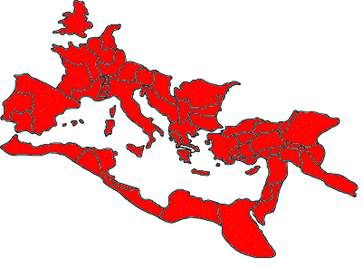
| 설명 | Roman empire |
| 날짜 | |
| 출처 |
이 파일은 다음에 의해 파생됨: REmpire-05 Aquitania.png |
| 저자 |
|

|
이 그림 파일은 벡터 SVG 형식으로 다시 만들어야 합니다. SVG의 장점에 대해서는 여기(영어)를 참고해 주십시오. 만약 이 그림의 SVG 버전이 이미 존재한다면 이 틀을 {{vector version available|새 파일 이름.svg}}으로 대체해 주십시오.
|
라이선스[편집]

|
GNU 자유 문서 사용 허가서 1.2판 또는 자유 소프트웨어 재단에서 발행한 이후 판의 규정에 따라 본 문서를 복제하거나 개작 및 배포할 수 있습니다. 본 문서에는 변경 불가 부분이 없으며, 앞 표지 구절과 뒷 표지 구절도 없습니다. 본 사용 허가서의 전체 내용은 GNU 자유 문서 사용 허가서 부분에 포함되어 있습니다. |
| 이 파일은 크리에이티브 커먼즈 저작자표시-동일조건변경허락 3.0 Unported 라이선스로 배포됩니다. | ||
| ||
| 이 라이선스 틀은 GFDL 라이선스 변경의 일부로 이 파일에 추가되었습니다. |
파일 역사
날짜/시간 링크를 클릭하면 해당 시간의 파일을 볼 수 있습니다.
| 날짜/시간 | 섬네일 | 크기 | 사용자 | 설명 | |
|---|---|---|---|---|---|
| 현재 | 2017년 10월 21일 (토) 04:23 | | 400 × 296 (29 KB) | Geagea (토론 | 기여) | adjustment |
| 2016년 7월 29일 (금) 08:45 |  | 400 × 296 (15 KB) | Ldorfman (토론 | 기여) | Something wrong regarding the transparency... | |
| 2016년 7월 29일 (금) 08:42 |  | 400 × 296 (15 KB) | Ldorfman (토론 | 기여) | Transparent | |
| 2016년 7월 29일 (금) 08:37 |  | 400 × 296 (15 KB) | Ldorfman (토론 | 기여) | "Transparent" background | |
| 2007년 7월 16일 (월) 10:19 |  | 400 × 296 (9 KB) | Nihad Hamzic (토론 | 기여) | Reduced image size by losslessly reducing color domain. | |
| 2005년 10월 12일 (수) 14:18 |  | 400 × 296 (48 KB) | Yug (토론 | 기여) | Made by myself from en:Image:REmpire-Aquitania.png ~~~~ |
이 파일을 덮어쓸 수 없습니다.
이 파일을 사용하는 문서
다음 문서 35개가 이 파일을 사용하고 있습니다:
- Atlas of Albania
- Atlas of Algeria
- Atlas of Austria
- Atlas of Bosnia and Herzegovina
- Atlas of Croatia
- Atlas of Cyprus
- Atlas of Egypt
- Atlas of Galicia
- Atlas of Greece
- Atlas of Hungary
- Atlas of Iraq
- Atlas of Jordan
- Atlas of Kosovo
- Atlas of Libya
- Atlas of Luxembourg
- Atlas of Malta
- Atlas of Montenegro
- Atlas of Morocco
- Atlas of North Macedonia
- Atlas of Northern Cyprus
- Atlas of Portugal
- Atlas of Romania
- Atlas of Serbia
- Atlas of Slovenia
- Atlas of Spain
- Atlas of Syria
- Atlas of Transylvania
- Atlas of Tunisia
- Atlas of Turkey
- Atlas of ancient Rome
- Maps of Switzerland
- Top 200 locator map images that should use vector graphics
- Top 200 map images that should use vector graphics
- User:Alex:D/Project2
- User:MorbZ
이 파일을 사용하고 있는 모든 위키의 문서 목록
다음 위키에서 이 파일을 사용하고 있습니다:
- af.wikipedia.org에서 이 파일을 사용하고 있는 문서 목록
- ar.wikipedia.org에서 이 파일을 사용하고 있는 문서 목록
- br.wikipedia.org에서 이 파일을 사용하고 있는 문서 목록
- Henroma
- Proviñs Britannia
- Osroene
- Patrom:Proviñsoù roman 120
- Mauretania
- Proviñs roman
- Kilikia
- Trakia
- Belgica
- Gallia Cisalpina
- Narbonensis
- Lugdunensis
- Africa (proviñs roman)
- Alpes Cottiae
- Galatia
- Alpes Maritimae
- Alpes Poenninae
- Arabia Petraea
- Asia
- Assyria (proviñs roman)
- Bithynia
- Hispania Baetica
- Cyrenaica
- Dalmatia (proviñs roman)
- Germania Inferior
- Lusitania
- Hispania Tarraconensis
- Raetia
- Germania Superior
- Noricum
- Gallia Aquitania
- Syria (proviñs roman)
- Armenia Inferior
- Dacia
- Hispania
- Moesia
- Pannonia
- Mauretania Caesariensis
- Sophene
- Achaea (proviñs roman)
- ca.wikipedia.org에서 이 파일을 사용하고 있는 문서 목록
- cs.wikipedia.org에서 이 파일을 사용하고 있는 문서 목록
- cy.wikipedia.org에서 이 파일을 사용하고 있는 문서 목록
이 파일의 더 많은 사용 내역을 봅니다.