Category:Indiana County, Pennsylvania
Пређи на навигацију
Пређи на претрагу
Counties of Pennsylvania : Adams · Allegheny · Armstrong · Beaver · Bedford · Berks · Blair · Bradford · Bucks · Butler · Cambria · Cameron · Carbon · Centre · Chester · Clarion · Clearfield · Clinton · Columbia · Crawford · Cumberland · Dauphin · Delaware · Elk · Erie · Fayette · Forest · Franklin · Fulton · Greene · Huntingdon · Indiana · Jefferson · Juniata · Lackawanna · Lancaster · Lawrence · Lebanon · Lehigh · Luzerne · Lycoming · McKean · Mercer · Mifflin · Monroe · Montgomery · Montour · Northampton · Northumberland · Perry · Philadelphia · Pike · Potter · Schuylkill · Snyder · Somerset · Sullivan · Susquehanna · Tioga · Union · Venango · Warren · Washington · Wayne · Westmoreland · Wyoming · York
county in Pennsylvania, United States   | |||||
| Отпремање медија | |||||
| Је | |||||
|---|---|---|---|---|---|
| Названо по | |||||
| Локација | Пенсилванија, САД | ||||
| Престоница | |||||
| Настанак |
| ||||
| Насељеност |
| ||||
| Површина |
| ||||
| званични веб-сајт | |||||
 | |||||
Поткатегорије
Приказано је 14 поткатегорија; укупно 14.
B
E
G
H
M
N
P
S
T
Медији у категорији „Indiana County, Pennsylvania”
Следећих 83 датотека је у овој категорији, од укупно 83.
-
 Map of Pennsylvania highlighting Indiana County.svg 1.980 × 1.138; 96 kB
-
 Fall - panoramio - Ron Shawley.jpg 1.920 × 1.080; 2,13 MB
-
 Fall and the lake - panoramio.jpg 1.920 × 1.080; 1,51 MB
-
 Farm Life - panoramio.jpg 640 × 480; 71 kB
-
 Forest around powerplant - panoramio (1).jpg 5.184 × 3.456; 10,73 MB
-
 Forest around powerplant - panoramio (10).jpg 3.456 × 5.184; 8,14 MB
-
 Forest around powerplant - panoramio (11).jpg 5.184 × 3.456; 8,09 MB
-
 Forest around powerplant - panoramio (12).jpg 5.184 × 3.456; 8,89 MB
-
 Forest around powerplant - panoramio (13).jpg 5.184 × 3.456; 8,05 MB
-
 Forest around powerplant - panoramio (15).jpg 5.184 × 3.456; 10,16 MB
-
 Forest around powerplant - panoramio (16).jpg 5.184 × 3.456; 8,99 MB
-
 Forest around powerplant - panoramio (17).jpg 5.184 × 3.456; 7,78 MB
-
 Forest around powerplant - panoramio (18).jpg 5.184 × 3.456; 10,01 MB
-
 Forest around powerplant - panoramio (19).jpg 5.184 × 3.456; 5,66 MB
-
 Forest around powerplant - panoramio (2).jpg 5.184 × 3.456; 11,01 MB
-
 Forest around powerplant - panoramio (21).jpg 5.184 × 3.456; 5,46 MB
-
 Forest around powerplant - panoramio (22).jpg 5.184 × 3.456; 5,45 MB
-
 Forest around powerplant - panoramio (23).jpg 5.184 × 3.456; 7,08 MB
-
 Forest around powerplant - panoramio (4).jpg 5.184 × 3.456; 11,48 MB
-
 Forest around powerplant - panoramio (5).jpg 5.184 × 3.456; 9,58 MB
-
 Forest around powerplant - panoramio (6).jpg 5.184 × 3.456; 7,87 MB
-
 Forest around powerplant - panoramio (7).jpg 5.184 × 3.456; 10,63 MB
-
 Forest around powerplant - panoramio (8).jpg 5.184 × 3.456; 10,52 MB
-
 Forest around powerplant - panoramio (9).jpg 3.456 × 5.184; 9,22 MB
-
 Forest around powerplant - panoramio.jpg 5.184 × 3.456; 9,07 MB
-
 Georgeville from Route 210.jpg 6.016 × 4.000; 6,29 MB
-
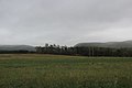
 Grant Township fields and hillside.jpg 6.016 × 4.000; 6,84 MB
-
 HCGeneratingCoolingTowers.JPG 2.816 × 1.680; 386 kB
-
 HCGeneratingLandscape.JPG 2.816 × 2.112; 335 kB
-
 HDR sunset - panoramio (1).jpg 1.728 × 1.152; 592 kB
-
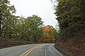
 Heading south on Clymer Road, Clymer, PA in Indiana county, Pennsylvania, USA.jpg 1.280 × 1.033; 502 kB
-
 Hemlock Lake Winter HDR.jpg 3.037 × 2.010; 3,52 MB
-
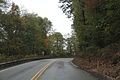
 Hillsdale scene on PA286.jpg 6.016 × 4.000; 6,88 MB
-
 Home center of town.jpg 2.800 × 2.128; 1,27 MB
-
 Indiana County (Jimmy Stewart) Airport Runway.jpg 4.246 × 2.831; 6,43 MB
-
 Indiana County Jimmy Stewart Airport Front View.jpg 4.519 × 3.013; 6 MB
-
 Indiana County Jimmy Stewart Airport with Airplane Display in Front.jpg 4.896 × 3.264; 8,33 MB
-
 Kovalchick Corporation Indiana Pennsylvania.jpg 2.816 × 1.584; 2,09 MB
-
 Kovalchick Corporation Sign Indiana Pennsylvania.jpg 2.816 × 1.584; 1,96 MB
-
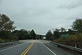
 Northwest from Steffey Church Road.jpg 6.016 × 4.000; 6,21 MB
-
 Panorama Weather Shot - panoramio (115).jpg 17.356 × 3.084; 10,71 MB
-
 Panorama Weather Shot - panoramio (116).jpg 9.078 × 2.258; 6,49 MB
-
 Panorama Weather Shot - panoramio (121).jpg 9.078 × 2.258; 10,89 MB
-
 Panorama Weather Shot - panoramio (124).jpg 15.777 × 1.553; 14,32 MB
-
 Panorama Weather Shot - panoramio (15).jpg 10.988 × 2.110; 5,39 MB
-
 Panorama Weather Shot - panoramio (16).jpg 8.568 × 3.101; 16,63 MB
-
 Panorama Weather Shot - panoramio (18).jpg 13.531 × 2.143; 8,62 MB
-
 Panorama Weather Shot - panoramio (19).jpg 10.032 × 2.088; 4,38 MB
-
 Panorama Weather Shot - panoramio (61).jpg 2.922 × 4.806; 9,71 MB
-
 Panorama Weather Shot - panoramio (67).jpg 2.205 × 4.962; 7,78 MB
-
 Panorama Weather Shot - panoramio (71).jpg 4.090 × 5.324; 8,14 MB
-

-
 South from Round Top.jpg 6.016 × 4.000; 6,81 MB
-
 Sunday Drive in the Laurel Mountains - panoramio (1).jpg 5.184 × 3.456; 4 MB
-
 Sunday Drive in the Laurel Mountains - panoramio (10).jpg 5.184 × 3.456; 6,34 MB
-
 Sunday Drive in the Laurel Mountains - panoramio (11).jpg 5.184 × 3.456; 6,68 MB
-
 Sunday Drive in the Laurel Mountains - panoramio (12).jpg 5.184 × 3.456; 4,79 MB
-
 Sunday Drive in the Laurel Mountains - panoramio (13).jpg 5.184 × 3.456; 5,58 MB
-
 Sunday Drive in the Laurel Mountains - panoramio (14).jpg 5.184 × 3.456; 6,61 MB
-
 Sunday Drive in the Laurel Mountains - panoramio (15).jpg 5.184 × 3.456; 7,22 MB
-
 Sunday Drive in the Laurel Mountains - panoramio (16).jpg 5.184 × 3.456; 7,63 MB
-
 Sunday Drive in the Laurel Mountains - panoramio (17).jpg 5.184 × 3.456; 7,29 MB
-
 Sunday Drive in the Laurel Mountains - panoramio (18).jpg 5.184 × 3.456; 7,25 MB
-
 Sunday Drive in the Laurel Mountains - panoramio (19).jpg 5.184 × 3.456; 8,97 MB
-
 Sunday Drive in the Laurel Mountains - panoramio (2).jpg 5.184 × 3.456; 4,06 MB
-
 Sunday Drive in the Laurel Mountains - panoramio (21).jpg 5.184 × 3.456; 8,38 MB
-
 Sunday Drive in the Laurel Mountains - panoramio (23).jpg 5.184 × 3.456; 5,82 MB
-
 Sunday Drive in the Laurel Mountains - panoramio (25).jpg 5.184 × 3.456; 4,65 MB
-
 Sunday Drive in the Laurel Mountains - panoramio (3).jpg 5.184 × 3.456; 8,78 MB
-
 Sunday Drive in the Laurel Mountains - panoramio (4).jpg 5.184 × 3.456; 8,96 MB
-
 Sunday Drive in the Laurel Mountains - panoramio (5).jpg 5.184 × 3.456; 6,09 MB
-
 Sunday Drive in the Laurel Mountains - panoramio (6).jpg 5.184 × 3.456; 9,4 MB
-
 Sunday Drive in the Laurel Mountains - panoramio (7).jpg 5.184 × 3.456; 6,7 MB
-
 Sunday Drive in the Laurel Mountains - panoramio (8).jpg 5.184 × 3.456; 6,28 MB
-
 Sunday Drive in the Laurel Mountains - panoramio (9).jpg 5.184 × 3.456; 7,35 MB
-
 Sunday Drive in the Laurel Mountains - panoramio.jpg 5.184 × 3.456; 4,82 MB
-
 Sutton Hall 2nd floor.jpg 380 × 341; 74 kB
-
 USA Indiana County, Pennsylvania age pyramid.svg 520 × 600; 8 kB
-
 Western Pennsylvania - Airborne Batimore to Minneapolis (3358222980).jpg 2.592 × 1.944; 1,77 MB
-
 Wildlife around power plant - panoramio (2).jpg 5.184 × 3.456; 8,85 MB
-
 Wildlife around power plant - panoramio (3).jpg 5.184 × 3.456; 7,96 MB
-
 Wildlife around power plant - panoramio.jpg 5.184 × 3.456; 4,94 MB
-
 Yellow creek fall season - panoramio.jpg 640 × 480; 69 kB


.jpg)
.jpg)
.jpg)
.jpg)
.jpg)
.jpg)
.jpg)
.jpg)
.jpg)
.jpg)
.jpg)
.jpg)
.jpg)
.jpg)
.jpg)
.jpg)
.jpg)
.jpg)
.jpg)
.jpg)


.jpg)


_Airport_Runway.jpg)


.jpg)
.jpg)
.jpg)
.jpg)

.jpg)
.jpg)
.jpg)
.jpg)
.jpg)
.jpg)
.jpg)
.jpg)
.jpg)
.jpg)
.jpg)
.jpg)
.jpg)
.jpg)
.jpg)
.jpg)
.jpg)
.jpg)
.jpg)
.jpg)
.jpg)
.jpg)


.jpg)
.jpg)
.jpg)


.jpg)
.jpg)
.jpg)
.jpg)
.jpg)
.jpg)
.jpg)
.jpg)