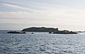
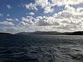
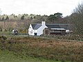
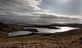
Category:Islay
Jump to navigation
Jump to search
southernmost island of the Inner Hebrides in Argyll and Bute, Scotland, UK   | |||||
| Upload media | |||||
| Instance of | |||||
|---|---|---|---|---|---|
| Part of | |||||
| Location |
| ||||
| Located in or next to body of water | |||||
| Capital | |||||
| Width |
| ||||
| Length |
| ||||
| Highest point |
| ||||
| Population |
| ||||
| Area |
| ||||
| Elevation above sea level |
| ||||
 | |||||
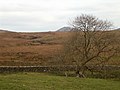
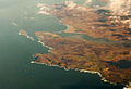
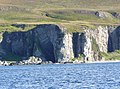
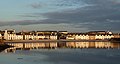
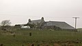
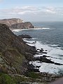
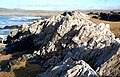
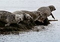
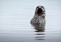
Islay is an island in the Inner Hebrides, famous for Scotch malt whisky. Its landforms are of geologic interest; its wildlife, of biologic. Abundant ruins attest to a previously larger, agrarian population. Tracts have been reforested. Its numerous archaeological sites attest to continuous occupation for several thousand years of prehistory. Its location is strategic for Atlantic defense and also for past cultural connections to Ireland and Scandinavia.
Subcategories
This category has the following 110 subcategories, out of 110 total.
- Anthropology of Islay (2 F)
- Geology of Islay (15 F)
- Maps of Islay (35 F)
- Moorlands on Islay (7 F)
- Plants of Islay (17 F)
- Ships registered in Islay (1 F)
A
- Achadh, Islay (3 F)
- An Cladach (5 F)
- Ardlarach (1 F)
- Arivoichallum (1 F)
- Avenvogie (9 F)
B
- Bachlaig, Islay (10 F)
- Ballachlaven (4 F)
- Ballimartin (4 F)
- Ballimony (6 F)
- Ballitarsin (1 F)
- Ballivicar (3 F)
- Ballychatrigan (3 F)
- Ballymeanach (2 F)
- Bolsay (1 F)
- Borichill (1 F)
- Brahunisary (4 F)
- Braibruich (1 F)
- Braigo (3 F)
C
- Carnduncan, Islay (5 F)
- Carrabus, Islay (4 F)
- Cattadale, Islay (4 F)
- Cladville, Islay (6 F)
- Cluanach, Islay (5 F)
- Cornabus, Islay (2 F)
- Coull, Islay (13 F)
- Cruach, Islay (7 F)
D
- Duich Lots (2 F)
- Duich Moss (4 F)
E
- Eallabus (4 F)
- Easter Ellister (2 F)
- Emeraconart (4 F)
F
- Fang-Dhu (2 F)
- Frachdale, Islay (3 F)
G
- Gartbreck (3 F)
- Gartloist (2 F)
- Gartmain (3 F)
- Gearach (4 F)
- Gleannagaoidh (1 F)
- Glenmachrie, Islay (2 F)
- Gortan, Islay (6 F)
- Gortantaoid (18 F)
- Gruinart (2 F)
I
- Imeraval, Islay (4 F)
- Ineraval, Islay (1 F)
K
- Kelsay, Islay (4 F)
- Kilbride, Islay (4 F)
- Kilennan River, Islay (4 F)
- Killinallan, Islay (11 F)
- Kindrochid (3 F)
- Kintour, Islay (7 F)
- Kintra, Islay (22 F)
- Knockdon, Islay (4 F)
L
- Laggan, Islay (12 F)
- Leckgruinart (2 F)
- Leorin, Islay (2 F)
- Lossit, Islay (11 F)
- Lower Coillabus (3 F)
- Lower Cragabus (3 F)
M
- Machrie, Islay (8 F)
- Mulindry (3 F)
- Mulreesh (3 F)
N
- Neriby (2 F)
O
- Octofad, Islay (5 F)
P
- Pennycraig (4 F)
- Persabus, Islay (6 F)
R
- Ronnachmore, Islay (2 F)
S
- Saligo, Islay (5 F)
- Sgairail (3 F)
- Sleivemore (3 F)
- Solam, Islay (3 F)
- Storakaig (1 F)
T
- Tallant near Bowmore (6 F)
- Tayandock, Islay (1 F)
- The Book of Islay (1895) (6 F)
- Torrabus (4 F)
U
- Uiskentuie (6 F)
- Upper Cragabus (1 F)
W
- Wester Ellister (4 F)
Media in category "Islay"
The following 154 files are in this category, out of 154 total.
-
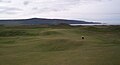
 6th green.jpg 5,515 × 3,677; 8.06 MB
-
 9th bunkers (2).jpg 3,350 × 2,234; 1.4 MB
-
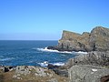
 Across the rock arch, Slochd Maol Doiridh, Islay - geograph.org.uk - 1898229.jpg 768 × 1,024; 265 KB
-
 Another phone box^ - geograph.org.uk - 756160.jpg 527 × 640; 67 KB
-

-
 Argyll and Bute, UK - panoramio (5).jpg 1,280 × 853; 1.33 MB
-
 Balach Rocks - geograph.org.uk - 5207279.jpg 1,024 × 768; 205 KB
-
 Balulive - geograph.org.uk - 760035.jpg 640 × 480; 52 KB
-
 Big Strand HDR (15147038785).jpg 3,846 × 2,583; 5.48 MB
-
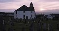 Bowmore Round Church, (May 2001) - panoramio.jpg 3,500 × 1,864; 1.46 MB
-
 Building at Gartnatra (geograph 1850743).jpg 640 × 480; 37 KB
-
 Cam Sgeir near Carmichael's Rocks - geograph.org.uk - 3935758.jpg 1,606 × 1,000; 986 KB
-
 Campa, Islay - geograph.org.uk - 4233742.jpg 640 × 427; 84 KB
-
 Carmichael's Rocks - geograph.org.uk - 3930046.jpg 1,739 × 1,000; 1.25 MB
-
 Carraig an t-Sluic, Islay - geograph.org.uk - 4150921.jpg 640 × 424; 45 KB
-
 Edge of the moorland - geograph.org.uk - 112501.jpg 640 × 480; 222 KB
-
 Ceann nan Sgeiran, Islay - geograph.org.uk - 3359339.jpg 640 × 480; 50 KB
-
 Ceann nan Sgeirean - geograph.org.uk - 3930334.jpg 1,972 × 1,000; 1.5 MB
-
 Ceann nan Sgeirean, Islay - geograph.org.uk - 4150904.jpg 640 × 377; 39 KB
-
 Central Tàrr Sgeir - geograph.org.uk - 3933936.jpg 1,333 × 1,000; 1.11 MB
-
 Checking the Seaweed - geograph.org.uk - 5169853.jpg 4,272 × 2,848; 1.48 MB
-
 Cill Naoimh cross taken from inside the church, Kilnave, Islay.jpg 3,120 × 4,160; 1.32 MB
-
 Grassy meadow with mountains beyond - geograph.org.uk - 1422211.jpg 640 × 454; 137 KB
-
 Coast of Islay - geograph.org.uk - 1895276.jpg 1,024 × 768; 166 KB
-

-
 Corr Sgeir - geograph.org.uk - 3930077.jpg 1,304 × 1,000; 982 KB
-
 Cottages at Bunnahabhainn - geograph.org.uk - 934931.jpg 640 × 437; 102 KB
-
 Detail of beach by Carragh an t-Sruith - geograph.org.uk - 2394404.jpg 640 × 485; 251 KB
-
-
 Doorway of a house on Isay - geograph.org.uk - 2039552.jpg 640 × 479; 221 KB
-
 Eastern end of Tàrr Sgeir - geograph.org.uk - 3930038.jpg 1,462 × 1,000; 1.03 MB
-

-
 Finlaggan, (May 2001) - panoramio (1).jpg 3,500 × 2,331; 4.71 MB
-
 Finlaggan, (May 2001) - panoramio.jpg 3,500 × 2,174; 3.64 MB
-
 Finlaggan, Eilean na Comhairle, the Council Isle, (May 2001) - panoramio.jpg 3,500 × 2,322; 2.52 MB
-
 Fionn-phort - geograph.org.uk - 5441402.jpg 1,600 × 1,067; 166 KB
-
 Frenchman's Rocks - geograph.org.uk - 4150078.jpg 640 × 397; 36 KB
-
 Frenchman's Rocks - geograph.org.uk - 5776477.jpg 3,147 × 2,360; 1.35 MB
-
 Frenchman's Rocks - geograph.org.uk - 5776479.jpg 3,264 × 2,448; 3.69 MB
-
 Frenchman's Rocks - geograph.org.uk - 5776486.jpg 3,264 × 2,448; 3.75 MB
-
 From Antrim to Islay - geograph.org.uk - 4605261.jpg 3,648 × 2,736; 4.37 MB
-
 Garbh Sgeir Beag, Islay - geograph.org.uk - 4150914.jpg 640 × 488; 66 KB
-
 Heather Moor Near Wester Ellister - geograph.org.uk - 1774818.jpg 640 × 426; 110 KB
-
 Hermosa Caleta de Acupita en Islay.jpg 466 × 350; 21 KB
-
 Iomallach - geograph.org.uk - 3930071.jpg 1,333 × 1,000; 1 MB
-
 Iseanach Mòr, Islay - geograph.org.uk - 4150960.jpg 640 × 406; 46 KB
-
 Islay (9860605223).jpg 3,264 × 2,448; 835 KB
-
 Islay Livestock Auction Market - geograph.org.uk - 1804734.jpg 640 × 425; 99 KB
-
 Islay Seals.jpg 3,580 × 2,671; 4.97 MB
-
Islay, Scotland.webm 2 min 29 s, 2,276 × 1,280; 68.66 MB
-
Islay.ogg 0.8 s; 21 KB
-
 Isle of Islay by Ben Birdsall.JPG 1,421 × 675; 373 KB
-

-
 James Swinton and a keeper stalking, Islay by John Francis Campbell.jpg 1,241 × 853; 204 KB
-
 Kilchoman Cross with Kilchoman House behind.jpg 3,120 × 4,160; 1.07 MB
-
 Kilchoman, (May 2001) - panoramio.jpg 2,500 × 1,592; 1.36 MB
-
 Kildalton Bay, Islay - geograph.org.uk - 210112.jpg 640 × 480; 54 KB
-
 Kildalton church, Islay - panoramio.jpg 5,089 × 3,456; 9.67 MB
-
 Kildalton cross, Islay - panoramio (1).jpg 3,456 × 5,184; 12.92 MB
-
 Kildalton cross, Islay - panoramio.jpg 3,456 × 4,822; 8.02 MB
-
 Farm building - geograph.org.uk - 112464.jpg 640 × 480; 198 KB
-
 Cottage at Knockanbearach - geograph.org.uk - 759153.jpg 640 × 480; 74 KB
-
 Lachlan Mor Maclean of Duart Fell Here - geograph.org.uk - 1774739.jpg 640 × 480; 101 KB
-
Laphroaig - Hollow By The Bay - Making Whisky.webm 3 min 30 s, 1,920 × 1,080; 126.99 MB
-
 Loch Sholum-4 (16647661118).jpg 3,810 × 2,259; 6.18 MB
-

-
 Lossit Point, Islay - geograph.org.uk - 4150093.jpg 640 × 420; 57 KB
-
 Machir Bay, Kilchoman, (May 2001) - panoramio.jpg 2,500 × 1,663; 2.76 MB
-
 MachrieGolfCourseIslay.jpg 1,118 × 602; 71 KB
-

-
 Moorland in the heart of Islay - geograph.org.uk - 216034.jpg 640 × 480; 95 KB
-
 Moorland in the heart of Islay - geograph.org.uk - 216038.jpg 640 × 480; 95 KB
-
 Moorland on the Dunlossit Estate - geograph.org.uk - 112502.jpg 640 × 480; 185 KB
-
 Navigation buoy off Islay - geograph.org.uk - 4042918.jpg 3,264 × 2,448; 2.24 MB
-
 Near Gortantoid Point, Islay - geograph.org.uk - 3772902.jpg 640 × 427; 63 KB
-
 Near Rubha Lamanais - geograph.org.uk - 351035.jpg 640 × 480; 116 KB
-
 NW Islay aerial.jpg 2,077 × 1,411; 2.73 MB
-
-
 Outram from the seaward side - geograph.org.uk - 3930369.jpg 2,227 × 1,000; 1.7 MB
-
 Paps of Jura from Finlaggan, (May 2001) - panoramio.jpg 3,500 × 1,567; 1.48 MB
-
 Pastureland with geese - geograph.org.uk - 756065.jpg 640 × 480; 67 KB
-
 Plod Sgeirean and Cnoc Rhaonastil - geograph.org.uk - 4150844.jpg 640 × 332; 55 KB
-
 Port Ellen - Islay - panoramio.jpg 3,948 × 2,122; 2.26 MB
-
 Port na Seilich - geograph.org.uk - 2563215.jpg 3,456 × 2,304; 912 KB
-
 Post Rocks, Islay - geograph.org.uk - 4150531.jpg 640 × 418; 53 KB
-
 PSM V70 D194 Sand dune on the desert of islay.png 1,639 × 1,266; 658 KB
-
 Red Deer (13542248124).jpg 4,000 × 3,000; 1.31 MB
-

-
 Rocks At Campa - geograph.org.uk - 1163365.jpg 640 × 393; 125 KB
-

-
 Rocky coastline at Port Ban, Islay - geograph.org.uk - 4197181.jpg 640 × 427; 84 KB
-

-
 Royal Air Force Radar, 1939-1945 CH16469.jpg 800 × 560; 51 KB
-
 RSPB Hide - geograph.org.uk - 15499.jpg 640 × 480; 125 KB
-
 Rubha Port an t-Seilich - geograph.org.uk - 3602222.jpg 1,245 × 852; 164 KB
-
 Ruins at Gartantaoid - geograph.org.uk - 753876.jpg 640 × 362; 51 KB
-
 Scarrabus Farm - geograph.org.uk - 760087.jpg 640 × 364; 34 KB
-
 Scene in the cave by John Francis Campbell.jpg 1,286 × 853; 167 KB
-
 Scotland Argyll Bute Islay from ferry.jpg 3,456 × 2,304; 3.46 MB
-
 Scotland Argyll Bute Islay Kildalton Landscape 01.jpg 3,456 × 2,304; 4.38 MB
-
 Scotland Argyll Bute Islay Kildalton Landscape 02.jpg 3,456 × 2,304; 5.44 MB
-
 Scotland Argyll Bute Islay Kildalton Landscape 03.jpg 3,456 × 2,304; 4.09 MB
-
 Scotland Argyll Bute Islay Kildalton Landscape 04.jpg 3,456 × 2,304; 4.93 MB
-
 Scotland Argyll Bute Islay Kildalton Landscape 05.jpg 3,456 × 2,304; 4.91 MB
-
 Scotland Argyll Bute Islay Kildalton Landscape 06.jpg 3,456 × 2,304; 4.38 MB
-
 Scotland Argyll Bute Islay Lagavulin Distillery Landscape 01.jpg 3,456 × 2,304; 4.07 MB
-
 Scotland Argyll Bute Islay Lagavulin Distillery Landscape 02.jpg 2,304 × 3,456; 4.85 MB
-
 Sea Caves, Slochd Mhaol Doraidh, Islay by John Francis Campbell.jpg 1,016 × 854; 173 KB
-
 Seal on Cam Sgeir (south of Texa) - geograph.org.uk - 3935690.jpg 1,559 × 1,000; 1.27 MB
-
 Seals on the rocks - geograph.org.uk - 5441337.jpg 1,600 × 1,223; 266 KB
-
 Sgeir Fhada - geograph.org.uk - 15828.jpg 640 × 480; 56 KB
-
 Sgeir Sgleàta and Corr Sgeir, Islay - geograph.org.uk - 4150934.jpg 640 × 413; 50 KB
-
 Sgeirean Dearga - northeastern rocks - geograph.org.uk - 3930341.jpg 1,155 × 1,000; 909 KB
-
 Sgeirean Dearga - southwestern rocks - geograph.org.uk - 3930084.jpg 1,333 × 1,000; 1.2 MB
-
 Sgeirean Fiaclach (Northwestern rocks) - geograph.org.uk - 3944749.jpg 1,316 × 1,000; 907 KB
-
 Sheep on the beach. - geograph.org.uk - 320351.jpg 640 × 480; 93 KB
-
 Small wood on Jura - geograph.org.uk - 134692.jpg 640 × 480; 194 KB
-
 Southern shore of Isay - geograph.org.uk - 2039587.jpg 640 × 475; 180 KB
-
 Southern tip of Isay - geograph.org.uk - 2039582.jpg 640 × 480; 162 KB
-
 Stac na Faoilinn, Islay - geograph.org.uk - 4150717.jpg 640 × 407; 48 KB
-
 Staoisha Forest Track - geograph.org.uk - 1361846.jpg 640 × 480; 122 KB
-
 Telephone booth at Bruichladdich.jpg 3,000 × 4,000; 2.12 MB
-
 The big strand, Islay - panoramio (2).jpg 3,368 × 5,118; 6.95 MB
-
 The big strand, Islay - panoramio (3).jpg 5,184 × 3,456; 5.86 MB
-
 The big strand, Islay - panoramio (4).jpg 5,184 × 3,456; 7.02 MB
-
 The big strand, Islay - panoramio (5).jpg 5,184 × 3,456; 6.54 MB
-
 The big strand, Islay - panoramio (6).jpg 5,184 × 3,456; 8.14 MB
-
 The big strand, Islay - panoramio.jpg 3,227 × 5,040; 10.52 MB
-
 The east coast of Islay from the Kennacraig ferry - geograph.org.uk - 5442619.jpg 1,600 × 1,067; 180 KB
-
 The grave of the crew of the Exmouth Castle by John Francis Campbell.jpg 1,465 × 851; 245 KB
-
 The green roof - geograph.org.uk - 164639.jpg 640 × 480; 186 KB
-
 The Oa Islay.JPG 960 × 1,280; 907 KB
-
 The Ring-Dyke At Campa - geograph.org.uk - 1163360.jpg 640 × 411; 130 KB
-
 The Seal Of Approval.jpg 2,224 × 1,581; 2.37 MB
-
 The Seal of Approval.jpg 3,256 × 2,251; 3.03 MB
-
 The trusty old tractor - geograph.org.uk - 756818.jpg 640 × 366; 65 KB
-
 Three-arched bridge - geograph.org.uk - 112497.jpg 640 × 480; 210 KB
-
 Tighandrom service reservoir - geograph.org.uk - 755175.jpg 640 × 387; 59 KB
-
 Traigh Ban, Islay - geograph.org.uk - 2416238.jpg 640 × 480; 115 KB
-
 Tàrr Sgeir - geograph.org.uk - 4163717.jpg 640 × 480; 412 KB
-

-
 View south from Inver Cottage - geograph.org.uk - 1089320.jpg 640 × 480; 58 KB
-
 Wave energy power generator - geograph.org.uk - 1419260.jpg 640 × 427; 354 KB
-
 Waves crash on Iomallach - geograph.org.uk - 3977826.jpg 1,532 × 1,000; 1.11 MB
-
 White Ring-Dyke At Campa - geograph.org.uk - 1163355.jpg 640 × 364; 116 KB
-
 Across the Moor - geograph.org.uk - 349861.jpg 640 × 456; 111 KB
-
 Cnoc Fada - geograph.org.uk - 350696.jpg 640 × 480; 118 KB
-
 From Gruinart Woods - geograph.org.uk - 704005.jpg 640 × 473; 126 KB
-
 From The Lookout Point - geograph.org.uk - 700318.jpg 640 × 436; 63 KB
-
 Gruinart Fields - geograph.org.uk - 704096.jpg 640 × 384; 63 KB
-
 Inland from Rubha Lamanais - geograph.org.uk - 351051.jpg 640 × 480; 121 KB
-
 Rocky Coast - geograph.org.uk - 706184.jpg 640 × 353; 40 KB
-

-
 View towards Port Carraig Sgairn, Islay - geograph.org.uk - 272308.jpg 556 × 640; 125 KB

.jpg)


.jpg)


.jpg)
_-_panoramio.jpg)
.jpg)


_-_panoramio_(1).jpg)
_-_panoramio.jpg)
_-_panoramio.jpg)


.jpg)


_-_panoramio.jpg)


.jpg)


.jpg)


_-_panoramio.jpg)


_-_panoramio.jpg)


.jpg)


_-_geograph.org.uk_-_3935690.jpg)


_-_geograph.org.uk_-_3944749.jpg)


.jpg)
.jpg)
.jpg)
.jpg)
.jpg)


