Category:Luzerne County, Pennsylvania
Aller à la navigation
Aller à la recherche
Comtés de Pennsylvanie : Adams · Allegheny · Armstrong · Beaver · Bedford · Berks · Blair · Bradford · Bucks · Butler · Cambria · Cameron · Carbon · Centre · Chester · Clarion · Clearfield · Clinton · Columbia · Crawford · Cumberland · Dauphin · Delaware · Elk · Erie · Fayette · Forest · Franklin · Fulton · Greene · Huntingdon · Indiana · Jefferson · Juniata · Lackawanna · Lancaster · Lawrence · Lebanon · Lehigh · Luzerne · Lycoming · McKean · Mercer · Mifflin · Monroe · Montgomery · Montour · Northampton · Northumberland · Perry · Philadelphia · Pike · Potter · Schuylkill · Snyder · Somerset · Sullivan · Susquehanna · Tioga · Union · Venango · Warren · Washington · Wayne · Westmoreland · Wyoming · York
comté de la Pennsylvanie, État-Unis   | |||||
| Téléverser des médias | |||||
| Nature de l’élément |
| ||||
|---|---|---|---|---|---|
| Nommé(e) en référence à | |||||
| Lieu | Pennsylvanie, É.-U. | ||||
| Capitale | |||||
| Date de fondation ou de création |
| ||||
| Population |
| ||||
| Superficie |
| ||||
| À ne pas confondre avec | |||||
| site officiel | |||||
 | |||||
Sous-catégories
Cette catégorie comprend 15 sous-catégories, dont les 15 ci-dessous.
D
E
G
H
N
P
S
T
Média dans la catégorie « Luzerne County, Pennsylvania »
Cette catégorie comprend 363 fichiers, dont les 200 ci-dessous.
(page précédente) (page suivante)-
 1901 University of PA Crew.jpg 1 500 × 1 026 ; 264 kio
-
 Adams Falls 1.JPG 2 056 × 3 088 ; 1,91 Mio
-
 Adams Falls 2.JPG 2 056 × 3 088 ; 2,37 Mio
-
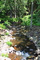
 Bear Hollow Creek.JPG 2 056 × 3 088 ; 3,4 Mio
-
 Beaver Pond (Luzerne County, Pennsylvania).JPG 2 256 × 1 504 ; 2,56 Mio
-
 Bell Bend from Council Cup 1.JPG 2 256 × 1 504 ; 2,88 Mio
-
 Bell Bend from Council Cup 2.JPG 2 167 × 1 498 ; 3,42 Mio
-
 Black Ash Creek.JPG 1 504 × 2 256 ; 2,95 Mio
-
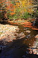
 Black Creek (Nescopeck Creek).JPG 3 264 × 2 448 ; 3,83 Mio
-
 Black Creek satellite map.PNG 982 × 433 ; 1,03 Mio
-
 Blue Giant Meadow Lake 1.JPG 3 088 × 2 056 ; 1,06 Mio
-
 Blue Giant Meadow Lake 2.JPG 3 088 × 2 056 ; 1,86 Mio
-
 Boats on Harveys Lake.JPG 3 088 × 2 056 ; 1,54 Mio
-
 Bow Creek looking downstream.JPG 2 056 × 3 088 ; 2,41 Mio
-
 Bow Creek looking upstream.JPG 2 056 × 3 088 ; 2,53 Mio
-
 Bowman Creek looking downstream in its upper reaches.JPG 2 056 × 3 088 ; 2,61 Mio
-
 Bowman Creek looking upstream in its upper reaches.JPG 2 056 × 3 088 ; 2,5 Mio
-
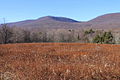 Central Mountain and Red Rock Mountain.JPG 2 256 × 1 504 ; 3,3 Mio
-
 Cliff on Council Cup.JPG 2 256 × 1 504 ; 3,11 Mio
-
 Closeup of Crooked Creek.JPG 1 493 × 1 495 ; 1,58 Mio
-
 Council Cup from Pennsylvania Route 93.JPG 3 088 × 2 056 ; 1,23 Mio
-
 Council Cup from Wapwallopen.JPG 3 264 × 2 448 ; 1,69 Mio
-

-
 Cows in a field in Luzerne County, Pennsylvania 1.JPG 3 076 × 1 624 ; 1,74 Mio
-
 Cows in a field in Luzerne County, Pennsylvania 2.JPG 2 975 × 2 056 ; 1,96 Mio
-
 East - panoramio (2).jpg 1 536 × 2 048 ; 440 kio
-
 Elijah C. Wadhams.jpg 900 × 1 162 ; 318 kio
-
 Entering the Lackawanna State Forest.JPG 3 088 × 2 056 ; 1,96 Mio
-
-

-
-
-
-

-

-

-

-

-

-

-
-

-
-

-
-

-
 Flickr - Nicholas T - Beech Lake.jpg 4 608 × 3 456 ; 9,9 Mio
-
 Flickr - Nicholas T - Bowmans Marsh (1).jpg 4 559 × 3 068 ; 9,63 Mio
-
 Flickr - Nicholas T - Bowmans Marsh (2).jpg 4 608 × 2 879 ; 8,94 Mio
-
 Flickr - Nicholas T - Dusted.jpg 1 100 × 836 ; 871 kio
-
 Flickr - Nicholas T - Fallow.jpg 4 049 × 2 262 ; 8,11 Mio
-
 Flickr - Nicholas T - Open Canopy.jpg 3 456 × 4 608 ; 12,99 Mio
-
 Flickr - Nicholas T - Twilight.jpg 2 760 × 2 073 ; 2,7 Mio
-
 Flickr - Nicholas T - Westbound.jpg 4 320 × 3 118 ; 8,46 Mio
-
 Gamesa wind turbine at bald mountain.jpg 402 × 602 ; 126 kio
-
 Group of breaker boys in -9 breaker.jpg 690 × 800 ; 105 kio
-
 Group of Breaker boys. Smallest is Sam Belloma.jpg 4 806 × 3 276 ; 8,81 Mio
-
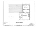
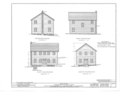
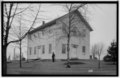
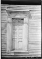
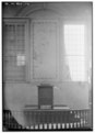
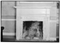
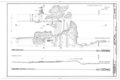
 Elisha Atherton Coray House, Exeter, Luzerne County, PA HABS PA,40-EXT,1- (sheet 0 of 6).tif 9 312 × 7 584 ; 225 kio
-
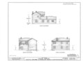
 Elisha Atherton Coray House, Exeter, Luzerne County, PA HABS PA,40-EXT,1- (sheet 1 of 6).tif 9 308 × 7 584 ; 350 kio
-
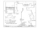
 Elisha Atherton Coray House, Exeter, Luzerne County, PA HABS PA,40-EXT,1- (sheet 2 of 6).tif 9 304 × 7 584 ; 409 kio
-
 Elisha Atherton Coray House, Exeter, Luzerne County, PA HABS PA,40-EXT,1- (sheet 3 of 6).tif 9 312 × 7 584 ; 516 kio
-
 Elisha Atherton Coray House, Exeter, Luzerne County, PA HABS PA,40-EXT,1- (sheet 4 of 6).tif 9 312 × 7 584 ; 552 kio
-
 Elisha Atherton Coray House, Exeter, Luzerne County, PA HABS PA,40-EXT,1- (sheet 5 of 6).tif 9 312 × 7 584 ; 386 kio
-
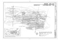
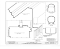
 Council Ridge Colliery, Eckley, Luzerne County, PA HAER PA,40-ECK,1- (sheet 1 of 5).tif 14 443 × 9 802 ; 784 kio
-
 Council Ridge Colliery, Eckley, Luzerne County, PA HAER PA,40-ECK,1- (sheet 2 of 5).tif 14 462 × 9 865 ; 639 kio
-
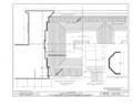
 Council Ridge Colliery, Eckley, Luzerne County, PA HAER PA,40-ECK,1- (sheet 3 of 5).tif 14 459 × 9 825 ; 3,81 Mio
-
 Council Ridge Colliery, Eckley, Luzerne County, PA HAER PA,40-ECK,1- (sheet 4 of 5).tif 14 452 × 9 834 ; 1,53 Mio
-
 Council Ridge Colliery, Eckley, Luzerne County, PA HAER PA,40-ECK,1- (sheet 5 of 5).tif 14 478 × 9 861 ; 4,48 Mio
-

-
-

-
-

-

-
-

-
-

-

-
-

-

-

-

-

-

-
-
 Harris Pond Dam.JPG 2 256 × 1 504 ; 2,36 Mio
-
 Harris Pond in April (1).JPG 2 256 × 1 504 ; 1,37 Mio
-
 Harris Pond in April (2).JPG 2 256 × 1 504 ; 1,36 Mio
-
 Harris Pond in April (3).JPG 2 256 × 1 504 ; 2,21 Mio
-
 Harry Livingston French.jpg 750 × 983 ; 148 kio
-
 Harveys Creek in 1899.png 405 × 513 ; 218 kio
-
 Harveys Creek looking downstream from Meeker Outlet Road.JPG 3 088 × 2 056 ; 3,31 Mio
-
 Harveys Creek looking downstream.JPG 2 056 × 3 088 ; 2,83 Mio
-
 Harveys Creek looking upstream 1.JPG 2 056 × 3 088 ; 2,93 Mio
-
 Harveys Creek looking upstream 2.JPG 3 088 × 2 056 ; 3,08 Mio
-
 Harveys Creek looking upstream from Meeker Outlet Road.JPG 2 056 × 3 088 ; 3,36 Mio
-
 Harveys Creek looking upstream in its upper reaches.JPG 3 088 × 2 056 ; 2,91 Mio
-
 Harveys Lake as viewed from OpenStreetMap.PNG 708 × 584 ; 94 kio
-
 Harveys Lake Dam.JPG 3 088 × 2 011 ; 2,27 Mio
-
 Harveys Lake Enviromapper image.png 400 × 300 ; 99 kio
-
 Harveys Lake from the north 1.JPG 3 088 × 2 056 ; 1,27 Mio
-
 Harveys Lake from the north 2.JPG 3 088 × 2 056 ; 1,33 Mio
-
 Harveys Lake from the northeast.JPG 3 088 × 1 954 ; 1,33 Mio
-
 Harveys Lake from the west.JPG 3 035 × 2 048 ; 1,42 Mio
-
 Headwaters of Roaring Brook 1.JPG 1 504 × 2 256 ; 1,39 Mio
-
 Headwaters of Roaring Brook 2.JPG 2 256 × 1 504 ; 2,93 Mio
-
-

-

-

-

-

-

-
-

-

-

-

-
-

-
-
-

-
-

-

-
 Hughestown PA Breaker Boys 1911.jpg 1 024 × 719 ; 124 kio
-
 Hunlock Creek looking downstream.JPG 2 056 × 3 088 ; 3,26 Mio
-
 Hunlock Creek looking upstream.JPG 2 056 × 3 088 ; 2,98 Mio
-
 Huntington Creek at Harveyville Road 1.JPG 2 256 × 1 504 ; 2,38 Mio
-
 Huntington Creek at Harveyville Road 2.JPG 2 203 × 1 374 ; 2,69 Mio
-
 Huntington Creek in its upper reaches 1.JPG 1 985 × 1 322 ; 2,47 Mio
-
 Huntington Creek looking downstream above Huntington Mills.JPG 1 504 × 2 256 ; 2,1 Mio
-
 Huntington Creek looking downstream below Mitchler Run 1.JPG 1 504 × 2 256 ; 2,36 Mio
-
 Huntington Creek looking downstream below Mitchler Run 2.JPG 2 256 × 1 504 ; 2,31 Mio
-
 Huntington Creek looking upstream above Huntington Mills 1.JPG 2 256 × 1 504 ; 3,46 Mio
-
 Huntington Creek looking upstream above Huntington Mills 2.JPG 2 215 × 1 501 ; 2,86 Mio
-
 Huntington Creek looking upstream below Mitchler Run 1.JPG 2 256 × 1 504 ; 2,16 Mio
-
 Huntington Creek looking upstream below Mitchler Run 2.JPG 1 504 × 2 256 ; 2,67 Mio
-
 Huntington Creek looking upstream in its upper reaches.JPG 2 056 × 3 088 ; 2,94 Mio
-
 Huntington Creek near Harveyville Road.JPG 2 256 × 1 504 ; 3,39 Mio
-
 Inocybe apiosmota 358465.jpg 1 632 × 1 224 ; 878 kio
-
 Inocybe apiosmota 358466.jpg 1 632 × 1 224 ; 829 kio
-
 Inocybe apiosmota 358467.jpg 1 632 × 1 224 ; 795 kio
-
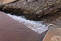
 Jeddo Tunnel outflow (cropped).png 296 × 223 ; 130 kio
-
 Jeddo Tunnel outflow.png 301 × 223 ; 132 kio
-
 John Jenks Shonk.jpg 750 × 983 ; 128 kio
-
 John Smith, Plymouth PA.jpg 900 × 1 222 ; 266 kio
-
 Kitchen Creek looking downstream above the Kitchen Creek Falls.JPG 2 256 × 1 504 ; 2,93 Mio
-
 Kitchen Creek looking downstream in Ricketts Glen State Park.JPG 3 088 × 2 056 ; 2,27 Mio
-
 Kitchen Creek looking downstream.JPG 2 256 × 1 504 ; 3,12 Mio
-
 Kitchen Creek looking upstream.JPG 1 504 × 2 256 ; 3,62 Mio
-
 Knox Mine Flood area from USMSHA report.gif 2 101 × 1 275 ; 229 kio
-
 Lackawanna State Forest.jpg 2 816 × 1 864 ; 5,01 Mio
-
 Lake Pinecrest.JPG 2 256 × 1 504 ; 2,86 Mio
-
 Lake Rose 1939.PNG 510 × 422 ; 303 kio
-
 Laurel Run (Huntington Creek) looking upstream.JPG 2 256 × 1 504 ; 3,2 Mio
-
 Lewis Hine, Jim McNulty, 15 years old, miner, North Pittston, Pennsylvania, 1911.jpg 5 000 × 3 514 ; 6,33 Mio
-
 Lick Branch looking downstream.JPG 2 256 × 1 504 ; 3,43 Mio
-
 Lick Branch looking upstream.JPG 2 256 × 1 504 ; 3,43 Mio
-
 Lily Lake dam.JPG 3 088 × 2 056 ; 1,3 Mio
-
 Little Nescopeck Creek satellite map.PNG 856 × 231 ; 518 kio
-
 Little Shickshinny Creek.JPG 2 256 × 1 504 ; 2,76 Mio
-
 Little Wapwallopen Creek from Pennsylvania Route 239.JPG 2 056 × 3 088 ; 2,95 Mio
-
 Little Wapwallopen Creek in its upper reaches looking downstream.JPG 3 088 × 2 056 ; 1,94 Mio
-
 Little Wapwallopen Creek in its upper reaches looking upstream.JPG 2 056 × 3 088 ; 1,82 Mio
-
 Little Wapwallopen Creek.JPG 3 264 × 2 448 ; 3,5 Mio
-
-
 Luzerne (Pennsylvania)2.jpg 2 816 × 2 112 ; 4,01 Mio
-
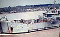 Luzerne County LST-902.jpg 468 × 289 ; 35 kio
-
 Luzerne County Railroad.jpg 200 × 254 ; 52 kio
-
 Luzerne Pennsylvania banner.jpg 2 750 × 393 ; 917 kio
-
-
 Map of Pennsylvania highlighting Luzerne County.svg 1 980 × 1 138 ; 96 kio
-
 Maple Run looking downstream 1.JPG 2 256 × 1 504 ; 2,98 Mio
-
 Maple Run looking downstream 2.JPG 1 504 × 2 256 ; 3,32 Mio
-
 Maple Run looking upstream.JPG 1 504 × 2 256 ; 2,83 Mio
-
 Marsh Creek looking downstream.JPG 1 340 × 2 039 ; 2,44 Mio
-
 Marsh Creek looking upstream.JPG 2 256 × 1 504 ; 2,62 Mio
-
 Marsh Run looking upstream.JPG 2 056 × 3 088 ; 1,82 Mio
-
 Mill Creek in October 1903.JPG 334 × 266 ; 25 kio
-
 Mitchler Run looking downstream 1.JPG 2 256 × 1 504 ; 2,37 Mio
-
 Mitchler Run looking downstream 2.JPG 1 504 × 2 256 ; 2,57 Mio
-
 Mitchler Run looking upstream 1.JPG 2 256 × 1 504 ; 2,75 Mio
-
 Mitchler Run looking upstream 2.JPG 2 256 × 1 504 ; 3,05 Mio
-
 Mitchler Run looking upstream 3.JPG 1 504 × 2 256 ; 2,59 Mio
-
 Mocanaqua Loop Trail 1.JPG 2 112 × 2 816 ; 2,72 Mio
-
 Mocanaqua Loop Trail 2.JPG 2 816 × 2 112 ; 3,11 Mio
-
 Mocanaqua Loop Trail 3.JPG 2 112 × 2 816 ; 2,88 Mio
-
 Mocanaqua Loop Trail sign.JPG 2 816 × 2 112 ; 2,01 Mio
-
 Nanticoke City.jpg 1 500 × 801 ; 252 kio
-
 Nescopeck Creek north of Conyngham.JPG 3 005 × 2 232 ; 2,81 Mio
-
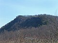
 Nescopeck Mountain from Council Cup Road.JPG 3 088 × 2 056 ; 1,68 Mio
-
 Nescopeck Mountain in June 2015 (1).JPG 3 088 × 2 056 ; 1,65 Mio
-
 Nescopeck Mountain in June 2015 (2).JPG 3 088 × 2 056 ; 1,67 Mio
-
 North Lake.JPG 2 256 × 1 504 ; 2,88 Mio
-
 North Mountain near Ricketts Glen State Park 1.JPG 2 256 × 1 504 ; 2,71 Mio
-
 North Mountain near Ricketts Glen State Park 2.JPG 2 256 × 1 504 ; 1,58 Mio


.JPG)


.JPG)


.png)


.jpg)


.jpg)
.jpg)
.jpg)
.jpg)
.jpg)
.jpg)
.jpg)
.jpg)
.jpg)
.jpg)
.jpg)
.jpg)
.jpg)
.jpg)
.jpg)
.jpg)
.jpg)
.jpg)

.jpg)
.jpg)


.png)
.png)
.png)
.png)
.png)
.png)
.png)
.png)
.png)

.JPG)
.JPG)
.JPG)


.png)


_looking_upstream.JPG)


2.jpg)


.JPG)
.JPG)


