Category:Maps of West Africa
Jump to navigation
Jump to search
Wikimedia category | |||||
| Upload media | |||||
| Instance of | |||||
|---|---|---|---|---|---|
| Category combines topics | |||||
| West Africa | |||||
westernmost region of the African continent   | |||||
| Pronunciation audio | |||||
| Instance of | |||||
| Part of | |||||
| Location | Africa, Southern Hemisphere | ||||
| Has part(s) | |||||
 | |||||
Subcategories
This category has the following 30 subcategories, out of 30 total.
Media in category "Maps of West Africa"
The following 42 files are in this category, out of 42 total.
-

-
 West Africa map.gif 1,500 × 977; 120 KB
-
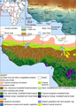
 Afrotropic-West Tropical Africa.svg 2,487 × 2,770; 339 KB
-
 Afrotropic-Ecozone-West Tropical Africa.svg 500 × 340; 74 KB
-
 West Africa countries (strict).png 360 × 392; 10 KB
-
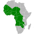
 Ecowas map.svg 1,200 × 1,230; 70 KB
-
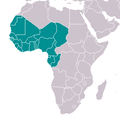 Africa (Western region).png 341 × 341; 10 KB
-
 UN Macroregion Western Africa.svg 1,000 × 1,000; 172 KB
-
 La Guinea occidentale (Antonio Zatta 1794, twelve small maps).jpg 374 × 569; 75 KB
-
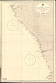 Admiralty Chart No 604 Cap Lopez to Luanda, Published 1959.jpg 11,106 × 16,250; 51.51 MB
-
 Africa de l'Oèst en 1875-hu.svg 1,588 × 771; 263 KB
-
 Africa-countries-bulge.png 341 × 341; 10 KB
-
 Africa-countries-WAFU-UFOA.png 360 × 392; 14 KB
-
 Africa-countries-western.png 360 × 392; 10 KB
-
 Africa-countries-western.svg 384 × 420; 26 KB
-
 Afryka Zachodnia.png 360 × 392; 24 KB
-
-
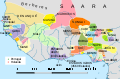
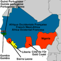 Colonial West-Africa.png 936 × 940; 226 KB
-
 ECDM 20230626 West and Central Africa.pdf 1,754 × 1,239; 852 KB
-
 ECOWAS members 2024.svg 1,157 × 1,031; 339 KB
-
 Francafrique map.png 4,463 × 3,228; 5.3 MB
-
 LocationWesternAfrica.png 359 × 359; 7 KB
-
 Map of livelihood distributions in 1000 BC Western Africa.webp 1,382 × 803; 249 KB
-
 Map of livelihood distributions in 1400 BC Western Africa.webp 1,382 × 803; 252 KB
-
 Map of livelihood distributions in 1800 BC Western Africa.webp 1,382 × 803; 248 KB
-
 Map of livelihood distributions in 200 BC Western Africa.webp 1,382 × 803; 274 KB
-
 Map of livelihood distributions in 600 BC Western Africa.webp 1,382 × 803; 273 KB
-
 Map of livelihood distributions in AD 1100 Western Africa.webp 1,382 × 803; 308 KB
-
 Map of livelihood distributions in AD 1500 Western Africa.webp 1,382 × 803; 336 KB
-
 Map of livelihood distributions in AD 200 Western Africa.webp 1,382 × 803; 287 KB
-
 Map of livelihood distributions in AD 600 Western Africa.webp 1,382 × 803; 304 KB
-
 Map of study area, White (1983), and Hijmans et al. (2005).webp 1,299 × 1,812; 552 KB
-
 Moha ennaji.jpg 362 × 329; 27 KB
-
 Slave Coast map.png 859 × 637; 38 KB
-
 Tamazgha map.png 2,048 × 2,048; 493 KB
-
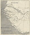
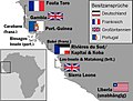 West Africa 1885.jpg 850 × 644; 114 KB
-
 West and Central Africa.svg 1,000 × 1,000; 189 KB
-
 West-Africa.svg 1,200 × 1,230; 55 KB
-
 WestAfrica1625-pt.svg 606 × 397; 637 KB
-
 Western-Africa-map.PNG 360 × 392; 10 KB
-
 World TLD Map-crop.png 369 × 427; 232 KB
-
 دول غرب أفريقيا.png 360 × 392; 10 KB


.png)

.png)

.jpg)


,_and_Hijmans_et_al._(2005).webp)


