Category:Maps of Guinea-Bissau
Jump to navigation
Jump to search
Countries of Africa: Algeria · Angola · Benin · Botswana · Burkina Faso · Burundi · Cameroon · Cape Verde · Central African Republic · Chad · Comoros · Democratic Republic of the Congo · Republic of the Congo · Djibouti · Egypt‡ · Equatorial Guinea · Eritrea · Eswatini · Ethiopia · Gabon · The Gambia · Ghana · Guinea · Guinea-Bissau · Ivory Coast · Kenya · Lesotho · Liberia · Libya · Madagascar · Malawi · Mali · Mauritania · Mauritius · Morocco · Mozambique · Namibia · Niger · Nigeria · Rwanda · São Tomé and Príncipe · Senegal · Seychelles · Sierra Leone · Somalia · South Africa · South Sudan · Sudan · Tanzania · Togo · Tunisia · Uganda · Zambia · Zimbabwe
Limited recognition: Ambazonia · Azawad · Puntland · Sahrawi Arab Democratic Republic · Somaliland – Other areas: Canary Islands · Ceuta · Madeira · Mayotte · Melilla · Réunion · Saint Helena, Ascension and Tristan da Cunha · Scattered Islands in the Indian Ocean · Western Sahara
‡: partly located in Africa
Wikimedia category | |||||
| Upload media | |||||
| Instance of | |||||
|---|---|---|---|---|---|
| Category combines topics | |||||
 | |||||
Subcategories
This category has the following 21 subcategories, out of 21 total.
- Blank maps of Guinea Bissau (2 F)
*
- Maps of Bolama (3 F)
B
C
E
- Election maps of Guinea-Bissau (26 F)
F
L
O
R
S
T
Pages in category "Maps of Guinea-Bissau"
The following 2 pages are in this category, out of 2 total.
Media in category "Maps of Guinea-Bissau"
The following 76 files are in this category, out of 76 total.
-
 AFR V3 D231 Bissagos Archipelago.jpg 1,480 × 2,693; 692 KB
-

-

-
 Bafata sectors-ar.png 948 × 770; 46 KB
-
 Bafata sectors.png 948 × 770; 27 KB
-
 Biombo sectors-ar.png 948 × 770; 22 KB
-
 Biombo sectors.png 948 × 770; 19 KB
-
 Bissagos 250 txu-oclc-6595921-nc28-2.jpg 5,000 × 3,771; 3.95 MB
-
 Bissagos archipel karte.png 486 × 331; 7 KB
-
 Bissagos txu-oclc-6654394-nc-28-4th-ed.jpg 1,258 × 908; 1.07 MB
-
 Bissau sector.png 1,056 × 816; 32 KB
-
 Bolama sectors bg.png 1,056 × 816; 46 KB
-
 Bolama sectors-ar.png 948 × 770; 44 KB
-
 Bolama sectors.png 948 × 770; 24 KB
-
 Cacheu sectors-ar.png 948 × 770; 43 KB
-
 Cacheu sectors.png 948 × 770; 23 KB
-
 Carte Bolama.jpg 657 × 382; 139 KB
-
 ECHO Guinea Bissau Editable A4 Landscape.pdf 1,754 × 1,239; 2.01 MB
-
 EEZ Cape Verde.png 1,988 × 1,170; 61 KB
-
 Ethne in Guinea Bissaviensi.jpg 1,200 × 526; 140 KB
-
 FLII GuineaBissau.png 1,274 × 771; 666 KB
-
 Gabu sectors-ar.png 948 × 770; 36 KB
-
 Gabu sectors.png 948 × 770; 20 KB
-
-
 Guinea Bissau Base Map.png 1,102 × 694; 490 KB
-
 Guinea Bissau Population Density, 2000 (6172438708).jpg 2,322 × 3,160; 666 KB
-
 Guinea Bissau Provinces map.png 2,000 × 1,182; 63 KB
-
 Guinea Bissau regions named.png 400 × 236; 13 KB
-
 Guinea-Bissau - DPLA - 15bb215f34ca4fa14126a4193c2e5919 (page 1).jpg 2,552 × 3,248; 5.4 MB
-
 Guinea-Bissau - DPLA - 15bb215f34ca4fa14126a4193c2e5919 (page 2).jpg 2,550 × 3,260; 5.51 MB
-
 Guinea-Bissau - DPLA - 5095a96635f0d76b66d7dce83465904d.jpg 2,550 × 3,276; 5.04 MB
-
 Guinea-Bissau national parks.jpg 1,024 × 674; 461 KB
-
 Guinea-Bissau Population Density, 2000 (5457013405).jpg 2,479 × 3,220; 607 KB
-
 Guinea-Bissau sectors.png 1,025 × 595; 21 KB
-
 GuineaBissau Hydrogeology3.png 951 × 856; 41 KB
-
 Guineabissau regions by HDI.png 1,181 × 746; 62 KB
-
 Guineae Bissaviensis sectores.png 1,025 × 595; 53 KB
-
 GW-region mk.svg 660 × 400; 107 KB
-
 GW-region.svg 660 × 400; 68 KB
-
 GW-regions.png 645 × 381; 18 KB
-
 Iles Bissagos - btv1b53153425n.jpg 5,558 × 5,128; 3.24 MB
-
 Ilha de Bolama,Guine Bissau,2018.png 261 × 299; 28 KB
-
 Ilha de Carache,Guine Bissau,2018.png 257 × 299; 24 KB
-
 Ilha de Formosa ,Guiné Bissau ,2018.png 277 × 319; 28 KB
-
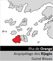 Ilha de Orango,Guiné Bissau,2018.png 277 × 319; 27 KB
-
 Ilha de UNO,Guiné Bissau,2018,I.png 257 × 262; 6 KB
-
 Ilha Poilão,Guiné Bissau,2018.png 277 × 338; 26 KB
-
 Map of rice polders.png 414 × 661; 676 KB
-
 Map of the sectors of the Bolama Region, Guinea-Bissau.png 1,206 × 941; 172 KB
-
 Mapa da Guiné-Bissau (OCHA).svg 254 × 254; 464 KB
-
 Oio sectors-ar.png 948 × 770; 46 KB
-
 Oio sectors.png 948 × 770; 23 KB
-
 Parque Nacional de Orango,Guné Bissau,2018,MAPA.png 277 × 339; 27 KB
-
 Parque Nacional Marinho João Vieira e Poilão,Guiné Bissau,2018.png 277 × 366; 11 KB
-
 Population density of Guinea-Bissau regions.png 4,643 × 3,004; 544 KB
-
 Portugal Colonial War 1970.jpg 360 × 480; 182 KB
-
 Portuguese Guinea - DPLA - 48b051fe0b922c6e673ce156e19b87d5.jpg 3,264 × 2,528; 1.52 MB
-
 Quinara sectors-ar.png 948 × 770; 48 KB
-
 Quinara sectors.png 948 × 770; 28 KB
-
 Regionis Biomboënsis sectores.png 948 × 770; 31 KB
-
 Regionis Bolāmae sectores.png 948 × 770; 39 KB
-
 Regionis Cachei sectores.png 948 × 770; 43 KB
-
 Regionis Oioënsis sectores.png 948 × 770; 37 KB
-
 Regionis Quinārae sectores.png 948 × 770; 44 KB
-
 Regionis Tombăliensis sectores.png 948 × 770; 50 KB
-
 ROXA loc.PNG 946 × 628; 15 KB
-
 Setor de Caravela,Guiné Bissau,2018.png 277 × 319; 30 KB
-
 SVG-Koort Guinea-Bissau.svg 800 × 450; 64 KB
-
 Tabula Guineae Bissaviensis Latine.png 325 × 350; 26 KB
-
 Tombali sectors-ar.png 948 × 770; 51 KB
-
 Tombali sectors.png 948 × 770; 32 KB
-
 Un-guinea-bissau-Empada1024x784.jpg 1,024 × 784; 614 KB
-
 Un-guinea-bissau.png 2,709 × 2,073; 1.94 MB
-
 UNO loc.PNG 946 × 628; 14 KB
-

-
 מפת גינאה ביסאו עם נהר קאזמאנסה מודגש.jpg 1,354 × 1,036; 778 KB


.jpg)


.jpg)
.jpg)


.jpg)


.svg)


