Category:Maps of Liberia
Jump to navigation
Jump to search
Countries of Africa: Algeria · Angola · Benin · Botswana · Burkina Faso · Burundi · Cameroon · Cape Verde · Central African Republic · Chad · Comoros · Democratic Republic of the Congo · Republic of the Congo · Djibouti · Egypt‡ · Equatorial Guinea · Eritrea · Eswatini · Ethiopia · Gabon · The Gambia · Ghana · Guinea · Guinea-Bissau · Ivory Coast · Kenya · Lesotho · Liberia · Libya · Madagascar · Malawi · Mali · Mauritania · Mauritius · Morocco · Mozambique · Namibia · Niger · Nigeria · Rwanda · São Tomé and Príncipe · Senegal · Seychelles · Sierra Leone · Somalia · South Africa · South Sudan · Sudan · Tanzania · Togo · Tunisia · Uganda · Zambia · Zimbabwe
Limited recognition: Ambazonia · Azawad · Puntland · Sahrawi Arab Democratic Republic · Somaliland – Other areas: Canary Islands · Ceuta · Madeira · Mayotte · Melilla · Réunion · Saint Helena, Ascension and Tristan da Cunha · Scattered Islands in the Indian Ocean · Western Sahara
‡: partly located in Africa
Wikimedia category | |||||
| Upload media | |||||
| Instance of | |||||
|---|---|---|---|---|---|
| Category combines topics | |||||
 | |||||
Subcategories
This category has the following 25 subcategories, out of 25 total.
+
A
- Maps of Liberia in art (1 F)
B
- Maps of borders of Liberia (4 F)
C
E
- ECHO Daily Maps of Liberia (22 F)
F
H
- Health maps of Liberia (2 F)
L
- Location maps of Liberia (2 F)
M
- Maps of Liberia on stamps (1 F)
- Maps of Monrovia (20 F)
R
S
T
- Transport maps of Liberia (1 F)
Pages in category "Maps of Liberia"
The following 2 pages are in this category, out of 2 total.
Media in category "Maps of Liberia"
The following 48 files are in this category, out of 48 total.
-
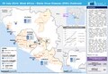
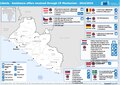 20150217 Liberia Assistance CP Mechanism 2014-2015.pdf 1,754 × 1,239; 470 KB
-
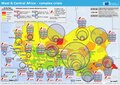 20230530 West & Central Africa Complex Crisis(1).pdf 1,754 × 1,239; 728 KB
-
 20230530 West & Central Africa Complex Crisis(1).png 3,509 × 2,482; 10.26 MB
-
 Admiralty Chart No 2478 Manna River to Junk River, Published 1906, Large Corrections 1961.jpg 16,352 × 11,235; 21.07 MB
-
 ECDM 20140324 Guinea Ebola.pdf 1,625 × 1,125; 622 KB
-
 ECDM 20140401 GuineaLiberia Ebola.pdf 1,625 × 1,125; 669 KB
-
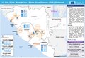 ECDM 20140711 WestAfrica Ebola.pdf 1,625 × 1,125; 549 KB
-
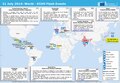
 ECDM 20140717 World Events.pdf 1,625 × 1,125; 383 KB
-
 ECDM 20140729 WestAfrica Ebola.pdf 1,625 × 1,125; 631 KB
-
 ECDM 20140731 World Events.pdf 1,625 × 1,125; 366 KB
-
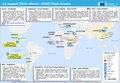 ECDM 20140814 World Events.pdf 1,625 × 1,125; 386 KB
-
 ECDM 20140818 WestAfrica Ebola.pdf 1,625 × 1,125; 738 KB
-
 ECDM 20140819 World Events.pdf 1,625 × 1,125; 377 KB
-
 ECDM 20141003 WestAfrica Ebola.pdf 1,625 × 1,125; 622 KB
-
 ECDM 20141020 WestAfrica Ebola.pdf 1,625 × 1,125; 603 KB
-
 ECDM 20141210 WestAfrica Ebola Disease Outbreack.pdf 1,625 × 1,125; 519 KB
-
 ECDM 20150213 WestAfrica EVDOutbreak.pdf 1,625 × 1,125; 817 KB
-
 ECDM 20150302 WestAfrica EVDOutbreak.pdf 1,625 × 1,125; 834 KB
-
 ECDM 20150521 WestAfrica EVDOutbreak.pdf 1,625 × 1,125; 564 KB
-
 ECDM 20150717 WestAfrica EVDOutbreak.pdf 1,625 × 1,125; 562 KB
-
 ECDM 20150827 World Events.pdf 1,625 × 1,125; 469 KB
-
 ECDM 20151009 WestAfrica Ebola.pdf 1,625 × 1,125; 470 KB
-
 ECDM 20160610 World events.pdf 1,625 × 1,125; 567 KB
-
 ECDM 20160701 World SevereWeather.pdf 1,625 × 1,125; 667 KB
-
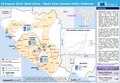
 ECHO Liberia Editable A4 Landscape.pdf 1,754 × 1,239; 339 KB
-
 ECHO Liberia Editable A4 Landscape.png 1,123 × 794; 291 KB
-
 ECHO West Africa Editable A4 Landscape.pdf 1,754 × 1,239; 571 KB
-
 FLII Liberia.png 981 × 826; 602 KB
-
 Liberia - DPLA - 187843a46b1377ec4b089c5b60182fa0.jpg 2,542 × 3,278; 6.18 MB
-
 Liberia - DPLA - 288d2c1a40b4fbd49c85e22e23b11187.jpg 2,554 × 3,276; 5.64 MB
-
 Liberia - DPLA - 9d43fec9d6056abcbe6a09725696aa02.jpg 2,552 × 3,278; 6.45 MB
-
 Liberia - DPLA - e2aa526a16d0d758343713d12d3dd829.jpg 2,554 × 3,276; 5.49 MB
-
 Liberia - DPLA - f54d5247a0c22a5bb014e35d6d225842.jpg 2,556 × 3,278; 6.47 MB
-
 Liberia - DPLA - fa1f7d2579ed2d1d475b8611020f18d8.jpg 2,546 × 3,280; 6.08 MB
-
 Liberia - DPLA - fbaedf9e2e32c20670b4c6a203e75ab9.jpg 2,406 × 3,136; 6.13 MB
-
 Liberia Base Map.png 1,108 × 697; 309 KB
-
 Liberia Fluss.jpg 694 × 712; 326 KB
-
 Liberia Population Density, 2000 (5457015245).jpg 2,493 × 3,220; 597 KB
-
 Liberia Population Density, 2000 (6171912269).jpg 2,322 × 3,160; 592 KB
-
 Liberia Principal Resources - DPLA - 4c52ce694e367e3156220395544c4a84.jpg 3,575 × 3,350; 1.57 MB
-
 Liberia sat.png 497 × 505; 333 KB
-
 Liberia Stammesgebiete.jpg 818 × 859; 257 KB
-
 Liberiamap.PNG 401 × 432; 13 KB
-
 LiberiaMap.png 620 × 810; 674 KB
-
 Map of Liberia.gif 324 × 356; 25 KB
-
 Mapa localizador Tuzon.png 1,000 × 1,010; 91 KB
-
 Population density of Liberia counties.png 3,790 × 4,446; 487 KB
-
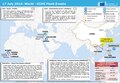
 Un-liberia.png 3,037 × 2,257; 1.42 MB
.png)


.jpg)
.jpg)


