Category:Sweetwater County, Wyoming
Vai alla navigazione
Vai alla ricerca
contea statunitense     | |||||
| Carica un file multimediale | |||||
| Istanza di | |||||
|---|---|---|---|---|---|
| Prende il nome da | |||||
| Luogo | Wyoming, Stati Uniti d'America | ||||
| Capitale | |||||
| Data di fondazione o creazione |
| ||||
| Popolazione |
| ||||
| Superficie |
| ||||
| sito web ufficiale | |||||
 | |||||
Sottocategorie
Questa categoria contiene le 19 sottocategorie indicate di seguito, su un totale di 19.
A
- Adobe Town Wilderness Study Area (30 F)
B
F
- Faulted sandstone in Wyoming (10 F)
M
- Minerals of Hays Ranch (1 F)
P
S
W
- Westvaco Mine (5 F)
- White Mountain (Wyoming) (3 F)
- Wilkins Peak (3 F)
File nella categoria "Sweetwater County, Wyoming"
Questa categoria contiene 116 file, indicati di seguito, su un totale di 116.
-
 Flag of Sweetwater County, Wyoming.gif 360 × 217; 14 KB
-
 Flag of Sweetwater County, Wyoming.svg 1 200 × 723; 36 KB
-
 2017.06.05 12.46.33 IMG 0536 - Flickr - andrey zharkikh.jpg 5 472 × 3 648; 2,99 MB
-
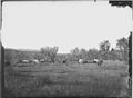 A camp on Henry's Fork. Sweetwater County, Wyoming - NARA - 516934.jpg 3 000 × 2 202; 1,56 MB
-

-

-
 Adobetown (20043670162).jpg 2 048 × 1 365; 2,6 MB
-
 Aerial Photo of Airport.jpg 5 184 × 3 456; 8,72 MB
-

-
 AspenMountain ArrowheadSprings.jpg 4 476 × 944; 1,91 MB
-

-
 Bradley 1930 dreikanter.jpg 1 400 × 1 138; 1,21 MB
-
 Burning Rock cut, Green River. Sweetwater County, Wyoming - NARA - 517364.jpg 3 000 × 1 587; 1,23 MB
-
 Burning Rock Cut, near Green River Station. Sweetwater County, Wyoming. - NARA - 516623.jpg 3 000 × 2 418; 1,83 MB
-
 Carmichael's Camp, Bitter Creek Valley. (18412591458).jpg 1 000 × 783; 675 KB
-
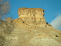 Castle Rock 1.jpg 1 280 × 960; 317 KB
-
 Coal hauler.jpg 2 089 × 1 495; 1,3 MB
-
 BLM Wyoming Employees and Volunteers Replace Crookston Ranch Fencing (15163291400).jpg 3 072 × 2 304; 2,55 MB
-
 BLM Wyoming Employees and Volunteers Replace Crookston Ranch Fencing (15163291590).jpg 1 663 × 1 109; 594 KB
-
 BLM Wyoming Employees and Volunteers Replace Crookston Ranch Fencing (15349986275).jpg 1 648 × 1 179; 346 KB
-
 Crop circles - panoramio.jpg 3 648 × 2 736; 2,1 MB
-

-
 Desert pronghorn.jpg 3 456 × 1 944; 2,18 MB
-

-

-
 East from Green River. Sweetwater County, Wyoming - NARA - 517370.jpg 3 000 × 1 608; 886 KB
-
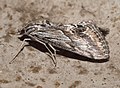 Evergestis simulatilis 59996363.jpg 2 048 × 1 501; 943 KB
-
 First Assembly of God Rock Springs sign.jpg 1 510 × 1 041; 1,05 MB
-
 Giant's Club, Green River. Sweetwater County, Wyoming - NARA - 517368.jpg 3 000 × 1 769; 1,27 MB
-
 Giant's Club, near Green River Station. Sweetwater County, Wyoming. - NARA - 516619.jpg 3 000 × 2 345; 1,28 MB
-
 Greater Sage-Grouse in Red Desert, WY (7487155676).jpg 3 648 × 2 736; 3,53 MB
-
 Green River bridge and butte. Sweetwater County, Wyoming - NARA - 516617.jpg 3 000 × 2 329; 1,02 MB
-
 Green River Butte and bridge. Sweetwater County, Wyoming - NARA - 517366.jpg 3 000 × 1 592; 1,07 MB
-
 Green River Butte, near view. Sweetwater County, Wyoming - NARA - 516616.jpg 2 431 × 3 000; 1,89 MB
-
 Green River Station. Sweetwater County, Wyoming - NARA - 517365.jpg 3 000 × 1 549; 938 KB
-
 Green River Station. Sweetwater County, Wyoming. 1869. (Stereoscopic view) (29949924434).jpg 7 732 × 3 636; 13,01 MB
-
 Green River Wyoming from South Mountain.jpg 1 600 × 1 200; 362 KB
-
 Habronattus amicus (Peckham & Peckham, 1909) (SDSU HA1184) 002.jpg 1 400 × 1 050; 223 KB
-

-

-

-
-

-
 KYCStwr.jpg 2 472 × 3 296; 947 KB
-

-
 Natrual gas pipeline warning sign.jpg 1 944 × 3 456; 2,7 MB
-

-

-

-

-

-

-

-
-

-

-

-

-
-

-
 Petrified Fish Cut, Green River. Sweetwater County, Wyoming - NARA - 517367.jpg 3 000 × 1 624; 915 KB
-

-
 Photo of the Rock Springs history posted in the Interstate rest area informational kiosk.jpg 3 024 × 4 032; 3,83 MB
-
 Pilotbutte.jpg 3 072 × 2 304; 1,29 MB
-
 Prairie dog, Wyoming.jpg 1 194 × 855; 503 KB
-
 Pronghorn in Wyoming's Red Desert.jpg 3 456 × 1 944; 2,68 MB
-

-
 Red Desert Ranch (Wyoming).jpg 3 456 × 1 944; 2,9 MB
-
 Sandstone desert pinnacles.jpg 3 456 × 1 944; 2,81 MB
-
 Sept Oct trip 2012 073x4 (13212833843).jpg 5 717 × 3 797; 16,87 MB
-
 SheepheardersWagonWyoming1940.jpg 936 × 690; 396 KB
-

-

-
-

-

-

-
-

-

-
-
 Sweetwater County Route 85 WY.svg 450 × 450; 18 KB
-

-

-
 Temporary desert wetland.jpg 3 456 × 1 944; 2,8 MB
-
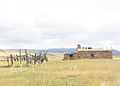
 Tipple in Reliance, WY (Looking west).jpg 2 560 × 1 920; 1,07 MB
-
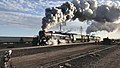 Union Pacific Big Boy 4014 Departs Granger, WY May 6th, 2019.jpg 3 412 × 1 920; 1,93 MB
-
 US-WY - Granger Junction - Road Trip - The West - Rocky Mountains (4891964615).jpg 4 288 × 2 493; 6,95 MB
-
 USA Sweetwater County, Wyoming age pyramid.svg 520 × 600; 8 KB
-
-

-

-

-

-

-

-

-

-

-
 West bank of Green River. Sweetwater County, Wyoming - NARA - 516625.jpg 3 000 × 2 368; 1,52 MB
-
 West bank of Green River. Sweetwater County, Wyoming - NARA - 516626.jpg 3 000 × 2 373; 1,57 MB
-
 West bank of Green River. Sweetwater County, Wyoming - NARA - 516627.jpg 3 000 × 2 371; 1,7 MB
-

-

-
-
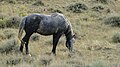 Wild horse.jpg 3 456 × 1 944; 2,67 MB
-
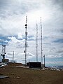 WilkinsTV KFRZ.jpg 2 472 × 3 296; 883 KB
-
 Wyoming 1997 09.jpg 1 036 × 690; 816 KB
-
 Wyoming 1997 10.jpg 1 065 × 710; 1 001 KB
-
 Wyoming 1997 11.jpg 1 042 × 707; 753 KB
-
 Wyoming 1997 12.jpg 1 022 × 689; 869 KB
-
 Wyoming 4166.jpg 3 264 × 2 448; 2,04 MB
-
 Wyoming 4167.jpg 3 264 × 2 448; 2,5 MB
-
 Wyoming Red Desert Vista.jpg 4 912 × 1 080; 1,82 MB
-
 Zirkel Mesa WY Leucite Hills.jpg 3 200 × 782; 918 KB
-
 Zirkel Mesa.jpg 3 600 × 2 400; 4,14 MB


.jpg)


_on_the_Mormon_Pioneer_National_Historic_Trail_(2003)_(8f6a5831-21df-477f-ba03-069a1372eb7a).jpg)


.jpg)


.jpg)
.jpg)
.jpg)


_on_the_California,_Mormon_Pioneer,_Oregon,_and_Pony_Express_National_Historic_Trails_(2007)_(ca7d918a-41c1-4440-93fc-5484fb952475).jpg)


.jpg)


_(29949924434).jpg)

_(SDSU_HA1184)_002.jpg)


.jpg)

.jpg)


.jpg)

.jpg)


