Category:Old maps of Buckinghamshire
Jump to navigation
Jump to search
Ceremonial counties of England: Bedfordshire · Berkshire · Buckinghamshire · Cambridgeshire · Cheshire · Cornwall · Cumbria · Derbyshire · Devon · Dorset · Durham · East Riding of Yorkshire · East Sussex · Essex · Gloucestershire · Greater London · Greater Manchester · Hampshire · Herefordshire · Hertfordshire · Isle of Wight · Kent · Lancashire · Leicestershire · Lincolnshire · Norfolk · North Yorkshire · Northamptonshire · Northumberland · Nottinghamshire · Oxfordshire · Rutland · Shropshire · Somerset · South Yorkshire · Staffordshire · Suffolk · Surrey · Warwickshire · West Midlands · West Sussex · West Yorkshire · Wiltshire · Worcestershire
City-counties: Bristol · City of London
Former historic counties: Cumberland · Huntingdonshire · Middlesex · Sussex · Westmorland · Yorkshire
Other former counties:
City-counties: Bristol · City of London
Former historic counties: Cumberland · Huntingdonshire · Middlesex · Sussex · Westmorland · Yorkshire
Other former counties:
Subcategories
This category has the following 2 subcategories, out of 2 total.
Media in category "Old maps of Buckinghamshire"
The following 20 files are in this category, out of 20 total.
-
 Bodleian Libraries, Buckinghamshire by Herman Moll.jpg 672 × 1,000; 142 KB
-
 Buckingham Shire - By H. Moll Geographer - btv1b530563681.jpg 3,048 × 4,296; 1.83 MB
-
 Ordnance Survey Drawings - Windsor (OSD 153).jpg 3,682 × 4,000; 5.27 MB
-
 Ordnance Survey Drawings - High Wycombe (OSD 154).jpg 4,000 × 2,822; 5.17 MB
-
 Ordnance Survey Drawings - Winslow, Buckinghamshire (OSD 231).jpg 4,000 × 2,537; 3.05 MB
-
 Ordnance Survey Drawings - Stony Stratford, Milton Keynes (OSD 229).jpg 4,000 × 2,584; 3.51 MB
-
 Ordnance Survey Drawings - Bedford, Bedfordshire (OSD 233).jpg 4,000 × 2,300; 4 MB
-
 Ordnance Survey Drawings - Worminghall (OSD 156).jpg 4,000 × 3,479; 5.52 MB
-

-

-
 Bodleian Libraries, A map of the County of Oxford 19.jpg 675 × 992; 79 KB
-
 Bodleian Libraries, Buckingham area map 45.jpg 992 × 672; 150 KB
-
 Bodleian Libraries, Buckingham.jpg 992 × 672; 139 KB
-
 Buckinghamshire (1722).png 4,166 × 5,016; 47.79 MB
-
 Henley regatta course map 1893.jpg 1,024 × 619; 205 KB
-
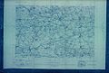
 Marlowmap1945.jpg 758 × 603; 429 KB
-
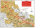 Metro-land-map.jpg 1,507 × 1,200; 2.25 MB
-
 Nash Map - 146 - Buckingham 1945.png 1,205 × 780; 540 KB
-
 Ordnance Survey One-Inch Sheet 105 Oxford & Henley on Thames, Published 1919.jpg 11,905 × 8,853; 41.79 MB
-
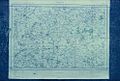
 The chilterns 1945baseof map77to90.jpg 2,550 × 2,832; 1.3 MB


.jpg)
.jpg)
.jpg)
.jpg)
.jpg)
.jpg)
.jpg)


.png)


