Category:Old maps of Oxfordshire
Jump to navigation
Jump to search
Ceremonial counties of England: Bedfordshire · Berkshire · Buckinghamshire · Cambridgeshire · Cheshire · Cornwall · Cumbria · Derbyshire · Devon · Dorset · Durham · East Riding of Yorkshire · East Sussex · Essex · Gloucestershire · Greater London · Greater Manchester · Hampshire · Herefordshire · Hertfordshire · Isle of Wight · Kent · Lancashire · Leicestershire · Lincolnshire · Norfolk · North Yorkshire · Northamptonshire · Northumberland · Nottinghamshire · Oxfordshire · Rutland · Shropshire · Somerset · South Yorkshire · Staffordshire · Suffolk · Surrey · Warwickshire · West Midlands · West Sussex · West Yorkshire · Wiltshire · Worcestershire
City-counties: Bristol · City of London
Former historic counties: Cumberland · Huntingdonshire · Middlesex · Sussex · Westmorland · Yorkshire
Other former counties:
City-counties: Bristol · City of London
Former historic counties: Cumberland · Huntingdonshire · Middlesex · Sussex · Westmorland · Yorkshire
Other former counties:
Subcategories
This category has the following 6 subcategories, out of 6 total.
O
Media in category "Old maps of Oxfordshire"
The following 35 files are in this category, out of 35 total.
-
 002osd000000020u00116000.jpg 4,000 × 2,470; 3.47 MB
-
 Oxford Shire - By H. Moll Geographer - btv1b53056541t.jpg 2,936 × 4,096; 1.83 MB
-
 Roman Pavement.jpg 948 × 293; 90 KB
-
 Ordnance Survey Drawings - Reading (OSD 126) (cropped).jpg 4,733 × 2,769; 4.01 MB
-
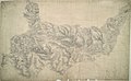
 Ordnance Survey Drawings - Bampton (OSD 161).jpg 4,000 × 2,585; 3.9 MB
-
 Ordnance Survey Drawings - Banbury, Oxfordshire (OSD 225).jpg 4,000 × 3,844; 4.91 MB
-
 Ordnance Survey Drawings - Wallingford (OSD 157).jpg 3,465 × 4,000; 5.14 MB
-
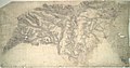
 Ordnance Survey Drawings - Woodstock (OSD 162).jpg 4,000 × 2,726; 4.16 MB
-
 Ordnance Survey Drawings - Shipston, Warwickshire (OSD 226).jpg 3,212 × 4,000; 3.17 MB
-
 Ordnance Survey Drawings - Barford St. John (OSD 224).jpg 4,000 × 2,086; 2.59 MB
-
 Ordnance Survey Drawings - Ot Moor, Oxfordshire (OSD 230).jpg 4,000 × 3,662; 5.17 MB
-
 Ordnance Survey Drawings - Bicester, Oxfordshire (OSD 223).jpg 4,000 × 2,087; 3.27 MB
-
 Ordnance Survey Drawings - Worminghall (OSD 156).jpg 4,000 × 3,479; 5.52 MB
-

-
 1860s Oxfordshire County Map Print WS Orr Henley Watlington.jpg 4,192 × 5,376; 5.64 MB
-
 16 of 'Shrimpton's Popular Handbooks' (11177642745).jpg 1,968 × 1,273; 925 KB
-
 66 of 'England and Wales Delineated, etc' (11032232294).jpg 2,384 × 1,453; 861 KB
-

-

-

-
 Bodleian Libraries, A map of Gageingwell in the County of Oxon.jpg 790 × 1,000; 96 KB
-

-
 Bodleian Libraries, Abingdon.jpg 1,000 × 675; 160 KB
-
 Bodleian Libraries, Blenheim and Woodstock.jpg 1,000 × 654; 108 KB
-

-
 Bodleian Libraries, Geological Survey of England and Wales- Oxford.jpg 1,000 × 675; 142 KB
-

-

-
 Bodleian Libraries, Oxford area map.jpg 1,000 × 675; 167 KB
-

-

-

-

-
 Four-shire-stone-map.png 1,154 × 1,027; 2.53 MB
-
 Henley regatta course map 1893.jpg 1,024 × 619; 205 KB


_(cropped).jpg)
.jpg)
.jpg)
.jpg)
.jpg)
.jpg)
.jpg)
.jpg)
.jpg)
.jpg)
_Cruchley%27s_railway_and_station_map_of_Oxford,_showing_all_the_railways_%26_names_of_stations,_also_the_turnpike_roads,_gentlemens_seats,_%26c._%26c.,_improved_from_the_Ordnance_Surveys_by_G._F._Cruchley_-_commonwealth_ht2504813.jpg)

.jpg)
.jpg)


