Category:Old maps of Wiltshire
Jump to navigation
Jump to search
Ceremonial counties of England: Bedfordshire · Berkshire · Buckinghamshire · Cambridgeshire · Cheshire · Cornwall · Cumbria · Derbyshire · Devon · Dorset · Durham · East Riding of Yorkshire · East Sussex · Essex · Gloucestershire · Greater London · Greater Manchester · Hampshire · Herefordshire · Hertfordshire · Isle of Wight · Kent · Lancashire · Leicestershire · Lincolnshire · Norfolk · North Yorkshire · Northamptonshire · Northumberland · Nottinghamshire · Oxfordshire · Rutland · Shropshire · Somerset · South Yorkshire · Staffordshire · Suffolk · Surrey · Warwickshire · West Midlands · West Sussex · West Yorkshire · Wiltshire · Worcestershire
City-counties: Bristol · City of London
Former historic counties: Cumberland · Huntingdonshire · Middlesex · Sussex · Westmorland · Yorkshire
Other former counties:
City-counties: Bristol · City of London
Former historic counties: Cumberland · Huntingdonshire · Middlesex · Sussex · Westmorland · Yorkshire
Other former counties:
Subcategories
This category has the following 6 subcategories, out of 6 total.
Media in category "Old maps of Wiltshire"
The following 23 files are in this category, out of 23 total.
-
 Wilt Shire - By Her. Moll Geographer - btv1b530570005.jpg 3,016 × 4,304; 2.22 MB
-
 Print, map (BM 1848,0212.15).jpg 1,716 × 2,500; 1.38 MB
-
 Ordnance Survey Drawings - Berwick St. John (OSD 64).jpg 4,000 × 2,650; 3.86 MB
-
 Ordnance Survey Drawings - Salisbury (OSD 76).jpg 2,849 × 4,000; 4.74 MB
-
 Ordnance Survey Drawings - Bradford Leigh (OSD 61).jpg 4,000 × 3,029; 4.06 MB
-
 Ordnance Survey Drawings - Hampshire (OSD 78).jpg 4,000 × 2,669; 4.25 MB
-
 Ordnance Survey Drawings - Warminster (OSD 63).jpg 4,000 × 2,193; 2.89 MB
-
 Ordnance Survey Drawings - Wilcot (OSD 62).jpg 4,000 × 2,705; 3.58 MB
-
 Ordnance Survey Drawings - Bath (OSD 169).jpg 5,805 × 3,515; 3.73 MB
-
 Ordnance Survey Drawings - Cirencester (OSD 164).jpg 4,000 × 2,251; 3.09 MB
-
 Ordnance Survey Drawings - Froxfield (OSD 167).jpg 4,000 × 2,429; 2.93 MB
-
 Ordnance Survey Drawings - Swindon (OSD 166).jpg 3,749 × 5,751; 3.56 MB
-

-

-
 Chippenham1773.jpg 1,080 × 780; 222 KB
-
 Cole Park on a 1920s Ordnance Survey map.png 9,450 × 5,870; 2.87 MB
-

-
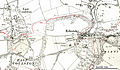 Erlestoke map 1922.jpg 897 × 525; 208 KB
-
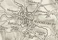 Malmesbury and Westport.jpg 619 × 425; 253 KB
-
 Map of Avebury and surrounding area, by Denis Grant King.png 1,375 × 890; 2.56 MB
-
 Map Stourton Kilmington Jackson 1864 4.jpg 1,760 × 2,812; 827 KB
-
 Ordnance Survey One-inch Sheet 122 Salisbury and Bulford, Published 1919.jpg 11,739 × 8,883; 43.93 MB
-


.jpg)
.jpg)
.jpg)
.jpg)
.jpg)
.jpg)
.jpg)
.jpg)
.jpg)
.jpg)
.jpg)
.jpg)
_being_the_Index_Map_to_the_large_one_-_btv1b530572807.jpg)


.png)


,_planned_on_a_scale_of_one_inch_to_the_mile_accompanied_by_indexes,_topographic_(14782039981).jpg)