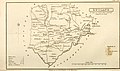
Category:Old maps of Rutland
Jump to navigation
Jump to search
Ceremonial counties of England: Bedfordshire · Berkshire · Buckinghamshire · Cambridgeshire · Cheshire · Cornwall · Cumbria · Derbyshire · Devon · Dorset · Durham · East Riding of Yorkshire · East Sussex · Essex · Gloucestershire · Greater London · Greater Manchester · Hampshire · Herefordshire · Hertfordshire · Isle of Wight · Kent · Lancashire · Leicestershire · Lincolnshire · Norfolk · North Yorkshire · Northamptonshire · Northumberland · Nottinghamshire · Oxfordshire · Rutland · Shropshire · Somerset · South Yorkshire · Staffordshire · Suffolk · Surrey · Warwickshire · West Midlands · West Sussex · West Yorkshire · Wiltshire · Worcestershire
City-counties: Bristol · City of London
Former historic counties: Cumberland · Huntingdonshire · Middlesex · Sussex · Westmorland · Yorkshire
Other former counties:
City-counties: Bristol · City of London
Former historic counties: Cumberland · Huntingdonshire · Middlesex · Sussex · Westmorland · Yorkshire
Other former counties:
Subcategories
This category has the following 3 subcategories, out of 3 total.
Media in category "Old maps of Rutland"
The following 5 files are in this category, out of 5 total.
-
 Rutland Shire - By H. Moll Geographer - btv1b530564959.jpg 4,112 × 3,104; 1.77 MB
-
-

-
 Print, map (BM 1848,0212.10).jpg 1,654 × 2,500; 1.34 MB
-
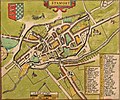 Stamford map.jpg 1,892 × 1,571; 1.84 MB

.jpg)

.jpg)
