Category:Old maps of Cheshire
Jump to navigation
Jump to search
Ceremonial counties of England: Bedfordshire · Berkshire · Buckinghamshire · Cambridgeshire · Cheshire · Cornwall · Cumbria · Derbyshire · Devon · Dorset · Durham · East Riding of Yorkshire · East Sussex · Essex · Gloucestershire · Greater London · Greater Manchester · Hampshire · Herefordshire · Hertfordshire · Isle of Wight · Kent · Lancashire · Leicestershire · Lincolnshire · Norfolk · North Yorkshire · Northamptonshire · Northumberland · Nottinghamshire · Oxfordshire · Rutland · Shropshire · Somerset · South Yorkshire · Staffordshire · Suffolk · Surrey · Warwickshire · West Midlands · West Sussex · West Yorkshire · Wiltshire · Worcestershire
City-counties: Bristol · City of London
Former historic counties: Cumberland · Huntingdonshire · Middlesex · Sussex · Westmorland · Yorkshire
Other former counties:
City-counties: Bristol · City of London
Former historic counties: Cumberland · Huntingdonshire · Middlesex · Sussex · Westmorland · Yorkshire
Other former counties:
Subcategories
This category has the following 4 subcategories, out of 4 total.
- Old county maps of Cheshire (20 F)
- Ordnance Survey 1st series 1:10560, Map of Cheshire (1 P, 140 F)
!
C
Media in category "Old maps of Cheshire"
The following 21 files are in this category, out of 21 total.
-
 1777 Burdett map of area around Sale.jpg 2,773 × 1,781; 2.2 MB
-
 1777 Burdett map of Sale.jpg 995 × 786; 455 KB
-

-
 Ordnance Survey Drawings - Combermere (OSD 327).jpg 4,802 × 3,913; 2.48 MB
-
 Ordnance Survey Drawings - Betley (OSD 329).jpg 4,036 × 4,209; 3.06 MB
-
 Ordnance Survey Drawings - Hooton Hall, Cheshire (OSD 344).jpg 5,123 × 4,168; 2.48 MB
-
 Ordnance Survey Drawings - Macclesfield (OSD 351).jpg 5,061 × 4,183; 4.04 MB
-
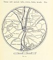 55 of 'Object Lessons in Geography for Standards I. II. & III' (11289634733).jpg 1,215 × 1,391; 376 KB
-

-

-
 Acton Grange, Walton & Warrington RJD 147.jpg 2,742 × 1,656; 739 KB
-
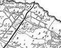
 Altrinchammap1924.jpg 3,504 × 2,544; 1.51 MB
-
 Bodleian Libraries, A New Exact Survey of the River Dee or ChesterWater.jpg 1,000 × 693; 89 KB
-
 Crewe & Sandbach Macclesfield RJD 20.jpg 2,861 × 1,890; 686 KB
-
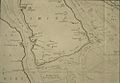
 Crewe Hall park 1840.jpg 800 × 747; 360 KB
-
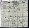 DELEPINE; Investigations in the Public Healt Wellcome L0032434.jpg 4,391 × 4,192; 7.29 MB
-
 Roman Roads in Delamere Forest and Neighbourhood, c.1885.jpg 2,543 × 1,751; 822 KB
-
 Sale 1842 map.jpg 2,000 × 2,274; 6.26 MB
-
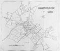 Sandbach town centre map 1840.png 2,379 × 2,041; 1.77 MB
-
 Stockportmap1924.jpg 3,504 × 2,544; 1.73 MB
-
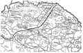
 Turnpike roads of Lancashire and Cheshire.jpg 1,630 × 2,537; 813 KB


.jpg)
.jpg)
.jpg)
.jpg)
.jpg)
.jpg)
%27_(11059395156).jpg)


