Category:London Borough of Hackney
둘러보기로 이동
검색으로 이동
Boroughs of London: City of London · City of Westminster · Barking and Dagenham · Barnet · Bexley · Brent · Bromley · Camden · Croydon · Ealing · Enfield · Greenwich · Hackney · Hammersmith and Fulham · Haringey · Harrow · Havering · Hillingdon · Hounslow · Islington · Kensington and Chelsea · Kingston · Lambeth · Lewisham · Merton · Newham · Redbridge · Richmond · Southwark · Sutton · Tower Hamlets · Waltham Forest · Wandsworth
borough in the London Region in England  Rådhuset i Hackney   | |||||
| 미디어 올리기 | |||||
| 다음 종류에 속함 | |||||
|---|---|---|---|---|---|
| 위치 | 그레이터런던, London, 잉글랜드 | ||||
| 입법부 |
| ||||
| 행정부 |
| ||||
| 행정부 수반 |
| ||||
| 만들어진 날 |
| ||||
| 인구수 |
| ||||
| 면적 |
| ||||
| 다음에서 이어받음 | |||||
| 공식 웹사이트 | |||||
 | |||||
"London Borough of Hackney" 분류에 속하는 미디어
다음은 이 분류에 속하는 파일 2,375개 가운데 200개입니다.
(이전 페이지) (다음 페이지)-
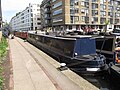
 "Footloose", narrowboat on Regent's Canal, Hackney - geograph.org.uk - 5762876.jpg 3,648 × 2,736; 2.88 MB
-
 "Ilion", narrowboat on Regent's Canal, Hackney - geograph.org.uk - 5762912.jpg 3,648 × 2,736; 3.22 MB
-
-
 "Old King's Head" public house, Holywell Row - geograph.org.uk - 4200271.jpg 1,600 × 1,060; 380 KB
-
 "The Duke of Wellington" public house, Nile Street - geograph.org.uk - 4156860.jpg 1,600 × 1,513; 583 KB
-
 "The Hop Pole" public house, Pitfield Street - geograph.org.uk - 3666924.jpg 1,800 × 1,348; 2.13 MB
-
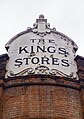 "The Kings Stores" public house sign, Widegate Street - geograph.org.uk - 5262051.jpg 1,128 × 1,600; 389 KB
-
 "The Plough" public house, Homerton High Street - geograph.org.uk - 5041564.jpg 2,169 × 2,750; 836 KB
-
 "The Star at Hackney Downs" public house - geograph.org.uk - 3880224.jpg 3,936 × 2,624; 1.51 MB
-
 "Tintagel" narrowboat goes under Wharf Road bridge - geograph.org.uk - 5763813.jpg 3,648 × 2,736; 2.95 MB
-
 'Hallowed Ground' ,South Millfields Park - geograph.org.uk - 3314420.jpg 4,288 × 3,216; 5.51 MB
-

-
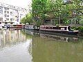
 'Oliekop' on the Regent's Canal - geograph.org.uk - 1923388.jpg 1,280 × 960; 183 KB
-
 'The Water Jugglers', Hackney Marsh - geograph.org.uk - 5203988.jpg 3,072 × 2,048; 2.54 MB
-

-
 130 Tabernacle Street - geograph.org.uk - 2682315.jpg 446 × 640; 210 KB
-
 17-18 Clere Street - geograph.org.uk - 2683514.jpg 487 × 640; 177 KB
-
 171 Glenarm Road, Lower Clapton - geograph.org.uk - 3314483.jpg 3,722 × 2,884; 4.57 MB
-
 174 - 8 Albion Rd - geograph.org.uk - 5376563.jpg 640 × 426; 65 KB
-
 2016, a year on Geograph (Day 93) - geograph.org.uk - 4890537.jpg 640 × 480; 128 KB
-
 22 Cowper Street - geograph.org.uk - 2683536.jpg 562 × 640; 209 KB
-
 236 Dalston Lane, Hackney - geograph.org.uk - 6341590.jpg 1,920 × 1,280; 1.58 MB
-
 290 Mare Street, Hackney - geograph.org.uk - 6334175.jpg 1,802 × 1,066; 1.08 MB
-
 3-11 Westland Place - geograph.org.uk - 2599602.jpg 640 × 504; 171 KB
-
 30 Crown Place and Broadgate Tower - geograph.org.uk - 4338331.jpg 1,280 × 960; 304 KB
-
 61A Dalston Lane, Hackney - geograph.org.uk - 6341593.jpg 1,920 × 1,280; 1.45 MB
-
 69-85 Tabernacle Street - geograph.org.uk - 2684771.jpg 640 × 490; 175 KB
-
 86, Albion Rd - geograph.org.uk - 5376616.jpg 640 × 426; 62 KB
-
 A Child of the Jago - geograph.org.uk - 2856642.jpg 1,024 × 768; 145 KB
-
-
 A frozen Regent's Canal - geograph.org.uk - 2791157.jpg 2,386 × 1,790; 743 KB
-
 A frozen Regent's Canal ^2 - geograph.org.uk - 2791162.jpg 3,456 × 2,592; 2.98 MB
-
 A graffiti wall on derelict flats - geograph.org.uk - 6422695.jpg 1,904 × 1,254; 1.94 MB
-
 A leafy corner of Manhattan - geograph.org.uk - 5464378.jpg 480 × 640; 113 KB
-
 A lion on Green Lanes - geograph.org.uk - 4390714.jpg 4,000 × 3,000; 4.05 MB
-
 A Lock on the Lea or Lee.jpg 2,560 × 1,920; 1.1 MB
-
 A lot of scaffolding at the front of a house - geograph.org.uk - 4925578.jpg 6,000 × 4,000; 4.34 MB
-
 A partially submerged yacht - geograph.org.uk - 3907236.jpg 3,456 × 2,592; 3.14 MB
-
 A rainy day on Walthamstow Marshes - geograph.org.uk - 5343829.jpg 1,600 × 1,067; 249 KB
-
 A small green area, Hackney - geograph.org.uk - 2193837.jpg 640 × 480; 107 KB
-
 A speedboat on the West Reservoir - geograph.org.uk - 3907267.jpg 3,456 × 2,592; 3.02 MB
-
 A Sunny Day on the Lea or Lee.jpg 2,560 × 1,920; 2.45 MB
-
 A Walk by the River - geograph.org.uk - 4830666.jpg 3,369 × 2,694; 2.45 MB
-
 A104 - A107 junction - geograph.org.uk - 5798711.jpg 640 × 426; 67 KB
-
 A105, B105 junction - geograph.org.uk - 3839373.jpg 640 × 430; 59 KB
-
 A106 bridge, Lea Navigation - geograph.org.uk - 3304648.jpg 640 × 430; 44 KB
-
 A107 - geograph.org.uk - 5358118.jpg 640 × 426; 61 KB
-
 A107 Bridge, Regents Canal - geograph.org.uk - 2899502.jpg 640 × 430; 75 KB
-
 A107, Amhurst Rd - geograph.org.uk - 3320806.jpg 640 × 430; 44 KB
-
 A107, Hackney - geograph.org.uk - 3320813.jpg 640 × 430; 57 KB
-
 A12 - geograph.org.uk - 3119782.jpg 640 × 427; 72 KB
-
 A12 going through Olympic Park - geograph.org.uk - 4389921.jpg 1,600 × 1,200; 525 KB
-
 A12 over the Lea Navigation - geograph.org.uk - 3304623.jpg 640 × 430; 52 KB
-
 A1202 - geograph.org.uk - 3863347.jpg 640 × 430; 63 KB
-
 A1207 - geograph.org.uk - 5354696.jpg 640 × 426; 59 KB
-
 A1207 in Hackney - geograph.org.uk - 3863432.jpg 640 × 430; 48 KB
-
 Abandoned Building, Englefield Road, Salston.jpg 5,212 × 3,474; 14.98 MB
-
 Access road near Copper Box - geograph.org.uk - 3118416.jpg 640 × 427; 71 KB
-
 Access to the A106, Eastway - geograph.org.uk - 5526023.jpg 5,184 × 3,456; 6.51 MB
-

-
 Albion Grove - geograph.org.uk - 5376576.jpg 640 × 426; 74 KB
-
 Alcester Crescent - geograph.org.uk - 5803063.jpg 640 × 426; 69 KB
-
 Alexandra Trust dining rooms, EC1 - geograph.org.uk - 2051793.jpg 3,504 × 2,336; 1.96 MB
-

-
 Alive and dead pubs - geograph.org.uk - 4747267.jpg 640 × 480; 102 KB
-
 Alley to Kayani Avenue - geograph.org.uk - 3833429.jpg 640 × 430; 63 KB
-
-
-
-
 Allpress Espresso Roastery ^ Cafe, Dalston Lane - geograph.org.uk - 5591757.jpg 4,896 × 3,672; 6.06 MB
-
 Along the A10 - geograph.org.uk - 4908992.jpg 640 × 427; 85 KB
-
 Along the New River.jpg 1,280 × 960; 275 KB
-
 Alongside Regent's Canal - geograph.org.uk - 6218978.jpg 1,024 × 678; 786 KB
-
 Amhurst Park (A107), N16 - geograph.org.uk - 4579845.jpg 640 × 480; 83 KB
-
 Amhurst Park, Stamford Hill - geograph.org.uk - 2763408.jpg 4,320 × 3,240; 4.34 MB
-
 Anchor ^ Hope public house, River Lea, Clapton - geograph.org.uk - 1918801.jpg 3,264 × 2,448; 2.95 MB
-
-
 Andrews Road, London - geograph.org.uk - 6381765.jpg 5,456 × 3,632; 1.91 MB
-
 Another capsized yacht - geograph.org.uk - 3907232.jpg 3,456 × 2,592; 3.11 MB
-
 Another capsized yacht ^2 - geograph.org.uk - 3907247.jpg 3,456 × 2,592; 3.23 MB
-
 Another closed pub^ - geograph.org.uk - 3341208.jpg 1,024 × 691; 151 KB
-
 Apartment block, Hackney - geograph.org.uk - 3320814.jpg 640 × 430; 56 KB
-
 Apartment blocks - geograph.org.uk - 3294225.jpg 640 × 430; 57 KB
-
-
 Apartments blocks, Seven Sisters Rd - geograph.org.uk - 3832014.jpg 640 × 430; 52 KB
-
 Apartments, Albion Rd - geograph.org.uk - 5376537.jpg 640 × 425; 56 KB
-
 Apartments, Amhurst Park - geograph.org.uk - 3832021.jpg 640 × 430; 67 KB
-
 Appold Street - geograph.org.uk - 5162732.jpg 640 × 425; 184 KB
-
 Approach to Lea Bridge roundabout, Upper Clapton Road - geograph.org.uk - 2303178.jpg 1,600 × 1,200; 618 KB
-
 Approaching Shoreditch Fire Station - geograph.org.uk - 5747607.jpg 5,184 × 3,888; 6.51 MB
-
 Approaching Sturt's Lock - geograph.org.uk - 3443676.jpg 959 × 1,280; 420 KB
-
 Approaching the River Lea - geograph.org.uk - 5354723.jpg 640 × 426; 76 KB
-
 Arch to Mother's Square - geograph.org.uk - 5798705.jpg 640 × 425; 49 KB
-
 Ardleigh Rd - geograph.org.uk - 5385420.jpg 640 × 426; 77 KB
-
 Art deco offices on Dalston Lane, Hackney - geograph.org.uk - 6280187.jpg 1,816 × 1,096; 1.07 MB
-
 Art wall on Wenlock Road - geograph.org.uk - 2354472.jpg 3,456 × 2,592; 2.86 MB
-
 Art wall on Wenlock Road ^2 - geograph.org.uk - 2354488.jpg 3,456 × 2,592; 3.02 MB
-
 Ashpitel Tomb, St John Churchyard, Hackney.jpg 1,152 × 864; 179 KB
-
 Athackneystadium.jpg 1,477 × 1,141; 488 KB
-
 Atherden Rd - geograph.org.uk - 5798318.jpg 640 × 425; 63 KB
-
 Avebury Court - geograph.org.uk - 2908066.jpg 640 × 430; 78 KB
-
 Ayrsome Rd - geograph.org.uk - 5373005.jpg 640 × 426; 73 KB
-
 B112 bridge, Lea Navigation - geograph.org.uk - 3299016.jpg 640 × 430; 62 KB
-
 Bakers Hill - geograph.org.uk - 5803090.jpg 640 × 425; 80 KB
-
 Ballance Road, Homerton - geograph.org.uk - 6422706.jpg 1,920 × 1,280; 1.07 MB
-
 Balls Pond Road at the junction of Kingsland Road - geograph.org.uk - 5146521.jpg 2,048 × 1,536; 955 KB
-
 Barbauld Rd - geograph.org.uk - 5376565.jpg 640 × 426; 52 KB
-
 Barcham House, Riversdale Road, N5 - geograph.org.uk - 4577609.jpg 640 × 480; 104 KB
-
 Barges, Lea Navigation - geograph.org.uk - 3297039.jpg 640 × 430; 96 KB
-
 Barn St - geograph.org.uk - 5373018.jpg 640 × 426; 73 KB
-
 Barton House Health Centre - geograph.org.uk - 5376530.jpg 640 × 426; 55 KB
-
 Baxter's Court - geograph.org.uk - 4925595.jpg 6,000 × 4,000; 3.48 MB
-
 Baxter's Court on Mare Street, Hackney - geograph.org.uk - 6334176.jpg 1,280 × 1,920; 886 KB
-
 Beatty Road entrance, Newstoke House - geograph.org.uk - 5529146.jpg 1,067 × 1,600; 511 KB
-
 Beaumont Court - geograph.org.uk - 5798348.jpg 640 × 425; 85 KB
-
 Beck Road, Bethnal Green - geograph.org.uk - 4857072.jpg 4,000 × 3,000; 2.08 MB
-
 Beck Road, Hackney - geograph.org.uk - 4324789.jpg 2,272 × 1,704; 742 KB
-
 Beck Road, Hackney - geograph.org.uk - 4324795.jpg 2,272 × 1,704; 741 KB
-
 Beck Road.jpg 1,280 × 960; 325 KB
-
 Bedford House, Spitalfields - geograph.org.uk - 5656626.jpg 1,043 × 1,600; 566 KB
-
 Below the A12 - geograph.org.uk - 3304635.jpg 640 × 430; 38 KB
-
 Bethnal Green Gas Holder - geograph.org.uk - 4760732.jpg 960 × 1,280; 439 KB
-
 Bethnal Green Gas Holders by Regent's Canal - geograph.org.uk - 5409088.jpg 3,801 × 4,935; 4.15 MB
-
 Bethnal Green gasholders - geograph.org.uk - 5496955.jpg 3,264 × 2,448; 2.41 MB
-
 Bethnal Green, gasometers - geograph.org.uk - 3121306.jpg 1,024 × 743; 188 KB
-
 Bevenden Street at the junction of East Road - geograph.org.uk - 3105395.jpg 2,048 × 1,536; 1.52 MB
-
 Big Screen - Olympic Park - geograph.org.uk - 3118906.jpg 1,600 × 1,200; 398 KB
-
 Bikes for hire - geograph.org.uk - 2241742.jpg 640 × 480; 135 KB
-
 Bilney Lodge - geograph.org.uk - 5373007.jpg 640 × 426; 59 KB
-
 Block B, Timber Wharf - geograph.org.uk - 6219094.jpg 1,024 × 678; 775 KB
-
 Blossom on Green Lanes - geograph.org.uk - 4390709.jpg 4,000 × 3,000; 4.05 MB
-
 Blue Plaque, Regents Canal, Islington, London - geograph.org.uk - 5158617.jpg 1,400 × 1,050; 1.43 MB
-
 Boat lined River Lea - geograph.org.uk - 3290079.jpg 640 × 430; 66 KB
-

-
 Boats moored near Whitmore Road - geograph.org.uk - 4909080.jpg 640 × 427; 101 KB
-
 Boats on the canal - geograph.org.uk - 4909083.jpg 640 × 427; 98 KB
-
 Boats on the Lea - geograph.org.uk - 3292301.jpg 1,024 × 768; 181 KB
-
 Boats, West Reservoir - geograph.org.uk - 3839342.jpg 640 × 430; 43 KB
-
 Boleyn Rd - geograph.org.uk - 5393582.jpg 640 × 426; 69 KB
-
 Boscobel House, Hackney - geograph.org.uk - 1975470.jpg 640 × 480; 76 KB
-
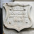 Boundary marker, Blackstock Road, Finsbury Park - geograph.org.uk - 2153693.jpg 1,518 × 1,536; 710 KB
-
 Boundary Street Estate, 1989 - geograph.org.uk - 3466378.jpg 1,066 × 1,600; 320 KB
-
 Bouverie Rd - geograph.org.uk - 5373000.jpg 640 × 426; 59 KB
-
 Bowling Green Walk, London - geograph.org.uk - 2958803.jpg 4,288 × 3,216; 6.25 MB
-
 Box junction, Balls Pond Rd - geograph.org.uk - 5387963.jpg 640 × 426; 56 KB
-
-
 Braydon Road, Stamford Hill - geograph.org.uk - 4189543.jpg 2,486 × 1,818; 1.05 MB
-
 Brett Passage - geograph.org.uk - 2258814.jpg 640 × 480; 136 KB
-
 Brewery plaque, Hackney Wick - geograph.org.uk - 5038305.jpg 2,400 × 2,325; 1,010 KB
-
 Bridge 49, Regent's Canal - geograph.org.uk - 5851000.jpg 1,024 × 768; 325 KB
-
 Bridge Academy, Shoreditch, London - geograph.org.uk - 6381939.jpg 5,456 × 3,632; 2.43 MB
-
 Bridge Academy, Shoreditch, London - geograph.org.uk - 6381941.jpg 5,456 × 3,632; 1.91 MB
-
 Bridge at Kingsland Basin - geograph.org.uk - 4909006.jpg 640 × 427; 110 KB
-
 Bridge carrying A12 across River Lea (or Lee) - geograph.org.uk - 5634595.jpg 1,600 × 1,067; 546 KB
-
 Bridge carrying A12 slip road across River Lea (or Lee) - geograph.org.uk - 5634593.jpg 1,600 × 1,067; 361 KB
-
 Bridge Carrying Overground, Stratford, London - geograph.org.uk - 4713053.jpg 788 × 1,050; 697 KB
-
 Bridge over Downs Park Road, Hackney - geograph.org.uk - 6382968.jpg 1,024 × 768; 236 KB
-
 Bridge over Lee Navigation - geograph.org.uk - 4944702.jpg 6,000 × 4,000; 4.42 MB
-
 Bridge over Middleton Road, Kingsland - geograph.org.uk - 4178166.jpg 3,264 × 2,448; 1.95 MB
-
 Bridge over Regents Canal, london - geograph.org.uk - 5158686.jpg 1,400 × 1,050; 1.52 MB
-
 Bridge over River Lea, Olympic Park - geograph.org.uk - 3119808.jpg 640 × 427; 86 KB
-
 Bridge over River Lea, Olympic Park - geograph.org.uk - 3119810.jpg 640 × 427; 62 KB
-
 Bridge over River Lee - geograph.org.uk - 5764657.jpg 4,896 × 3,672; 5.89 MB
-
 Bridge over the New River - geograph.org.uk - 3832028.jpg 640 × 430; 105 KB
-
 Bridge over the New River - geograph.org.uk - 3832030.jpg 640 × 430; 121 KB
-

-

-

-

-
 Bridge ^45, Kingsland Road, Regent's Canal - geograph.org.uk - 6381956.jpg 5,456 × 3,632; 2.66 MB
-
 Bridge, Regent's Canal - geograph.org.uk - 2249962.jpg 640 × 480; 89 KB
-
 Bridges over the Regent's Canal - geograph.org.uk - 5685077.jpg 1,600 × 1,067; 259 KB
-
 Bridges, Lea Navigation - geograph.org.uk - 3298978.jpg 640 × 430; 59 KB
-
 Bridgeside Lodge Specialist Care Centre, Wharf Road - geograph.org.uk - 5762860.jpg 3,648 × 2,736; 2.45 MB
-
 Broadgate, cycle hire - geograph.org.uk - 3049624.jpg 1,024 × 755; 160 KB
-
 Brooke Rd - geograph.org.uk - 5798346.jpg 640 × 426; 69 KB
-
 Brooke Road - geograph.org.uk - 3585225.jpg 3,648 × 2,736; 4.14 MB
-
 Brooke Road, Clapton - geograph.org.uk - 6383026.jpg 1,024 × 768; 174 KB
-
 Brooksby's Walk, London E9 - geograph.org.uk - 1978704.jpg 3,072 × 2,304; 2.25 MB
-
 Brownswood Road, N4 - geograph.org.uk - 4577445.jpg 640 × 480; 102 KB
-
 Brunswick Place - geograph.org.uk - 5027605.jpg 3,000 × 4,000; 1.66 MB
-
 Brunswick Wharf ^ Kent Wharf - geograph.org.uk - 5479564.jpg 1,024 × 683; 221 KB
-
 BSIX Sixth Form College - geograph.org.uk - 5798334.jpg 640 × 426; 74 KB
-
 Buckingham Road, Islington - geograph.org.uk - 4341825.jpg 2,272 × 1,704; 861 KB
-
 Builders on the Roof - geograph.org.uk - 4857275.jpg 3,939 × 2,969; 2.91 MB
-
 Building (14106719985).jpg 2,532 × 4,655; 5.77 MB
-
 Building by the Lea Bridge Weir - geograph.org.uk - 3297025.jpg 640 × 430; 68 KB
-
 Building by the Lea navigation - geograph.org.uk - 3304707.jpg 640 × 375; 45 KB
-
 Building the Eagle, City Road - geograph.org.uk - 4155942.jpg 1,060 × 1,600; 429 KB
-
 Building under construction at the end of Wharf Road - geograph.org.uk - 2354521.jpg 3,456 × 2,592; 877 KB
-
 Buildings by Regent's Canal - geograph.org.uk - 2250042.jpg 640 × 446; 71 KB
-
 Burbage House - geograph.org.uk - 1054500.jpg 640 × 480; 82 KB
-
 Bus Art, 'English Herbaceous Border' - geograph.org.uk - 4262068.jpg 1,024 × 682; 155 KB
-
 Bus Art, 'English Herbaceous Border' - geograph.org.uk - 4262069.jpg 800 × 800; 193 KB
-
 Bus Art, 'Hold Tight' - geograph.org.uk - 4262062.jpg 1,024 × 682; 209 KB
-
 Bus Art, 'Hold Tight' - geograph.org.uk - 4262064.jpg 1,024 × 682; 140 KB
-
 Bus Art, 'Union Jack' - geograph.org.uk - 4262052.jpg 1,024 × 682; 134 KB
-
 Bus on Balls Pond Road - geograph.org.uk - 4908981.jpg 427 × 640; 110 KB
-
 Bus Station, Lea Bridge Roundabout - geograph.org.uk - 5798337.jpg 640 × 426; 53 KB
-


_Barnes_Motors,_Petherton_Road,_N5_-_geograph.org.uk_-_4518753.jpg)


_-_geograph.org.uk_-_4890537.jpg)


_-_geograph.org.uk_-_4518802.jpg)
_-_geograph.org.uk_-_4518807.jpg)


,_N16_-_geograph.org.uk_-_4579845.jpg)


_-_geograph.org.uk_-_5634595.jpg)
_-_geograph.org.uk_-_5634593.jpg)


_-_geograph.org.uk_-_4580945.jpg)
,_N16_-_geograph.org.uk_-_4579839.jpg)


.jpg)


_-_geograph.org.uk_-_6206305.jpg)