Category:London Borough of Southwark
Jump to navigation
Jump to search
Boroughs of London: City of London · City of Westminster · Barking and Dagenham · Barnet · Bexley · Brent · Bromley · Camden · Croydon · Ealing · Enfield · Greenwich · Hackney · Hammersmith and Fulham · Haringey · Harrow · Havering · Hillingdon · Hounslow · Islington · Kensington and Chelsea · Kingston · Lambeth · Lewisham · Merton · Newham · Redbridge · Richmond · Southwark · Sutton · Tower Hamlets · Waltham Forest · Wandsworth
borough in the London Region in England .jpg)    | |||||
| Upload media | |||||
| Pronunciation audio | |||||
|---|---|---|---|---|---|
| Instance of | |||||
| Part of | |||||
| Location |
| ||||
| Capital | |||||
| Legislative body |
| ||||
| Executive body |
| ||||
| Head of government |
| ||||
| Has part(s) | |||||
| Inception |
| ||||
| Population |
| ||||
| Area |
| ||||
| Replaces | |||||
| Different from | |||||
| official website | |||||
 | |||||
Subcategories
This category has the following 22 subcategories, out of 22 total.
A
E
F
G
H
M
N
O
P
S
T
Media in category "London Borough of Southwark"
The following 200 files are in this category, out of 4,997 total.
(previous page) (next page)-
 "Boris bikes" on the Riverside Walk - geograph.org.uk - 3296565.jpg 640 × 480; 81 KB
-
 "Floating greenhouse" - geograph.org.uk - 4234754.jpg 1,000 × 667; 223 KB
-

-
 "Fragile" Paddington Bear, Millennium Bridge - geograph.org.uk - 4245706.jpg 1,024 × 682; 241 KB
-
-
 "Rear Window" - geograph.org.uk - 5302384.jpg 2,308 × 2,329; 1.76 MB
-
-

-

-

-
 "The Blue Eyed Maid" public house, Southwark - geograph.org.uk - 4952856.jpg 1,088 × 1,600; 451 KB
-
 "The Ivy House" public house, Nunhead - geograph.org.uk - 5210747.jpg 1,600 × 1,507; 551 KB
-

-
-
 'Alaska' building - geograph.org.uk - 4328586.jpg 640 × 480; 98 KB
-
 'EXPECT BETTER THINGS' - geograph.org.uk - 2642031.jpg 1,024 × 680; 142 KB
-
 'Golden Sunrise' on the River Thames - geograph.org.uk - 4597824.jpg 640 × 496; 93 KB
-
 'Onaway', 135 Half Moon Lane - geograph.org.uk - 3044551.jpg 3,798 × 2,694; 6.1 MB
-
 (Not a) Major Road - geograph.org.uk - 3996686.jpg 640 × 480; 96 KB
-
 1 - 9 (odds) Ada Road, SE5 - geograph.org.uk - 3170722.jpg 640 × 428; 86 KB
-
 1 Blackfriars - geograph.org.uk - 5661576.jpg 1,712 × 2,288; 782 KB
-
 1 Doyce Street - geograph.org.uk - 4825516.jpg 489 × 640; 151 KB
-
 1, Flint St - geograph.org.uk - 5743939.jpg 640 × 426; 82 KB
-
 1-3 Morocco Street - geograph.org.uk - 4985118.jpg 517 × 640; 212 KB
-
 1-4 Brunswick Villas - geograph.org.uk - 3658539.jpg 640 × 462; 206 KB
-
 1-5 Leathermarket Street - geograph.org.uk - 4984969.jpg 563 × 640; 209 KB
-
 1-7 St Agnes Place - geograph.org.uk - 4781822.jpg 561 × 640; 235 KB
-
 1-9 Glengall Road - geograph.org.uk - 4831839.jpg 640 × 514; 174 KB
-

-
 100-138B Camberwell Grove - geograph.org.uk - 5293595.jpg 1,600 × 1,153; 564 KB
-
 101, Dulwich Village - geograph.org.uk - 5823821.jpg 1,024 × 681; 158 KB
-
 103 - 105, Dulwich Village - geograph.org.uk - 5823824.jpg 1,024 × 681; 206 KB
-
 110 Page's Walk - geograph.org.uk - 4988068.jpg 562 × 640; 234 KB
-
 116 Sedgmoor Place - geograph.org.uk - 3658517.jpg 640 × 477; 179 KB
-
 123 Grove Park - geograph.org.uk - 3658856.jpg 640 × 404; 183 KB
-
 124-125 Grove Park - geograph.org.uk - 3658846.jpg 611 × 640; 206 KB
-
 126 Dawes Street - geograph.org.uk - 4829762.jpg 640 × 497; 212 KB
-
 140-164 Portland Street - geograph.org.uk - 4829745.jpg 640 × 533; 212 KB
-
 162-164 Abbey Street - geograph.org.uk - 4986984.jpg 640 × 455; 195 KB
-
 17 Stamford Street - geograph.org.uk - 4806903.jpg 640 × 505; 210 KB
-
 2 More London Riverside at night - geograph.org.uk - 3246111.jpg 640 × 480; 50 KB
-
 2 Whites Grounds - geograph.org.uk - 4985418.jpg 462 × 640; 173 KB
-
 2, London Bridge - geograph.org.uk - 5468807.jpg 640 × 426; 58 KB
-
 20 Fenchurch Street, London EC3 - geograph.org.uk - 5027972.jpg 4,739 × 2,696; 1.24 MB
-
 209 Grange Road - geograph.org.uk - 4986889.jpg 548 × 640; 242 KB
-
 20a-24 Camberwell Green - geograph.org.uk - 3660217.jpg 640 × 480; 442 KB
-
 21 Webber Street - geograph.org.uk - 4781442.jpg 640 × 485; 159 KB
-
 22 Leathermarket Street - geograph.org.uk - 3701166.jpg 1,024 × 768; 293 KB
-
 22 Leathermarket Street - geograph.org.uk - 4981896.jpg 543 × 640; 245 KB
-
 23 Jacob Street - geograph.org.uk - 4988103.jpg 640 × 479; 193 KB
-
 23 Paradise Street - geograph.org.uk - 4958510.jpg 488 × 640; 224 KB
-
 23-25 Blue Anchor Lane - geograph.org.uk - 4982160.jpg 501 × 640; 236 KB
-
 26 Paradise Street, SE16 - geograph.org.uk - 2717867.jpg 480 × 640; 86 KB
-
 2a Morocco Street - geograph.org.uk - 4985131.jpg 458 × 640; 172 KB
-
-
 30 Great Guildford Street - geograph.org.uk - 4806652.jpg 438 × 640; 162 KB
-
 33 Hatfields - geograph.org.uk - 2929103.jpg 446 × 640; 143 KB
-
 34 Sydenham Hill - geograph.org.uk - 4263306.jpg 640 × 504; 187 KB
-
 34-68 Colombo Street - geograph.org.uk - 2929090.jpg 640 × 472; 179 KB
-
 34a Sydenham Hill - geograph.org.uk - 2209766.jpg 2,048 × 1,536; 805 KB
-
 34a Sydenham Hill - geograph.org.uk - 4263371.jpg 640 × 539; 168 KB
-
 37-39 Great Guildford Street - geograph.org.uk - 4814205.jpg 507 × 640; 175 KB
-
 4 Newhams Row, Bermondsey (rear) - geograph.org.uk - 4486263.jpg 1,024 × 768; 278 KB
-
 40-100 Victoria Embankment - geograph.org.uk - 4770499.jpg 640 × 454; 132 KB
-
 41-43 Dockhead - geograph.org.uk - 4988098.jpg 471 × 640; 220 KB
-
 5-9 Newcomen Street - geograph.org.uk - 4811642.jpg 640 × 504; 193 KB
-
 50 - 52, Dulwich Village - geograph.org.uk - 5823792.jpg 1,024 × 681; 155 KB
-
 55 Great Suffolk Street - geograph.org.uk - 4825538.jpg 486 × 640; 168 KB
-
 55-59 Thrale Street - geograph.org.uk - 4806614.jpg 543 × 640; 188 KB
-
 55-60 Sutherland Square - geograph.org.uk - 4829031.jpg 640 × 506; 206 KB
-
 57-59 Dulwich Village - geograph.org.uk - 4763201.jpg 640 × 497; 267 KB
-
 59 Lant Street - geograph.org.uk - 4814439.jpg 515 × 640; 183 KB
-
 65-67 Hopton Street - geograph.org.uk - 4806947.jpg 566 × 640; 212 KB
-
 67 Grange Walk, Bermondsey - geograph.org.uk - 3701232.jpg 1,024 × 768; 251 KB
-
 68 Enid Street SE1 - geograph.org.uk - 5308790.jpg 1,944 × 2,592; 1.8 MB
-
 7-9 Crucifix Lane - geograph.org.uk - 3785957.jpg 480 × 640; 107 KB
-
 90-106 Benhill Road - geograph.org.uk - 4704919.jpg 640 × 521; 132 KB
-
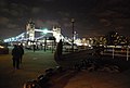
 A 2 second long exposure over London Bridge - geograph.org.uk - 4852421.jpg 2,952 × 1,976; 948 KB
-
 A 2 second long exposure over London Bridge ^2 - geograph.org.uk - 4852434.jpg 3,872 × 2,592; 2.63 MB
-
 A 2 second long exposure over Tower Bridge - geograph.org.uk - 4852426.jpg 2,887 × 1,933; 921 KB
-
 A 2 second long exposure over Tower Bridge ^2 - geograph.org.uk - 4852438.jpg 2,821 × 1,889; 825 KB
-

-
 A bare majority.jpg 4,901 × 3,744; 7.93 MB
-
 A bed of yellow flowers - geograph.org.uk - 4076600.jpg 640 × 480; 78 KB
-
 A building with a history^ - geograph.org.uk - 4258428.jpg 1,600 × 1,008; 375 KB
-
 A cannon and Anchor, Durand's Wharf - geograph.org.uk - 2963158.jpg 640 × 430; 80 KB
-
 A cormorant keeping cool on the end of the pier - geograph.org.uk - 4068522.jpg 3,872 × 2,592; 3.46 MB
-
 A deceptive cat - geograph.org.uk - 3701187.jpg 768 × 1,024; 231 KB
-

-

-
-

-

-

-
-
 A glimpse of St Paul's - geograph.org.uk - 3893346.jpg 743 × 1,024; 188 KB
-
 A glimpse of The Shard - geograph.org.uk - 2640978.jpg 680 × 1,024; 140 KB
-
 A glimpse of Walworth Road - geograph.org.uk - 4746323.jpg 640 × 428; 93 KB
-

-
-
 A large birdbath - geograph.org.uk - 4076586.jpg 480 × 640; 80 KB
-
 A leaning Shard^ - geograph.org.uk - 3346562.jpg 480 × 640; 53 KB
-
 A misty HMS Belfast - geograph.org.uk - 5341400.jpg 640 × 426; 39 KB
-
 A mysterious object in the Thames near Rotherhithe - geograph.org.uk - 4069350.jpg 3,872 × 2,592; 3.36 MB
-
 A new Blackfriars Pier^ - geograph.org.uk - 5738979.jpg 640 × 480; 93 KB
-

-
 A patch of purple in Kennington - geograph.org.uk - 4447103.jpg 1,024 × 768; 121 KB
-

-
 A river Thames beach - geograph.org.uk - 5652520.jpg 640 × 426; 107 KB
-

-
 A Small Cemetery in Dulwich Village - geograph.org.uk - 5675950.jpg 640 × 424; 103 KB
-
 A snow covered car park at Asda in Old Kent Road - geograph.org.uk - 2200272.jpg 4,000 × 3,000; 2.76 MB
-
 A tempting display from the shop doorway - geograph.org.uk - 2264391.jpg 640 × 494; 106 KB
-
 A view down river - geograph.org.uk - 3399831.jpg 640 × 426; 50 KB
-

-
 A view towards the Shard from Blackfriars Station - geograph.org.uk - 6074711.jpg 2,000 × 1,333; 1.42 MB
-
 A view up river - geograph.org.uk - 3399953.jpg 640 × 426; 59 KB
-
 A view up river - geograph.org.uk - 3399985.jpg 640 × 426; 45 KB
-
 A wall, SE1 - geograph.org.uk - 4328591.jpg 640 × 480; 108 KB
-
 A warped house. Bermondsey - geograph.org.uk - 2484717.jpg 640 × 480; 133 KB
-
-
 A300 - geograph.org.uk - 5741975.jpg 640 × 425; 81 KB
-
 Abbey Street Railway Bridge, London SE1 - geograph.org.uk - 4380409.jpg 1,238 × 929; 1.1 MB
-
 Abutment detail, Hill Street Bridge - geograph.org.uk - 4041968.jpg 480 × 640; 98 KB
-
 Access for under the arches - geograph.org.uk - 4244552.jpg 1,600 × 1,063; 411 KB
-
 Access Storage, Willow Walk - geograph.org.uk - 2439845.jpg 1,024 × 768; 225 KB
-
 Acorn Walk - geograph.org.uk - 3703451.jpg 640 × 430; 120 KB
-
 Across Bowyer Place, Camberwell - geograph.org.uk - 4905236.jpg 640 × 427; 107 KB
-
 Across the river Thames - geograph.org.uk - 2856480.jpg 1,000 × 371; 95 KB
-
 Across the river Thames - geograph.org.uk - 2856485.jpg 1,000 × 385; 88 KB
-
 Across the river Thames - geograph.org.uk - 2856490.jpg 1,000 × 411; 99 KB
-
 Across the River Thames - geograph.org.uk - 6073881.jpg 4,135 × 2,758; 7.73 MB
-
 Across the River Thames - geograph.org.uk - 6073899.jpg 3,737 × 2,492; 7.81 MB
-
 Across the River Thames, London - geograph.org.uk - 1815219.jpg 3,872 × 2,592; 1.94 MB
-
 Across the River Thames, London - geograph.org.uk - 2196474.jpg 3,872 × 2,592; 3.53 MB
-
 Across the River Thames, London - geograph.org.uk - 2196477.jpg 3,872 × 2,592; 3.5 MB
-
 Across the River Thames, London - geograph.org.uk - 2331420.jpg 2,772 × 1,856; 3.12 MB
-
 Across the Thames - geograph.org.uk - 4090711.jpg 640 × 427; 72 KB
-
 Across the Thames from Hay's Lane - geograph.org.uk - 272209.jpg 480 × 640; 93 KB
-
-
 Action House, Sandgate Street, North Peckham - geograph.org.uk - 4583166.jpg 1,024 × 768; 127 KB
-

-
 Adventure park in Peckham Rye Park - geograph.org.uk - 2620425.jpg 4,288 × 3,216; 7.46 MB
-

-
 Aftermath of a traffic incident - geograph.org.uk - 4553207.jpg 1,024 × 768; 134 KB
-
 Air shaft - geograph.org.uk - 3682874.jpg 640 × 430; 91 KB
-
 Aird House and Arroll House, Southwark - geograph.org.uk - 2296084.jpg 1,024 × 768; 367 KB
-
 Al Fresco Lunch - geograph.org.uk - 5404711.jpg 4,621 × 3,081; 5.68 MB
-
 Albert Arms, Gladstone Street - geograph.org.uk - 4826763.jpg 640 × 500; 181 KB
-
 Albion Channel - geograph.org.uk - 4046596.jpg 427 × 640; 93 KB
-
 Albury House, Boyfield Street - geograph.org.uk - 4825795.jpg 640 × 495; 154 KB
-
 Alderney Mews, London SE1 - geograph.org.uk - 4379607.jpg 1,238 × 928; 894 KB
-

-
 All Bar One, London Bridge Quarter - geograph.org.uk - 3364252.jpg 640 × 426; 60 KB
-
 All change in Rusworth Street - geograph.org.uk - 4260155.jpg 1,600 × 1,063; 368 KB
-
 All Hallows Church garden, Southwark - geograph.org.uk - 4948970.jpg 1,600 × 1,157; 546 KB
-
 All Hallows Church vicarage, Southwark - geograph.org.uk - 4950068.jpg 1,539 × 1,600; 491 KB
-

-
 Alleyn's School - geograph.org.uk - 5823745.jpg 1,024 × 681; 149 KB
-
 Alleyn's School Memorial Garden - geograph.org.uk - 2116112.jpg 640 × 480; 98 KB
-
 Alleyn's School playing fields - geograph.org.uk - 5823751.jpg 1,024 × 681; 98 KB
-
 Alleyns Head, West Dulwich - geograph.org.uk - 4607282.jpg 2,272 × 1,704; 1.05 MB
-
 Alleyway on Sartor Road - geograph.org.uk - 2620450.jpg 4,288 × 3,216; 4.92 MB
-
 Almshouse, Calton Avenue - geograph.org.uk - 5823991.jpg 1,024 × 681; 227 KB
-
 Almshouses, Calton Avenue - geograph.org.uk - 5823980.jpg 1,024 × 681; 194 KB
-
 Almshouses, Calton Avenue - geograph.org.uk - 5823981.jpg 1,024 × 681; 272 KB
-
 Almshouses, Calton Avenue - geograph.org.uk - 5823984.jpg 1,024 × 681; 279 KB
-

-
 Along Rothsay Street - geograph.org.uk - 5230139.jpg 427 × 640; 165 KB
-
 Along Weston Street - geograph.org.uk - 5230164.jpg 640 × 427; 182 KB
-
 America Street - geograph.org.uk - 5104323.jpg 640 × 426; 74 KB
-
 America Street - geograph.org.uk - 5230253.jpg 427 × 640; 174 KB
-
 America Street, Borough - geograph.org.uk - 4804669.jpg 2,272 × 1,704; 791 KB
-
 Amisha Court, Bermondsey - geograph.org.uk - 3701257.jpg 1,024 × 768; 181 KB
-

-
-

-
 An old wharf - geograph.org.uk - 2983621.jpg 640 × 430; 84 KB
-
 An old wharf, Rotherhithe - geograph.org.uk - 2983626.jpg 640 × 430; 78 KB
-
 An upside down building - geograph.org.uk - 4279743.jpg 768 × 1,024; 115 KB
-
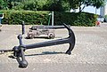 Anchor and Cannon, Durand's Wharf - geograph.org.uk - 3703425.jpg 640 × 430; 112 KB
-
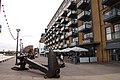 Anchor on the Thames Path - geograph.org.uk - 3352708.jpg 1,500 × 1,000; 166 KB
-
 Anchor, Butlers Wharf - geograph.org.uk - 2988700.jpg 640 × 430; 53 KB
-
 Anchor, Durand's Wharf - geograph.org.uk - 5652544.jpg 640 × 426; 97 KB
-
 Ancient and Modern - geograph.org.uk - 2717884.jpg 640 × 480; 84 KB
-
 Angel Wharf - geograph.org.uk - 2988664.jpg 430 × 640; 49 KB
-
 Angel Wharf on Bermondsey Road East - geograph.org.uk - 3355881.jpg 1,500 × 1,230; 276 KB
-

-
 Apartment Block, Sturgeon Street, London SE1 - geograph.org.uk - 4379614.jpg 1,238 × 929; 856 KB
-
 Apartment Blocks by Thames Path, London SE1 - geograph.org.uk - 4863722.jpg 1,400 × 1,050; 1.12 MB
-
 Apartment blocks, Sumner Street - geograph.org.uk - 4376378.jpg 768 × 1,024; 165 KB
-

-
 Apartments in Bywater Place - geograph.org.uk - 3392846.jpg 1,500 × 1,000; 183 KB
-
 Apartments on Broadwall - geograph.org.uk - 6259473.jpg 4,032 × 3,024; 2.92 MB
-
-
-
 Apartments, Bermondsey - geograph.org.uk - 5505849.jpg 640 × 335; 47 KB
-
 Apartments, Canada Water - geograph.org.uk - 3735470.jpg 640 × 430; 85 KB
-
 Apartments, corner of Mundania Rd - geograph.org.uk - 3189895.jpg 640 × 430; 84 KB
-
 Apartments, Greenland Dock - geograph.org.uk - 3735413.jpg 640 × 430; 93 KB


_Major_Road_-_geograph.org.uk_-_3996686.jpg)
_Ada_Road,_SE5_-_geograph.org.uk_-_3170722.jpg)


_-_geograph.org.uk_-_4486263.jpg)


_-_geograph.org.uk_-_5589722.jpg)
_-_geograph.org.uk_-_5589723.jpg)
_-_geograph.org.uk_-_5589724.jpg)
_-_geograph.org.uk_-_5589726.jpg)
_-_geograph.org.uk_-_5589729.jpg)


