Category:London Borough of Waltham Forest
둘러보기로 이동
검색으로 이동
Boroughs of London: City of London · City of Westminster · Barking and Dagenham · Barnet · Bexley · Brent · Bromley · Camden · Croydon · Ealing · Enfield · Greenwich · Hackney · Hammersmith and Fulham · Haringey · Harrow · Havering · Hillingdon · Hounslow · Islington · Kensington and Chelsea · Kingston · Lambeth · Lewisham · Merton · Newham · Redbridge · Richmond · Southwark · Sutton · Tower Hamlets · Waltham Forest · Wandsworth
borough in the London Region in England    | |||||
| 미디어 올리기 | |||||
| 다음 종류에 속함 | |||||
|---|---|---|---|---|---|
| 명칭의 유래 |
| ||||
| 위치 | 그레이터런던, London, 잉글랜드 | ||||
| 정부 소재지 | |||||
| 입법부 |
| ||||
| 행정부 |
| ||||
| 행정부 수반 |
| ||||
| 만들어진 날 |
| ||||
| 인구수 |
| ||||
| 면적 |
| ||||
| 공식 웹사이트 | |||||
 | |||||
하위 분류
다음은 이 분류에 속하는 하위 분류 20개 가운데 20개입니다.
A
E
F
H
M
P
S
T
"London Borough of Waltham Forest" 분류에 속하는 미디어
다음은 이 분류에 속하는 파일 1,843개 가운데 200개입니다.
(이전 페이지) (다음 페이지)-
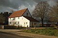 "Butler's Retreat", Rangers Road - geograph.org.uk - 4816778.jpg 3,008 × 2,008; 1.19 MB
-
 "Electric House" Church Hill Walthamstow - geograph.org.uk - 2634865.jpg 1,600 × 1,162; 527 KB
-
 "Nature's Throne", Middlesex Filter Beds - geograph.org.uk - 2249050.jpg 2,794 × 1,871; 1.88 MB
-
-
 "The Wishing Well", South Chingford - geograph.org.uk - 4817171.jpg 2,426 × 3,239; 1.13 MB
-

-
 ...and welcome to the London Borough of Redbridge^ - geograph.org.uk - 3178168.jpg 3,456 × 2,592; 3.03 MB
-
 102 Diana Road E17 - geograph.org.uk - 4471748.jpg 480 × 640; 101 KB
-
 112-114 New Road - geograph.org.uk - 3187031.jpg 640 × 428; 75 KB
-
 A bit of infill, Brewster Road - geograph.org.uk - 2065716.jpg 1,024 × 768; 110 KB
-
 A distinctive house in Pevensey Road - geograph.org.uk - 4312490.jpg 3,804 × 2,999; 1.1 MB
-
 A Pond on Leyton Flats - geograph.org.uk - 5438301.jpg 640 × 424; 71 KB
-
 A rainy day on Walthamstow Marshes - geograph.org.uk - 5343829.jpg 1,600 × 1,067; 249 KB
-
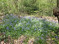
 A show of bluebells in Larks Wood - geograph.org.uk - 5339295.jpg 4,000 × 3,000; 4.85 MB
-
 A very narrow house - geograph.org.uk - 4851395.jpg 4,608 × 3,456; 3.42 MB
-
 A view of The Engine House - geograph.org.uk - 6070083.jpg 3,659 × 4,872; 4.27 MB
-
 A Walk by the River - geograph.org.uk - 4830666.jpg 3,369 × 2,694; 2.45 MB
-
 A.D. Jones Bathrooms, Walthamstow - geograph.org.uk - 5343456.jpg 2,304 × 1,728; 1.2 MB
-
 A1009 - geograph.org.uk - 5919642.jpg 1,024 × 681; 173 KB
-
 A1009, Chingford Lane - geograph.org.uk - 5919639.jpg 1,024 × 681; 166 KB
-
 A1009, Chingford Lane - geograph.org.uk - 5919641.jpg 1,024 × 681; 194 KB
-
 A1009, Chingford Lane - geograph.org.uk - 5919644.jpg 1,024 × 681; 218 KB
-
 A104 - A112 junction, Bakers Arms - geograph.org.uk - 5818658.jpg 1,024 × 680; 145 KB
-
 A104 - geograph.org.uk - 5924441.jpg 1,024 × 681; 187 KB
-
 A104 - geograph.org.uk - 5928082.jpg 1,024 × 681; 157 KB
-
 A104 - geograph.org.uk - 5928109.jpg 1,024 × 681; 192 KB
-
 A104 - geograph.org.uk - 5928119.jpg 1,024 × 681; 188 KB
-
 A104 - geograph.org.uk - 5928126.jpg 1,024 × 681; 183 KB
-

-
 A104, A503 junction, Waterworks Corner - geograph.org.uk - 5924442.jpg 1,024 × 681; 146 KB
-
 A104, Woodford new Rd - geograph.org.uk - 5928096.jpg 1,024 × 681; 187 KB
-
 A104, Woodford new Rd - geograph.org.uk - 5928114.jpg 1,024 × 681; 189 KB
-
 A104, Woodford New Rd - geograph.org.uk - 5928133.jpg 1,024 × 681; 202 KB
-
 A1069 - geograph.org.uk - 5916968.jpg 1,024 × 681; 177 KB
-
 A1069 - geograph.org.uk - 5916970.jpg 1,024 × 681; 221 KB
-
 A1069 Ranger's Road - geograph.org.uk - 4936813.jpg 640 × 424; 70 KB
-
 A110 - geograph.org.uk - 5916995.jpg 1,024 × 681; 213 KB
-
 A110 - geograph.org.uk - 5919640.jpg 1,024 × 681; 221 KB
-
 A112 Leyton High Road bridge - geograph.org.uk - 3107562.jpg 4,288 × 3,216; 3.52 MB
-
 A112, Chingford Rd - geograph.org.uk - 5939307.jpg 1,024 × 681; 153 KB
-
 A12 - geograph.org.uk - 5827291.jpg 1,024 × 681; 113 KB
-
 A12 dual-carriageway at Leytonstone - geograph.org.uk - 2507951.jpg 640 × 480; 60 KB
-
 A12 going through Olympic Park - geograph.org.uk - 4389921.jpg 1,600 × 1,200; 525 KB
-
 A12 Leytonstone - geograph.org.uk - 2432199.jpg 4,320 × 3,240; 4.25 MB
-
 A12 to Leyton and Hackney - geograph.org.uk - 3400909.jpg 4,288 × 3,216; 5.08 MB
-
 A12 towards central London - geograph.org.uk - 5984892.jpg 1,024 × 768; 260 KB
-
 A12 towards Wanstead - geograph.org.uk - 3400906.jpg 4,288 × 3,216; 5.16 MB
-
 A12, Leytonstone - geograph.org.uk - 3242540.jpg 640 × 480; 91 KB
-
 A406 North Circular Road - geograph.org.uk - 6206942.jpg 800 × 600; 94 KB
-
 A406, North Circular Road - geograph.org.uk - 5924434.jpg 1,024 × 681; 162 KB
-
 A503 - A112 crossroads - geograph.org.uk - 5939302.jpg 1,024 × 681; 154 KB
-
 A503 Forest Road, Walthamstow - geograph.org.uk - 6413673.jpg 1,024 × 768; 115 KB
-
 A503, Forest Road - geograph.org.uk - 5601043.jpg 1,600 × 1,067; 282 KB
-
 A604 North Circular Road - geograph.org.uk - 5438834.jpg 424 × 640; 47 KB
-

-
 Acorn Close near Chingford - geograph.org.uk - 6416718.jpg 1,024 × 768; 178 KB
-
 Addison Road Medical Practise - geograph.org.uk - 3375896.jpg 4,288 × 3,216; 5.71 MB
-
 Ainslie Wood Road, near Chingford - geograph.org.uk - 6416722.jpg 1,024 × 768; 108 KB
-
 Ainslie Wood Road, near Chingford - geograph.org.uk - 6416724.jpg 1,024 × 768; 158 KB
-
 Ainslie Wood, near Chingford - geograph.org.uk - 6418011.jpg 1,024 × 768; 281 KB
-
 Akdeniz Supermarket - geograph.org.uk - 5939543.jpg 1,024 × 681; 162 KB
-
 Aldi, Lea Bridge Rd - geograph.org.uk - 5809165.jpg 1,024 × 681; 179 KB
-
 Alexandra Rd, A106 - geograph.org.uk - 5827273.jpg 1,024 × 681; 200 KB
-

-
 Alley from Raglan Road to Shernhall Street - geograph.org.uk - 5984726.jpg 1,024 × 768; 327 KB
-
 Allied Bakeries, E17.jpg 2,133 × 1,600; 472 KB
-
 Allotment gates and footpath, Walthamstow - geograph.org.uk - 6413814.jpg 1,024 × 768; 266 KB
-
 Alongside Ranger's Road - geograph.org.uk - 4475746.jpg 4,000 × 3,000; 3.96 MB
-
 Alpacas at Brooks Farm - geograph.org.uk - 4305202.jpg 4,000 × 3,000; 4.3 MB
-

-
 Amesbury Drive southbound bus stop - geograph.org.uk - 3189613.jpg 640 × 480; 113 KB
-
 An ivied churchyard - geograph.org.uk - 5985899.jpg 1,024 × 768; 475 KB
-
 Anchor ^ Hope public house, River Lea, Clapton - geograph.org.uk - 1918801.jpg 3,264 × 2,448; 2.95 MB
-
 Antique Centre, Wood St - geograph.org.uk - 5928240.jpg 1,024 × 681; 177 KB
-
 Apple Blossom - geograph.org.uk - 4936845.jpg 424 × 640; 75 KB
-
 Apple Blossom ^ Forest Ride - geograph.org.uk - 4936815.jpg 640 × 424; 89 KB
-
 Aqueduct, Lee Valley - geograph.org.uk - 3187322.jpg 640 × 480; 99 KB
-
 Arches under Clapton Junction - geograph.org.uk - 2638800.jpg 1,600 × 1,176; 426 KB
-
 Arches, Leyton Midland Road Station - geograph.org.uk - 5822747.jpg 1,024 × 681; 182 KB
-
 Arriva bus garage on Ruckholt Road, Leyton - geograph.org.uk - 6422325.jpg 1,898 × 1,246; 990 KB
-
 Asda supermarket, Leyton Mills - geograph.org.uk - 2258721.jpg 640 × 480; 73 KB
-
 Aspray House - geograph.org.uk - 5812909.jpg 1,024 × 990; 197 KB
-
 Athletics and a circus - geograph.org.uk - 3186872.jpg 640 × 480; 107 KB
-
 Autumn, Maida Avenue - geograph.org.uk - 3189642.jpg 640 × 480; 128 KB
-
 B146, A1009 junction - geograph.org.uk - 5919636.jpg 1,024 × 681; 165 KB
-
 B146, Friday Hill - geograph.org.uk - 5919634.jpg 1,024 × 681; 172 KB
-
 B160 - geograph.org.uk - 5933092.jpg 1,024 × 681; 157 KB
-
 B161, Cathall Rd - geograph.org.uk - 5830592.jpg 1,024 × 681; 135 KB
-
 Back garden fence, Normanshire Drive, Chingford - geograph.org.uk - 4793514.jpg 1,024 × 768; 126 KB
-
-
 Bailey Close, E4 - geograph.org.uk - 2110502.jpg 1,600 × 1,200; 582 KB
-
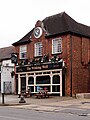
 Baker's Arms - geograph.org.uk - 2173681.jpg 640 × 384; 62 KB
-
 Bakers Almshouses Lea Bridge Road Leyton - geograph.org.uk - 2665017.jpg 1,600 × 1,200; 543 KB
-
 Bakers Arms Leyton - geograph.org.uk - 2635943.jpg 1,600 × 1,200; 454 KB
-
 Bakers' Almshouses - geograph.org.uk - 5812957.jpg 1,024 × 681; 304 KB
-
 Bakers' Almshouses - geograph.org.uk - 5818651.jpg 1,024 × 681; 280 KB
-
 Bakers' Almshouses - geograph.org.uk - 5818653.jpg 1,024 × 681; 317 KB
-
 Bakers' Almshouses gardens - geograph.org.uk - 5818652.jpg 1,024 × 681; 279 KB
-
 Banbury Road - geograph.org.uk - 3182189.jpg 640 × 480; 61 KB
-
 Bank by the River Lea, Enfield - geograph.org.uk - 5688710.jpg 2,304 × 1,728; 845 KB
-
 Bank on Lea Bridge Road (A104) - geograph.org.uk - 5489875.jpg 640 × 480; 65 KB
-
 Baptist Sunday School, Leyton - geograph.org.uk - 3402115.jpg 4,288 × 3,216; 4.31 MB
-
 Bar of Peter May Sports Centre, with sports drinks - geograph.org.uk - 3680273.jpg 2,736 × 2,050; 2.15 MB
-
 Barber Shop, Wanstead.jpg 4,588 × 3,824; 12.79 MB
-
 Beacon, Waltham Forest - geograph.org.uk - 5939290.jpg 681 × 1,024; 165 KB
-
 Bedford Road, Walthamstow - geograph.org.uk - 6414021.jpg 1,024 × 768; 164 KB
-
 Beech House, South Chingford - geograph.org.uk - 4814532.jpg 1,205 × 761; 1.01 MB
-
 Beech Tree Glade - geograph.org.uk - 5916984.jpg 1,024 × 681; 202 KB
-
 Beetle Food on Leyton Flats - geograph.org.uk - 5438257.jpg 424 × 640; 104 KB
-
 Beresford Road at the junction of Forest Avenue - geograph.org.uk - 5660289.jpg 2,304 × 1,728; 843 KB
-
 Berneliu Uzeiga - geograph.org.uk - 5830716.jpg 1,024 × 681; 153 KB
-
 Berva Plastico on Rigg Approach, Leyton - geograph.org.uk - 6421320.jpg 1,837 × 1,222; 1.51 MB
-
 Beydag Food Centre - geograph.org.uk - 5809156.jpg 1,024 × 681; 132 KB
-
 Billet Works - geograph.org.uk - 3187293.jpg 640 × 428; 78 KB
-
 Birch Grove - geograph.org.uk - 5830584.jpg 1,024 × 681; 141 KB
-
 Bistern Avenue - geograph.org.uk - 5928161.jpg 1,024 × 681; 193 KB
-
 Blackhorse Lane - geograph.org.uk - 6206835.jpg 800 × 600; 99 KB
-
 Blackhorse Lane at the corner of Sutton Road - geograph.org.uk - 3846770.jpg 2,492 × 1,826; 1.46 MB
-
 Blackhorse Road Baptist Church - geograph.org.uk - 6206334.jpg 800 × 590; 94 KB
-
 Blackhorse Road Baptist Church, Walthamstow - geograph.org.uk - 5438250.jpg 1,600 × 1,303; 594 KB
-
 Block of flats at Whipps Cross Roundabout - geograph.org.uk - 4681257.jpg 4,608 × 3,456; 3.59 MB
-
-
 Bluebells alongside a path in Larks Wood - geograph.org.uk - 5339275.jpg 4,000 × 3,000; 4.96 MB
-
 Bluebells in Larks Wood - geograph.org.uk - 5339279.jpg 4,000 × 3,000; 4.84 MB
-
 Bluebells in Larks Wood - geograph.org.uk - 5339283.jpg 4,000 × 3,000; 5.01 MB
-
 Bluebells in Larks Wood - geograph.org.uk - 5339286.jpg 4,000 × 3,000; 5.01 MB
-
 Boardwalk at Waterworks Nature Reserve - geograph.org.uk - 5764629.jpg 4,896 × 3,672; 5.9 MB
-

-
 Borough of Leyton Electricity Department substation - geograph.org.uk - 4946275.jpg 6,000 × 4,000; 4.58 MB
-
 Boundary Road Leyton-Walthamstow - geograph.org.uk - 2670158.jpg 1,024 × 768; 291 KB
-
 Box junction, A112 - geograph.org.uk - 5827244.jpg 1,024 × 681; 138 KB
-
 Boys Entrance, Woodside Primary School - geograph.org.uk - 5933402.jpg 1,024 × 681; 198 KB
-
 Brandon Rd - geograph.org.uk - 5928231.jpg 1,024 × 681; 189 KB
-
 Bridge on Chigwell branch - geograph.org.uk - 5986222.jpg 1,024 × 684; 263 KB
-
 Bridge over the River Ching - geograph.org.uk - 2684190.jpg 1,600 × 1,200; 748 KB
-
 Bridge over the River Lea - geograph.org.uk - 3272923.jpg 640 × 430; 102 KB
-
 Bridge over the River Lea, London N18 - geograph.org.uk - 4421261.jpg 1,167 × 875; 1.53 MB
-
 Bridge under the A12 - geograph.org.uk - 4312642.jpg 4,000 × 3,000; 4.11 MB
-
 Bridge upon bridge - geograph.org.uk - 2233198.jpg 640 × 480; 134 KB
-
 Bridge, Walthamstow - geograph.org.uk - 6266002.jpg 3,264 × 2,448; 1.8 MB
-
 Brisbane Road, Leyton Orient F.C. - geograph.org.uk - 3977361.jpg 2,848 × 2,136; 3.16 MB
-
 Brockway Close - geograph.org.uk - 5830838.jpg 1,024 × 681; 175 KB
-
 Brookscroft - geograph.org.uk - 5933484.jpg 1,024 × 681; 263 KB
-
 Brydges Road from Chobham Road, Stratford - geograph.org.uk - 5598885.jpg 2,048 × 1,536; 1.5 MB
-
 Builders' Merchants, Blackhorse Road - geograph.org.uk - 3582119.jpg 1,600 × 1,200; 349 KB
-
 Building by the Lea Bridge Weir - geograph.org.uk - 3297025.jpg 640 × 430; 68 KB
-
 Building site off Forest Side - geograph.org.uk - 5916992.jpg 1,024 × 681; 269 KB
-
-
 Building site, E10 - geograph.org.uk - 5985646.jpg 1,024 × 768; 300 KB
-
 Building site^ Chadwick Road - geograph.org.uk - 3861696.jpg 640 × 480; 83 KB
-
 Buildings along Church Hill, Walthamstow - geograph.org.uk - 3846790.jpg 2,518 × 1,862; 1.16 MB
-
 Buildings by the Green Man Roundabout, Leytonstone - geograph.org.uk - 3846702.jpg 2,560 × 1,920; 1.38 MB
-
 Bungalows, Mount Echo Drive, Chingford - geograph.org.uk - 4792592.jpg 1,024 × 768; 162 KB
-
 Burnside Avenue, near Chingford - geograph.org.uk - 6414070.jpg 1,024 × 768; 152 KB
-
 Burnside Avenue, near Chingford - geograph.org.uk - 6416700.jpg 1,024 × 768; 135 KB
-
 Burwell Road Factory, E10.jpg 1,600 × 2,133; 507 KB
-
 Bury Road at the junction of Rangers Road - geograph.org.uk - 5660425.jpg 2,206 × 1,588; 855 KB
-

-
 Bus stop on Grove Green Road, Leytonstone - geograph.org.uk - 6426647.jpg 1,920 × 1,280; 1.14 MB
-
 Bus stop on Winchester Road, Highams Park - geograph.org.uk - 6215045.jpg 5,184 × 3,888; 4.79 MB
-
 Bus terminus at Chingford Station - geograph.org.uk - 6080947.jpg 1,920 × 1,280; 1.92 MB
-
 Business entrance on Rigg Approach, Leyton - geograph.org.uk - 6421324.jpg 1,920 × 1,280; 989 KB
-
 Butler's Retreat - geograph.org.uk - 3709371.jpg 1,600 × 1,064; 537 KB
-
 Butlers Retreat - geograph.org.uk - 5916963.jpg 1,024 × 681; 180 KB
-
 Buxton Road looking towards The Drive - geograph.org.uk - 5660409.jpg 2,304 × 1,728; 863 KB
-
 By Reservoir No.4, Walthamstow Wetlands - geograph.org.uk - 6070109.jpg 4,804 × 3,592; 3.94 MB
-
 By Warwick Reservoir East - geograph.org.uk - 6070102.jpg 3,641 × 4,827; 2.76 MB
-
 By Warwick Reservoir East - geograph.org.uk - 6070107.jpg 4,700 × 2,684; 3.35 MB
-
 B^M, High Rd Leytonstone - geograph.org.uk - 5830717.jpg 1,024 × 681; 157 KB
-
 Cairo Rd - geograph.org.uk - 5939495.jpg 1,024 × 681; 172 KB
-
 Cairo Road, Walthamstow - geograph.org.uk - 6343036.jpg 1,280 × 960; 381 KB
-
 Cann Hall Park - geograph.org.uk - 4312376.jpg 4,000 × 3,000; 4.34 MB
-
 Capital Ring - geograph.org.uk - 3294168.jpg 640 × 430; 48 KB
-
 Capital Ring - geograph.org.uk - 5357871.jpg 640 × 426; 45 KB
-
 Capital Ring by Lea Navigation - geograph.org.uk - 5354732.jpg 640 × 426; 61 KB
-
 Capital Ring by the River Lea - geograph.org.uk - 3290119.jpg 640 × 430; 55 KB
-
 Capital Ring, Walthamstow Marshes - geograph.org.uk - 3290096.jpg 640 × 430; 46 KB
-
 Car park near Whipps Cross - geograph.org.uk - 6240750.jpg 1,024 × 768; 202 KB
-
 Car park on Coppermill Lane, Walthamstow - geograph.org.uk - 5598606.jpg 2,048 × 1,536; 1.51 MB
-
 Car wash on Hoe Street, Walthamstow - geograph.org.uk - 3846978.jpg 2,560 × 1,920; 1.28 MB
-
-
 Cash and carry warehouse, Rigg Approach, London E10 - geograph.org.uk - 2774099.jpg 4,320 × 3,240; 3.72 MB
-
 Cash Converters, High Rd - geograph.org.uk - 5818671.jpg 1,024 × 681; 161 KB
-
 Cathall Rd, B161 - geograph.org.uk - 5830591.jpg 1,024 × 681; 181 KB
-
 Cattle grazing the marshes - geograph.org.uk - 3294176.jpg 640 × 430; 61 KB
-
 Centenary Walk - geograph.org.uk - 5919646.jpg 1,024 × 681; 300 KB
-
 Centenary Walk - geograph.org.uk - 5924373.jpg 1,024 × 681; 286 KB
-
 Centenary Walk - geograph.org.uk - 5924378.jpg 1,024 × 681; 300 KB
-
 Centenary Walk - geograph.org.uk - 5924387.jpg 1,024 × 681; 254 KB
-
 Centenary Walk - geograph.org.uk - 5924395.jpg 1,024 × 681; 196 KB
-
 Centenary Walk - geograph.org.uk - 5924413.jpg 1,024 × 681; 273 KB
-
 Centenary Walk - geograph.org.uk - 5924417.jpg 1,024 × 681; 276 KB
-
 Centenary Walk - geograph.org.uk - 5924421.jpg 1,024 × 681; 279 KB
-
 Centenary Walk - geograph.org.uk - 5924424.jpg 1,024 × 681; 267 KB
-
 Centenary Walk - geograph.org.uk - 5924426.jpg 1,024 × 681; 301 KB
-
 Centenary Walk alongside Highams Park lake - geograph.org.uk - 4415075.jpg 4,000 × 3,000; 4.32 MB
-
 Centenary Walk goes right - geograph.org.uk - 5924390.jpg 1,024 × 681; 305 KB
-
 Centenary Walk looking towards Oak Hill - geograph.org.uk - 2704313.jpg 3,648 × 2,255; 2.59 MB
-
 Centenary Walk, Hatch Forest - geograph.org.uk - 5919612.jpg 1,024 × 681; 273 KB
-
 Centenary Walk, Highams Park - geograph.org.uk - 5919645.jpg 1,024 × 681; 218 KB


_sign_for_The_(former)_Chequers,_High_Street_-_Storey_Road,_E17_-_geograph.org.uk_-_5287397.jpg)


_-_geograph.org.uk_-_5489875.jpg)


_-_geograph.org.uk_-_5489794.jpg)


_-_geograph.org.uk_-_5489901.jpg)


