Category:Luzerne County, Pennsylvania
Пређи на навигацију
Пређи на претрагу
Counties of Pennsylvania : Adams · Allegheny · Armstrong · Beaver · Bedford · Berks · Blair · Bradford · Bucks · Butler · Cambria · Cameron · Carbon · Centre · Chester · Clarion · Clearfield · Clinton · Columbia · Crawford · Cumberland · Dauphin · Delaware · Elk · Erie · Fayette · Forest · Franklin · Fulton · Greene · Huntingdon · Indiana · Jefferson · Juniata · Lackawanna · Lancaster · Lawrence · Lebanon · Lehigh · Luzerne · Lycoming · McKean · Mercer · Mifflin · Monroe · Montgomery · Montour · Northampton · Northumberland · Perry · Philadelphia · Pike · Potter · Schuylkill · Snyder · Somerset · Sullivan · Susquehanna · Tioga · Union · Venango · Warren · Washington · Wayne · Westmoreland · Wyoming · York
county in Pennsylvania, United States   | |||||
| Отпремање медија | |||||
| Је |
| ||||
|---|---|---|---|---|---|
| Названо по | |||||
| Локација | Пенсилванија, САД | ||||
| Престоница | |||||
| Настанак |
| ||||
| Насељеност |
| ||||
| Површина |
| ||||
| Различито од | |||||
| званични веб-сајт | |||||
 | |||||
Поткатегорије
Приказано је 15 поткатегорија; укупно 15.
D
E
G
H
N
P
S
T
Медији у категорији „Luzerne County, Pennsylvania”
Следећих 200 датотека је у овој категорији, од укупно 366.
(претходна страница) (следећа страница)-
 1901 University of PA Crew.jpg 1.500 × 1.026; 264 kB
-
 Adams Falls 1.JPG 2.056 × 3.088; 1,91 MB
-
 Adams Falls 2.JPG 2.056 × 3.088; 2,37 MB
-
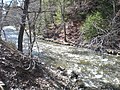
 Bear Hollow Creek.JPG 2.056 × 3.088; 3,4 MB
-
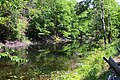
 Beaver Pond (Luzerne County, Pennsylvania).JPG 2.256 × 1.504; 2,56 MB
-
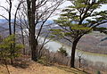
 Bell Bend from Council Cup 1.JPG 2.256 × 1.504; 2,88 MB
-
 Bell Bend from Council Cup 2.JPG 2.167 × 1.498; 3,42 MB
-
 Black Ash Creek.JPG 1.504 × 2.256; 2,95 MB
-
 Black Creek (Nescopeck Creek).JPG 3.264 × 2.448; 3,83 MB
-
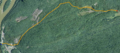 Black Creek satellite map.PNG 982 × 433; 1,03 MB
-
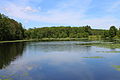 Blue Giant Meadow Lake 1.JPG 3.088 × 2.056; 1,06 MB
-
 Blue Giant Meadow Lake 2.JPG 3.088 × 2.056; 1,86 MB
-
 Boats on Harveys Lake.JPG 3.088 × 2.056; 1,54 MB
-
 Bow Creek looking downstream.JPG 2.056 × 3.088; 2,41 MB
-
 Bow Creek looking upstream.JPG 2.056 × 3.088; 2,53 MB
-
 Bowman Creek looking downstream in its upper reaches.JPG 2.056 × 3.088; 2,61 MB
-
 Bowman Creek looking upstream in its upper reaches.JPG 2.056 × 3.088; 2,5 MB
-
 Central Mountain and Red Rock Mountain.JPG 2.256 × 1.504; 3,3 MB
-
 Cliff on Council Cup.JPG 2.256 × 1.504; 3,11 MB
-
 Closeup of Crooked Creek.JPG 1.493 × 1.495; 1,58 MB
-
 Council Cup from Pennsylvania Route 93.JPG 3.088 × 2.056; 1,23 MB
-
 Council Cup from Wapwallopen.JPG 3.264 × 2.448; 1,69 MB
-

-
 Cows in a field in Luzerne County, Pennsylvania 1.JPG 3.076 × 1.624; 1,74 MB
-
 Cows in a field in Luzerne County, Pennsylvania 2.JPG 2.975 × 2.056; 1,96 MB
-
 East - panoramio (2).jpg 1.536 × 2.048; 440 kB
-
 Elijah C. Wadhams.jpg 900 × 1.162; 318 kB
-
 Entering the Lackawanna State Forest.JPG 3.088 × 2.056; 1,96 MB
-
-

-
-
-
-

-

-

-

-

-

-

-
-

-
-

-
-

-
 Flickr - Nicholas T - Beech Lake.jpg 4.608 × 3.456; 9,9 MB
-
 Flickr - Nicholas T - Bowmans Marsh (1).jpg 4.559 × 3.068; 9,63 MB
-
 Flickr - Nicholas T - Bowmans Marsh (2).jpg 4.608 × 2.879; 8,94 MB
-
 Flickr - Nicholas T - Dusted.jpg 1.100 × 836; 871 kB
-
 Flickr - Nicholas T - Fallow.jpg 4.049 × 2.262; 8,11 MB
-
 Flickr - Nicholas T - Open Canopy.jpg 3.456 × 4.608; 12,99 MB
-
 Flickr - Nicholas T - Twilight.jpg 2.760 × 2.073; 2,7 MB
-
 Flickr - Nicholas T - Westbound.jpg 4.320 × 3.118; 8,46 MB
-
 Gamesa wind turbine at bald mountain.jpg 402 × 602; 126 kB
-
 Group of breaker boys in -9 breaker.jpg 690 × 800; 105 kB
-
 Group of Breaker boys. Smallest is Sam Belloma.jpg 4.806 × 3.276; 8,81 MB
-

-
-
-

-
-
-
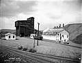
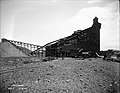
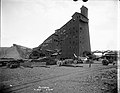
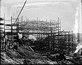
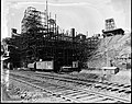
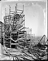
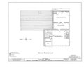
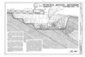
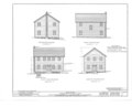
 Council Ridge Colliery, Eckley, Luzerne County, PA HAER PA,40-ECK,1- (sheet 1 of 5).tif 14.443 × 9.802; 784 kB
-
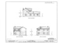
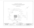
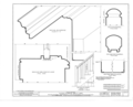
 Council Ridge Colliery, Eckley, Luzerne County, PA HAER PA,40-ECK,1- (sheet 2 of 5).tif 14.462 × 9.865; 639 kB
-
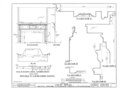
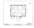
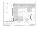
 Council Ridge Colliery, Eckley, Luzerne County, PA HAER PA,40-ECK,1- (sheet 3 of 5).tif 14.459 × 9.825; 3,81 MB
-
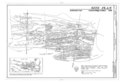
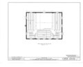
 Council Ridge Colliery, Eckley, Luzerne County, PA HAER PA,40-ECK,1- (sheet 4 of 5).tif 14.452 × 9.834; 1,53 MB
-
 Council Ridge Colliery, Eckley, Luzerne County, PA HAER PA,40-ECK,1- (sheet 5 of 5).tif 14.478 × 9.861; 4,48 MB
-

-
-

-
-

-

-
-

-
-

-

-
-

-

-

-

-

-

-
-
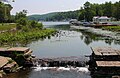
 Harris Pond Dam.JPG 2.256 × 1.504; 2,36 MB
-
 Harris Pond in April (1).JPG 2.256 × 1.504; 1,37 MB
-
 Harris Pond in April (2).JPG 2.256 × 1.504; 1,36 MB
-
 Harris Pond in April (3).JPG 2.256 × 1.504; 2,21 MB
-
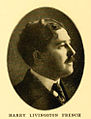 Harry Livingston French.jpg 750 × 983; 148 kB
-
 Harveys Creek in 1899.png 405 × 513; 218 kB
-
 Harveys Creek looking downstream from Meeker Outlet Road.JPG 3.088 × 2.056; 3,31 MB
-
 Harveys Creek looking downstream.JPG 2.056 × 3.088; 2,83 MB
-
 Harveys Creek looking upstream 1.JPG 2.056 × 3.088; 2,93 MB
-
 Harveys Creek looking upstream 2.JPG 3.088 × 2.056; 3,08 MB
-
 Harveys Creek looking upstream from Meeker Outlet Road.JPG 2.056 × 3.088; 3,36 MB
-
 Harveys Creek looking upstream in its upper reaches.JPG 3.088 × 2.056; 2,91 MB
-
 Harveys Lake as viewed from OpenStreetMap.PNG 708 × 584; 94 kB
-
 Harveys Lake Dam.JPG 3.088 × 2.011; 2,27 MB
-
 Harveys Lake Enviromapper image.png 400 × 300; 99 kB
-
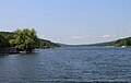
 Harveys Lake from the north 1.JPG 3.088 × 2.056; 1,27 MB
-
 Harveys Lake from the north 2.JPG 3.088 × 2.056; 1,33 MB
-
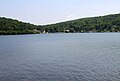
 Harveys Lake from the northeast.JPG 3.088 × 1.954; 1,33 MB
-
 Harveys Lake from the west.JPG 3.035 × 2.048; 1,42 MB
-
 Headwaters of Roaring Brook 1.JPG 1.504 × 2.256; 1,39 MB
-
 Headwaters of Roaring Brook 2.JPG 2.256 × 1.504; 2,93 MB
-
-

-

-

-

-

-

-
-

-

-

-

-
-

-
-
-

-
-

-

-
 Hughestown PA Breaker Boys 1911.jpg 1.024 × 719; 124 kB
-
 Hunlock Creek looking downstream.JPG 2.056 × 3.088; 3,26 MB
-
 Hunlock Creek looking upstream.JPG 2.056 × 3.088; 2,98 MB
-
 Huntington Creek at Harveyville Road 1.JPG 2.256 × 1.504; 2,38 MB
-
 Huntington Creek at Harveyville Road 2.JPG 2.203 × 1.374; 2,69 MB
-
 Huntington Creek in its upper reaches 1.JPG 1.985 × 1.322; 2,47 MB
-
 Huntington Creek looking downstream above Huntington Mills.JPG 1.504 × 2.256; 2,1 MB
-
 Huntington Creek looking downstream below Mitchler Run 1.JPG 1.504 × 2.256; 2,36 MB
-
 Huntington Creek looking downstream below Mitchler Run 2.JPG 2.256 × 1.504; 2,31 MB
-
 Huntington Creek looking upstream above Huntington Mills 1.JPG 2.256 × 1.504; 3,46 MB
-
 Huntington Creek looking upstream above Huntington Mills 2.JPG 2.215 × 1.501; 2,86 MB
-
 Huntington Creek looking upstream below Mitchler Run 1.JPG 2.256 × 1.504; 2,16 MB
-
 Huntington Creek looking upstream below Mitchler Run 2.JPG 1.504 × 2.256; 2,67 MB
-
 Huntington Creek looking upstream in its upper reaches.JPG 2.056 × 3.088; 2,94 MB
-
 Huntington Creek near Harveyville Road.JPG 2.256 × 1.504; 3,39 MB
-
 Inocybe apiosmota 358465.jpg 1.632 × 1.224; 878 kB
-
 Inocybe apiosmota 358466.jpg 1.632 × 1.224; 829 kB
-
 Inocybe apiosmota 358467.jpg 1.632 × 1.224; 795 kB
-
 Jeddo Tunnel outflow (cropped).png 296 × 223; 130 kB
-
 Jeddo Tunnel outflow.png 301 × 223; 132 kB
-
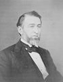
 John Jenks Shonk.jpg 750 × 983; 128 kB
-
 John Smith, Plymouth PA.jpg 900 × 1.222; 266 kB
-
 Kitchen Creek looking downstream above the Kitchen Creek Falls.JPG 2.256 × 1.504; 2,93 MB
-
 Kitchen Creek looking downstream in Ricketts Glen State Park.JPG 3.088 × 2.056; 2,27 MB
-
 Kitchen Creek looking downstream.JPG 2.256 × 1.504; 3,12 MB
-
 Kitchen Creek looking upstream.JPG 1.504 × 2.256; 3,62 MB
-
 Knox Mine Flood area from USMSHA report.gif 2.101 × 1.275; 229 kB
-
 Lackawanna State Forest.jpg 2.816 × 1.864; 5,01 MB
-
 Lake Pinecrest.JPG 2.256 × 1.504; 2,86 MB
-
 Lake Rose 1939.PNG 510 × 422; 303 kB
-
 Laurel Run (Huntington Creek) looking upstream.JPG 2.256 × 1.504; 3,2 MB
-
 Lewis Hine, Jim McNulty, 15 years old, miner, North Pittston, Pennsylvania, 1911.jpg 5.000 × 3.514; 6,33 MB
-
 Lick Branch looking downstream.JPG 2.256 × 1.504; 3,43 MB
-
 Lick Branch looking upstream.JPG 2.256 × 1.504; 3,43 MB
-
 Lily Lake dam.JPG 3.088 × 2.056; 1,3 MB
-
 Little Nescopeck Creek satellite map.PNG 856 × 231; 518 kB
-
 Little Shickshinny Creek.JPG 2.256 × 1.504; 2,76 MB
-
 Little Wapwallopen Creek from Pennsylvania Route 239.JPG 2.056 × 3.088; 2,95 MB
-
 Little Wapwallopen Creek in its upper reaches looking downstream.JPG 3.088 × 2.056; 1,94 MB
-
 Little Wapwallopen Creek in its upper reaches looking upstream.JPG 2.056 × 3.088; 1,82 MB
-
 Little Wapwallopen Creek.JPG 3.264 × 2.448; 3,5 MB
-
-
 Luzerne (Pennsylvania)2.jpg 2.816 × 2.112; 4,01 MB
-
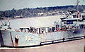 Luzerne County LST-902.jpg 468 × 289; 35 kB
-
 Luzerne County Railroad.jpg 200 × 254; 52 kB
-
 Luzerne Pennsylvania banner.jpg 2.750 × 393; 917 kB
-
-
 Map of Pennsylvania highlighting Luzerne County.svg 4.950 × 2.846; 106 kB
-
 Maple Run looking downstream 1.JPG 2.256 × 1.504; 2,98 MB
-
 Maple Run looking downstream 2.JPG 1.504 × 2.256; 3,32 MB
-
 Maple Run looking upstream.JPG 1.504 × 2.256; 2,83 MB
-
 Marsh Creek looking downstream.JPG 1.340 × 2.039; 2,44 MB
-
 Marsh Creek looking upstream.JPG 2.256 × 1.504; 2,62 MB
-
 Marsh Run looking upstream.JPG 2.056 × 3.088; 1,82 MB
-
 Mill Creek in October 1903.JPG 334 × 266; 25 kB
-
 Mitchler Run looking downstream 1.JPG 2.256 × 1.504; 2,37 MB
-
 Mitchler Run looking downstream 2.JPG 1.504 × 2.256; 2,57 MB
-
 Mitchler Run looking upstream 1.JPG 2.256 × 1.504; 2,75 MB
-
 Mitchler Run looking upstream 2.JPG 2.256 × 1.504; 3,05 MB
-
 Mitchler Run looking upstream 3.JPG 1.504 × 2.256; 2,59 MB
-
 Mocanaqua Loop Trail 1.JPG 2.112 × 2.816; 2,72 MB
-
 Mocanaqua Loop Trail 2.JPG 2.816 × 2.112; 3,11 MB
-
 Mocanaqua Loop Trail 3.JPG 2.112 × 2.816; 2,88 MB
-
 Mocanaqua Loop Trail sign.JPG 2.816 × 2.112; 2,01 MB
-
 Nanticoke City.jpg 1.500 × 801; 252 kB
-
 Nescopeck Creek north of Conyngham.JPG 3.005 × 2.232; 2,81 MB
-
 Nescopeck Mountain from Council Cup Road.JPG 3.088 × 2.056; 1,68 MB
-
 Nescopeck Mountain in June 2015 (1).JPG 3.088 × 2.056; 1,65 MB
-
 Nescopeck Mountain in June 2015 (2).JPG 3.088 × 2.056; 1,67 MB
-
 North Lake.JPG 2.256 × 1.504; 2,88 MB
-
 North Mountain near Ricketts Glen State Park 1.JPG 2.256 × 1.504; 2,71 MB
-
 North Mountain near Ricketts Glen State Park 2.JPG 2.256 × 1.504; 1,58 MB


.JPG)


.JPG)


.png)


.jpg)


.jpg)
.jpg)
.jpg)
.jpg)
.jpg)
.jpg)
.jpg)
.jpg)
.jpg)
.jpg)
.jpg)
.jpg)
.jpg)
.jpg)
.jpg)
.jpg)
.jpg)
.jpg)

.jpg)
.jpg)


.png)
.png)
.png)
.png)
.png)
.png)
.png)
.png)
.png)

.JPG)
.JPG)
.JPG)


.png)


_looking_upstream.JPG)


2.jpg)


.JPG)
.JPG)


