Category:Lincolnshire
Saltar para a navegação
Saltar para a pesquisa
ceremonial county in the east of England    | |||||
| Carregar ficheiro | |||||
| Instância de |
| ||||
|---|---|---|---|---|---|
| Parte de | |||||
| Localização |
| ||||
| Capital | |||||
| Composto de | |||||
| População |
| ||||
| Área |
| ||||
| Diferente de | |||||
| Diz-se ser o mesmo que | Lincolnshire (condado histórico da Inglaterra, Condados cerimoniais da Inglaterra, 1844) | ||||
| sítio web oficial | |||||
 | |||||

Subcategorias
Esta categoria contém as seguintes 53 subcategorias (de um total de 53).
!
*
A
B
- Benchmarks in Lincolnshire (29 F)
C
D
- Datestones in Lincolnshire (2 F)
E
F
G
- Geology of Lincolnshire (9 F)
H
I
- Images from Vine House Farm (2 F)
L
M
- Morris dance in Lincolnshire (1 F)
N
O
P
Q
- Quality images of Lincolnshire (60 F)
R
S
T
V
W
Multimédia na categoria "Lincolnshire"
Esta categoria contém os seguintes 52 ficheiros (de um total de 52).
-
 A Map of East and West Fenne (c. 1662).jpg 4 535 × 3 989; 12,08 MB
-
 All Saint North Scarle Lincolnshire England.png 600 × 425; 198 kB
-
 All Saints Nocton Lincolnshire England.png 600 × 425; 216 kB
-
 Andrew Gedney and his wife St Margaret Bag Enderby.png 425 × 600; 167 kB
-
 Applying fertiliser to fields ahead of potato planting (9202).jpg 2 400 × 1 600; 1,57 MB
-
 Bede Houses Main Street 1827 Belton Lincolnshire England.png 600 × 425; 184 kB
-
 Belton House Parish of Belton Near Grantham Lincolnshire.png 600 × 425; 270 kB
-
 Burghley House Stamford Lincolnshire England.png 600 × 425; 263 kB
-
 Burghley House Stamford Lincolnshire.png 600 × 425; 166 kB
-
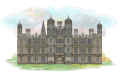 Burghley-House Stamford Lin.gif 1 200 × 762; 691 kB
-
 Carols on Christmas Eve (24041991861).jpg 5 156 × 3 547; 2,28 MB
-
 Church All Saints Brocklesby village Lincolnshire England.png 600 × 425; 233 kB
-
 Church of St Peter & St Paul Belchford UK.png 600 × 425; 187 kB
-
 Doddington Hall A folly Pyramid.png 425 × 600; 239 kB
-
 Doddington Hall Doddington North Kesteven Lincolnshire.png 600 × 425; 328 kB
-
 Doddington-Hall Doddington.gif 1 200 × 713; 715 kB
-
 Flooded Agricultural Land 4.jpg 1 234 × 925; 244 kB
-
 Gainsborough Old Hall Gainsborough Lincolnshire.png 600 × 425; 301 kB
-
 Greyhound Lodge Main Street 1839 Belton Lincolnshire England.png 600 × 425; 222 kB
-
 Gunby Hall Lincolnshire England.png 600 × 425; 285 kB
-
 Gunby-Hall Lincolnshire Eng.gif 1 200 × 708; 778 kB
-
 Lincoln City Skyline in 2024.jpg 4 000 × 2 250; 1,95 MB
-
 Lincoln Cliff Map-topographic.svg 1 320 × 1 201; 2,04 MB
-
 Lincolnshire Map.png 4 967 × 4 967; 4,19 MB
-
 Lincolnshire UK PCC election 2024.svg 474 × 651; 301 kB
-
 Market Deeping.jpg 4 237 × 3 177; 7,99 MB
-
 Marton Village Pumping Station 1.jpg 1 234 × 925; 312 kB
-
 Marton Village Pumping Station 2.jpg 1 234 × 925; 278 kB
-
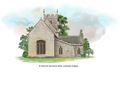
 Old Church of St Peter Aubourn Lincolnshire.png 425 × 600; 283 kB
-
 RAF Stenigot the last Chain Home Low Radar station, Lincolnshire, UK (13971891464).jpg 2 336 × 3 504; 861 kB
-
 River welland.jpg 9 248 × 6 936; 14,19 MB
-
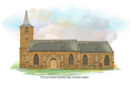
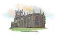
 St Andrew Fulletby Lincolnshire England.png 1 200 × 849; 759 kB
-
 St Edmund Riby Lincolnshire England.png 600 × 425; 204 kB
-
 St Helen Kirmington Lincolnshire England.png 600 × 425; 195 kB
-
 St John the Evangelist's Bracebridge Heat Lincolnshire.png 600 × 425; 196 kB
-
 St Lawrence Aylesby Lincolnshire England.png 600 × 425; 204 kB
-
 St Leonard Haugh Lincolnshire England.png 425 × 600; 210 kB
-
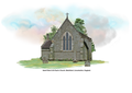
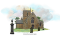
 St Margaret's parish church Bag Enderby Lincolnshire.png 600 × 425; 225 kB
-
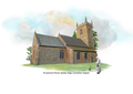
 St Mary Harrington Lincolnshire England.png 600 × 425; 217 kB
-
 St Mary Tetford Lincolnshire England.png 600 × 425; 202 kB
-
 St Mary's Church Village of North Cockerington Lincolnshire.png 600 × 425; 228 kB
-
 St Michael & All Angels Thorpe on the Hill Lincolnshire England.png 600 × 425; 193 kB
-
 St Peter & St Paul Church Belton Lincolnshire.png 600 × 425; 210 kB
-
 St Peter Aubourn Lincolnshire England.png 425 × 600; 182 kB
-
 St Peter Conisholme Lincolnshire England.png 600 × 425; 223 kB
-
 St Peter Raithby cum Maltby Lincolnshire England.png 600 × 425; 196 kB
-
 St Radegund Grayingham West Lindsey Lincolnshire Englang.png 600 × 425; 223 kB
-
 The Folly River.jpg 6 936 × 5 351; 10,65 MB
-
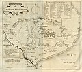
 The Map of Deeping Fenne (c.1662).jpg 4 739 × 4 193; 13,64 MB
-
 The Map of South Holland (1662).jpg 4 710 × 4 211; 12,45 MB
-
 The Maxey Cut.jpg 5 975 × 4 482; 15,49 MB
-
 Victoria Araj quote - Reimagining Lincolnshire.png 1 877 × 1 001; 903 kB
.jpg)


.jpg)


.jpg)


.jpg)


.jpg)
.jpg)

