Category:London Borough of Haringey
Przejdź do nawigacji
Przejdź do wyszukiwania
Boroughs of London: City of London · City of Westminster · Barking and Dagenham · Barnet · Bexley · Brent · Bromley · Camden · Croydon · Ealing · Enfield · Greenwich · Hackney · Hammersmith and Fulham · Haringey · Harrow · Havering · Hillingdon · Hounslow · Islington · Kensington and Chelsea · Kingston · Lambeth · Lewisham · Merton · Newham · Redbridge · Richmond · Southwark · Sutton · Tower Hamlets · Waltham Forest · Wandsworth
borough in the London Region in England  Bruce Castle   | |||||
| Prześlij plik multimedialny | |||||
| Jest to | |||||
|---|---|---|---|---|---|
| Miejsce | Wielki Londyn, London, Anglia | ||||
| Parlament |
| ||||
| Władza wykonawcza |
| ||||
| Szef rządu lub urzędu |
| ||||
| Data utworzenia lub powstania |
| ||||
| Liczba ludności |
| ||||
| Powierzchnia |
| ||||
| Zastąpił |
| ||||
| oficjalna strona internetowa | |||||
 | |||||
Podkategorie
Poniżej wyświetlono 19 spośród wszystkich 19 podkategorii tej kategorii.
Pliki w kategorii „London Borough of Haringey”
Poniżej wyświetlono 200 spośród wszystkich 1325 plików w tej kategorii.
(poprzednia strona) (następna strona)-
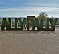 "Ally Pally" signage, Alexandra Palace - geograph.org.uk - 5935405.jpg 4248 × 3887; 4,72 MB
-
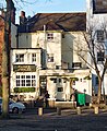 "Prince of Wales" public house, Highgate Village - geograph.org.uk - 5285920.jpg 1311 × 1600; 626 KB
-
 "The Palace Band", The Grove, Alexandra Park - geograph.org.uk - 5464441.jpg 1600 × 1073; 890 KB
-
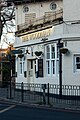 "The Woodman" public house, Highgate - geograph.org.uk - 5257750.jpg 1068 × 1600; 458 KB
-
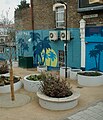 "Tropical Tottenham" mural, Seven Sisters - geograph.org.uk - 4782606.jpg 2008 × 2348; 5,26 MB
-
 'Ghost sign', South Tottenham - geograph.org.uk - 2452867.jpg 1471 × 1281; 874 KB
-
 'Madala' in Tottenham Lock - geograph.org.uk - 5852728.jpg 1024 × 768; 261 KB
-

-
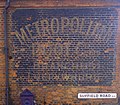
 1960's advert on Suffield Road N15 - geograph.org.uk - 5306779.jpg 640 × 480; 69 KB
-
 52 White Hart Lane, Tottenham - geograph.org.uk - 5683592.jpg 2216 × 1606; 1,06 MB
-
 800popiuy.jpg 700 × 350; 94 KB
-
 A Game in Finsbury Park - geograph.org.uk - 4446972.jpg 1600 × 1200; 556 KB
-
 A sign of the times - geograph.org.uk - 5939697.jpg 2448 × 3264; 2,12 MB
-
 A1 at Highgate - geograph.org.uk - 3302689.jpg 640 × 427; 84 KB
-
 A503, Forest Road - geograph.org.uk - 5601043.jpg 1600 × 1067; 282 KB
-
-
 Abandoned railway cutting - geograph.org.uk - 5857070.jpg 1024 × 768; 515 KB
-
 Abbots Terrace Crouch End - geograph.org.uk - 5708498.jpg 916 × 1632; 465 KB
-
 Abbotts Terrace, N8 - geograph.org.uk - 5856115.jpg 1024 × 768; 413 KB
-
 Abbotts Terrace, N8 - geograph.org.uk - 5856118.jpg 1024 × 768; 376 KB
-
 Access road to new railway depot, Hornsey - geograph.org.uk - 5561947.jpg 1024 × 768; 114 KB
-
-
 Albert Road Recreation Ground - geograph.org.uk - 2775348.jpg 1024 × 683; 251 KB
-
 Albert Road Recreation Ground - geograph.org.uk - 3399418.jpg 640 × 480; 158 KB
-
 Albert Road, Alexandra Park - geograph.org.uk - 5757217.jpg 2214 × 1600; 1,44 MB
-
 Alexandra Palace , TV mast - geograph.org.uk - 5989975.jpg 1067 × 1600; 415 KB
-
 Alexandra Palace and TV mast - geograph.org.uk - 5568196.jpg 1600 × 1085; 431 KB
-
 Alexandra Palace Boating Lake - geograph.org.uk - 6301273.jpg 2784 × 1568; 2,13 MB
-
 Alexandra Palace Farmers' Market - geograph.org.uk - 5935236.jpg 5067 × 3801; 5,22 MB
-
 Alexandra Palace from Shepherds Hill Field - geograph.org.uk - 3636503.jpg 1600 × 1200; 580 KB
-

-
 Alexandra Park , former United Reformed Church - geograph.org.uk - 5989810.jpg 1600 × 1187; 576 KB
-
 Alexandra Park , View over Hornsey - geograph.org.uk - 5867575.jpg 1600 × 1067; 492 KB
-
 Alexandra Park - geograph.org.uk - 5744168.jpg 2304 × 1728; 794 KB
-
 Alexandra Park Road, Muswell Hill - geograph.org.uk - 6222865.jpg 800 × 600; 82 KB
-
 Alfoxton Avenue, Harringay - geograph.org.uk - 5779999.jpg 1972 × 1428; 1,31 MB
-
 All Hallows Church, Tottenham - geograph.org.uk - 5566357.jpg 1067 × 1600; 653 KB
-
 Allotments between Crouch End and Queen's Wood - geograph.org.uk - 2458977.jpg 3008 × 2000; 3,81 MB
-
 Allotments by Parkland Walk, Crouch End - geograph.org.uk - 4158411.jpg 1728 × 2304; 2,31 MB
-
 Ally Pally from Oakfield Road N4 - geograph.org.uk - 5629665.jpg 916 × 1632; 281 KB
-
 Ally Pally on the Horizon - geograph.org.uk - 4816196.jpg 4000 × 3000; 2,83 MB
-
 Alroy Road HDC building - geograph.org.uk - 5929692.jpg 575 × 1024; 126 KB
-
 Animals mural, Nightingale Gardens, Bounds Green (50589312603).jpg 1600 × 1059; 753 KB
-
 Antill Road, N15 (2) - geograph.org.uk - 5459295.jpg 640 × 480; 90 KB
-
 Antill Road, N15 - geograph.org.uk - 5457877.jpg 640 × 480; 97 KB
-
 Antill Road, N15 - geograph.org.uk - 5459289.jpg 640 × 480; 118 KB
-
 Apartment blocks, Hillcrest Estate - geograph.org.uk - 5460208.jpg 1410 × 1600; 812 KB
-
 Apex House Replacement - geograph.org.uk - 5929697.jpg 575 × 1024; 118 KB
-
 Aquarius Archery Club, East Finchley - geograph.org.uk - 3969089.jpg 2304 × 1728; 870 KB
-
 Arc Gallery - geograph.org.uk - 3282546.jpg 640 × 430; 55 KB
-
 Archway Road - geograph.org.uk - 5860752.jpg 3024 × 4032; 2,94 MB
-
 Archway Road - geograph.org.uk - 5860755.jpg 3024 × 4032; 3,06 MB
-
 Argyle Passage, N17 - geograph.org.uk - 3222126.jpg 640 × 480; 127 KB
-
 Art supplies, Muswell Hill - geograph.org.uk - 6222821.jpg 600 × 800; 100 KB
-
 Autumnal colours, Avenue Gardens - geograph.org.uk - 3816530.jpg 640 × 430; 100 KB
-
 Autumnal scene, Priory Park, Hornsey - geograph.org.uk - 5568092.jpg 1100 × 1600; 1020 KB
-
 Avenue Gardens - geograph.org.uk - 3816520.jpg 640 × 430; 129 KB
-
 Avenue Gardens - geograph.org.uk - 3816525.jpg 640 × 430; 76 KB
-
 Avenue Road bridge over abandoned railway - geograph.org.uk - 5341779.jpg 916 × 1632; 600 KB
-

-
 Bank Chambers, N8 - geograph.org.uk - 5854968.jpg 1024 × 768; 346 KB
-
 Banner, Hornsey Food Bank (50772781906).jpg 4668 × 1600; 1,43 MB
-
 Barclays Bank, Crouch End, London N8 - geograph.org.uk - 4464395.jpg 656 × 875; 499 KB
-
 Barclays Bank, Crouch End, London N8 - geograph.org.uk - 4464397.jpg 1167 × 875; 839 KB
-
 Bedford Van on Wood Vale, Muswell Hill - geograph.org.uk - 6183006.jpg 1920 × 1280; 1,35 MB
-

-

-
 Berkeley Road, Crouch End - geograph.org.uk - 6097408.jpg 1024 × 768; 178 KB
-
 Beside the New River at Hornsey - geograph.org.uk - 5661882.jpg 640 × 360; 75 KB
-
 Birchington Road, Crouch End - geograph.org.uk - 6097404.jpg 1024 × 768; 203 KB
-
 Birstall Road London N15 - geograph.org.uk - 5868430.jpg 431 × 768; 58 KB
-
 Blackbird in Crouch End - geograph.org.uk - 2454369.jpg 3008 × 2000; 2,42 MB
-
 Blocks in Wood Green from Alexandra Park - geograph.org.uk - 4423670.jpg 2560 × 1920; 1,73 MB
-
 Blocks of flats on Fortis Green, London N2 - geograph.org.uk - 5278195.jpg 1600 × 1064; 302 KB
-
 Bluebells, Queen's Wood.jpg 6000 × 4000; 8,14 MB
-
 Boarding a bus, Turnpike Lane - geograph.org.uk - 4524509.jpg 429 × 600; 117 KB
-
 Bovine embellishments, Harringay - geograph.org.uk - 2819217.jpg 2947 × 1423; 2,64 MB
-
-
 Bowes Park Community Gardens - geograph.org.uk - 3812270.jpg 640 × 430; 108 KB
-
 Bowes Park Community Gardens - geograph.org.uk - 3812298.jpg 640 × 430; 115 KB
-
 Bowl, Barratt Memorial Fountain, Wood Green (50770464086).jpg 4811 × 2520; 1,87 MB
-
 Bowling Green - geograph.org.uk - 2903534.jpg 480 × 640; 139 KB
-
 Braemar Avenue Baptist Church - geograph.org.uk - 3813407.jpg 640 × 388; 86 KB
-
 Bridge at Tottenham Hale - geograph.org.uk - 1807514.jpg 640 × 420; 63 KB
-
 Bridge Gate, Highgate Wood - geograph.org.uk - 5194074.jpg 640 × 426; 111 KB
-

-

-
 Bridge over the ECML - geograph.org.uk - 4169204.jpg 640 × 430; 98 KB
-
-

-
-

-
-

-
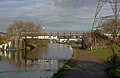
 Bridge over the River Lea - geograph.org.uk - 3272923.jpg 640 × 430; 102 KB
-
 Bridge over the River Lea, London N18 - geograph.org.uk - 4421261.jpg 1167 × 875; 1,53 MB
-

-
 Bright Colours on a dull road - geograph.org.uk - 3607791.jpg 2210 × 1473; 1,74 MB
-
 British Legion hall, Elder Avenue, N8 - geograph.org.uk - 5855965.jpg 1024 × 768; 215 KB
-
 Broad Lane - Talbot Road, N15 - geograph.org.uk - 5457830.jpg 640 × 480; 92 KB
-
 Broad Lane at the junction of Ferry Lane - geograph.org.uk - 5577684.jpg 2304 × 1728; 1,01 MB
-
 Broad Lane, N15 (2) - geograph.org.uk - 5457264.jpg 640 × 480; 92 KB
-
 Broad Lane, N15 (2) - geograph.org.uk - 5457869.jpg 640 × 480; 86 KB
-
 Broad Lane, N15 (3) - geograph.org.uk - 5457834.jpg 640 × 480; 95 KB
-
 Broad Lane, N15 (4) - geograph.org.uk - 5457839.jpg 640 × 480; 95 KB
-
 Broad Lane, N15 (5) - geograph.org.uk - 5457849.jpg 640 × 480; 79 KB
-
 Broad Lane, N15 - geograph.org.uk - 5457262.jpg 640 × 480; 96 KB
-
 Broad Lane, N15 - geograph.org.uk - 5457861.jpg 640 × 480; 95 KB
-
 Broad Lane, N8 - geograph.org.uk - 5855874.jpg 1024 × 768; 271 KB
-

-

-
 Brownlow Road, N11 - geograph.org.uk - 5503221.jpg 1600 × 1064; 555 KB
-
 Bruce Castle Disused Toilets - geograph.org.uk - 6172603.jpg 916 × 1632; 507 KB
-
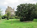
 Bruce Castle Park, Tottenham - geograph.org.uk - 5212295.jpg 1600 × 1094; 871 KB
-
 Brunswick Park N15 - geograph.org.uk - 6167296.jpg 575 × 1024; 91 KB
-
 Bryanstone Road, Crouch End - geograph.org.uk - 6097411.jpg 1024 × 768; 141 KB
-
 Building stone, Westbury Avenue Baptist Church - geograph.org.uk - 3449593.jpg 2439 × 1411; 1,04 MB
-
 Burghley Road "PlaySpace" - geograph.org.uk - 5934717.jpg 4705 × 3598; 4,05 MB
-
 Bus station, Tottenham Hale - geograph.org.uk - 6216442.jpg 800 × 533; 75 KB
-
 Bush, New River Path - geograph.org.uk - 3812306.jpg 640 × 430; 99 KB
-
-
 Businesses on Broad Lane, Tottenham Hale - geograph.org.uk - 5747731.jpg 5179 × 3885; 4,11 MB
-
 Businesses on Middle Lane, Hornsey - geograph.org.uk - 6222788.jpg 800 × 600; 107 KB
-
 Businesses on Palace Gates Road - geograph.org.uk - 6222869.jpg 800 × 600; 101 KB
-
 Cafe N15, Broad Lane, N15 - geograph.org.uk - 5457855.jpg 640 × 480; 87 KB
-
-
 Canal basin below Tottenham Locks - geograph.org.uk - 3285715.jpg 640 × 430; 43 KB
-
 Canal Boats near Tottenham Marshes on Lee Navigation - geograph.org.uk - 2607306.jpg 4000 × 3000; 4,12 MB
-
 Canal feeder, Lea Navigation - geograph.org.uk - 3285718.jpg 640 × 430; 95 KB
-
 Canary Wharf - geograph.org.uk - 5599626.jpg 758 × 1129; 1,01 MB
-
 Candler Street, N15 - geograph.org.uk - 5462775.jpg 640 × 480; 120 KB
-
-
 Capital Ring - geograph.org.uk - 5189064.jpg 640 × 426; 113 KB
-
 Capital Ring by New River - geograph.org.uk - 3829470.jpg 640 × 430; 72 KB
-
 Capital Ring enters Highgate Wood - geograph.org.uk - 3873968.jpg 1200 × 798; 509 KB
-
 Capital Ring in Queen's Wood, Highgate - geograph.org.uk - 6097322.jpg 1024 × 768; 338 KB
-
 Capital Ring in Queen's Wood, Highgate - geograph.org.uk - 6097360.jpg 1024 × 768; 337 KB
-
 Capital Ring Mileage Finger Post - geograph.org.uk - 3873442.jpg 1200 × 798; 504 KB
-
 Capital Ring Mileage Finger Post - geograph.org.uk - 3873975.jpg 1200 × 798; 394 KB
-
-
 Capital Ring walk near Highgate - geograph.org.uk - 6039336.jpg 1600 × 1200; 1013 KB
-
 Capital Ring, Highgate - geograph.org.uk - 6097365.jpg 1024 × 768; 333 KB
-
 Car park behind North Point - geograph.org.uk - 5855863.jpg 1024 × 768; 294 KB
-
 Carbuncle Passage - geograph.org.uk - 5285512.jpg 3362 × 2353; 1,39 MB
-
 Caxton Road, Wood Green - geograph.org.uk - 6016949.jpg 1024 × 768; 144 KB
-
 Cecile Park bus stop, looking north - geograph.org.uk - 5488951.jpg 640 × 480; 147 KB
-
 Ceramic fleur-de-lys, Tottenham - geograph.org.uk - 3518703.jpg 609 × 640; 590 KB
-
 Ceramic panel, "The Prince" public house - geograph.org.uk - 5990628.jpg 943 × 1600; 529 KB
-
 Ceramic public house sign, West Green (50720354288).jpg 4353 × 2017; 2,9 MB
-
-
 Chalk Bridge, River Lee Navigation - geograph.org.uk - 5634225.jpg 640 × 416; 82 KB
-
 Chapel in the Valley Stanhope Road London N4 - geograph.org.uk - 5469332.jpg 1600 × 898; 328 KB
-
 Chestnut's Cafe - geograph.org.uk - 5306805.jpg 1600 × 1200; 178 KB
-
 Chestnuts Park Autumn Mist - geograph.org.uk - 5704465.jpg 1600 × 1200; 119 KB
-
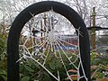 Chestnuts Park spider web - geograph.org.uk - 5306792.jpg 1600 × 1200; 413 KB
-
 Chicken Shop on The Broadway, Crouch End - geograph.org.uk - 6222743.jpg 665 × 800; 103 KB
-
 Children's playground, Priory Park - geograph.org.uk - 5806172.jpg 1600 × 1079; 657 KB
-
 Children's stone, Gospel Centre, Hornsey (50629779126).jpg 2393 × 1695; 3,32 MB
-
 Chimney by the New River - geograph.org.uk - 3829529.jpg 430 × 640; 51 KB
-
 Chimney by the New River - geograph.org.uk - 3829563.jpg 640 × 430; 39 KB
-
 Chimneys and gable in the Gothick style, Highgate - geograph.org.uk - 5257710.jpg 1801 × 2703; 1,34 MB
-

-
-
 Church direction sign, Crouch End (50763038272).jpg 2838 × 1540; 2,82 MB
-
 Church in a cinema, Wood Green - geograph.org.uk - 3453526.jpg 3115 × 1215; 1,17 MB
-
 Church of Holy Innocents, Tottenham Lane, N8 - geograph.org.uk - 5855958.jpg 1024 × 768; 414 KB
-
 Church Path, N8 - geograph.org.uk - 5855857.jpg 1024 × 768; 309 KB
-
 City of London and beyond - geograph.org.uk - 5138268.jpg 2757 × 1994; 484 KB
-
 Clearwater Canal Boat on Lee Navigation - geograph.org.uk - 2607309.jpg 4000 × 3000; 3,46 MB
-
 Clock tower - geograph.org.uk - 5488956.jpg 640 × 480; 152 KB
-
 Clock tower, Crouch End - geograph.org.uk - 6222746.jpg 600 × 800; 100 KB
-
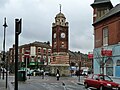 Clock Tower, Crouch End N8 - geograph.org.uk - 5856105.jpg 1024 × 768; 259 KB
-
 Coat of arms of the London Borough of Haringey.svg 495 × 663; 189 KB
-
 Cobblers Lodge at Seven Sisters station - geograph.org.uk - 5587641.jpg 916 × 1632; 485 KB
-
 Coldfall Wood - geograph.org.uk - 5107609.jpg 4608 × 3456; 3,47 MB
-
 Colney Hatch Lane (B550), Muswell Hill - geograph.org.uk - 6222839.jpg 800 × 600; 129 KB
-
 Coming Onto The Depot - geograph.org.uk - 2775575.jpg 1024 × 730; 346 KB
-
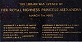 Commemorative panel, Crouch End Library (50763057762).jpg 4786 × 2463; 1,51 MB
-
 Commercial yard on Garman Road, Tottenham - geograph.org.uk - 4374504.jpg 1632 × 918; 271 KB
-

-

-
 Community Garden, Myddleton Road, London N22 - geograph.org.uk - 4471805.jpg 1100 × 825; 1,13 MB
-
 Community Garden, Myddleton Road, London N22 - geograph.org.uk - 4471806.jpg 1100 × 825; 1,4 MB
-
 Community Garden, Myddleton Road, London N22 - geograph.org.uk - 4471834.jpg 1100 × 825; 1,02 MB
-
 Connaught Gardens, Muswell Hill - geograph.org.uk - 6190422.jpg 1920 × 1280; 1,5 MB
-
 Connaught Gardens, Muswell Hill - geograph.org.uk - 6190423.jpg 1920 × 1280; 1,88 MB
-
 Coolhurst Road, Crouch End - geograph.org.uk - 6097395.jpg 1024 × 768; 182 KB
-

-

-
 Corner of Shanklin Road in Crouch End - geograph.org.uk - 5488960.jpg 640 × 480; 157 KB
-
 Cornwall Road bridge over abandoned railway - geograph.org.uk - 5341737.jpg 916 × 1632; 682 KB
-
 Cornwall Road Electricity Sub Station - geograph.org.uk - 5679050.jpg 1632 × 916; 559 KB
-
 Cottages, Abbotts Terrace, N8 - geograph.org.uk - 5856107.jpg 1024 × 768; 325 KB
-

-
 Cranbrook Park, Wood Green, London N22 - geograph.org.uk - 6026345.jpg 1600 × 1064; 264 KB
-
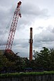
 Cranes over Hornsey - geograph.org.uk - 4773203.jpg 3648 × 2736; 6,27 MB
-
 Creating a fabric river - geograph.org.uk - 3665320.jpg 1314 × 1989; 2,07 MB
-
 Creighton Avenue, East Finchley - geograph.org.uk - 2407598.jpg 1600 × 1200; 645 KB
-
 Crescent Rise, London N22 - geograph.org.uk - 6222874.jpg 800 × 600; 90 KB
-
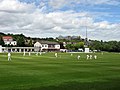 Cricket at Hornsey - geograph.org.uk - 3513852.jpg 2592 × 1944; 2,08 MB


_branch_line_-_geograph.org.uk_-_4744734.jpg)


.jpg)
_-_geograph.org.uk_-_5459295.jpg)


_-_sign,_724-726_High_Road,_Tottenham,_London_-_geograph.org.uk_-_4214245.jpg)
_-_sign,_724-726_High_Road,_Tottenham,_London_-_geograph.org.uk_-_4214253.jpg)


.jpg)


_branch_line_-_geograph.org.uk_-_4744724.jpg)


_-_geograph.org.uk_-_4580945.jpg)


_-_geograph.org.uk_-_5457264.jpg)
_-_geograph.org.uk_-_5457869.jpg)
_-_geograph.org.uk_-_5457834.jpg)
_-_geograph.org.uk_-_5457839.jpg)
_-_geograph.org.uk_-_5457849.jpg)


.jpg)


.jpg)


.jpg)


,_Muswell_Hill_-_geograph.org.uk_-_6222839.jpg)

.jpg)


.jpg)