Category:London Borough of Islington
Vai alla navigazione
Vai alla ricerca
Boroughs of London: City of London · City of Westminster · Barking and Dagenham · Barnet · Bexley · Brent · Bromley · Camden · Croydon · Ealing · Enfield · Greenwich · Hackney · Hammersmith and Fulham · Haringey · Harrow · Havering · Hillingdon · Hounslow · Islington · Kensington and Chelsea · Kingston · Lambeth · Lewisham · Merton · Newham · Redbridge · Richmond · Southwark · Sutton · Tower Hamlets · Waltham Forest · Wandsworth
uno dei 32 borghi di Londra, Inghilterra    | |||||
| Carica un file multimediale | |||||
| Istanza di | |||||
|---|---|---|---|---|---|
| Luogo | Grande Londra, Londra, Inghilterra | ||||
| Capitale | |||||
| Organo legislativo |
| ||||
| Organo esecutivo |
| ||||
| Capo del governo |
| ||||
| Data di fondazione o creazione |
| ||||
| Popolazione |
| ||||
| Superficie |
| ||||
| Ha sostituito | |||||
| Distinto da | |||||
| sito web ufficiale | |||||
 | |||||
Sottocategorie
Questa categoria contiene le 23 sottocategorie indicate di seguito, su un totale di 23.
A
E
F
G
H
I
M
P
S
File nella categoria "London Borough of Islington"
Questa categoria contiene 200 file, indicati di seguito, su un totale di 2 510.
(pagina precedente) (pagina successiva)-
-
 "Blue plaque" on Great Sutton Street, EC1 - geograph.org.uk - 6397249.jpg 1 200 × 1 600; 156 KB
-
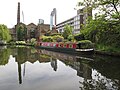
 "Buxton", narrowboat on Regent's Canal by Islington tunnel - geograph.org.uk - 5763952.jpg 3 648 × 2 736; 3,48 MB
-
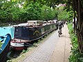 "Clarissa II", narrowboat by towpath near Islington tunnel - geograph.org.uk - 5763957.jpg 3 648 × 2 736; 3,54 MB
-
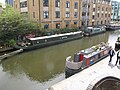 "Prosper", narrowboat on Regent's Canal, Islington - geograph.org.uk - 5762862.jpg 3 648 × 2 736; 3,05 MB
-
 "Quest" narrowboat by Wharf Road bridge - geograph.org.uk - 5763826.jpg 3 648 × 2 736; 3,57 MB
-
 "Widgeon" narrowboat by City Road Basin - geograph.org.uk - 5763841.jpg 3 648 × 2 736; 2,89 MB
-
 "Winnicott" public house and bar, Green Lanes - geograph.org.uk - 5386992.jpg 1 600 × 1 554; 734 KB
-
 'Ghost sign', Angel, Islington - geograph.org.uk - 3595667.jpg 1 515 × 1 904; 1,77 MB
-
 'Oliekop' on the Regent's Canal - geograph.org.uk - 1923388.jpg 1 280 × 960; 183 KB
-
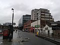
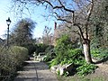
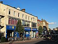 (Part of) Highbury Corner, N5 - geograph.org.uk - 3163893.jpg 640 × 480; 77 KB
-
-

-

-
-
 1 and 3 - 7 Liverpool Road - geograph.org.uk - 6217010.jpg 1 024 × 728; 678 KB
-
 1 Liverpool Road - geograph.org.uk - 6217012.jpg 678 × 1 024; 598 KB
-
 1-12 Wilmington Square - geograph.org.uk - 6120627.jpg 4 032 × 3 024; 3,53 MB
-
 1-4 Cruikshank Street - geograph.org.uk - 4515720.jpg 562 × 640; 230 KB
-
 1-5 Clerkenwell Road, Clerkenwell - geograph.org.uk - 5237023.jpg 2 030 × 1 494; 406 KB
-
 12-33 Chadwell Street - geograph.org.uk - 4517275.jpg 543 × 640; 202 KB
-
 15-24 River Street - geograph.org.uk - 4518433.jpg 640 × 492; 207 KB
-
 156 Caledonian Road - geograph.org.uk - 4904690.jpg 640 × 427; 92 KB
-
 16 - 38 Barnsbury Road - geograph.org.uk - 6216387.jpg 1 024 × 678; 745 KB
-
 17 Tabley Road, Islington - geograph.org.uk - 3371783.jpg 3 216 × 4 288; 4,2 MB
-
 18-28 Arlington Way - geograph.org.uk - 4518401.jpg 494 × 640; 206 KB
-
 1906 horns.jpg 522 × 373; 37 KB
-
 1A Alwyne Place - geograph.org.uk - 3026029.jpg 640 × 480; 115 KB
-
 2-5 Mylne Street - geograph.org.uk - 4517260.jpg 640 × 519; 198 KB
-
 2-5 Owen's Row - geograph.org.uk - 4518386.jpg 640 × 508; 215 KB
-
 22 Cowper Street - geograph.org.uk - 2683536.jpg 562 × 640; 209 KB
-
 30 Crown Place and Broadgate Tower - geograph.org.uk - 4338331.jpg 1 280 × 960; 304 KB
-
 35-45 Skinner Street, EC1 - geograph.org.uk - 6154997.jpg 1 024 × 768; 220 KB
-
 37a Clerkenwell Green - geograph.org.uk - 2508571.jpg 636 × 456; 167 KB
-
 38 Graham Street N1 - geograph.org.uk - 4748388.jpg 640 × 480; 112 KB
-
 4 new houses, Sotheby Road - geograph.org.uk - 3050746.jpg 640 × 480; 76 KB
-
 42-57 Turpin Way N19 - geograph.org.uk - 2211011.jpg 640 × 480; 75 KB
-
 43 - 46, Chiswell St (geograph 6531403).jpg 684 × 1 024; 174 KB
-
 51, Calthorpe Street, WC1 - geograph.org.uk - 4749584.jpg 640 × 428; 99 KB
-
 54 - 60 Liverpool Road - geograph.org.uk - 6216832.jpg 1 024 × 678; 708 KB
-
 8-10 Charterhouse Buildings, Clerkenwell - geograph.org.uk - 5236978.jpg 1 599 × 1 789; 632 KB
-
-
 99 St John Street, Clerkenwell - geograph.org.uk - 4766424.jpg 1 131 × 2 081; 2,06 MB
-
 A Bit of Colour on Central Street - geograph.org.uk - 4439991.jpg 4 000 × 3 000; 2,08 MB
-
 A Mail Rail train at the Postal Museum - geograph.org.uk - 6416017.jpg 4 000 × 3 000; 4,79 MB
-
 A new view across Pentonville Road - geograph.org.uk - 5849853.jpg 819 × 1 024; 867 KB
-
 A pair of spheres, City Road - geograph.org.uk - 5133479.jpg 2 304 × 1 728; 841 KB
-
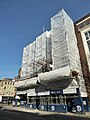
 A street full of scaffolding - geograph.org.uk - 4889558.jpg 5 560 × 3 706; 3,2 MB
-
 A Triangular Building - geograph.org.uk - 5383460.jpg 1 024 × 992; 303 KB
-
-

-
-
-
-

-

-

-

-
-
-
-
-
-
-
-
-
-

-
-
-

-
-
-
-
-

-

-

-
-

-

-
-
-
-

-
-
-

-
-

-

-

-
-

-
-

-
-

-

-
-
-

-

-

-
-
 A1 at Highgate - geograph.org.uk - 3302689.jpg 640 × 427; 84 KB
-
 A105 - geograph.org.uk - 5376697.jpg 640 × 426; 66 KB
-
 A105, Newington Green - geograph.org.uk - 5376753.jpg 640 × 426; 83 KB
-
-
 A5200 - geograph.org.uk - 3783777.jpg 640 × 480; 81 KB
-
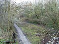 Abandoned railway cutting - geograph.org.uk - 5856877.jpg 1 024 × 768; 475 KB
-
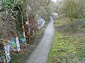 Abandoned railway cutting - geograph.org.uk - 5857070.jpg 1 024 × 768; 515 KB
-
 Aberdeen Park - geograph.org.uk - 4905006.jpg 640 × 427; 123 KB
-

-
 Adventure playground entrance on Grenville Road - geograph.org.uk - 4383528.jpg 2 304 × 1 728; 836 KB
-

-
 Agdon street junction with St John Street - geograph.org.uk - 6363980.jpg 2 910 × 2 235; 1,84 MB
-
 Akari Japanese Restaurant - geograph.org.uk - 5052430.jpg 1 600 × 1 279; 536 KB
-
 Al-Nehar Mosque ^ Education Centre, Caledonian Road - geograph.org.uk - 5982774.jpg 1 067 × 1 600; 392 KB
-
 Albemarle Mansions, Holloway Road - geograph.org.uk - 3960540.jpg 456 × 600; 108 KB
-
 Albert Wharf, Regent's Canal - geograph.org.uk - 5087442.jpg 4 000 × 3 000; 3,03 MB
-
 Albert Wharf, Regent's Canal - geograph.org.uk - 5087443.jpg 4 000 × 3 000; 2,86 MB
-
 Albion Lodge, Islington - geograph.org.uk - 3374096.jpg 4 288 × 3 216; 5,4 MB
-
 Alexandra Trust dining rooms, EC1 - geograph.org.uk - 2051793.jpg 3 504 × 2 336; 1,96 MB
-
 Alive and dead pubs - geograph.org.uk - 4747267.jpg 640 × 480; 102 KB
-
 All London Glass^ - geograph.org.uk - 3234898.jpg 768 × 1 024; 157 KB
-
 Almeida Theatre - geograph.org.uk - 3255244.jpg 3 648 × 2 736; 2,04 MB
-
 Along Regent's Canal - geograph.org.uk - 4904688.jpg 640 × 427; 116 KB
-
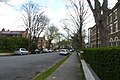
 Alwyne Road, N1 - geograph.org.uk - 4514066.jpg 640 × 480; 102 KB
-
 Alwyne Road, N1 - geograph.org.uk - 4514961.jpg 640 × 480; 137 KB
-
 Amwell Street - River Street, EC1 - geograph.org.uk - 4299253.jpg 480 × 640; 83 KB
-
 An entrance to Elthorne Park - geograph.org.uk - 4328566.jpg 4 000 × 3 000; 4,03 MB
-
 Angel (Islington) major intersection, 1990 - geograph.org.uk - 4649844.jpg 2 277 × 1 470; 3,43 MB
-
 Angel Baptist Church, Chadwell Street - geograph.org.uk - 3985563.jpg 972 × 1 200; 265 KB
-
 Angel bus station - geograph.org.uk - 4259383.jpg 1 920 × 1 080; 1,65 MB
-
 Angel Gate - geograph.org.uk - 2921070.jpg 640 × 430; 87 KB
-
 Angel Square, Islington - geograph.org.uk - 5382154.jpg 1 320 × 1 600; 451 KB
-
 Angel Square, Islington, London N1 - geograph.org.uk - 3762119.jpg 3 796 × 3 019; 2,25 MB
-
-
 ANGEL, Angel - geograph.org.uk - 5470567.jpg 640 × 480; 64 KB
-
 Angel, Pentonville Road N1 - geograph.org.uk - 2759122.jpg 640 × 480; 64 KB
-
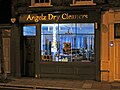 Angelz Dry Cleaners, Arlington Way, EC1 - geograph.org.uk - 6111299.jpg 1 024 × 768; 129 KB
-
 Annette Crescent, Islington - geograph.org.uk - 3322311.jpg 4 144 × 3 216; 4,74 MB
-
 Another brick in the wall - geograph.org.uk - 6109200.jpg 1 024 × 768; 294 KB
-
 Ansell's Cottage, Islington - geograph.org.uk - 5381824.jpg 1 222 × 1 600; 837 KB
-
 Apart Hotel, Goswell Rd - geograph.org.uk - 2923643.jpg 640 × 430; 63 KB
-
 Apartment blocks, Queensland Road, Holloway - geograph.org.uk - 5164511.jpg 1 600 × 1 385; 560 KB
-
 Apostleship of the Sea - geograph.org.uk - 2988711.jpg 2 736 × 3 648; 3,38 MB
-
 Approaching Petherton Roundabout - geograph.org.uk - 4905010.jpg 640 × 427; 120 KB
-
 Approaching the Archway Gyratory System - geograph.org.uk - 4879750.jpg 6 000 × 4 000; 7,49 MB
-

-
 Arch entrance to Waterside, Wharf Road, Hackney - geograph.org.uk - 5762852.jpg 3 586 × 2 689; 1,78 MB
-
 Arches and Windows, Clerkenwell - geograph.org.uk - 5056034.jpg 3 436 × 3 000; 2,6 MB
-
 Architectural diversity, Holloway Road (A1) - geograph.org.uk - 4257070.jpg 1 340 × 1 600; 449 KB
-
 Archway campus - geograph.org.uk - 1834361.jpg 640 × 480; 231 KB
-
 Archway Close - geograph.org.uk - 3312701.jpg 1 024 × 768; 197 KB
-
 Archway Leisure Centre - geograph.org.uk - 3929590.jpg 1 024 × 647; 636 KB
-
 Archway Methodist Church - geograph.org.uk - 2778766.jpg 640 × 482; 64 KB
-
 Archway Methodist Church - geograph.org.uk - 4776906.jpg 2 008 × 2 583; 1,17 MB
-
 Archway Methodist Church - geograph.org.uk - 4879734.jpg 6 000 × 4 000; 7,51 MB
-
 Archway Methodist Church - geograph.org.uk - 5659323.jpg 1 600 × 1 122; 542 KB
-
 Archway Methodist Church - geograph.org.uk - 6065245.jpg 4 579 × 3 622; 1,61 MB
-
 Archway Tavern - geograph.org.uk - 6318768.jpg 1 024 × 768; 201 KB
-
 Archway Tavern, Tollhouse Way N19 - geograph.org.uk - 2211858.jpg 480 × 640; 63 KB
-
 Archway Tower 1994 - geograph.org.uk - 4033181.jpg 1 120 × 1 776; 329 KB
-
 Archway, North London - geograph.org.uk - 3898590.jpg 768 × 1 024; 596 KB
-
 Arms of the New River Company - geograph.org.uk - 3369651.jpg 640 × 480; 125 KB
-
 Arsenal - geograph.org.uk - 2253226.jpg 1 292 × 1 600; 509 KB
-
 Arsenal Food ^ Wine, Blackstock Road N4 - geograph.org.uk - 3775569.jpg 636 × 476; 184 KB
-
 Arsenal lettering, Drayton Park - geograph.org.uk - 4768378.jpg 2 716 × 1 582; 4,42 MB
-
 Arsenal Superstore - geograph.org.uk - 3873985.jpg 640 × 458; 61 KB
-
 Art galleries in Wharf Road, Hackney side - geograph.org.uk - 5762703.jpg 2 736 × 3 648; 4,2 MB
-
 Arthouse, King's Cross - geograph.org.uk - 3370649.jpg 4 288 × 3 216; 4,72 MB
-
 Artillery Fields EC1 - geograph.org.uk - 2199383.jpg 640 × 157; 45 KB
-
 Artillery Place West - geograph.org.uk - 6036235.jpg 4 288 × 3 216; 3,54 MB
-

-
 Ashurst Lodge, Islington - geograph.org.uk - 3374349.jpg 4 288 × 3 216; 4,37 MB
-
 Asteys Row Rock Garden (2) - geograph.org.uk - 4513815.jpg 640 × 480; 128 KB
-
 Asteys Row Rock Garden - geograph.org.uk - 4513685.jpg 640 × 480; 105 KB
-
 Asteys Row Rock Garden - geograph.org.uk - 4513689.jpg 640 × 480; 151 KB
-
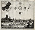 Astronomy; a view of London in 1748, with diagrams of an ecl Wellcome V0024734.jpg 2 972 × 2 512; 3,43 MB
-
 At the corner of Caledonian Road and Pentonville Road - geograph.org.uk - 6203127.jpg 1 024 × 1 024; 1,12 MB
-
 Attneave St - geograph.org.uk - 5403028.jpg 640 × 426; 53 KB
-
 Au revoir, M Wenger ... et merci^ - geograph.org.uk - 5765335.jpg 1 067 × 1 600; 595 KB
-
 Autumn colour on Highbury Fields - geograph.org.uk - 5971192.jpg 1 024 × 768; 408 KB
-
 Autumn in Bunhill Fields - The North West Corner - geograph.org.uk - 5571602.jpg 3 600 × 2 365; 1,88 MB
-
 Autumn sunlight on Highbury Fields - geograph.org.uk - 5971185.jpg 1 024 × 768; 409 KB
-
 Autumn sunshine on Highbury Fields - geograph.org.uk - 5971189.jpg 1 024 × 768; 396 KB
-
 B502 - geograph.org.uk - 5403039.jpg 640 × 426; 73 KB
-

-
 Balls Pond Road at the junction of Kingsland Road - geograph.org.uk - 5146521.jpg 2 048 × 1 536; 955 KB
-
 Balls Pond Road, Canonbury - geograph.org.uk - 6301932.jpg 1 280 × 1 696; 868 KB
-
 Baltic St West - geograph.org.uk - 2923634.jpg 640 × 430; 59 KB
-
 Bank Buildings, Goswell Road-St John Street, Islington - geograph.org.uk - 5382188.jpg 1 600 × 1 475; 538 KB
-
 Bank of Friendship, Highbury - geograph.org.uk - 4566965.jpg 2 272 × 1 704; 865 KB
-
 Barber shop, Highbury Barn - geograph.org.uk - 5398839.jpg 1 478 × 1 600; 491 KB
-
 Barbican YMCA - geograph.org.uk - 2927865.jpg 430 × 640; 59 KB
-
 Barbican, Silk Street (6) - geograph.org.uk - 2585671.jpg 426 × 640; 165 KB
-
 Barcham House, Riversdale Road, N5 - geograph.org.uk - 4577609.jpg 640 × 480; 104 KB
-
 Barclays Bank, Highbury Corner, London - geograph.org.uk - 3435865.jpg 1 024 × 683; 646 KB


_Highbury_Corner,_N5_-_geograph.org.uk_-_3163893.jpg)
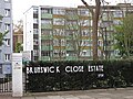
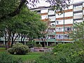
_The_Brunswick_Close_Estate,_Percival_Street,_EC1_-_geograph.org.uk_-_6154092.jpg)
_The_Brunswick_Close_Estate,_Percival_Street,_EC1_-_geograph.org.uk_-_6154094.jpg)
_The_Brunswick_Close_Estate,_Percival_Street,_EC1_-_geograph.org.uk_-_6154096.jpg)
_The_Brunswick_Close_Estate,_Percival_Street,_EC1_-_geograph.org.uk_-_6154949.jpg)


.jpg)


_-_geograph.org.uk_-_6067732.jpg)
_-_geograph.org.uk_-_6068085.jpg)
_-_geograph.org.uk_-_6068087.jpg)
_-_geograph.org.uk_-_6068088.jpg)
_-_geograph.org.uk_-_6068089.jpg)
_-_geograph.org.uk_-_6068091.jpg)
_-_geograph.org.uk_-_6069148.jpg)
_-_geograph.org.uk_-_6069149.jpg)
_-_geograph.org.uk_-_6069151.jpg)
_-_geograph.org.uk_-_6069153.jpg)
_-_geograph.org.uk_-_6069157.jpg)
_-_geograph.org.uk_-_6067734.jpg)
_-_geograph.org.uk_-_6069160.jpg)
_-_geograph.org.uk_-_6069165.jpg)
_-_geograph.org.uk_-_6069169.jpg)
_-_geograph.org.uk_-_6069170.jpg)
_-_geograph.org.uk_-_6069174.jpg)
_-_geograph.org.uk_-_6069179.jpg)
_-_geograph.org.uk_-_6069184.jpg)
_-_geograph.org.uk_-_6069185.jpg)
_-_geograph.org.uk_-_6069186.jpg)
_-_geograph.org.uk_-_6069190.jpg)
_-_geograph.org.uk_-_6067737.jpg)
_-_geograph.org.uk_-_6069655.jpg)
_-_geograph.org.uk_-_6069660.jpg)
_-_geograph.org.uk_-_6069663.jpg)
_-_geograph.org.uk_-_6069666.jpg)
_-_geograph.org.uk_-_6069670.jpg)
_-_geograph.org.uk_-_6069676.jpg)
_-_geograph.org.uk_-_6070771.jpg)
_-_geograph.org.uk_-_6070786.jpg)
_-_geograph.org.uk_-_6070792.jpg)
_-_geograph.org.uk_-_6070795.jpg)
_-_geograph.org.uk_-_6067738.jpg)
_-_geograph.org.uk_-_6073723.jpg)
_-_geograph.org.uk_-_6073734.jpg)
_-_geograph.org.uk_-_6073765.jpg)
_-_geograph.org.uk_-_6073769.jpg)
_-_geograph.org.uk_-_6076015.jpg)
_-_geograph.org.uk_-_6076016.jpg)
_-_geograph.org.uk_-_6076020.jpg)
_-_geograph.org.uk_-_6076026.jpg)
_-_geograph.org.uk_-_6068076.jpg)
_-_geograph.org.uk_-_6076027.jpg)
_-_geograph.org.uk_-_6076070.jpg)
_-_geograph.org.uk_-_6076081.jpg)
_-_geograph.org.uk_-_6068078.jpg)
_-_geograph.org.uk_-_6076083.jpg)
_-_geograph.org.uk_-_6076085.jpg)
_-_geograph.org.uk_-_6076100.jpg)
_-_geograph.org.uk_-_6076111.jpg)
_-_geograph.org.uk_-_6076113.jpg)
_-_geograph.org.uk_-_6068079.jpg)
_-_geograph.org.uk_-_6076126.jpg)
_-_geograph.org.uk_-_6068080.jpg)
_-_geograph.org.uk_-_6068084.jpg)


_major_intersection,_1990_-_geograph.org.uk_-_4649844.jpg)


_-_geograph.org.uk_-_4257070.jpg)


_-_geograph.org.uk_-_4513815.jpg)


_-_geograph.org.uk_-_2585671.jpg)

