Category:Kirkcudbrightshire
Here nagîvasyonê
Here lêgerînê
Traditional counties (shires) of Scotland: Aberdeenshire · Angus · Argyll ≈ Argyllshire · Ayrshire · Banffshire · Berwickshire · Buteshire · Caithness · Clackmannanshire · Cromartyshire · Dumbartonshire · Dumfriesshire · East Lothian · Fife · Inverness-shire · Kincardineshire · Kinross-shire · Kirkcudbrightshire · Lanarkshire · Midlothian · Moray · Nairnshire · the Orkney Islands ≈ Orkney Islands · Peeblesshire · Perthshire · Renfrewshire · Ross-shire · Roxburghshire · Selkirkshire · the Shetland Islands ≈ Shetland Islands · Stirlingshire · Sutherland · West Lothian · Wigtownshire
historic county in south-west Scotland   | |||||
| Medya bar bike | |||||
| Mînakek ji bo |
| ||||
|---|---|---|---|---|---|
| Beşek ji | |||||
| Cih | Skotland | ||||
| Gelhe |
| ||||
 | |||||
Binkategorî
Di vê kategoriyê de 20 binkategorî hene. Jêr 20 binkategorî tên nîşandan.
Medya di kategoriya "Kirkcudbrightshire" de
Di vê kategoriyê de 93 dane hene. Jêr 93 dane tên nîşandan.
-
 "Albatross" Kirkcudbright Harbour - geograph.org.uk - 6543026.jpg 2976 x 1984; 2,68 MB
-
 "Albatross" Kirkcudbright Harbour - geograph.org.uk - 6543031.jpg 2976 x 1984; 2,72 MB
-
 "Mytilus" Kirkcudbright Harbour - geograph.org.uk - 6543024.jpg 2976 x 1984; 2,43 MB
-
 Aground beside the River Dee - geograph.org.uk - 5582179.jpg 1600 x 1200; 496 KB
-
 Aground beside the River Dee - geograph.org.uk - 5582183.jpg 1600 x 1067; 485 KB
-
 Balmaghie Graveyard, Kirkcudbrightshire.jpg 684 x 327; 36 KB
-
 Boat by the Dee - geograph.org.uk - 5560454.jpg 4272 x 2848; 3,62 MB
-
 Bridge over the Dee, Kirkcudbright - geograph.org.uk - 6543212.jpg 2976 x 1984; 2,73 MB
-
 Bridge over the Dee, Kirkcudbright - geograph.org.uk - 6543214.jpg 2976 x 1984; 2,73 MB
-
 Castellated Wall - geograph.org.uk - 5559896.jpg 4272 x 2848; 2,8 MB
-
 Castle Douglas, Burgh Coat of Arms, Kirkcudbrightshire, Scotland.jpg 864 x 1249; 193 KB
-

-

-
 Church of the Resurrection, Gatehouse of Fleet, Kirkcudbrightshire.jpg 1536 x 864; 108 KB
-
 Clachan Eòin.jpg 2098 x 1638; 938 KB
-
 Cros Mhìcheil.jpg 2546 x 1736; 1,12 MB
-
 Explanation of sheet 9. Kirkcudbright (north-east part) and Dumfriesshire (south-west part) (IA cu31924004137182).pdf 806 × 1414, 68 rûpel; 2,08 MB
-
 Dee Bridge - geograph.org.uk - 5560363.jpg 4272 x 2848; 1,63 MB
-
 Dee Walk - geograph.org.uk - 5560376.jpg 4272 x 2848; 2,26 MB
-
 Deeside Wreck - geograph.org.uk - 5560461.jpg 4272 x 2848; 3,69 MB
-
 Flag of Kirkcudbrightshire.svg 900 x 540; 1 KB
-

-
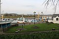
 Harbour at Kirkcudbright. - geograph.org.uk - 6296085.jpg 1024 x 683; 112 KB
-

-
 Kenmure Castle, New Galloway, Kirkcudbrightshire Scotland.jpg 176 x 107; 10 KB
-
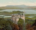 Kenmure Castle, New Galloway, Kirkcudbrightshire, Scotland.jpg 467 x 386; 77 KB
-
 Kingfisher, Kirkcudbright - geograph.org.uk - 5706254.jpg 2976 x 1984; 2,66 MB
-
 Kirkcudbright - geograph.org.uk - 6159851.jpg 1024 x 768; 202 KB
-
 Kirkcudbright - geograph.org.uk - 6278089.jpg 1024 x 768; 268 KB
-
 Kirkcudbright Bridge - geograph.org.uk - 5582910.jpg 1600 x 1200; 385 KB
-
 Kirkcudbright Bridge - geograph.org.uk - 5706317.jpg 2976 x 1984; 2,93 MB
-
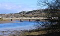 Kirkcudbright Bridge - geograph.org.uk - 5706619.jpg 2823 x 1717; 949 KB
-
 Kirkcudbright Bridge - geograph.org.uk - 5707516.jpg 2976 x 1984; 2,42 MB
-
 Kirkcudbright Bridge - geograph.org.uk - 5707518.jpg 2976 x 1984; 2,45 MB
-
 Kirkcudbright Bridge - geograph.org.uk - 5745755.jpg 2901 x 1893; 483 KB
-
 Kirkcudbright Bridge - geograph.org.uk - 5923669.jpg 640 x 389; 64 KB
-
 Kirkcudbright Bridge - geograph.org.uk - 6289412.jpg 1024 x 688; 481 KB
-
 Kirkcudbright Bridge, Kirkcudbright - geograph.org.uk - 5713445.jpg 640 x 480; 67 KB
-
 Kirkcudbright Harbour - geograph.org.uk - 5706253.jpg 2976 x 1984; 2,53 MB
-
 Kirkcudbright Harbour - geograph.org.uk - 5745714.jpg 2976 x 1984; 2,93 MB
-
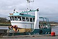 Kirkcudbright Harbour - geograph.org.uk - 5745739.jpg 2976 x 1984; 2,12 MB
-
 Kirkcudbright Harbour - geograph.org.uk - 6059377.jpg 2976 x 1984; 2,51 MB
-
 Kirkcudbright Harbour - geograph.org.uk - 6059381.jpg 2976 x 1984; 2,38 MB
-
 Kirkcudbright Harbour - geograph.org.uk - 6286500.jpg 2796 x 1893; 1,04 MB
-
 Kirkcudbright Harbour - geograph.org.uk - 6543164.jpg 2976 x 1984; 3,09 MB
-
 Kirkcudbright Harbour - geograph.org.uk - 6543216.jpg 2976 x 1984; 2,89 MB
-
 Kirkcudbrightshire Map.png 4967 x 4967; 6,62 MB
-
 Looking Upriver - geograph.org.uk - 5574474.jpg 4608 x 3456; 4,2 MB
-
 Mapa dg an abaid ùr.jpg 2004 x 1363; 599 KB
-
 Mapa dg Baile MhicIllFhaolain.jpg 2004 x 1363; 599 KB
-
 Mapa dg baile ùr a' ghall-ghaidhealaibh.jpg 2004 x 1363; 599 KB
-
 Mapa dg beeswing.jpg 2004 x 1363; 599 KB
-
 Mapa dg borgh.jpg 2004 x 1363; 599 KB
-
 Mapa dg clachan eòin.jpg 2004 x 1363; 599 KB
-
 Mapa dg dail bheithe.jpg 2004 x 1363; 599 KB
-
 Mapa dg dùn droighnein.jpg 2004 x 1363; 599 KB
-
 Mapa dg palnackie.jpg 2004 x 1363; 599 KB
-
 Mapa dg tìr na h-eaglaise.jpg 2004 x 1363; 599 KB
-
 Mapa Poll an Iùbhair ann an DG.jpg 2004 x 1363; 598 KB
-
 Mud, glorious mud - geograph.org.uk - 6289414.jpg 1024 x 683; 596 KB
-
 Munches House, Dalbeattie, Kirkcudbrightshire in 1797.jpg 600 x 376; 29 KB
-
 Mytilus, Kirkcudbright Harbour - geograph.org.uk - 5745744.jpg 2976 x 1984; 1,83 MB
-
 Nautalis by the Quay - geograph.org.uk - 5560334.jpg 4272 x 2848; 2,04 MB
-
 Old and New Ramhill Bridges, Castle Douglas, Kirkcudbrightshire, Scotland.jpg 1200 x 1600; 488 KB
-
 Old Ramhill Bridge near Castle Douglas, Kirkcudbrightshire, Scotland.jpg 1600 x 1200; 1,12 MB
-
 Outbuildings - geograph.org.uk - 722684.jpg 640 x 480; 61 KB
-
 Parton.jpg 2321 x 1736; 466 KB
-
 Path on Venniehill - geograph-4887685.jpg 1920 x 1280; 2 MB
-

-
 Plaque south end of bridge - geograph.org.uk - 463139.jpg 640 x 480; 144 KB
-
 Poll an Achaidh 02.jpg 960 x 737; 94 KB
-
 Poll an Achaidh.jpg 960 x 540; 76 KB
-

-

-
 Rev. Professor H. M. B. Reid.jpg 942 x 1416; 253 KB
-
 River Dee - geograph.org.uk - 5706256.jpg 2976 x 1984; 2,37 MB
-
 River Dee - geograph.org.uk - 5706313.jpg 2976 x 1984; 3,18 MB
-
 River Dee - geograph.org.uk - 5707521.jpg 2976 x 1984; 2,95 MB
-
 River Dee - geograph.org.uk - 6059438.jpg 2976 x 1984; 2,03 MB
-
 Road Bridge over the River Dee at Kirkcudbright - geograph.org.uk - 6286496.jpg 2976 x 1984; 2,04 MB
-

-
 The Dee at Kirkcudbright - geograph.org.uk - 5745712.jpg 2976 x 1984; 2,49 MB
-
 The Doughs, Tongland, Kirkcudbright, Scotland LOC 3450332528.jpg 1024 x 775; 229 KB
-

-
 The Quarterly journal of the Geological Society of London (12512005023).jpg 3200 x 1869; 1,38 MB
-
 The River Dee - geograph.org.uk - 5745727.jpg 2976 x 1984; 2,39 MB
-
 The River Dee - geograph.org.uk - 5745748.jpg 2913 x 1900; 545 KB
-
 Trawler at the Quay - geograph.org.uk - 5744113.jpg 4219 x 2961; 5,69 MB
-
 Upstream to the Bridge - geograph.org.uk - 5559756.jpg 4272 x 2848; 1,91 MB
-
 Wellspring beside the River Dee - geograph.org.uk - 5580545.jpg 1600 x 1119; 490 KB
-
 Wellspring beside the River Dee - geograph.org.uk - 5583338.jpg 1600 x 1043; 465 KB
-
 Wellspring beside the River Dee - geograph.org.uk - 5583347.jpg 1600 x 1041; 536 KB
-
 Wellspring beside the River Dee - geograph.org.uk - 5583356.jpg 1600 x 1067; 267 KB


_Minister_of_Balmaghie_Parish,_Kirkcudbrightshire,_Scotland.jpg)


.jpg)


