Category:Peeblesshire
Jump to navigation
Jump to search
Traditional counties (shires) of Scotland: Aberdeenshire · Angus · Argyll ≈ Argyllshire · Ayrshire · Banffshire · Berwickshire · Buteshire · Caithness · Clackmannanshire · Cromartyshire · Dumbartonshire · Dumfriesshire · East Lothian · Fife · Inverness-shire · Kincardineshire · Kinross-shire · Kirkcudbrightshire · Lanarkshire · Midlothian · Moray · Nairnshire · the Orkney Islands ≈ Orkney Islands · Peeblesshire · Perthshire · Renfrewshire · Ross-shire · Roxburghshire · Selkirkshire · the Shetland Islands ≈ Shetland Islands · Stirlingshire · Sutherland · West Lothian · Wigtownshire
English: Peeblesshire — historic county and shire of Scotland, in the Scottish Borders, southeastern Scotland.
- The current governing subdivision within the same borders is the Tweeddale committee area.
historic county of Scotland  | |||||
| Upload media | |||||
| Instance of | |||||
|---|---|---|---|---|---|
| Location | Scottish Borders, Scotland | ||||
| Population |
| ||||
| Said to be the same as | Tweeddale | ||||
 | |||||
Subcategories
This category has the following 3 subcategories, out of 3 total.
Media in category "Peeblesshire"
The following 13 files are in this category, out of 13 total.
-
 How many miles to Edinburgh^ - geograph.org.uk - 1185488.jpg 640 × 480; 76 KB
-
 John Parker Plantation picnic site - geograph.org.uk - 1455864.jpg 640 × 480; 114 KB
-
 Milestone near Peebles - geograph.org.uk - 1558473.jpg 640 × 480; 165 KB
-
 Milestone near Shiphams - geograph.org.uk - 1557615.jpg 640 × 480; 204 KB
-
 Milestone near Waterheads - geograph.org.uk - 1557602.jpg 640 × 480; 161 KB
-
 Milestone, Eddleston - geograph.org.uk - 1557635.jpg 480 × 640; 156 KB
-
 Peeblesshire Map.png 4,967 × 4,967; 6.82 MB
-
 Picnic site by the Newhall Burn - geograph.org.uk - 937413.jpg 640 × 480; 112 KB
-
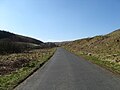 Road heading through of Peeblesshire - geograph.org.uk - 1231665.jpg 640 × 480; 63 KB
-
 The Newhall Burn - geograph.org.uk - 937419.jpg 640 × 480; 101 KB
-
 The Paddock Burn - geograph.org.uk - 1455857.jpg 640 × 480; 103 KB
-

-
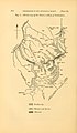 The Quarterly journal of the Geological Society of London (12895051495).jpg 1,211 × 2,081; 336 KB


.jpg)