Category:Nairnshire
Jump to navigation
Jump to search
Traditional counties (shires) of Scotland: Aberdeenshire · Angus · Argyll ≈ Argyllshire · Ayrshire · Banffshire · Berwickshire · Buteshire · Caithness · Clackmannanshire · Cromartyshire · Dumbartonshire · Dumfriesshire · East Lothian · Fife · Inverness-shire · Kincardineshire · Kinross-shire · Kirkcudbrightshire · Lanarkshire · Midlothian · Moray · Nairnshire · the Orkney Islands ≈ Orkney Islands · Peeblesshire · Perthshire · Renfrewshire · Ross-shire · Roxburghshire · Selkirkshire · the Shetland Islands ≈ Shetland Islands · Stirlingshire · Sutherland · West Lothian · Wigtownshire
historic county, lieutenancy area and registration county in Scotland   | |||||
| Upload media | |||||
| Instance of |
| ||||
|---|---|---|---|---|---|
| Part of | |||||
| Location | Highland, Scottish Highlands, Scotland | ||||
| Population |
| ||||
 | |||||
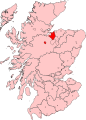
Nairnshire is a registration county and Lieutenancy area of Scotland. It was a county in its own right until its functions were transferred to the Highland council area.
Subcategories
This category has the following 3 subcategories, out of 3 total.
- Signs in Nairnshire (1 F)
C
Media in category "Nairnshire"
The following 48 files are in this category, out of 48 total.
-
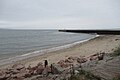
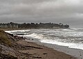
 Beach at Nairn - geograph.org.uk - 6373468.jpg 1,024 × 768; 120 KB
-
 Beach at Nairn - geograph.org.uk - 6507687.jpg 1,024 × 768; 111 KB
-
 Beach at Nairn - geograph.org.uk - 6636860.jpg 1,024 × 683; 163 KB
-
 Beach at West Links, Nairn - geograph.org.uk - 5621155.jpg 1,024 × 683; 149 KB
-
 Beach, Nairn - geograph.org.uk - 5874844.jpg 1,024 × 683; 309 KB
-
 Beach, West Links - geograph.org.uk - 5876166.jpg 1,024 × 575; 233 KB
-
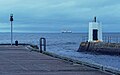
 Breakwater - geograph.org.uk - 6621569.jpg 768 × 1,024; 216 KB
-
 Docks at Nairn harbour - geograph.org.uk - 5620826.jpg 1,024 × 683; 136 KB
-
 Driftwood on Nairn West Beach - geograph.org.uk - 6370845.jpg 1,024 × 731; 172 KB
-
 Entrance to Nairn Harbour - geograph.org.uk - 5876859.jpg 1,024 × 768; 361 KB
-
 Entrance to Nairn Harbour - geograph.org.uk - 6624245.jpg 768 × 1,024; 125 KB
-

-
 Kitesurfers on Nairn West Beach - geograph.org.uk - 5803208.jpg 640 × 457; 49 KB
-
 Mouth of the River Nairn - geograph.org.uk - 5856919.jpg 640 × 480; 86 KB
-
 Mouth of the River Nairn - geograph.org.uk - 6285273.jpg 1,280 × 960; 273 KB
-
 Mouth of the River Nairn - geograph.org.uk - 6456083.jpg 1,600 × 1,067; 232 KB
-
 Mouth of the River Nairn - geograph.org.uk - 6456086.jpg 1,600 × 1,067; 106 KB
-
 Nairn Beach - geograph.org.uk - 5647196.jpg 1,600 × 1,200; 362 KB
-
 Nairn beach looking west - geograph.org.uk - 6636879.jpg 1,024 × 683; 305 KB
-
 Nairn East Beach - geograph.org.uk - 6563681.jpg 1,024 × 683; 172 KB
-
 Nairn East Beach - geograph.org.uk - 6624247.jpg 768 × 1,024; 142 KB
-
 Nairn Harbour (Marina) - geograph.org.uk - 5856930.jpg 640 × 480; 83 KB
-
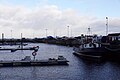
 Nairn Harbour - geograph.org.uk - 6276201.jpg 640 × 427; 237 KB
-
 Nairn Harbour - geograph.org.uk - 6334096.jpg 800 × 600; 143 KB
-
 Nairn Harbour - geograph.org.uk - 6621572.jpg 768 × 1,024; 224 KB
-
 Nairn Harbour Breakwater - geograph.org.uk - 6334987.jpg 800 × 800; 158 KB
-
 Nairn Harbour Carpark - geograph.org.uk - 6026535.jpg 1,024 × 819; 220 KB
-
 Nairn Harbour Entrance - geograph.org.uk - 5790373.jpg 1,024 × 731; 142 KB
-
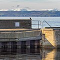
 Nairn Harbour Entrance Light - geograph.org.uk - 6334992.jpg 600 × 800; 115 KB
-
 Nairn Harbour entrance light - geograph.org.uk - 6728133.jpg 1,600 × 900; 748 KB
-
 Nairn Harbour entrance lights - geograph.org.uk - 6026548.jpg 800 × 500; 76 KB
-
 Nairn West Beach - geograph.org.uk - 6328083.jpg 640 × 457; 61 KB
-
 Nairn West Beach - geograph.org.uk - 6382871.jpg 1,024 × 731; 133 KB
-
 Nairn West Beach - geograph.org.uk - 6562182.jpg 1,024 × 640; 178 KB
-
 Nairnshire Constituency 1707-1832.svg 323 × 449; 2.11 MB
-
 Nairnshire Map.png 4,967 × 4,967; 6.78 MB
-
 Old Smokehouse Nairn Harbour - geograph.org.uk - 6340035.jpg 640 × 800; 122 KB
-
-
 Piers at Nairn Harbour - geograph.org.uk - 6781042.jpg 1,024 × 683; 183 KB
-
 Plaque on Howford Bridge - geograph.org.uk - 239780.jpg 480 × 640; 93 KB
-
 River Nairn - geograph.org.uk - 5649047.jpg 640 × 400; 34 KB
-
 River Nairn at Fishertown, Nairn - geograph.org.uk - 5620830.jpg 1,024 × 683; 171 KB
-
 Sand dunes and coast at Nairn West Beach - geograph.org.uk - 6445512.jpg 1,800 × 1,200; 511 KB
-
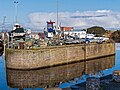
 Small harbour at Nairn - geograph.org.uk - 6624260.jpg 768 × 1,024; 257 KB
-
 The end of the pier - geograph.org.uk - 6163925.jpg 1,024 × 768; 191 KB
-
 View along the beach at Nairn - geograph.org.uk - 6503826.jpg 1,024 × 768; 103 KB
-
 View West along beach towards Pier - geograph.org.uk - 6507661.jpg 1,024 × 768; 167 KB
-
 Yachts in Nairn Dock - geograph.org.uk - 6508169.jpg 1,024 × 768; 149 KB


_-_geograph.org.uk_-_5856930.jpg)


