Category:London Borough of Tower Hamlets
Перейти до навігації
Перейти до пошуку
Boroughs of London: City of London · City of Westminster · Barking and Dagenham · Barnet · Bexley · Brent · Bromley · Camden · Croydon · Ealing · Enfield · Greenwich · Hackney · Hammersmith and Fulham · Haringey · Harrow · Havering · Hillingdon · Hounslow · Islington · Kensington and Chelsea · Kingston · Lambeth · Lewisham · Merton · Newham · Redbridge · Richmond · Southwark · Sutton · Tower Hamlets · Waltham Forest · Wandsworth
borough in the London Region in England    | |||||
| Завантажити медіафайл | |||||
| Є одним із | |||||
|---|---|---|---|---|---|
| Місце розташування | Великий Лондон, Лондон, Англія | ||||
| Законодавчий орган |
| ||||
| Виконавча влада |
| ||||
| Керівник виконавчої влади |
| ||||
| Дата створення / заснування |
| ||||
| Кількість населення |
| ||||
| Площа |
| ||||
| На заміну | |||||
| офіційний сайт | |||||
 | |||||
Файли в категорії «London Borough of Tower Hamlets»
Показано 200 файлів цієї категорії (із 4898).
(попередня сторінка) (наступна сторінка)-
 "Avenue of Sail" - geograph.org.uk - 2975491.jpg 4288 × 3216; 2,52 МБ
-
 "Centenary" at South Dock - geograph.org.uk - 2975190.jpg 3216 × 4288; 3,84 МБ
-
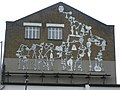
 "Community Fragments" mural, Bow - geograph.org.uk - 4731182.jpg 2783 × 2265; 663 КБ
-

-
 "Happy Nightmares" - panoramio.jpg 1600 × 1200; 653 КБ
-
 "I don't get no satisfaction" - geograph.org.uk - 5617129.jpg 2257 × 3009; 1,43 МБ
-
 "The Waverley" leaves Tower Pier - geograph.org.uk - 3712043.jpg 683 × 1024; 574 КБ
-
 'Adieu' - St Katharine Dock - geograph.org.uk - 4795938.jpg 960 × 1280; 325 КБ
-
 'Alleluja - Free Spirit' at Hackney Wick - geograph.org.uk - 4834758.jpg 1280 × 960; 315 КБ
-
 'Bus Art', The Paralympic Bus - geograph.org.uk - 4268773.jpg 1024 × 683; 163 КБ
-
 'Chimney' beside Regent's Canal - geograph.org.uk - 2256185.jpg 427 × 640; 57 КБ
-
-
 'Ghost sign', Stepney Green - geograph.org.uk - 3715027.jpg 558 × 1024; 499 КБ
-

-
 'Sun' Clipper - geograph.org.uk - 6073866.jpg 3816 × 2545; 7,76 МБ
-
 1 Norton Folgate and 201 Bishopsgate - geograph.org.uk - 4992433.jpg 960 × 1280; 369 КБ
-
 1-7 Coldharbour - geograph.org.uk - 4676590.jpg 640 × 468; 196 КБ
-

-
 12 white T-shirts on the move - geograph.org.uk - 2684839.jpg 2710 × 2083; 1 МБ
-
 17 - 32 St Mark's Gate - geograph.org.uk - 6220779.jpg 1024 × 678; 723 КБ
-
 17-28 Albert Gardens - geograph.org.uk - 3642751.jpg 640 × 477; 175 КБ
-
 2 More London Riverside at night - geograph.org.uk - 3246111.jpg 640 × 480; 50 КБ
-
 201 Bishopsgate - geograph.org.uk - 5223496.jpg 960 × 1280; 501 КБ
-
 21 gun salute for the Diamond Jubilee - geograph.org.uk - 3106643.jpg 2592 × 1936; 1,08 МБ
-
 29-39 Albert Gardens - geograph.org.uk - 3642742.jpg 640 × 505; 190 КБ
-
 37 Stepney Green E1 3JX.jpg 3504 × 2336; 3,78 МБ
-
 425 bus on Mile End Road - geograph.org.uk - 6279865.jpg 1920 × 1280; 1,49 МБ
-
 583-611 Manchester Road - geograph.org.uk - 4678324.jpg 640 × 474; 187 КБ
-
 6 and 7 Queens Yard - geograph.org.uk - 6220798.jpg 1024 × 678; 666 КБ
-
 62-74 White Horse Road - geograph.org.uk - 3642446.jpg 640 × 488; 205 КБ
-

-
 8 St Mark Street E1.jpg 4364 × 5818; 13,26 МБ
-
 A 115-year-old lamp post^ - geograph.org.uk - 3961816.jpg 2592 × 1944; 2,04 МБ
-

-
 A 2 second long exposure over London Bridge - geograph.org.uk - 4852421.jpg 2952 × 1976; 948 КБ
-
 A 2 second long exposure over London Bridge ^2 - geograph.org.uk - 4852434.jpg 3872 × 2592; 2,63 МБ
-
 A 2 second long exposure over Tower Bridge - geograph.org.uk - 4852426.jpg 2887 × 1933; 921 КБ
-
 A 2 second long exposure over Tower Bridge ^2 - geograph.org.uk - 4852438.jpg 2821 × 1889; 825 КБ
-
 A barge on the River Thames - geograph.org.uk - 3782370.jpg 1500 × 999; 146 КБ
-
 A bit of Roman London - geograph.org.uk - 3175550.jpg 1024 × 741; 205 КБ
-
 A boat called Thor - geograph.org.uk - 4489752.jpg 1024 × 768; 85 КБ
-
 A busy River Thames - geograph.org.uk - 4815157.jpg 640 × 403; 47 КБ
-
 A Damp Day at Watney St Market - geograph.org.uk - 2921300.jpg 640 × 429; 95 КБ
-
 A Dutch barge on the Thames - geograph.org.uk - 5995534.jpg 1024 × 710; 146 КБ
-
 A frozen Regent's Canal - geograph.org.uk - 2791157.jpg 2386 × 1790; 743 КБ
-
 A frozen Regent's Canal ^2 - geograph.org.uk - 2791162.jpg 3456 × 2592; 2,98 МБ
-
 A glade in Tower Hamlets Cemetery Park - geograph.org.uk - 3868978.jpg 4000 × 3000; 4,2 МБ
-
 A glimpse of Shadwell Basin from Newlands Quay - geograph.org.uk - 6067119.jpg 1024 × 1024; 1,7 МБ
-
 A glimpse of the Lord Amory - geograph.org.uk - 4490049.jpg 1024 × 768; 169 КБ
-
 A glimpse of the River Lee from Canning Town Station - geograph.org.uk - 4709110.jpg 6000 × 4000; 3,75 МБ
-
 A hole in the wall, E14 - geograph.org.uk - 3236746.jpg 640 × 480; 112 КБ
-
 A junction of watery walks - geograph.org.uk - 2193597.jpg 640 × 480; 95 КБ
-
 A mirrored bridge - geograph.org.uk - 3072281.jpg 640 × 480; 62 КБ
-
 A sailing barge at Millwall Cutting - geograph.org.uk - 6313088.jpg 731 × 1024; 778 КБ
-
-
 A small lock - geograph.org.uk - 2875255.jpg 640 × 430; 61 КБ
-
 A South Quay Plaza sign and shrubs on Marsh Wall - geograph.org.uk - 5059366.jpg 3872 × 2592; 2,29 МБ
-
 A speedboat passing the O2 - geograph.org.uk - 3169597.jpg 3456 × 2592; 2,84 МБ
-
-
 A Thames sailing barge - geograph.org.uk - 2329326.jpg 640 × 480; 79 КБ
-
 A truly grand view - geograph.org.uk - 3090106.jpg 640 × 432; 104 КБ
-
 A Victorian terrace near the William Sutton Estate - geograph.org.uk - 2662047.jpg 3456 × 2592; 2,61 МБ
-
 A way out of Mudchute Park - geograph.org.uk - 5959293.jpg 1024 × 768; 339 КБ
-
 A100 - geograph.org.uk - 5341412.jpg 640 × 426; 62 КБ
-
 A1020 - geograph.org.uk - 3977881.jpg 640 × 430; 52 КБ
-
 A1020 flyover and O2 Arena - geograph.org.uk - 3977846.jpg 640 × 430; 74 КБ
-
 A107 Bridge, Regents Canal - geograph.org.uk - 2899502.jpg 640 × 430; 75 КБ
-
 A12 from Footbridge - geograph.org.uk - 2928803.jpg 1000 × 666; 175 КБ
-
 A12 to Blackwall Tunnel - geograph.org.uk - 2807839.jpg 4288 × 3216; 3,57 МБ
-
 A1202, Whitechapel - geograph.org.uk - 5602659.jpg 640 × 345; 72 КБ
-
 A1205 - geograph.org.uk - 5602816.jpg 640 × 426; 84 КБ
-
 A1211 - geograph.org.uk - 5341434.jpg 640 × 426; 51 КБ
-
 A126 - geograph.org.uk - 4810997.jpg 640 × 426; 67 КБ
-
 A126 - geograph.org.uk - 5625713.jpg 640 × 425; 76 КБ
-
 A126 junction with Cable Street from the DLR - geograph.org.uk - 3049009.jpg 3648 × 2736; 1,47 МБ
-
 A1261 - geograph.org.uk - 3977941.jpg 640 × 376; 42 КБ
-
 A1261 - geograph.org.uk - 3978016.jpg 640 × 430; 67 КБ
-
 A1261 - geograph.org.uk - 4810853.jpg 640 × 426; 70 КБ
-
 A1261 - geograph.org.uk - 4810891.jpg 623 × 640; 84 КБ
-
 A13 - B126 junction - geograph.org.uk - 4427439.jpg 640 × 430; 62 КБ
-
 A13 - geograph.org.uk - 5602670.jpg 640 × 426; 65 КБ
-
 A13 bridge over the River Lea - geograph.org.uk - 6149742.jpg 800 × 600; 99 КБ
-
 A13 Commercial Road crosses the Grand Union Canal - geograph.org.uk - 3051864.jpg 3533 × 2608; 1,31 МБ
-
 Abbotts Wharf Mooring with narrowboat Navigator - geograph.org.uk - 4696056.jpg 3648 × 2736; 2,99 МБ
-
-
-
 Accumulator tower, Poplar Dock - geograph.org.uk - 2570604.jpg 427 × 640; 105 КБ
-
 Ack Ack Gun, Mudchute Farm, London E14 - geograph.org.uk - 4387849.jpg 740 × 987; 616 КБ
-

-
 Across Shadwell Basin - geograph.org.uk - 4965534.jpg 640 × 427; 75 КБ
-
 Across the Hertford Union Canal - geograph.org.uk - 6220795.jpg 678 × 1024; 725 КБ
-
 Across the river Thames - geograph.org.uk - 2856480.jpg 1000 × 371; 95 КБ
-
 Across the river Thames - geograph.org.uk - 2856485.jpg 1000 × 385; 88 КБ
-
 Across the river Thames - geograph.org.uk - 2856490.jpg 1000 × 411; 99 КБ
-
 Across the River Thames, London - geograph.org.uk - 2989935.jpg 6000 × 3240; 6,55 МБ
-
 Across the Thames to Oliver's Wharf - geograph.org.uk - 6312925.jpg 1024 × 1024; 1,15 МБ
-
 Across the Thames towards the O2 Arena - geograph.org.uk - 6313016.jpg 1024 × 731; 707 КБ
-
 Adidas Outdoor Gym, Wennington Green - geograph.org.uk - 4314226.jpg 1024 × 768; 118 КБ
-
 Adjacent track near Bethnal Green - geograph.org.uk - 4939390.jpg 800 × 444; 81 КБ
-
 Advert by the River Lea - geograph.org.uk - 4810829.jpg 640 × 426; 53 КБ
-
 Advertising hoarding on Whitechapel High Street - geograph.org.uk - 5148876.jpg 2048 × 1536; 1,51 МБ
-
 Advertising sail by Lee Navigation - geograph.org.uk - 2193691.jpg 640 × 480; 106 КБ
-
 Air Shaft, Rotherhithe Tunnel - geograph.org.uk - 5993378.jpg 1024 × 681; 125 КБ
-
 Air Vent for Rotherhithe Tunnel - geograph.org.uk - 5927671.jpg 6000 × 3368; 3,1 МБ
-

-
 Aldgate Curzon Cinema on opening day - geograph.org.uk - 5258735.jpg 3648 × 2736; 2,61 МБ
-
-
 Aldgate Tower - geograph.org.uk - 3133230.jpg 1024 × 821; 178 КБ
-
 Aldgate, cycle hire - geograph.org.uk - 3049562.jpg 1024 × 768; 186 КБ
-
 Aldgate, Eastern Dispensary - geograph.org.uk - 3133253.jpg 1024 × 768; 151 КБ
-
 Alleyway and workshops - geograph.org.uk - 2403532.jpg 3456 × 2592; 2,86 МБ
-
 Alleyway off Bishopsgate - geograph.org.uk - 2856691.jpg 768 × 1024; 136 КБ
-
 Alleyway off Brick Lane - geograph.org.uk - 3322730.jpg 1500 × 1000; 198 КБ
-
 Allotments, Isle of Dogs - geograph.org.uk - 5959273.jpg 1024 × 768; 449 КБ
-
 Allotments, Mudchute Park, London - geograph.org.uk - 4065553.jpg 3264 × 2448; 1,95 МБ
-
 Along the North Bank - geograph.org.uk - 6022710.jpg 1632 × 1224; 535 КБ
-
 Along the Thames - geograph.org.uk - 4965940.jpg 640 × 427; 93 КБ
-
 Along the Thames - geograph.org.uk - 4972556.jpg 640 × 427; 74 КБ
-
 Altaimage, Cannon Workshops - geograph.org.uk - 3987437.jpg 640 × 384; 47 КБ
-
 Am old chimney by Millwall Docks - geograph.org.uk - 3760209.jpg 430 × 640; 47 КБ
-
 Amani Bazar, Chapman Street E1 - geograph.org.uk - 2807154.jpg 640 × 471; 94 КБ
-
 Amelie Rose - geograph.org.uk - 4154480.jpg 3872 × 2592; 2,41 МБ
-
 Amsterdam Meets Deutschland - geograph.org.uk - 3078871.jpg 4288 × 3216; 3,64 МБ
-
 Amylum works, demolition - geograph.org.uk - 1987525.jpg 640 × 480; 42 КБ
-
 An arriving ferry - geograph.org.uk - 3396921.jpg 640 × 425; 67 КБ
-
 An entrance to the Olympic Site - geograph.org.uk - 2976972.jpg 800 × 600; 130 КБ
-
 An interesting object^ - geograph.org.uk - 2893664.jpg 430 × 640; 91 КБ
-
 Anchor by the Thames Path - geograph.org.uk - 2872437.jpg 640 × 430; 90 КБ
-
 Anchorage Point, E14 - geograph.org.uk - 2291462.jpg 480 × 640; 80 КБ
-
-
 Anglia House - geograph.org.uk - 4313944.jpg 768 × 1024; 130 КБ
-
 Aniseed - geograph.org.uk - 5989774.jpg 1024 × 681; 167 КБ
-
 Annabel J - geograph.org.uk - 4154446.jpg 3872 × 2592; 2,89 МБ
-
-
 Apartment Block, Vaughan Way - geograph.org.uk - 2868898.jpg 640 × 430; 62 КБ
-
 Apartments and houseboats, Tower Hamlets - geograph.org.uk - 5048851.jpg 480 × 640; 440 КБ
-
 Apartments and restaurant, Byng Street - geograph.org.uk - 2706233.jpg 4288 × 3216; 6,25 МБ
-
 Apartments at Blackwall - geograph.org.uk - 2637578.jpg 1024 × 680; 138 КБ
-
 Apartments at Blackwall - geograph.org.uk - 2637583.jpg 680 × 1024; 145 КБ
-
 Apartments by Limehouse Basin - geograph.org.uk - 2885916.jpg 640 × 417; 58 КБ
-
 Apartments by the Regents Canal - geograph.org.uk - 2893628.jpg 640 × 430; 77 КБ
-
 Apartments near Bromley-by-Bow - geograph.org.uk - 3807500.jpg 640 × 430; 70 КБ
-
 Apartments on the Thames Path - geograph.org.uk - 6166190.jpg 683 × 1024; 178 КБ
-
 Apartments on Trinity Buoy Wharf - geograph.org.uk - 2402581.jpg 3456 × 2592; 3,12 МБ
-
 Apartments onJames Voller Way - geograph.org.uk - 4954062.jpg 3924 × 2943; 3,21 МБ
-
 Apartments overlooking the River Thames - geograph.org.uk - 3782374.jpg 1500 × 999; 153 КБ
-
-
 Apartments, Shadwell - geograph.org.uk - 3807528.jpg 640 × 430; 61 КБ
-
 Approach Road towards Rotherhithe Tunnel - geograph.org.uk - 2966005.jpg 3072 × 2304; 1,74 МБ
-
 Approach Road, Bethnal Green - geograph.org.uk - 6281666.jpg 1844 × 1154; 1,46 МБ
-

-
 Arch entry to Limehouse Cut towpath - geograph.org.uk - 4695724.jpg 3648 × 2736; 2,99 МБ
-
 Archway, Flower ^ Dean Walk - geograph.org.uk - 6116961.jpg 1024 × 1024; 469 КБ
-
 ARD Hauptstadtstudio - geograph.org.uk - 3078801.jpg 4288 × 3216; 3,35 МБ
-
 Arnold Road, with railway overhead - geograph.org.uk - 3665121.jpg 4608 × 3456; 7,13 МБ
-
 Art by the Hackney Cut - geograph.org.uk - 4013625.jpg 4000 × 3000; 4,11 МБ
-
 Art in the Underpass - geograph.org.uk - 5738344.jpg 640 × 480; 50 КБ
-
 Art Space ^ Millwall Cut - geograph.org.uk - 2690607.jpg 429 × 640; 49 КБ
-
 ASD Metal Services - geograph.org.uk - 2402396.jpg 3456 × 2592; 2,98 МБ
-
 Aspen Way underpass - geograph.org.uk - 4564562.jpg 1024 × 768; 154 КБ
-
 Atkinson Memorial, Stepney Green - geograph.org.uk - 3715483.jpg 688 × 1024; 765 КБ
-
 Avenue of horse chestnuts - geograph.org.uk - 4489830.jpg 1024 × 768; 165 КБ
-
 Back Church Lane at the corner of Hooper Street - geograph.org.uk - 3526514.jpg 2048 × 1536; 1,66 МБ
-
 Baltimore Wharf - geograph.org.uk - 4545706.jpg 1024 × 768; 101 КБ
-
 Bankers lifeline - geograph.org.uk - 1935749.jpg 801 × 1024; 169 КБ
-

-
 Barge and railway arches - geograph.org.uk - 2888354.jpg 640 × 430; 92 КБ
-
 Barge moored on the River Thames - geograph.org.uk - 2872407.jpg 640 × 430; 54 КБ
-
 Barge of containers on the River Thames - geograph.org.uk - 3355885.jpg 1500 × 1000; 159 КБ
-
 Barge on the River Thames - geograph.org.uk - 2875254.jpg 640 × 430; 38 КБ
-
 Barges on the River Lea - geograph.org.uk - 4324299.jpg 2272 × 1704; 875 КБ
-
 Bascule Bridge - geograph.org.uk - 5760361.jpg 4140 × 2760; 7,75 МБ
-
 Bascule Bridge - geograph.org.uk - 5763708.jpg 3300 × 2200; 7,75 МБ
-
 Bascule Bridge at Shadwell Basin - geograph.org.uk - 4449793.jpg 3648 × 2736; 2,6 МБ
-
 Base of an old gasholder - geograph.org.uk - 3807494.jpg 640 × 430; 56 КБ
-
 Basin near Wapping - geograph.org.uk - 2442763.jpg 640 × 480; 65 КБ
-
 Battle Bowlers^ - geograph.org.uk - 2690655.jpg 429 × 640; 41 КБ
-
 Bay fronts make a porch below - geograph.org.uk - 4264253.jpg 600 × 800; 205 КБ
-
 Beacon by dock entrance lock - geograph.org.uk - 5953070.jpg 1024 × 768; 248 КБ
-
 Beaufort Court - geograph.org.uk - 3753792.jpg 640 × 430; 91 КБ
-
 Beauty in industrial bleakness - geograph.org.uk - 6134832.jpg 3264 × 1836; 1,7 МБ
-
 Bedford House, Spitalfields - geograph.org.uk - 5656626.jpg 1043 × 1600; 566 КБ
-
 Belfast and Waverley - geograph.org.uk - 2087267.jpg 2560 × 1920; 1,93 МБ
-
 Bellevue Place - geograph.org.uk - 6055566.jpg 4000 × 3000; 4,98 МБ
-
 Bellevue Place - geograph.org.uk - 6055569.jpg 4000 × 3000; 4,73 МБ
-
 Bellmouth Passage and adjacent offices - geograph.org.uk - 5077100.jpg 3672 × 4896; 1,71 МБ
-
 Benches on the Thames Path - geograph.org.uk - 4965942.jpg 640 × 427; 114 КБ
-
-
 Bethnal Green Gas Holder - geograph.org.uk - 4760732.jpg 960 × 1280; 439 КБ
-
 Bethnal Green Gas Holders by Regent's Canal - geograph.org.uk - 5409088.jpg 3801 × 4935; 4,15 МБ
-
 Bethnal Green gasholders - geograph.org.uk - 5496955.jpg 3264 × 2448; 2,41 МБ
-
 Bethnal Green Museum Gardens - geograph.org.uk - 5184127.jpg 640 × 481; 648 КБ
-
 Bethnal Green Road from the railway - geograph.org.uk - 5468708.jpg 800 × 533; 86 КБ
-
 Betthnal Green trackside - geograph.org.uk - 3516917.jpg 1024 × 535; 105 КБ
-
 Beveridge Mews - geograph.org.uk - 6124319.jpg 3619 × 2714; 711 КБ
-

-
 Big buoy, Orchard Place - geograph.org.uk - 2570587.jpg 640 × 427; 63 КБ
-
 Bike on a Boat - geograph.org.uk - 4833396.jpg 4000 × 3000; 3,59 МБ
-
 Bikes on the Waterfront - geograph.org.uk - 3710220.jpg 1600 × 1105; 458 КБ
-
 Bishop's Square - geograph.org.uk - 2856699.jpg 1024 × 768; 174 КБ


.jpg)


_Narrow_Street,_Limehouse_-_river_side_-_geograph.org.uk_-_4198693.jpg)


_at_Canning_Town_-_geograph.org.uk_-_1943174.jpg)


