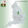
Category:Nottinghamshire
Sari la navigare
Sari la căutare

ceremonial county of England      | |||||
| Încarcă multimedia | |||||
| Este un/o | |||||
|---|---|---|---|---|---|
| Locul actual |
| ||||
| Capitală | |||||
| Populație |
| ||||
| Suprafață |
| ||||
| Diferit(ă) de | |||||
| Considerat identic cu | Nottinghamshire (comitat istoric, comitat ceremonial, 1844) | ||||
| site oficial | |||||
 | |||||

Subcategorii
Această categorie conține următoarele 62 de subcategorii, dintr-un total de 62.
*
A
- Archery in Nottinghamshire (1 F)
B
- Boughton Pumping Station (8 F)
C
- Campsites in Nottinghamshire (3 F)
- Cattle Market, Mansfield (9 F)
- Clawson Lodge (2 F)
- County Hall, Nottinghamshire (23 F)
D
E
F
G
H
- High Marnham Power Station (73 F)
I
L
M
N
- Nottinghamshire in art (2 F)
O
P
Q
- Quality images of Nottinghamshire (554 F)
S
T
V
W
Fișiere media din categoria „Nottinghamshire”
Următoarele 200 fișiere se află în această categorie, dintr-un total de 269.
(pagina anterioară) (pagina următoare)-
 5 mile marker - geograph.org.uk - 1622442.jpg 479x640; 128 KB
-
 Amen Corner Karting entrance - geograph.org.uk - 1349856.jpg 640x480; 119 KB
-
 Annesley Colliery.jpeg 3.648x2.056; 3,14 MB
-
 Approaching J28, M1 - geograph.org.uk - 44469.jpg 640x480; 69 KB
-
 Attenborough Sailing Club - geograph.org.uk - 1366116.jpg 640x479; 111 KB
-
 Beth Shalom memorial Garden 01.jpg 1.728x2.304; 953 KB
-
 Bracken, Pteridium aquilinum - geograph.org.uk - 1334890.jpg 640x427; 82 KB
-
 Bridge across the A46 - geograph.org.uk - 899273.jpg 640x456; 79 KB
-
 Bridge over the River Erewash - geograph.org.uk - 1366111.jpg 640x479; 137 KB
-
 Brinsley Headstocks - geograph.org.uk - 780325.jpg 640x480; 79 KB
-
 Brinsley-Woods-Fence-CowParsley.jpg 5.472x3.648; 5,23 MB
-
 Cemetery Gates - geograph.org.uk - 1195761.jpg 640x479; 140 KB
-

-
 Church (Rock) Cemetery - geograph.org.uk - 1196477.jpg 479x640; 177 KB
-
 Church (Rock) Cemetery - geograph.org.uk - 1196484.jpg 640x479; 143 KB
-
 Church Cemetery - geograph.org.uk - 1196450.jpg 640x480; 89 KB
-
 Church Cemetery - geograph.org.uk - 1196463.jpg 640x479; 128 KB
-
 Church Cemetery - geograph.org.uk - 1196471.jpg 640x479; 111 KB
-
 Closed superstore - geograph.org.uk - 1197042.jpg 640x453; 89 KB
-
 Colwick Driving Test Centre - geograph.org.uk - 1389418.jpg 640x479; 79 KB
-
 Cottam Power Station December 2023.jpg 5.377x3.575; 2,69 MB
-

-

-
 Courtyard at Thoresby Hall - geograph.org.uk - 1090398.jpg 640x471; 59 KB
-

-
 Disused railway line - geograph.org.uk - 780331.jpg 640x480; 112 KB
-
 Dog walking - geograph.org.uk - 780313.jpg 640x480; 119 KB
-

-
-
 Electricity Pole by the A38 - geograph.org.uk - 804349.jpg 640x480; 84 KB
-
En-southwell.ogg 2,7 s; 29 KB
-
 Entrance to Brinsley Headstocks - geograph.org.uk - 780310.jpg 640x480; 114 KB
-
 Fairham Brook - geograph.org.uk - 1323323.jpg 479x640; 170 KB
-

-
 Farmland bordering the A46 - geograph.org.uk - 899258.jpg 640x459; 64 KB
-
-
 Fly Agaric in Clumber - geograph.org.uk - 303256.jpg 480x640; 81 KB
-
-
 Former coop - geograph.org.uk - 1197065.jpg 640x457; 90 KB
-
 Former railway tunnel - geograph.org.uk - 1197845.jpg 640x479; 117 KB
-
 Foxhall Road - geograph.org.uk - 1749840.jpg 1.024x683; 267 KB
-
 Freight Train - geograph.org.uk - 78938.jpg 640x427; 82 KB
-

-
 Giant cabbage flower - geograph.org.uk - 1551584.jpg 457x640; 88 KB
-
 Goal^ - geograph.org.uk - 1198288.jpg 640x479; 90 KB
-

-
 Graves Moor Crossroads - geograph.org.uk - 1242036.jpg 640x426; 91 KB
-
 Great Central Railway Bridge - geograph.org.uk - 1335812.jpg 640x480; 55 KB
-
 Green tree tunnel - geograph.org.uk - 1454528.jpg 640x480; 132 KB
-
 Gypsum products works - geograph.org.uk - 1745376.jpg 1.280x959; 293 KB
-

-

-
 Hine Hall - geograph.org.uk - 1197588.jpg 640x443; 101 KB
-
 House on Carisbrooke Drive - geograph.org.uk - 1211630.jpg 640x479; 111 KB
-
 Humber head badge.JPG 283x606; 22 KB
-
 In Woodthorpe Grange Park - geograph.org.uk - 1198226.jpg 640x479; 119 KB
-

-

-
 KegCld2RH.JPG 2.576x1.932; 322 KB
-
 Lady Bay bridge towards city.jpg 4.032x3.024; 2,76 MB
-
 Langwith Mill House, Langwith 01.jpg 4.032x3.024; 4,89 MB
-
 Langwith Mill House, Langwith 02.jpg 4.032x3.024; 5,23 MB
-
 Langwith Mill House, Langwith 03.jpg 3.024x4.032; 4,64 MB
-
 Langwith Mill House, Langwith 04.jpg 4.032x3.024; 4,99 MB
-
 Langwith Mill House, Langwith 05.jpg 4.032x3.024; 4,91 MB
-
 Lay-by on the A1 North - geograph.org.uk - 956835.jpg 640x410; 41 KB
-
 Lay-by on the A611 - geograph.org.uk - 1432165.jpg 640x500; 52 KB
-

-
 Lime Tree Avenue, Clumber Park, Nottinghamshire.jpg 800x527; 819 KB
-
 Linby "Docks" - geograph.org.uk - 1002517.jpg 640x480; 112 KB
-
 Linby Colliery steam winder. - geograph.org.uk - 1777473.jpg 640x429; 59 KB
-

-
 Log barriers - geograph.org.uk - 841610.jpg 640x512; 72 KB
-
 M1 Motorway - geograph.org.uk - 805961.jpg 640x480; 38 KB
-
 M1 motorway at Misk Farm - geograph.org.uk - 1556381.jpg 640x480; 113 KB
-
 Main cemetery road - panoramio.jpg 2.304x1.728; 1,39 MB
-
 Marshall Street, Sherwood - geograph.org.uk - 925552.jpg 640x480; 68 KB
-
 Meden Vale - Portland Crescent.JPG 2.272x1.704; 877 KB
-

-
 N.C.B Kirkby -1 (5434306380).jpg 3.648x2.056; 2,68 MB
-
 N.C.B Kirkby -2 (5476215899).jpg 3.648x2.056; 2,75 MB
-
 National Cycle Network Route 6 - geograph.org.uk - 1045962.jpg 640x480; 119 KB
-
 Newark Name Around The World - panoramio.jpg 3.000x4.000; 4,01 MB
-
 Newstead - terraced houses.jpg 386x586; 282 KB
-
 Nexor Logo.png 150x49; 5 KB
-
 No. 3 Sherwood Rise - geograph.org.uk - 1802659.jpg 1.024x683; 196 KB
-
 Nottinghamshire districts transparent overlay.svg 300x450; 6 KB
-
 Nottinghamshire electoral divisions outline.svg 412x729; 32 KB
-
 Nottinghamshire map.png 583x1.001; 48 KB
-
 Nottinghamshire Map.png 4.967x4.967; 4,22 MB
-

-
 Number 12 and boundary wall.jpg 4.048x3.036; 5,13 MB
-
 Oak tree and pheasant - geograph.org.uk - 763186.jpg 640x480; 82 KB
-
 Occupation bridge - geograph.org.uk - 855539.jpg 640x426; 169 KB
-
 Old railway cutting - geograph.org.uk - 1198252.jpg 640x479; 147 KB
-

-
 On Coneries Pond - geograph.org.uk - 1366134.jpg 479x640; 62 KB
-
 On the Midshires Way - geograph.org.uk - 1750849.jpg 640x480; 59 KB
-
 Park Lodge - geograph.org.uk - 763209.jpg 640x480; 112 KB
-
-

-

-
-

-

-
 Pavilion At Debdale Hall (1).jpg 3.840x2.160; 3,63 MB
-

-
 Pollarded willows - geograph.org.uk - 1629007.jpg 640x479; 150 KB
-

-
 Radcliffe on Trent and Cropwell Butler parishes.jpg 1.765x1.125; 179 KB
-

-
 Red Hill Farm - geograph.org.uk - 738267.jpg 640x480; 65 KB
-
 River Leen outfall - geograph.org.uk - 753623.jpg 640x480; 70 KB
-

-
 Road widening works on the M1 - geograph.org.uk - 1556375.jpg 640x480; 106 KB
-

-

-

-

-

-

-
 Rough pull in on the A634 - geograph.org.uk - 886803.jpg 640x377; 53 KB
-
 Roundabout, A614 - geograph.org.uk - 1761699.jpg 640x480; 48 KB
-
 Route 6 Clumber Park - geograph.org.uk - 123798.jpg 640x480; 127 KB
-

-
 Rushcliffe Parish map Sutton Bonington.png 2.000x1.804; 322 KB
-
 Sand island - panoramio.jpg 2.304x1.728; 2,58 MB
-

-

-
 Seachange - Tone Club 19 Jan 2005.JPG 604x453; 38 KB
-
 Section of Jessops building - geograph.org.uk - 1778709.jpg 683x1.024; 246 KB
-
 Sherwood -2 (5462142762).jpg 3.648x2.056; 2,66 MB
-

-
 Sherwood Police Station - geograph.org.uk - 925559.jpg 640x549; 105 KB
-
 Sherwood.jpeg 3.648x2.056; 2,99 MB
-
-
 Shops on Burton Road - geograph.org.uk - 793943.jpg 640x426; 126 KB
-

-
 South Nottinghamshire countryside - geograph.org.uk - 903844.jpg 640x480; 101 KB
-
 South Nottinghamshire countryside - geograph.org.uk - 906182.jpg 640x469; 102 KB
-
-
 South Nottinghamshire farmland - geograph.org.uk - 899299.jpg 476x640; 100 KB
-

-

-
 Spot the wheel barrow - geograph.org.uk - 605550.jpg 640x391; 118 KB
-
 Sprint Racing - Thoresby Park - geograph.org.uk - 1708515.jpg 2.304x3.072; 2,89 MB
-
 St Ann's Community Orchard - geograph.org.uk - 1197570.jpg 640x479; 180 KB
-
-

-

-

-
-

-
 Supermarket, Carrington - geograph.org.uk - 1211687.jpg 640x479; 78 KB
-
 Syerston parkland - geograph.org.uk - 414256.jpg 640x427; 76 KB
-
 The A634 near Barnby Moor - geograph.org.uk - 909187.jpg 640x405; 62 KB
-
 The Bamford engine at Wollaton Park.jpg 4.000x3.000; 4,42 MB
-
 The Chestnut Tree - geograph.org.uk - 1211441.jpg 640x479; 71 KB
-
 The Double Top - geograph.org.uk - 1478828.jpg 640x479; 58 KB
-

-
-
-
 The shafts - geograph.org.uk - 780319.jpg 480x640; 104 KB
-
 The Turret House - geograph.org.uk - 1465408.jpg 640x479; 110 KB
-
 They are us - geograph.org.uk - 1218704.jpg 640x447; 70 KB
-
 Thoresby Park Courtyard View - geograph.org.uk - 744406.jpg 640x480; 86 KB
-
 Tile Kiln Wood - geograph.org.uk - 763280.jpg 640x480; 117 KB
-

-
 Train Sculpture - geograph.org.uk - 1198264.jpg 640x479; 140 KB
-
 Train Sculpture - geograph.org.uk - 1198278.jpg 640x479; 114 KB
-
 Travelodge, Worksop - geograph.org.uk - 1086514.jpg 640x430; 67 KB
-
 Tree Shadows in the Snow - geograph.org.uk - 1161074.jpg 640x427; 106 KB
-
 Tree tunnel - geograph.org.uk - 914454.jpg 640x480; 132 KB
-
 Trees in the snow - geograph.org.uk - 1166269.jpg 479x640; 159 KB
-

-
 TSCA Building-5789 (1280x850) (2012 03 02 09 26 25 UTC).jpg 1.280x850; 814 KB
-
 Turn for the A46 southbound - geograph.org.uk - 899275.jpg 640x378; 55 KB
-
 Unidentified flowering plant - geograph.org.uk - 1389793.jpg 640x479; 176 KB
-

-
 Veolia Transport bus 225 to Newark railway station.jpg 240x320; 27 KB
-
 Victorian beehive - geograph.org.uk - 1172768.jpg 640x426; 116 KB
-

-
 View into South Nottinghamshire - geograph.org.uk - 905827.jpg 541x640; 123 KB
-
 View to Calke Hall Farm - geograph.org.uk - 1774913.jpg 640x427; 103 KB
-
 View toward The Otter - geograph.org.uk - 554875.jpg 640x480; 122 KB
-
 Vine Cottage - geograph.org.uk - 780341.jpg 640x480; 113 KB
-
 Watnall -1 (5476796028).jpg 3.648x2.056; 3,02 MB
-
 Watnall.jpeg 3.648x2.056; 2,87 MB
-
 Welcome to Normanton on Soar - geograph.org.uk - 551943.jpg 640x486; 118 KB
-
 West Burton and Cottam from Ossington.jpg 6.016x4.000; 12,77 MB
-
 White gates - geograph.org.uk - 585956.jpg 640x537; 85 KB
-

-
 Wollaton Park Golf Club - geograph.org.uk - 232605.jpg 640x480; 107 KB
-

-
 Woodside Road - geograph.org.uk - 1461701.jpg 640x480; 124 KB
-
 Woodthorpe Grange Park - geograph.org.uk - 1197752.jpg 640x479; 132 KB
-
 Woodthorpe Grange Park - geograph.org.uk - 1198233.jpg 640x479; 141 KB
-
 Woodthorpe Grange Park - geograph.org.uk - 1198240.jpg 640x479; 108 KB
-
 Woodthorpe Grange Park - geograph.org.uk - 1198297.jpg 640x479; 96 KB
-
 Woodthorpe Grange Park - geograph.org.uk - 1198305.jpg 640x479; 74 KB


_Cemetery_-_geograph.org.uk_-_1196477.jpg)
_Cemetery_-_geograph.org.uk_-_1196484.jpg)


_Cemetery_-_geograph.org.uk_-_1196504.jpg)


._Front_view.jpg)


.jpg)
.jpg)


_at_junction_with_Piper_Lane_-_geograph.org.uk_-_1045940.jpg)


.jpg)


_Cemetery_-_geograph.org.uk_-_1196497.jpg)


_Cemetery_-_geograph.org.uk_-_1196564.jpg)
_Cemetery_-_geograph.org.uk_-_1196551.jpg)


_Cemetery_-_geograph.org.uk_-_1196527.jpg)
.jpg)


.jpg)
_-_geograph.org.uk_-_722036.jpg)


_(2012_03_02_09_26_25_UTC).jpg)


.jpg)


