Category:Eastern Ghats
Jump to navigation
Jump to search

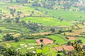
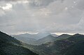
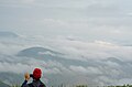
English: The Eastern Ghats — a discontinuous range of mountains along the eastern coast of India.
- The Eastern Ghats run from West Bengal state in the north, through Orissa and Andhra Pradesh to Tamil Nadu in the south.
- They are eroded and cut through by the four major rivers of southern India, the Godavari, Mahanadi, Krishna, and Kaveri.
- The mountain ranges run parallel to the Bay of Bengal. The Deccan Plateau lies to the west of the range, between the Eastern Ghats and Western Ghats.
Deutsch: Die Ostghats sind ein diskontinuierlicher Mittelgebirgszug parallel zur Ostküste Indiens. Sie beginnen an der Grenze Westbengalens zu Odisha und ziehen nach Süden über Andhra Pradesh und Telangana nach Tamil Nadu. Auf diesem Weg werden sie von vier großen Strömen in West-Ost-Richtung durchschnitten, dem Godavari, Mahanadi, Krishna und Kaveri. Die Ostghats begrenzen den Dekkan nach Osten hin.
mountain range  | |||||
| Upload media | |||||
| Instance of | |||||
|---|---|---|---|---|---|
| Part of |
| ||||
| Made from material | |||||
| Location | |||||
| Has part(s) |
| ||||
| Length |
| ||||
| Elevation above sea level |
| ||||
 | |||||
Subcategories
This category has the following 18 subcategories, out of 18 total.
*
.
A
- Arma Konda (9 F)
H
- Horsley Hills (148 F)
K
M
- Mahendragiri (Odisha) (2 F)
P
S
T
- Tammileru River (16 F)
Media in category "Eastern Ghats"
The following 99 files are in this category, out of 99 total.
-
 A photo of Dutta's Mahendragiri gecko.jpg 6,000 × 4,000; 10.28 MB
-
 Arma Konda trek 01.jpg 4,928 × 3,264; 2.45 MB
-
 Arma Konda trek 03.jpg 4,928 × 3,264; 784 KB
-
 Arma Konda trek 04.jpg 4,928 × 3,264; 638 KB
-
 Arma Konda trek 05.jpg 4,928 × 3,264; 2.56 MB
-
 Arma Konda trek 06.jpg 4,928 × 3,264; 1.78 MB
-
 Arma Konda trek 07.jpg 2,424 × 1,465; 1.4 MB
-
 Arma Konda trek 08.jpg 2,560 × 1,696; 2.12 MB
-
 Arma Konda trek 09.jpg 2,560 × 1,696; 916 KB
-
 Arma Konda trek 10.jpg 2,560 × 1,696; 978 KB
-
 Arma Konda trek 11.jpg 2,560 × 1,696; 675 KB
-
 Bauxite mountain e ghats.jpg 4,261 × 2,785; 9.6 MB
-
 Beautiful Eastern Ghats 01.jpg 3,802 × 2,020; 2.99 MB
-
 Beautiful Eastern Ghats 02.jpg 2,996 × 1,987; 2.45 MB
-
 Beautiful Eastern Ghats 03.jpg 4,612 × 2,846; 579 KB
-
 Beautiful Eastern Ghats 04.jpg 4,501 × 2,981; 7.77 MB
-
 Beautiful Eastern Ghats 05.jpg 2,364 × 1,566; 1.11 MB
-
 Beautiful Eastern Ghats 06.jpg 4,736 × 3,137; 8.56 MB
-
 Beautiful Eastern Ghats 07.jpg 2,560 × 1,696; 1.42 MB
-
 Beautiful Eastern Ghats 08.jpg 1,696 × 2,560; 1.32 MB
-
 Beautiful Eastern Ghats 09.jpg 2,560 × 1,696; 900 KB
-
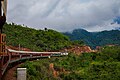
 Bridge and train in the Eastern Ghats.jpg 1,280 × 960; 297 KB
-
 Camping in the eastern ghats 02.jpg 6,000 × 4,000; 2.53 MB
-
 Camping in the eastern ghats.jpg 4,000 × 6,000; 3.55 MB
-
 Closeup photo of Dutta's mahendragiri gecko.jpg 4,871 × 3,413; 6.4 MB
-
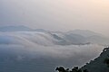
 Clouds over Vizag 04.jpg 3,871 × 2,115; 3.57 MB
-
 Clouds over Vizag 06.jpg 2,560 × 1,696; 1.45 MB
-
 Clouds over Vizag 13.jpg 4,928 × 3,264; 8.31 MB
-
 Coffee plantation 02.jpg 4,000 × 6,000; 4.02 MB
-
 Crepuscular Rays at Dallapalli.jpg 3,264 × 4,928; 1.39 MB
-
 DBK railway train at Chimidipalli station.jpg 3,872 × 2,592; 1.79 MB
-
 Deccan Plateau.png 2,015 × 2,160; 6.29 MB
-
 Dutta's Mahendragiri gecko.jpg 6,000 × 4,000; 11.42 MB
-
 Eastern ghats hills.jpg 6,000 × 4,000; 17.21 MB
-
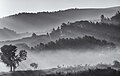
 Eastern Ghats in Black and White 01.jpg 5,568 × 3,712; 7.15 MB
-
 Eastern Ghats in Black and White 02.jpg 2,560 × 1,696; 896 KB
-
 Eastern Ghats in Black and White 03.jpg 2,400 × 1,527; 1.06 MB
-
 Eastern ghats in the monsoon.jpg 3,872 × 2,592; 5.97 MB
-
 Eastern ghats near kadapa.jpg 4,032 × 3,024; 3.27 MB
-
 Eastern Ghats near Veeraghattam.jpg 4,032 × 3,024; 1.29 MB
-
 Eastern Ghats view during monsoon near Sunki.jpg 4,000 × 3,000; 3.17 MB
-
 Eastern ghats.jpg 4,000 × 6,000; 14.9 MB
-
 Eastern Ghats.jpg 6,000 × 4,000; 10.16 MB
-
 Far view of Eastern Ghats from Mudasarlova reservoir.JPG 4,000 × 3,000; 4.03 MB
-
 Freight train in the Ghats.jpg 5,204 × 3,469; 2.89 MB
-
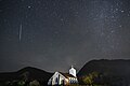 Geminid meteor over old church.jpg 4,950 × 3,301; 4.71 MB
-
 Giant Squirrel in the eastern ghats.jpg 3,589 × 2,393; 3.41 MB
-
 Golden hour in the Eastern Ghats.jpg 5,466 × 3,644; 3.54 MB
-
 Golden hour in the Ghats 02.jpg 5,466 × 3,644; 3.19 MB
-
 Hill of Padmanabham in Visakhapatnam district.jpg 4,000 × 2,556; 6.17 MB
-
 Hills of Vizag.jpg 5,568 × 3,712; 3.96 MB
-
 In search of Food.jpg 6,000 × 3,375; 5.15 MB
-
 Kaveri Crater visualization in Tamil.png 1,920 × 1,080; 3.04 MB
-
 Kaveri Crater visualization.png 1,920 × 1,080; 2.9 MB
-
 Lambasinghi on a cloudy day.jpg 4,000 × 3,000; 2.18 MB
-
 Lord Shri Venkateswara Swami temple from Rosehill, Visakhapatnam.jpg 5,184 × 2,920; 3.44 MB
-
 Male Mahadeshwara Hills Map.svg 840 × 666; 486 KB
-
 Man, Mountains and clouds.jpg 1,152 × 2,048; 713 KB
-
 Meteor at Aguru 01.jpg 5,568 × 3,712; 14.05 MB
-
 Meteor at Aguru 02.jpg 5,528 × 3,685; 11.6 MB
-
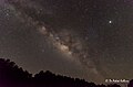
 Milky Way at Aguru 02.jpg 6,048 × 4,024; 8.51 MB
-
 Milky Way at Dallapalli 01.jpg 2,099 × 1,391; 1.77 MB
-
 Monsoon clouds over eastern ghats.jpg 2,560 × 1,696; 901 KB
-
 Moon and Venus Conjunction.jpg 2,560 × 1,696; 716 KB
-
 Morning people.jpg 6,000 × 3,375; 6.04 MB
-
 Nagalapuram Trekking Route.jpg 4,160 × 2,098; 1.37 MB
-
 Naglapeak.jpg 4,149 × 1,744; 1.03 MB
-
 Naglavalley.jpg 4,160 × 2,122; 2.05 MB
-
 Nap time enroute.jpg 4,928 × 3,264; 2.6 MB
-
 Relief-Inde.png 522 × 600; 189 KB
-
 Saperla.jpg 3,345 × 1,451; 3.55 MB
-
 Shevaroy Hills from Karadiyur Point 2.jpg 4,608 × 2,592; 4.22 MB
-
 Shevaroy Hills Yercaud 2.jpg 4,608 × 2,592; 3.77 MB
-
 Shevaroy Hills Yercaud.jpg 4,608 × 2,592; 4.81 MB
-
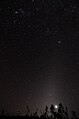
 Star trails near Araku 02.jpg 4,928 × 2,772; 5.28 MB
-
 Startrails near Araku.jpg 5,058 × 3,527; 4.79 MB
-
 Sunrise over the Eastern Ghats.jpg 4,928 × 3,264; 851 KB
-
 Terraced fields in the Eastern Ghats.jpg 4,928 × 3,264; 17.14 MB
-
 Transport at Vizag 17.jpg 3,750 × 2,510; 1.16 MB
-
 Transport at Vizag 37.jpg 3,872 × 2,592; 468 KB
-
 Transport at Vizag 49.jpg 2,560 × 1,696; 1.19 MB
-
 Tribal with traditional musical instrument.jpg 3,712 × 5,568; 4.71 MB
-
 Tribals at Araku 01.jpg 1,600 × 1,200; 606 KB
-
 Tribals at Araku 02.jpg 1,200 × 1,600; 614 KB
-
 Tribals at Araku 03.jpg 2,330 × 1,614; 1.55 MB
-
 Valley in blanket of clouds.jpg 5,374 × 3,023; 13.74 MB
-
 View of a degraded land near Samedha along the Eastern Ghats.jpg 4,160 × 3,120; 6.47 MB
-
 Views at Dallapalli.jpg 4,853 × 3,012; 3.77 MB
-
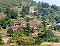 Village in the Eastern Ghats.jpg 2,030 × 1,535; 1.96 MB
-
 Vizag Nature 06.jpg 3,630 × 2,421; 1.43 MB
-
 Vizag Nature 08.jpg 6,000 × 4,000; 1.61 MB
-
 Vizag Nature 21.jpg 3,872 × 2,592; 2.87 MB
-
 Vizag Nature 34.jpg 5,142 × 3,427; 5.28 MB
-
 Vizag Nature 40.jpg 2,400 × 1,590; 490 KB
-
 Vizag Nature Panos 11.jpg 7,310 × 7,333; 7.73 MB
-
 Vizag Nature Panos 12.jpg 13,756 × 4,484; 2.75 MB
-
 Vizag Nature Panos 15.jpg 16,154 × 4,157; 2.3 MB
-
 Yerravaram waterfalls.jpg 1,920 × 1,080; 1.11 MB
-
 Zodiacal light at Araku.jpg 2,904 × 4,384; 4.35 MB


