Category:Huntingdonshire
Vai alla navigazione
Vai alla ricerca
contea inglese   | |||||
| Carica un file multimediale | |||||
| Istanza di | |||||
|---|---|---|---|---|---|
| Luogo | Cambridgeshire, Est dell'Inghilterra, Inghilterra | ||||
| Capitale | |||||
| Organo legislativo |
| ||||
| Data di fondazione o creazione |
| ||||
| Popolazione |
| ||||
| Superficie |
| ||||
| Distinto da | |||||
| sito web ufficiale | |||||
 | |||||
Sottocategorie
Questa categoria contiene le 32 sottocategorie indicate di seguito, su un totale di 32.
- Roads in Huntingdonshire (46 F)
- Agriculture in Huntingdonshire (13 F)
B
D
F
H
L
N
- Nene Valley (5 F)
O
P
- Portholme (13 F)
R
- Huntingdonshire RJD 1914 (4 F)
S
- Symbols of Huntingdonshire (9 F)
T
U
W
File nella categoria "Huntingdonshire"
Questa categoria contiene 200 file, indicati di seguito, su un totale di 1 266.
(pagina precedente) (pagina successiva)-
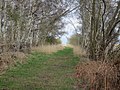
 4 Legged Footpath - geograph.org.uk - 1022798.jpg 480 × 640; 89 KB
-
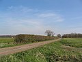 A rare hedge - geograph.org.uk - 389696.jpg 640 × 480; 72 KB
-
 Access road to car park - geograph.org.uk - 781307.jpg 640 × 480; 106 KB
-
 Across the field to Dillington farm - geograph.org.uk - 1191053.jpg 640 × 480; 65 KB
-
 Across the old quarry - August 2013 - panoramio.jpg 4 000 × 3 000; 1,38 MB
-
 Across the top Paxton Hill - August 2013 - panoramio.jpg 4 000 × 3 000; 2,15 MB
-
 After the rain - geograph.org.uk - 262368.jpg 640 × 480; 89 KB
-
 Agden Green - geograph.org.uk - 1193987.jpg 640 × 480; 76 KB
-
 Agdengreen Wood - geograph.org.uk - 1195038.jpg 640 × 480; 71 KB
-
 Alconbury Coming Up - geograph.org.uk - 1098829.jpg 640 × 480; 97 KB
-
 Alconbury Memorial Hall - geograph.org.uk - 1420162.jpg 640 × 480; 64 KB
-
 Alley, with alley cat - geograph.org.uk - 1139631.jpg 640 × 640; 152 KB
-
 Archeologists At Work - geograph.org.uk - 1036920.jpg 640 × 421; 86 KB
-
 Bizarre fishery sign - geograph.org.uk - 441951.jpg 640 × 425; 38 KB
-

-
 Bridleway from Alconbury to Ellington - geograph.org.uk - 539480.jpg 640 × 480; 86 KB
-
 CAFT Lads.jpg 4 032 × 2 473; 4,27 MB
-
 CAFT Shield.jpg 3 024 × 4 032; 6,79 MB
-
 CAFT Trophy.jpg 3 024 × 4 032; 2,8 MB
-
 Cambridgeshire Banham Draft.png 202 × 237; 5 KB
-
 Car Park for Millfield Playing Fields - geograph.org.uk - 392700.jpg 640 × 427; 90 KB
-
 Cloot Drove - geograph.org.uk - 593496.jpg 640 × 427; 58 KB
-
 Close to the visitor centre at Paxton Pits - August 2013 - panoramio.jpg 4 000 × 3 000; 2,94 MB
-
 County of Huntingdon - geograph.org.uk - 1210964.jpg 640 × 480; 97 KB
-
 Crash exit 3 Wyton airfield - geograph.org.uk - 497705.jpg 640 × 425; 74 KB
-
 Crash gate exit from RAF Wyton - geograph.org.uk - 614754.jpg 640 × 427; 107 KB
-
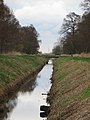
 Crooked Drain - geograph.org.uk - 673981.jpg 640 × 425; 74 KB
-
 Cross the pits beyond Diddington - Jan 2016 - panoramio.jpg 2 513 × 2 786; 1,25 MB
-
 Crowland Falls - geograph.org.uk - 593511.jpg 640 × 427; 76 KB
-
 Crowland Low Wash - geograph.org.uk - 443744.jpg 640 × 427; 83 KB
-
 Drove and Ditch, Woodwalton Fen NNR - geograph.org.uk - 678526.jpg 640 × 480; 119 KB
-
 Dutch Barn very near Huntingdon - geograph.org.uk - 1420873.jpg 640 × 480; 85 KB
-
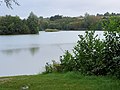
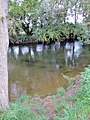
 Elney Lake - geograph.org.uk - 602724.jpg 640 × 480; 44 KB
-
 Evening harvest - August 2013 - panoramio.jpg 4 000 × 3 000; 1,72 MB
-
 Evening near Yarwell Junction - August 2012 - panoramio (1).jpg 4 000 × 3 000; 3,85 MB
-
 Evening near Yarwell Junction - August 2012 - panoramio.jpg 4 000 × 3 000; 5,59 MB
-
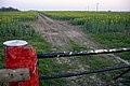
 Farm road junction - geograph.org.uk - 389582.jpg 640 × 480; 55 KB
-
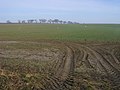
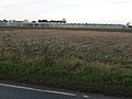
 Farmland - geograph.org.uk - 382657.jpg 640 × 481; 41 KB
-
 Farmland - geograph.org.uk - 385243.jpg 640 × 481; 66 KB
-
 Farmland - geograph.org.uk - 387832.jpg 640 × 481; 52 KB
-
 Farmland and glasshouses - geograph.org.uk - 458134.jpg 640 × 427; 73 KB
-

-
 Fens in the evening - geograph.org.uk - 589796.jpg 640 × 427; 83 KB
-
 Field boundaries near RAF Wyton - geograph.org.uk - 614743.jpg 640 × 427; 95 KB
-
 Field entrance - geograph.org.uk - 442866.jpg 640 × 480; 60 KB
-
 Field path between Colne & Earith, Huntingdonshire - geograph-4188030.jpg 4 608 × 3 440; 4,41 MB
-

-
 Fishing Lake at Yarwell Junction - August 2012 - panoramio.jpg 4 000 × 3 000; 4,6 MB
-
 Five Arches Pit Nature Reserve - April 2016 - panoramio.jpg 4 000 × 3 000; 3,88 MB
-
 Flooded fields near Earith Bridge - geograph.org.uk - 632312.jpg 640 × 427; 89 KB
-

-
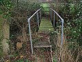
 Footbridge - no longer in use - geograph.org.uk - 619612.jpg 640 × 480; 61 KB
-
-
 Footpath - geograph.org.uk - 494488.jpg 640 × 480; 109 KB
-
 Footpath to Bury Lug Fen - geograph.org.uk - 613019.jpg 640 × 427; 83 KB
-
 Footpath waymarker Great Gidding - geograph.org.uk - 714543.jpg 640 × 480; 105 KB
-
 From Haddon House, Haddon Road - geograph.org.uk - 384799.jpg 640 × 428; 125 KB
-
 Gamekeeper's Footbridge - geograph.org.uk - 345930.jpg 480 × 640; 114 KB
-
 Glasshouses Holbeach Drove - geograph.org.uk - 650683.jpg 640 × 479; 70 KB
-
 Great Ouse barrier - geograph.org.uk - 632318.jpg 640 × 427; 57 KB
-

-
 Guard house or pill box - geograph.org.uk - 730348.jpg 640 × 480; 91 KB
-
 Highway boundary marker - geograph.org.uk - 1275511.jpg 640 × 480; 126 KB
-
 Hobb's Drain north-east view - geograph.org.uk - 446508.jpg 640 × 480; 70 KB
-

-
 Huntingdonshire Map.png 4 967 × 4 967; 4,29 MB
-
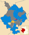 Huntingdonshire UK local election 2015 map.svg 1 055 × 1 266; 574 KB
-
 Huntingdonshire UK local election 2016 map.svg 1 055 × 1 266; 574 KB
-
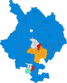 Huntingdonshire UK ward map 2018.svg 558 × 698; 310 KB
-
 Huntingdonshire UK ward map 2022.svg 558 × 698; 310 KB
-
 Land at Gaynes Lodge Farm - geograph.org.uk - 531994.jpg 640 × 480; 61 KB
-
 Lincolnshire Fen Country - geograph.org.uk - 599902.jpg 640 × 480; 114 KB
-
 Little South Holland Drain - geograph.org.uk - 479134.jpg 640 × 427; 104 KB
-
 Looking across to Catworth lodge - geograph.org.uk - 499379.jpg 640 × 480; 66 KB
-

-
 Meadow near Yarwell Junction - August 2012 - panoramio.jpg 4 000 × 3 000; 4,71 MB
-
 Meadows - May 2014 - panoramio.jpg 3 000 × 4 000; 1,77 MB
-
 Meadows - Paxton Pits - August 2013 - panoramio.jpg 4 000 × 3 000; 2,01 MB
-
 Meadows beside the river - August 2013 - panoramio.jpg 4 000 × 3 000; 2,73 MB
-
-
 Middle Level Catchwater Drain - geograph.org.uk - 389766.jpg 640 × 480; 63 KB
-
 Midloe Wood - geograph.org.uk - 656153.jpg 640 × 529; 62 KB
-
 Milestone Farm Barn - geograph.org.uk - 612931.jpg 640 × 425; 90 KB
-
 Mobile service van.jpg 3 264 × 2 448; 1,98 MB
-
 MOD buildings near RAF Wyton - geograph.org.uk - 262209.jpg 640 × 480; 100 KB
-
 Must be getting close to Paxton Pits Nature Reserve - April 2016 - panoramio.jpg 3 547 × 1 723; 945 KB
-
 Nene Bridge in Wansford - geograph.org.uk - 255908.jpg 640 × 480; 90 KB
-
 New Barn Drove - geograph.org.uk - 446794.jpg 640 × 480; 71 KB
-
 Open fields between Yarwell Junction ^ Sibson Airfield - August 2012 - panoramio.jpg 4 000 × 3 000; 4,99 MB
-
 Ornithological miscellany (Plate) (5981485233).jpg 1 260 × 1 684; 279 KB
-
 Oxholme Lake, Fen Drayton Lakes RSPB - geograph.org.uk - 602735.jpg 640 × 480; 54 KB
-
 Parking for Fen Drayton Lakes - geograph.org.uk - 602719.jpg 640 × 480; 42 KB
-
 Passing Connington sidings - April 2016 - panoramio.jpg 4 000 × 3 000; 3,02 MB
-
 Passing moored boats above Offord - April 2016 - panoramio.jpg 4 000 × 1 885; 1,45 MB
-
 Passing Offord Cluny - Jan 2016 - panoramio.jpg 4 000 × 2 028; 1,74 MB
-
 Passing the weir - April 2016 - panoramio.jpg 3 980 × 2 369; 2,53 MB
-
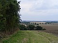
 Path heading up towards Old Manor Farm - geograph.org.uk - 588581.jpg 640 × 425; 119 KB
-
 Pathfinder House, Huntingdon.jpg 3 743 × 2 807; 2,03 MB
-
 Paxton Hill from Paxton Pits - August 2013 - panoramio.jpg 4 000 × 3 000; 2,18 MB
-
 Paxton Pits - 2005 - panoramio.jpg 2 288 × 1 712; 849 KB
-
 Paxton Pits - 30th August 2013 - panoramio.jpg 4 000 × 3 000; 2,56 MB
-
 Paxton Pits - August 2013 - panoramio.jpg 2 223 × 3 474; 1,67 MB
-
 Paxton Pits in late August - 2013 - panoramio.jpg 4 000 × 3 000; 1,73 MB
-
 Paxton Pits in late summer - 2013 - panoramio.jpg 4 000 × 3 000; 2,08 MB
-
 Paxton Pits near the visitor centre - August 2013 - panoramio.jpg 4 000 × 3 000; 1,94 MB
-
 Peace Garden, Molesworth Airbase - geograph.org.uk - 345589.jpg 640 × 480; 100 KB
-
 Pigs in Mud - geograph.org.uk - 345571.jpg 640 × 480; 93 KB
-
 Pill box - geograph.org.uk - 655900.jpg 640 × 480; 78 KB
-
 Plate Trophy.jpg 3 024 × 4 032; 5,56 MB
-
 Poplars at Shillhow Barn - geograph.org.uk - 613751.jpg 427 × 640; 101 KB
-
 Puddock Pumping Station - geograph.org.uk - 606172.jpg 640 × 427; 64 KB
-
 Pylon Island - geograph.org.uk - 539337.jpg 640 × 480; 78 KB
-
 Rain falling again - December 2015 - panoramio.jpg 3 000 × 4 000; 2,3 MB
-
 Rainy fields - December 2015 - panoramio.jpg 4 000 × 3 000; 2,67 MB
-
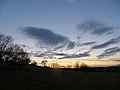
 Reaching for the sky - April 2016 - panoramio.jpg 3 000 × 4 000; 3,27 MB
-
 Reclaimed strip mine.jpg 640 × 480; 132 KB
-
 Reed fringed lake - Paxton Pits - August 2013 - panoramio.jpg 4 000 × 3 000; 1,56 MB
-
 Reed lined drain on Holme Fen - April 2016 - panoramio.jpg 3 000 × 4 000; 4,36 MB
-
 Reeds beside the River - April 2014 - panoramio.jpg 4 000 × 3 000; 3,44 MB
-
 Reeds catching the sun - Jan 2016 - panoramio.jpg 3 994 × 2 111; 2,13 MB
-
 Reeds on Sawtry Fen - April 2016 - panoramio.jpg 3 000 × 4 000; 3,67 MB
-
 Reflections - River Nene - August 2013 - panoramio.jpg 4 000 × 3 000; 2,01 MB
-
 Reflections at Paxton Pits Nature Reserve - August 2013 - panoramio.jpg 3 000 × 4 000; 1,5 MB
-
 Reflections in the marina - April 2016 - panoramio.jpg 4 000 × 3 000; 3,08 MB
-
 Reflections in the spring sunshine - April 2016 - panoramio.jpg 3 000 × 3 256; 2,8 MB
-
 Reflections on the cut to the Ouse - April 2016 - panoramio.jpg 4 000 × 3 000; 4,49 MB
-
 Reflections on the Lode - April 2016 - panoramio.jpg 3 000 × 4 000; 3,55 MB
-
 Remains of old camp - May 2013 - panoramio.jpg 4 000 × 3 000; 2,14 MB
-
 Rickerty bridge over the weir - August 2013 - panoramio.jpg 4 000 × 3 000; 1,65 MB
-
 Ride along edge of Holme Fen NNR - April 2016 - panoramio.jpg 4 000 × 3 000; 4,55 MB
-
 River - August 2012 - panoramio.jpg 3 000 × 4 000; 6,4 MB
-
 River along Straight Drove near Pondersbridge - panoramio.jpg 2 048 × 1 536; 621 KB
-
 River cruise - evening June 2013 - panoramio.jpg 4 000 × 3 000; 1,89 MB
-
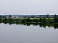
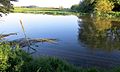
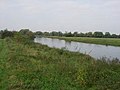 River Great Ouse - geograph.org.uk - 602701.jpg 640 × 480; 48 KB
-
 River Great Ouse between the Offords and Gt Paxton - April 2016 - panoramio.jpg 4 000 × 3 000; 2,28 MB
-
 River meadows alongside the Gt Ouse - April 2016 - panoramio.jpg 4 000 × 3 000; 2,89 MB
-
 River meadows between Elton ^ Yarwell - August 2013 - panoramio.jpg 4 000 × 3 000; 2,03 MB
-
 River Ouse from the Chapel - panoramio.jpg 2 304 × 3 072; 2,3 MB
-
 River side path partially submerged - Jan 2016 - panoramio.jpg 4 000 × 3 000; 2,86 MB
-
 Riverside meadows - April 2014 - panoramio.jpg 3 000 × 4 000; 2,31 MB
-
 Riverside meadows - late August at Paxton Pits - August 2013 - panoramio.jpg 4 000 × 3 000; 2,42 MB
-
 Route 12 to Crowland - geograph.org.uk - 593435.jpg 640 × 427; 70 KB
-
 Route 12 to Peterborough - geograph.org.uk - 593438.jpg 640 × 427; 78 KB
-
 Ruin below High Holborn - May 2014 - panoramio.jpg 2 669 × 3 000; 1,45 MB
-
 Ruined cottage between Elton ^ Wansford - May 2014 - panoramio.jpg 4 000 × 3 000; 1,74 MB
-
 Sample photo.jpg 3 024 × 4 032; 2,08 MB
-
 Sheep in the meadow - near Buckden - August 2013 - panoramio.jpg 4 000 × 3 000; 1,99 MB
-
 Shillhow Barn - geograph.org.uk - 612936.jpg 640 × 425; 108 KB
-
 Side view of the pumping station - Jan 2016 - panoramio.jpg 4 000 × 1 821; 1,31 MB
-
 Silvery green fields in the rain - May 2014 - panoramio.jpg 4 000 × 3 000; 1,28 MB
-
 Site of old stepping stones - August 2012 - panoramio.jpg 3 000 × 4 000; 6,61 MB
-
 Sodden fields - December 2015 - panoramio.jpg 4 000 × 1 841; 1,03 MB
-
 South Holland Main Drain - geograph.org.uk - 513673.jpg 640 × 480; 113 KB
-
 South View of the Old Dairy at Elton - geograph.org.uk - 321264.jpg 640 × 445; 110 KB
-
 Speeding north across the fens, Sawtry Fen - April 2016 - panoramio.jpg 3 970 × 1 322; 881 KB
-
 St Ives Indoor Leisure Centre - geograph.org.uk - 317532.jpg 640 × 427; 91 KB
-
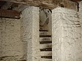
 Staircase of Bridge Chapel - panoramio.jpg 2 304 × 3 072; 2,88 MB
-

-
 Steep Stairs - panoramio.jpg 3 072 × 2 304; 3,01 MB
-
 Steeple Gidding is at the end of this farm track - December 2015 - panoramio.jpg 4 000 × 3 000; 3,15 MB
-
 Still evening on the Nene Valley - August 2013 - panoramio.jpg 4 000 × 3 000; 991 KB
-
 Still waters above the weir - AUgust 2013 - panoramio.jpg 4 000 × 3 000; 1,46 MB
-
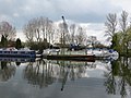
 Still waters in Buckden Marina - April 2016 - panoramio.jpg 4 000 × 3 000; 1,98 MB
-
 Stock grazing - swamped by grasses - August 2013 - panoramio.jpg 3 996 × 2 996; 2,52 MB
-
 Stone barns near Elton - Agust 2013 - panoramio.jpg 4 000 × 3 000; 1,08 MB
-
 Straight Drove, Sawtry Fen - April 2016 - panoramio.jpg 4 000 × 3 000; 3,31 MB
-
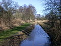
 Stream and Grassland - geograph.org.uk - 494470.jpg 640 × 480; 91 KB
-
 Stream through Fen Drayton gravel pits - geograph.org.uk - 495550.jpg 640 × 480; 121 KB
-
 Summer at Diddington - August 2013 - panoramio.jpg 4 000 × 3 000; 1,99 MB
-
 Sun going down near Sawtry - April 2016 - panoramio.jpg 4 000 × 3 000; 2,06 MB
-
 Sunlight on the River Nene - April 2014 - panoramio.jpg 4 000 × 3 000; 1,98 MB
-
 Sunny afternoon in Holme Fen - April 2016 - panoramio.jpg 4 000 × 1 867; 2,54 MB
-
 Sunset = Nene Valley - August 2013 - panoramio.jpg 4 000 × 3 000; 1,1 MB
-
 Sunset between Sawtry ^ Aversley Wood - April 2016 - panoramio.jpg 4 000 × 1 955; 1 MB
-
 Sunset in the Nene Valley - August 2013 - panoramio (1).jpg 4 000 × 3 000; 881 KB
-
 Sunset in the Nene Valley - August 2013 - panoramio (2).jpg 4 000 × 1 997; 561 KB
-
 Sunset in the Nene Valley - August 2013 - panoramio (3).jpg 3 000 × 4 000; 1,34 MB
-
 Sunset in the Nene Valley - August 2013 - panoramio.jpg 4 000 × 3 000; 842 KB
-
 Sunset in the Nene Valley - Yarwell - August 2013 - panoramio.jpg 3 000 × 4 000; 1,04 MB
-
 Sunset near Aversley Wood - April 2016 - panoramio.jpg 4 000 × 3 000; 2,99 MB
-
 Sunset near Sawtry - April 2016 - panoramio.jpg 4 000 × 3 000; 1,85 MB
-
 Sunset on apartments - Stukeley Meadows - May 2013 - panoramio.jpg 4 000 × 3 000; 1,55 MB
-
 Sunset over High Holborn above Sawtry - April 2016 - panoramio.jpg 4 000 × 3 000; 1,54 MB
-
 Tanks at the pumping station - geograph.org.uk - 473849.jpg 640 × 480; 94 KB
-

-
 The Bullock Road by Coldharbour Farm - December 2015 - panoramio.jpg 4 000 × 3 000; 2,98 MB
-
 The Bullock Track - March 2016 - panoramio.jpg 4 000 × 3 000; 2,47 MB
-
 The canoe portage dock under water - River Nene - May 2014 - panoramio.jpg 4 000 × 2 388; 1,37 MB
-
 The central arch - April 2016 - panoramio.jpg 3 000 × 4 000; 4,05 MB
-
 The church at Elton above the trees - May 2014 - panoramio.jpg 4 000 × 3 000; 1,32 MB
-
 The church at Offord Cluny from far bank - Jan 2016 - panoramio.jpg 3 000 × 4 000; 3,32 MB
-
 The church at Offord D'Arcy from the far bank - Jan 2016 - panoramio.jpg 4 000 × 1 614; 1,18 MB
-
 The copse at the road end Diddington - Jan 2016 - panoramio.jpg 2 996 × 2 800; 1,29 MB
-
-
 The edge of the rain away to the north - December 2015 - panoramio.jpg 4 000 × 3 000; 2,55 MB
-
 The end of the road - geograph.org.uk - 262006.jpg 640 × 480; 88 KB
-
 The Fens near Sawtry - April 2016 - panoramio.jpg 4 000 × 3 000; 2,76 MB
-
 The Great Ouse at Offord D'Arcy - Jan 2016 - panoramio.jpg 4 000 × 3 000; 3,42 MB
-
 The Great Ouse in afternoon sun - Jan 2016 - panoramio.jpg 4 000 × 2 197; 1,62 MB
-
 The Great Ouse River near Offord D'Arcy - April 2016 - panoramio.jpg 4 000 × 3 000; 2,88 MB


.jpg)


_-_geograph.org.uk_-_494500.jpg)


_(5981485233).jpg)


.jpg)
.jpg)
.jpg)


