Category:Lancashire
Перейти до навігації
Перейти до пошуку
ceremonial county in North-West England, United Kingdom  Clitheroe town centre    | |||||
| Завантажити медіафайл | |||||
| Є одним із | |||||
|---|---|---|---|---|---|
| Частина від | |||||
| Місце розташування |
| ||||
| Столиця | |||||
| Кількість населення |
| ||||
| Площа |
| ||||
| Не плутати з | |||||
| Ймовірно те саме | Ланкашир (Історичні графства Англії, церемоніальне графство Англії, 1844) | ||||
| офіційний сайт | |||||
 | |||||

Підкатегорії
Показано 50 підкатегорій із 50.
*
- Valued images of Lancashire (3 F)
- Videos from Lancashire (4 F)
A
C
- Campsites in Lancashire (6 F)
- Carved trees in Lancashire (2 F)
- Church portals in Lancashire (2 F)
- Cocklett Scar (2 F)
E
F
G
- Gallery pages of Lancashire (4 P)
H
I
L
- Lancashire cheese (5 F)
- Earthworks in Lancashire (3 F)
M
- Media from Lancashire Archives (18 F)
N
O
P
S
- Sunrises of Lancashire (5 F)
T
V
Файли в категорії «Lancashire»
Показано 26 файлів цієї категорії (із 26).
-
 97-365 Boats at Botany Bay (51102028185).jpg 5938 × 3959; 3,89 МБ
-
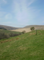
 Alden Valley.JPG 2848 × 2136; 1,51 МБ
-
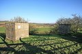 Block in the View - geograph.org.uk - 1146094.jpg 640 × 426; 118 КБ
-
 Bowland Fells.png 528 × 720; 465 КБ
-
 Causeway House - geograph.org.uk - 1237552.jpg 640 × 480; 74 КБ
-
 CCTV down the drain - geograph.org.uk - 1618057.jpg 640 × 480; 86 КБ
-
 Chattox Family - fr.svg 517 × 358; 7 КБ
-
 Clougha heather.jpg 1024 × 768; 156 КБ
-
 Eccles Wakes Fair (1822).jpg 1200 × 831; 115 КБ
-
 Exposed roots - geograph.org.uk - 1615271.jpg 480 × 640; 140 КБ
-
 Flag wall Hill End Lane - geograph.org.uk - 1054003.jpg 640 × 480; 86 КБ
-
 Folly Clough - geograph.org.uk - 1169585.jpg 640 × 480; 77 КБ
-
 Lancashire 05 (13408108744).jpg 1280 × 960; 917 КБ
-
 Lancashire Map.png 4967 × 4967; 4,32 МБ
-
 Lancashire-Cheshire border at Warrington.jpg 1200 × 584; 196 КБ
-
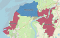 LancasterMorecambeBUA2011.png 1323 × 850; 1,25 МБ
-
 Light beams in England sky (Unsplash).jpg 4356 × 2904; 4,24 МБ
-
 Loveclough-from-west.jpg 1600 × 1200; 567 КБ
-
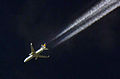 Networking the world. (4511616730).jpg 696 × 461; 334 КБ
-
 Out and Proud in East Lancashire.png 146 × 98; 10 КБ
-
 Potts.png 720 × 1124; 480 КБ
-
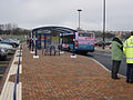
 R C C (Ribble Cruising Club) - geograph.org.uk - 996650.jpg 640 × 480; 60 КБ
-

-
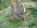 Stoop and Benchmark - panoramio.jpg 1500 × 1125; 973 КБ
-
 Tailboys of Kyme.png 545 × 600; 61 КБ
-

.jpg)


.jpg)


.jpg)


.jpg)

.jpg)


_-_geograph.org.uk_-_996650.jpg)


