Category:Suffolk
Перейти до навігації
Перейти до пошуку
Ceremonial counties of England: Bedfordshire · Berkshire · Buckinghamshire · Cambridgeshire · Cheshire · Cornwall · Cumbria · Derbyshire · Devon · Dorset · Durham · East Riding of Yorkshire · East Sussex · Essex · Gloucestershire · Greater London · Greater Manchester · Hampshire · Herefordshire · Hertfordshire · Isle of Wight · Kent · Lancashire · Leicestershire · Lincolnshire · Merseyside · Norfolk · North Yorkshire · Northamptonshire · Northumberland · Nottinghamshire · Oxfordshire · Rutland · Shropshire · Somerset · South Yorkshire · Staffordshire · Suffolk · Surrey · Tyne and Wear · Warwickshire · West Midlands · West Sussex · West Yorkshire · Wiltshire · Worcestershire
City-counties: Bristol · City of London
Історичні графства: Cumberland · Huntingdonshire · London · Middlesex · North Riding of Yorkshire · Sussex · West Riding of Yorkshire · Westmorland · Yorkshire
Other former counties: Avon · Cambridgeshire and Isle of Ely · Cleveland · East Suffolk · Hereford and Worcester · Hexhamshire · Humberside · Huntingdon and Peterborough · Isle of Ely · Parts of Holland · Parts of Kesteven · Parts of Lindsey · Soke of Peterborough · West Suffolk
county of England      | |||||
| Завантажити медіафайл | |||||
| Є одним із |
| ||||
|---|---|---|---|---|---|
| Місце розташування |
| ||||
| Столиця | |||||
| Законодавчий орган |
| ||||
| Кількість населення |
| ||||
| Площа |
| ||||
| Не плутати з | |||||
| Ймовірно те саме | Саффолк (Історичні графства Англії, церемоніальне графство Англії, 1844) | ||||
| офіційний сайт | |||||
 | |||||


Підкатегорії
Показано 39 підкатегорій із 39.
!
- Featured pictures of Suffolk (1 F)
A
- Adastral Park (2 F)
C
- Campsites in Suffolk (11 F)
- Carved trees in Suffolk (3 F)
E
F
G
- Gallery pages of Suffolk (14 P)
H
I
N
- Night in Suffolk (37 F)
O
P
Q
- Quality images of Suffolk (4 F)
R
- RAF Shepherds Grove (1 F)
- Rivers in Suffolk (empty)
S
- Suffolk Punch (1 P, 55 F)
T
V
Файли в категорії «Suffolk»
Показано 200 файлів цієї категорії (із 246).
(попередня сторінка) (наступна сторінка)-
 Alton Water aerial image reservoir in Suffolk - UK aerial view (12799442183).jpg 3774 × 2399; 3,15 МБ
-
 Thirty-sixth annual report of the Suffolk Lunatic Asylum - December, 1873 (IA b30312589).pdf 1120 × 1989, 20 сторінок; 1,16 МБ
-
 Boats Hall - aerial image - Suffolk UK b (14111501843).jpg 4881 × 2519; 4,91 МБ
-
 Bomb Ballistics Building (28281858660).jpg 3648 × 2736; 6,36 МБ
-
 Brewster arms.jpg 2288 × 2720; 1,68 МБ
-
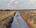
 Drain Nr Langham Bridge - geograph.org.uk - 1221087.jpg 3072 × 2304; 1,45 МБ
-
 Easton Farm Park, Suffolk - geograph.org.uk - 44338.jpg 640 × 480; 93 КБ
-

-
 Ectemnius sp. (lituratus^)Crabronidae - Flickr - gailhampshire.jpg 1284 × 1172; 249 КБ
-
 Edward Bliss's Mausoleum.jpg 1024 × 768; 354 КБ
-
 Electric fence (detail) - geograph.org.uk - 1516747.jpg 483 × 640; 183 КБ
-
 Eye Airfield aerial image - Suffolk UK - A (13855298135).jpg 3846 × 2592; 3,28 МБ
-
 Felixstowe Beach aerial image - Suffolk UK coast (14871964066).jpg 4723 × 3129; 4,61 МБ
-
 Field near Thetford - panoramio.jpg 3264 × 2448; 2,79 МБ
-
 Fishing boat at dry dock - geograph.org.uk - 659549.jpg 640 × 480; 61 КБ
-
 Footpath north of Cockfield Bird Farm - geograph.org.uk - 1451841.jpg 640 × 480; 112 КБ
-
 Ford - geograph.org.uk - 948691.jpg 3072 × 2304; 1,58 МБ
-
 Former pumping station by River Lark - geograph.org.uk - 1428785.jpg 640 × 427; 76 КБ
-
 Four birds on a fence - geograph.org.uk - 1020297.jpg 3072 × 2304; 1,66 МБ
-
 Framingham.png 145 × 156; 28 КБ
-
 Frederick George Cotman – An Ancient Fort in Suffolk.jpg 2974 × 2048; 793 КБ
-
 Free Range Chickens - geograph.org.uk - 1541986.jpg 640 × 480; 61 КБ
-
 Free range chickens at Maple Farm - geograph.org.uk - 1590781.jpg 640 × 428; 129 КБ
-
 Free Range Hens - geograph.org.uk - 973086.jpg 640 × 480; 78 КБ
-
 Frostenden Mound Satalite Image.png 1280 × 623; 432 КБ
-
 Furled mist-net - geograph.org.uk - 1329649.jpg 640 × 593; 180 КБ
-
 Fynn Valley Golf Driving Range - geograph.org.uk - 1128646.jpg 3072 × 2304; 1,3 МБ
-
 Graphomyia maculata.^ Male - Flickr - gailhampshire.jpg 984 × 853; 190 КБ
-
 Jack Snipe (13828491443).jpg 1528 × 1231; 478 КБ
-
 Justinian I Pent.jpg 1404 × 616; 511 КБ
-
 Lane near Thetford - panoramio (1).jpg 3264 × 2448; 2,76 МБ
-
 Lane near Thetford - panoramio.jpg 3264 × 2448; 2,8 МБ
-
 Lane off Saddlemakers Lane - geograph.org.uk - 1244266.jpg 3072 × 2304; 1,38 МБ
-

-
 Lay-by on A1071 Ipswich Road - geograph.org.uk - 1342222.jpg 640 × 480; 90 КБ
-
 Little Livermere, United Kingdom (Unsplash).jpg 5184 × 3251; 3,34 МБ
-
 Looking across Linden Farm - geograph.org.uk - 1063289.jpg 3072 × 2304; 1,42 МБ
-
 Looking north - geograph.org.uk - 850906.jpg 640 × 480; 57 КБ
-
 Marshland near Minsmere - geograph.org.uk - 775399.jpg 640 × 480; 52 КБ
-
 Mendham - Suffolk UK aerial image (8322643799).jpg 2001 × 1500; 550 КБ
-
 Methersgate Hall ha-ha - geograph.org.uk - 902406.jpg 640 × 427; 95 КБ
-
 Minsmere Cutting - geograph.org.uk - 1520787.jpg 480 × 640; 137 КБ
-
 Moated site and associated garden immediately east of The Hall.jpg 4032 × 3024; 4,61 МБ
-
 Monument Farm.jpg 5494 × 2167; 5,26 МБ
-
 Mystery balcony, A14 bridge - geograph.org.uk - 1401809.jpg 640 × 480; 96 КБ
-
 National Grid gas installation - geograph.org.uk - 1598771.jpg 640 × 427; 90 КБ
-
 New A14 towards Bury St Edmunds - geograph.org.uk - 1626123.jpg 640 × 459; 96 КБ
-
 New A14 towards Ipswich - geograph.org.uk - 1626132.jpg 640 × 445; 68 КБ
-
 North Wherstead marsh - geograph.org.uk - 1274314.jpg 640 × 480; 63 КБ
-
 Obverse of Anglo-Saxon coin brooch.jpg 781 × 789; 247 КБ
-
 Old props (4436411790).jpg 3872 × 2592; 3,85 МБ
-
 Old Winget - geograph.org.uk - 1367697.jpg 640 × 480; 82 КБ
-
 Passing Place - geograph.org.uk - 1173891.jpg 640 × 480; 63 КБ
-
 Paula White Illustration Illustrator.jpg 283 × 378; 97 КБ
-
 Pig field near Sudbourne - geograph.org.uk - 177642.jpg 640 × 480; 107 КБ
-
 Pile of sugar beet - geograph.org.uk - 1148161.jpg 640 × 427; 110 КБ
-
 Pine trees and bracken - geograph.org.uk - 1621979.jpg 640 × 465; 75 КБ
-
 Pines overlooking the Deben - geograph.org.uk - 816381.jpg 427 × 640; 76 КБ
-
 PlanNineWillVaughan3.jpg 286 × 439; 125 КБ
-
 Population of Suffolk.png 976 × 638; 23 КБ
-
-
 Reflections on the River Stour - geograph.org.uk - 780811.jpg 640 × 415; 41 КБ
-
 Restaurant at the Guiness Arms.jpg 2560 × 1440; 1,61 МБ
-
 Reverse of Anglo-Saxon coin brooch.jpg 872 × 1054; 311 КБ
-
 River Stour winter sunset cropped.jpg 2562 × 905; 709 КБ
-
 Road Junction, Cretingham - geograph.org.uk - 1120628.jpg 3072 × 2304; 1,4 МБ
-
 Road sign 'Kedington Hill' - geograph.org.uk - 1464343.jpg 640 × 480; 69 КБ
-
 Roadsign on Heveningham Long Lane - geograph.org.uk - 1316429.jpg 3072 × 2304; 1,38 МБ
-
 Rockstone Manor farm - geograph.org.uk - 771414.jpg 640 × 480; 86 КБ
-
 Round Bales - geograph.org.uk - 384134.jpg 640 × 480; 153 КБ
-
 Route of old road - geograph.org.uk - 1598768.jpg 640 × 427; 92 КБ
-
 Royal Hospital School aerial image - Suffolk UK e (12842884495).jpg 3821 × 2678; 3,25 МБ
-
 Rusty Winches - geograph.org.uk - 1082229.jpg 640 × 342; 76 КБ
-
 Sancroft Memorial Hall - geograph.org.uk - 1095838.jpg 3072 × 2304; 1,42 МБ
-
 Sancroft Memorial Hall - geograph.org.uk - 1095843.jpg 3072 × 2304; 1,48 МБ
-
 Seaweed-festooned old jetty - geograph.org.uk - 661371.jpg 480 × 640; 203 КБ
-
 Sky Dragon (7735238014).jpg 3872 × 1128; 1,52 МБ
-
 Smyth Seed Drill at Hornes Wood - geograph.org.uk - 1010954.jpg 3072 × 2304; 1,42 МБ
-
 Snape Maltings Suffolk (9092030069).jpg 3648 × 2736; 1,42 МБ
-
 Snape Maltings Suffolk (9092036847).jpg 2380 × 2380; 902 КБ
-
 Snowy field and woodland edge - geograph.org.uk - 1654617.jpg 640 × 480; 78 КБ
-
 South Suffolk Show (7195930096).jpg 1800 × 1196; 2,61 МБ
-
 South Suffolk Show (7195933822).jpg 1196 × 1800; 3,06 МБ
-
 South Suffolk Show (7195946766).jpg 1800 × 1196; 3,39 МБ
-
 South Suffolk Show (7195953434).jpg 1196 × 1800; 2,82 МБ
-
 South Western and North Eastern Chapels At Kirkley Cemetery 2.jpg 3008 × 2000; 3,12 МБ
-
 South Western and North Eastern Chapels At Kirkley Cemetery.jpg 3008 × 2000; 2,83 МБ
-
 South Western Chapel At Kirkley Cemetery.jpg 3008 × 2000; 3,19 МБ
-
 Sparrowhawk Road - geograph.org.uk - 1023631.jpg 3072 × 2304; 1,35 МБ
-
 Stanton Grundle.jpg 2112 × 2816; 7,39 МБ
-
 Steam powered hydraulic pump - geograph.org.uk - 1650157.jpg 640 × 438; 76 КБ
-
 Steps to mystery balcony, A14 bridge - geograph.org.uk - 1401840.jpg 480 × 640; 138 КБ
-
 Storey Bros Cattawade - boiler house - geograph.org.uk - 1650289.jpg 640 × 432; 71 КБ
-
 Storey Bros, Cattawade - power house - geograph.org.uk - 1650286.jpg 640 × 420; 63 КБ
-
 Straight Road - geograph.org.uk - 1311188.jpg 640 × 480; 125 КБ
-
 Straight Road - geograph.org.uk - 1325891.jpg 640 × 480; 130 КБ
-
 Straight Road - geograph.org.uk - 1530515.jpg 640 × 480; 121 КБ
-
 Strange rusted piece of machinery - geograph.org.uk - 542701.jpg 426 × 640; 158 КБ
-
 Stream at Little Bealings - geograph.org.uk - 1025963.jpg 3072 × 2304; 1,68 МБ
-
 Suffolk Glass art.jpg 1129 × 1141; 386 КБ
-
 Suffolk Landscape.jpg 210 × 165; 41 КБ
-
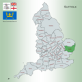 Suffolk Map.png 4967 × 4967; 4,31 МБ
-
 Sweffling Bowling Green - geograph.org.uk - 1063199.jpg 3072 × 2304; 1,4 МБ
-
 The Baker by the Sea.jpg 1063 × 1343; 1,48 МБ
-
 The Lychgate At Kirkley Cemetery.jpg 3008 × 2000; 2,4 МБ
-
 The Rear of the Fox and Goose Inn - geograph.org.uk - 1095884.jpg 3072 × 2304; 1,49 МБ
-

-
 The Sky Is The Limit (7817306004).jpg 3072 × 4608; 6,95 МБ
-
 The top of Rendham Road - geograph.org.uk - 1064409.jpg 3072 × 2304; 1,52 МБ
-
 Thetford Heath - geograph.org.uk - 1598766.jpg 640 × 427; 76 КБ
-
 Three Ash Farm - moated farm house - Flickr - John D Fielding.jpg 3984 × 2772; 4,8 МБ
-
 TowerSunset.jpg 3072 × 2304; 416 КБ
-

-
 Track repairs - geograph.org.uk - 570225.jpg 640 × 480; 55 КБ
-
 Trees and shrubs in Kings Forest, Suffolk.jpg 3456 × 4426; 12,29 МБ
-
 Trig Point at Hornes Wood - geograph.org.uk - 1010924.jpg 3072 × 2304; 1,66 МБ
-
 View from Coastal path - geograph.org.uk - 866892.jpg 640 × 480; 56 КБ
-
 Village Sign and Pump, Bredfield - geograph.org.uk - 1026390.jpg 3072 × 2304; 1,35 МБ
-
 Village Sign and Pump, Bredfield - geograph.org.uk - 1026395.jpg 3072 × 2304; 1,39 МБ
-
 Walpole Construction Site - geograph.org.uk - 979194.jpg 3072 × 2304; 1,43 МБ
-
 Webbs Tannery, Combs - geograph.org.uk - 721561.jpg 640 × 429; 71 КБ
-
 Webbs Tannery, Combs - geograph.org.uk - 721564.jpg 640 × 416; 102 КБ
-
 Webbs Tannery, Combs - geograph.org.uk - 721945.jpg 640 × 424; 57 КБ
-
 Webbs Tannery, Combs - geograph.org.uk - 722050.jpg 640 × 424; 114 КБ
-
 Wenhaston Lane - geograph.org.uk - 996289.jpg 3072 × 2304; 1,55 МБ
-
 West Row Stadium - geograph.org.uk - 216118.jpg 640 × 427; 61 КБ
-
 Window seen by Edusoli - panoramio.jpg 800 × 600; 134 КБ
-
 Winter Trees - geograph.org.uk - 1770869.jpg 1200 × 1600; 668 КБ
-
 Woodbridge Town Football Club Car Park - geograph.org.uk - 1008607.jpg 3072 × 2304; 1,43 МБ
-
 World's ugliest changing huts - geograph.org.uk - 1186603.jpg 640 × 480; 83 КБ
-
 Yarmouth Road - geograph.org.uk - 957914.jpg 3072 × 2304; 1,35 МБ
-
 Yellow Horned-poppy (166602445).jpg 1280 × 853; 101 КБ
-
 Yellow Horned-poppy (166602615).jpg 3456 × 2304; 2,63 МБ
-
 A clear shot - geograph.org.uk - 544251.jpg 640 × 480; 112 КБ
-
 A pair of revolving scarecrows - geograph.org.uk - 1413871.jpg 640 × 482; 133 КБ
-
 Abandoned oyster bed system - geograph.org.uk - 660980.jpg 640 × 480; 193 КБ
-
 Abandoned oyster beds - geograph.org.uk - 661249.jpg 640 × 190; 170 КБ
-
 Across to Felixstowe - geograph.org.uk - 1179276.jpg 640 × 426; 41 КБ
-
 Aim... Fire^ - geograph.org.uk - 544217.jpg 480 × 640; 103 КБ
-
 Aldeburgh from the old railway - geograph.org.uk - 1453307.jpg 640 × 426; 73 КБ
-
 Alongside Duke's Ride - geograph.org.uk - 741790.jpg 640 × 480; 94 КБ
-
 Beacon on the beach - geograph.org.uk - 758270.jpg 427 × 640; 59 КБ
-
 Beech pollards in Tunstall Forest - geograph.org.uk - 385302.jpg 640 × 480; 148 КБ
-
 Beet not bombs - geograph.org.uk - 571278.jpg 640 × 480; 90 КБ
-
 Boats overlooking the sea - geograph.org.uk - 1442456.jpg 640 × 410; 86 КБ
-

-
 Build Date - geograph.org.uk - 1422606.jpg 640 × 480; 100 КБ
-

-
 Carlton Marshes Nature Reserve - geograph.org.uk - 159341.jpg 640 × 480; 80 КБ
-
 Caught Short^ - geograph.org.uk - 544225.jpg 640 × 480; 101 КБ
-
 Christmas Fair - geograph.org.uk - 289424.jpg 480 × 640; 99 КБ
-
 Cliffs on the north Stour shore - geograph.org.uk - 661784.jpg 640 × 480; 140 КБ
-
 Coastguard station radio mast - geograph.org.uk - 661309.jpg 427 × 640; 99 КБ
-
 Converted Brewery, Oulton Broad - geograph.org.uk - 115620.jpg 640 × 480; 83 КБ
-
 Daisy path - geograph.org.uk - 765849.jpg 427 × 640; 96 КБ
-
 Defence against the erosion - geograph.org.uk - 678497.jpg 640 × 480; 93 КБ
-
 Derelict sluice structure - geograph.org.uk - 660924.jpg 480 × 640; 197 КБ
-
 Disused Cottages - geograph.org.uk - 544212.jpg 640 × 480; 94 КБ
-
 Drainage ditch at Fodderfen Drove - geograph.org.uk - 1428811.jpg 427 × 640; 113 КБ
-
 Drift Wood - geograph.org.uk - 393298.jpg 640 × 480; 141 КБ
-
 Earth embankment - geograph.org.uk - 577996.jpg 640 × 480; 75 КБ
-
 East Fen Fisheries, near Hockwold - geograph.org.uk - 521028.jpg 640 × 427; 76 КБ
-
 Entrance to Broom's Barn - geograph.org.uk - 35112.jpg 640 × 427; 93 КБ
-
 Entrance To Hall Farm - geograph.org.uk - 1421930.jpg 640 × 480; 77 КБ
-
 Entrance to Suffolk Yacht Harbour - geograph.org.uk - 281878.jpg 640 × 480; 69 КБ
-

-
 Exposed mud flats - geograph.org.uk - 661798.jpg 640 × 480; 109 КБ
-
 Fallen soldier by abandoned jetty - geograph.org.uk - 661372.jpg 480 × 640; 179 КБ
-
 Five Oaks - geograph.org.uk - 374027.jpg 640 × 480; 104 КБ
-
 Flooded marshland - geograph.org.uk - 664737.jpg 640 × 427; 132 КБ
-
 Flying the flag - geograph.org.uk - 544256.jpg 480 × 640; 113 КБ
-
 Former route of footpath near Bawdsey - geograph.org.uk - 415443.jpg 426 × 640; 140 КБ
-
 Fossditch - geograph.org.uk - 397423.jpg 640 × 480; 159 КБ
-
 Frozen Washlands, Lakenheath Fen - geograph.org.uk - 636883.jpg 480 × 640; 66 КБ
-
 Grassland near Cliff Farm - geograph.org.uk - 478625.jpg 640 × 426; 133 КБ
-
 Groyne and beacon - geograph.org.uk - 711818.jpg 640 × 423; 74 КБ
-
 Groyne E19 - geograph.org.uk - 711801.jpg 427 × 640; 105 КБ
-
 Groyne markers, Brackenbury Dip - geograph.org.uk - 721664.jpg 479 × 640; 60 КБ
-
 Gunhill Cliff Southwold - geograph.org.uk - 140920.jpg 640 × 395; 61 КБ
-
 Gunton Hall - geograph.org.uk - 524055.jpg 640 × 480; 61 КБ
-

-
 Hedge and footpath - geograph.org.uk - 1422126.jpg 640 × 467; 130 КБ
-
 Hide overlooking Benacre Broad - geograph.org.uk - 525895.jpg 640 × 480; 106 КБ
-
 Hockwold Washes - geograph.org.uk - 636682.jpg 640 × 427; 73 КБ
-
 Into The Sunset - geograph.org.uk - 407118.jpg 480 × 640; 36 КБ
-
 It's Getting Tight - geograph.org.uk - 311761.jpg 480 × 640; 144 КБ
-
 JCB - geograph.org.uk - 380567.jpg 640 × 480; 71 КБ
-
 Landing strip near Brockley Green - geograph.org.uk - 508291.jpg 640 × 427; 74 КБ
-
 Late afternoon sunshine - geograph.org.uk - 661728.jpg 480 × 640; 111 КБ
-
 Leaning pole of Friesland Farm - geograph.org.uk - 579535.jpg 480 × 640; 111 КБ
-
 Lightning-blasted tree - geograph.org.uk - 378951.jpg 640 × 480; 103 КБ
-
 Little Chef at Capel St Mary, Suffolk - geograph.org.uk - 249517.jpg 640 × 480; 65 КБ
-
 Local industry at Sweffling - geograph.org.uk - 184899.jpg 640 × 480; 81 КБ
-
 Looking across mudflats - geograph.org.uk - 661804.jpg 640 × 480; 108 КБ
-
 Marshland - geograph.org.uk - 495478.jpg 640 × 480; 90 КБ
-

-
 Mere at Minsmere - geograph.org.uk - 154726.jpg 480 × 640; 115 КБ
-
 Methersgate Quay, River Deben - geograph.org.uk - 478588.jpg 640 × 425; 83 КБ
-
 Military building in the forest - geograph.org.uk - 527931.jpg 640 × 480; 116 КБ
-
 Military training area, Scotch Green - geograph.org.uk - 201836.jpg 640 × 412; 84 КБ
.jpg)
.jpg)
.jpg)


._Crabronidae_-_Flickr_-_gailhampshire.jpg)
Crabronidae_-_Flickr_-_gailhampshire.jpg)

_-_geograph.org.uk_-_1516747.jpg)
.jpg)
.jpg)


.jpg)

.jpg)


.jpg)


.jpg)


.jpg)


.jpg)


.jpg)
.jpg)

.jpg)
.jpg)
.jpg)
.jpg)


.jpg)


.jpg)
.jpg)


_on_the_Deben_Estuary_-_geograph.org.uk_-_698251.jpg)


.jpg)