Category:Cumbria
(Redirected from Cumbria)
ceremonial county of England    | |||||
| Upload media | |||||
| Instance of |
| ||||
|---|---|---|---|---|---|
| Location |
| ||||
| Capital | |||||
| Legislative body |
| ||||
| Inception |
| ||||
| Highest point | |||||
| Population |
| ||||
| Area |
| ||||
| Replaces |
| ||||
| Different from | |||||
| official website | |||||
 | |||||


Subcategories
This category has the following 36 subcategories, out of 36 total.
!
- Featured pictures of Cumbria (10 F)
- Quality images of Cumbria (117 F)
- Valued images of Cumbria (6 F)
*
+
- Videos from Cumbria (1 F)
A
C
- Earthworks in Cumbria (5 F)
E
G
- Gallery pages of Cumbria (4 P)
- Graffiti in Cumbria (4 F)
H
I
L
M
N
O
P
S
T
V
- Vandalism in Cumbria (2 F)
W
- Wild camping in Cumbria (25 F)
Media in category "Cumbria"
The following 200 files are in this category, out of 778 total.
(previous page) (next page)-
 18.07.16 Eden Valley Goods Loop 90024+90019 (28526414042).jpg 4,694 × 3,352; 8.64 MB
-
 27.10.16 Keswick 06 (30616307105).jpg 4,928 × 2,776; 2.38 MB
-
 7.4.17 Hornby- to Keswick 051 (33517489840).jpg 5,472 × 3,648; 8.73 MB
-
 7.4.17 Hornby- to Keswick 052 (33517506330).jpg 5,472 × 3,648; 7.96 MB
-
 7.4.17 Hornby- to Keswick 053 (33517520360).jpg 5,472 × 3,648; 8.15 MB
-
 7.4.17 Hornby- to Keswick 096 (33089956363).jpg 3,648 × 5,472; 5.19 MB
-
 7.4.17 Hornby- to Keswick 097 (33089976833).jpg 5,472 × 3,648; 9.33 MB
-
 7.4.17 Hornby- to Keswick 098 (33059600104).jpg 5,472 × 3,648; 9.84 MB
-
 7.4.17 Hornby- to Keswick 099 (33746446702).jpg 5,472 × 3,648; 4.7 MB
-
 7.4.17 Hornby- to Keswick 100 (33746457432).jpg 5,472 × 3,648; 4.73 MB
-
 7.4.17 Hornby- to Keswick 101 (33059630704).jpg 5,472 × 3,648; 5.49 MB
-
 7.4.17 Hornby- to Keswick 102 (33773554511).jpg 5,472 × 3,648; 5.35 MB
-
 7.4.17 Hornby- to Keswick 103 (33902996845).jpg 5,472 × 3,648; 7.71 MB
-
 7.4.17 Hornby- to Keswick 104 (33059660834).jpg 5,472 × 3,648; 3.39 MB
-
 7.4.17 Hornby- to Keswick 105 (33059672054).jpg 5,472 × 3,648; 4.67 MB
-
 7.4.17 Hornby- to Keswick 106 (33090053433).jpg 5,472 × 3,648; 4.54 MB
-
 7.4.17 Hornby- to Keswick 107 (33773599771).jpg 5,472 × 3,648; 3.27 MB
-
 7.4.17 Hornby- to Keswick 108 (33773609491).jpg 5,472 × 3,648; 4.33 MB
-
 7.4.17 Hornby- to Keswick 109 (33903042925).jpg 5,472 × 3,648; 4.54 MB
-
 7.4.17 Hornby- to Keswick 110 (33090091553).jpg 5,472 × 3,648; 6.22 MB
-
 7.4.17 Hornby- to Keswick 111 (33090099473).jpg 5,472 × 3,648; 4.42 MB
-
 7.4.17 Hornby- to Keswick 112 (33773656691).jpg 5,472 × 3,648; 8.22 MB
-
 7.4.17 Hornby- to Keswick 113 (33746576472).jpg 5,472 × 3,648; 7.08 MB
-
 7.4.17 Hornby- to Keswick 114 (33518127160).jpg 5,472 × 3,648; 6.55 MB
-
 7.4.17 Hornby- to Keswick 115 (33862167256).jpg 5,472 × 3,648; 7.95 MB
-
 7.4.17 Hornby- to Keswick 116 (33518151750).jpg 5,472 × 3,648; 7.67 MB
-
 7.4.17 Hornby- to Keswick 119 (33903161885).jpg 5,472 × 3,648; 8.42 MB
-
 7.4.17 Hornby- to Keswick 120 (33862222606).jpg 5,472 × 3,648; 3.18 MB
-
 7.4.17 Hornby- to Keswick 121 (33862229646).jpg 5,472 × 3,648; 3.04 MB
-
 7.4.17 Hornby- to Keswick 122 (33773800151).jpg 5,472 × 3,648; 7.08 MB
-
 A Cumberland Bus service - Flickr - sludgegulper.jpg 2,100 × 3,114; 580 KB
-
 A little stream we walked past - panoramio.jpg 2,000 × 1,502; 2.64 MB
-
 A typical farmyard, Castlerigg nr. Keswick. - panoramio.jpg 4,114 × 2,563; 4.5 MB
-
 A View of Lower Rydal Falls, Cumbria MET DP822607.jpg 1,379 × 1,932; 2.24 MB
-
 A wee dram (31545273220).jpg 2,848 × 4,288; 3.85 MB
-
 ADL Enviro400-bodied Scania.jpg 4,608 × 3,456; 2.53 MB
-
 Alexander Dennis Enviro300.jpg 4,096 × 2,304; 1.05 MB
-
 Along the Path (31014072682).jpg 4,000 × 2,666; 2.64 MB
-
 And then there were three!.jpg 4,288 × 2,848; 2.82 MB
-
 Bat Cave - mine tunnel.jpg 4,288 × 2,848; 4.01 MB
-
 Belah Viaduct, Stainmore, South Durham & Lancashire Union Railway.jpg 2,094 × 1,156; 813 KB
-
 Binsey sunset from the Saharan dust clouds.jpg 1,024 × 768; 74 KB
-
 Blackburn Fingerpost A593 - panoramio.jpg 1,728 × 3,072; 1.64 MB
-
 Blea Tarn, Ambleside, United Kingdom (Unsplash).jpg 7,360 × 4,912; 21.19 MB
-
 Blencathra to Coniston (26964438842).jpg 6,803 × 2,404; 3.13 MB
-
 Blown over tree - panoramio.jpg 2,000 × 1,502; 2.2 MB
-
 Boats for Hire - panoramio.jpg 5,162 × 2,723; 4.56 MB
-
 Boredale hause.jpg 780 × 520; 100 KB
-
 Borrowdale - panoramio (1).jpg 3,000 × 1,930; 4.21 MB
-
 Borrowdale - panoramio.jpg 4,288 × 2,848; 8.87 MB
-
 Borrowdale Dec2012 - panoramio.jpg 4,277 × 2,221; 7.88 MB
-
 Cattle grid - geograph.org.uk - 939943.jpg 640 × 480; 75 KB
-
 Climbing way.jpg 4,288 × 2,848; 3.88 MB
-
 Cowder than a nuns chuff.jpg 4,288 × 2,848; 6.12 MB
-
 Crepidotus calolepis 280170.jpg 3,264 × 2,448; 4.06 MB
-
 Cumbria - Duddon Sands (geograph 5257558).jpg 6,000 × 4,000; 7.15 MB
-
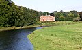 Cumbria-02-Fluss-Schloss-2009-gje.jpg 2,883 × 1,756; 2.05 MB
-
 Cumbria-04-Rinder-Schafe-2009-gje.jpg 2,778 × 1,780; 1.93 MB
-
 Cumbria-06-Rinder-Schafe-2009-gje.jpg 3,072 × 2,048; 2.98 MB
-
 Cumbria-08-Hofgut-2009-gje.jpg 3,072 × 2,048; 2.98 MB
-
 Cumbria-10-Hofgut-2009-gje.jpg 3,072 × 2,048; 2.59 MB
-
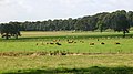 Cumbria-12-Rinder-Schafe-2009-gje.jpg 2,985 × 1,662; 1.85 MB
-
 Cumbria-14-Rinder-Schafe-2009-gje.jpg 3,072 × 2,048; 2.37 MB
-
 Cumbria-16-Hofgut-2009-gje.jpg 3,072 × 2,048; 2.86 MB
-
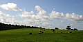 Cumbria-18-Rinder-2009-gje.jpg 3,054 × 1,561; 1.24 MB
-
 Cumbria-20-Rinder-2009-gje.jpg 3,063 × 1,846; 1.76 MB
-
 Cumbria-22-Centurion Inn-2009-gje.jpg 3,072 × 2,048; 2.13 MB
-
 Cumbria-24-Centurion Inn-2009-gje.jpg 3,027 × 1,932; 1.52 MB
-
 Cumbria-26-Gebuesch-2009-gje.jpg 3,072 × 2,048; 4.03 MB
-
 Cumbria-28-Weiden und Baeume-2009-gje.jpg 3,072 × 2,048; 2.51 MB
-
 Cumbria-30-Weide-2009-gje.jpg 3,060 × 1,843; 2.18 MB
-
 Cumbria-32-Bauernhof-2009-gje.jpg 3,072 × 2,048; 2.22 MB
-
 Cumbria-34-Ruine-2009-gje.jpg 3,066 × 1,824; 1.76 MB
-
 Cumbria-36-Rinder-2009-gje.jpg 2,739 × 1,648; 1.83 MB
-
 Cumbria-38-Rinder-2009-gje.jpg 2,436 × 1,732; 1.94 MB
-
 Cumbria-40-Rinder-2009-gje.jpg 2,703 × 1,741; 2.01 MB
-
 Cumbria-42-Rinder-2009-gje.jpg 2,796 × 1,570; 1.92 MB
-
 Cumbria-44-Rinder-2009-gje.jpg 2,841 × 1,642; 1.68 MB
-
 Cumbria. Fingerpost and flooding sign, Easton. Sept 1994 (3473361007).jpg 1,770 × 1,194; 139 KB
-
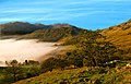
 Cumbrian Fells (9920102824).jpg 4,608 × 2,592; 3.18 MB
-
 Curly Mullein.JPG 1,080 × 1,920; 497 KB
-
 Disused mine on Cross fell - panoramio.jpg 3,264 × 2,448; 2.21 MB
-
 Do people really still use these?.jpg 3,004 × 2,179; 1.84 MB
-
 Dock Tran - panoramio.jpg 3,000 × 2,250; 6.53 MB
-
 Duddon Mosses National Nature Reserve.jpg 640 × 427; 160 KB
-
 Eden District, UK - panoramio (2).jpg 3,264 × 2,448; 2.52 MB
-
 Evidence of the hushes.jpg 4,288 × 2,848; 5.37 MB
-
 Extreme Mountain Biking.jpg 4,288 × 2,848; 5.65 MB
-
 Falling Tree. - panoramio.jpg 3,000 × 1,993; 6.44 MB
-
 Far End Bungalow - panoramio.jpg 3,072 × 1,728; 2.1 MB
-
 Farm at Gilts - geograph.org.uk - 1734354.jpg 2,848 × 2,136; 1.53 MB
-
 Farm buildings at Longdyke Farm - geograph.org.uk - 1237897.jpg 640 × 480; 75 KB
-
 FarmConnistonRH.JPG 697 × 523; 218 KB
-
 Farmland at Parton - geograph.org.uk - 960518.jpg 640 × 426; 63 KB
-
 Farmland near Hungerhill - geograph.org.uk - 1516385.jpg 640 × 480; 69 KB
-
 Farmland, Raby - geograph.org.uk - 901010.jpg 640 × 480; 114 KB
-
 Fell House, Barbondale - geograph.org.uk - 1285246.jpg 640 × 480; 96 KB
-
 Fell ponies - geograph.org.uk - 554207.jpg 640 × 480; 162 KB
-
 Fingerpost at Watendlath - panoramio.jpg 3,072 × 1,728; 2.43 MB
-
 Fishing chalet in Baron Wood - geograph.org.uk - 1769423.jpg 2,880 × 2,160; 1.49 MB
-
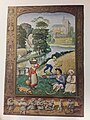 Flemish Monthly Occupations.jpg 2,448 × 3,264; 2.45 MB
-
 Footpath below Tarnmonath Fell - geograph.org.uk - 1775484.jpg 640 × 480; 93 KB
-
 Forestry on Cockley Moor - geograph.org.uk - 960575.jpg 640 × 480; 79 KB
-
 Freedom - mine entrance.jpg 4,120 × 2,737; 3.5 MB
-
 From Castlerigg with Derwentwater glimpsed in the distance. - panoramio.jpg 2,048 × 1,536; 1.65 MB
-
 From Helvellyn - panoramio.jpg 3,000 × 1,887; 4.18 MB
-
 Furness Fell with Far End Cottages - panoramio.jpg 3,072 × 1,728; 2.38 MB
-
 Furness Fells.jpg 600 × 355; 44 KB
-
 Gate and Fence Whitecombe Head - geograph.org.uk - 798006.jpg 640 × 480; 62 KB
-
 Goat's Beck and the bridge - geograph.org.uk - 1372974.jpg 2,112 × 2,816; 5.49 MB
-
 Gods Country (38667337505).jpg 4,288 × 2,848; 3.02 MB
-
 Gods Country - 27787207939.jpg 4,288 × 2,848; 4.81 MB
-
 Grass Dyke and the Solway Marshes - geograph.org.uk - 933240.jpg 640 × 480; 81 KB
-
 Groove Beck - geograph.org.uk - 1258679.jpg 640 × 391; 92 KB
-
 Hanging Walls of Mark Anthony, Kirkland - geograph.org.uk - 243021.jpg 640 × 468; 137 KB
-
 Hart Side - summit.JPG 1,024 × 768; 415 KB
-
 Haystacks by Safc cal - panoramio.jpg 1,280 × 960; 318 KB
-
 HDR rainbow (10419418375).jpg 3,872 × 2,592; 9.57 MB
-
 HDR rainbow (8380537437).jpg 3,872 × 2,592; 10.06 MB
-
 Head of Moasdale - geograph.org.uk - 1220032.jpg 640 × 427; 172 KB
-
 High Cup Nick.jpg 9,293 × 3,496; 32.27 MB
-
 High Plains - geograph.org.uk - 1635560.jpg 640 × 427; 80 KB
-
 High Rigg.jpg 4,608 × 3,456; 5 MB
-
 HighRigg StJohnsVale.JPG 2,560 × 1,920; 1,008 KB
-
 HLM - 30168920174.jpg 4,288 × 2,848; 3.54 MB
-
 HLM - 30499638120.jpg 4,288 × 2,848; 3.81 MB
-
 HLM - 30683636332.jpg 4,288 × 2,848; 3.66 MB
-
 HLM - 30683654712.jpg 8,153 × 2,535; 5.28 MB
-
 HLM - 30711970941.jpg 4,288 × 2,848; 3.73 MB
-
 HLM - 30711991931.jpg 4,288 × 2,848; 4.26 MB
-
 Hogweed near River Petteril. - geograph.org.uk - 848111.jpg 640 × 480; 84 KB
-
 Holiday caravan - geograph.org.uk - 227257.jpg 640 × 480; 185 KB
-
 Homesoffootballambleside.jpg 512 × 345; 58 KB
-
 Icy Gill - geograph.org.uk - 1690818.jpg 640 × 480; 100 KB
-
 In Lingy Hut - geograph.org.uk - 652930.jpg 640 × 480; 94 KB
-
 ITV Border.svg 130 × 38; 4 KB
-
 Jacques at mine entrance.jpg 1,940 × 1,314; 1.17 MB
-
 Jihadi Duerden.jpg 2,848 × 4,288; 4.63 MB
-
 Kentsbank7.jpg 600 × 450; 116 KB
-
 King Water near Snowden Close, Cumberland - geograph-1847566.jpg 600 × 450; 384 KB
-
 Kirk Fell - panoramio.jpg 4,000 × 3,000; 4.19 MB
-
 Krankenhaus Day 3 Hike (48712173553).jpg 2,048 × 1,365; 835 KB
-
 Krankenhaus Day 3 Hike (48712173698).jpg 2,048 × 1,365; 692 KB
-
 Krankenhaus Day 3 Hike (48712173758).jpg 2,048 × 1,365; 900 KB
-
 Krankenhaus Day 3 Hike (48712173878).jpg 2,048 × 1,365; 251 KB
-
 Krankenhaus Day 3 Hike (48712504301).jpg 2,048 × 1,365; 535 KB
-
 Krankenhaus Day 3 Hike (48712504316).jpg 2,048 × 1,152; 606 KB
-
 Krankenhaus Day 3 Hike (48712504331).jpg 2,048 × 1,366; 850 KB
-
 Krankenhaus Day 3 Hike (48712504336).jpg 2,048 × 1,365; 787 KB
-
 Krankenhaus Day 3 Hike (48712504456).jpg 2,048 × 1,365; 740 KB
-
 Krankenhaus Day 3 Hike (48712504536).jpg 2,048 × 1,365; 836 KB
-
 Krankenhaus Day 3 Hike (48712504931).jpg 2,048 × 1,365; 691 KB
-
 Krankenhaus Day 3 Hike (48712504946).jpg 2,048 × 1,152; 650 KB
-
 Krankenhaus Day 3 Hike (48712669297).jpg 2,048 × 1,152; 442 KB
-
 Krankenhaus Day 3 Hike (48712669537).jpg 2,048 × 1,152; 846 KB
-
 Krankenhaus Day 3 Hike (48712669672).jpg 2,048 × 1,152; 717 KB
-
 Krankenhaus Day 3 Hike (48712669797).jpg 2,048 × 454; 325 KB
-
 Krankenhaus Day 3 Hike (48712670252).jpg 2,048 × 1,152; 544 KB
-
 Lake District -panoramio (547).jpg 3,072 × 2,304; 2.77 MB
-
 Lambfoot Dub - geograph.org.uk - 918534.jpg 427 × 640; 72 KB
-
 Landslide Scar - geograph.org.uk - 1329521.jpg 640 × 430; 148 KB
-
-
 Langstrath Drumlins - geograph.org.uk - 1514522.jpg 640 × 459; 94 KB
-
 Langstrath Valley (15032265261).jpg 2,400 × 1,600; 4.72 MB
-
 Lank rigg from flat fell.jpg 1,024 × 577; 351 KB
-
 Lawsons Haulage - Mountain Transformer.jpg 960 × 720; 48 KB
-
 Lighting Up Time (30684200531).jpg 3,080 × 5,472; 8.81 MB
-
 Lightning Strike - geograph.org.uk - 1009175.jpg 640 × 480; 116 KB
-

-
 Limestone pavement on Orton Moor - geograph.org.uk - 541371.jpg 640 × 480; 120 KB
-
 Little Cascade (15032156601).jpg 1,600 × 2,400; 7.57 MB
-
 Little Pond (14848609030).jpg 2,400 × 1,600; 5.69 MB
-
 Little Town - geograph.org.uk - 780782.jpg 640 × 426; 83 KB
-
 Looking Back (15034891682).jpg 2,400 × 1,600; 5.43 MB
-
-
 Looking towards Johnson House - geograph.org.uk - 264070.jpg 640 × 480; 88 KB
-
 Looking up to Great End (15032222661).jpg 2,400 × 1,600; 5.69 MB
-
 Looking West from The Fairy Steps - geograph.org.uk - 328905.jpg 640 × 480; 105 KB
-
 Low Birker Pool - geograph.org.uk - 1142121.jpg 640 × 480; 80 KB
-
 Lune Source - geograph.org.uk - 726372.jpg 640 × 480; 163 KB
-
 Main stage at Kendal Calling 2010.jpg 3,872 × 2,592; 2.55 MB
-
 Man On The Edge (30634926182).jpg 5,176 × 2,772; 8.97 MB
-
 Manjushri Kadampa Meditation Centre.jpg 4,311 × 2,063; 7.02 MB
-
 MarchesiniaMRT1.jpg 3,265 × 2,445; 2.82 MB
-
 MarchesiniaMRT2.jpg 2,117 × 1,513; 1.1 MB
-
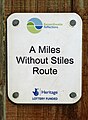 Miles Without Stiles (15132805891).jpg 2,248 × 3,065; 4.21 MB
-
 Milk Churn Stand - geograph.org.uk - 188531.jpg 640 × 480; 157 KB
-

-
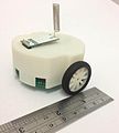 Mona robot designed for Perpetual Robotic Swarm.jpg 2,352 × 2,610; 396 KB
-
 Moricambe Bay.jpg 640 × 415; 67 KB
-
 Near Mawbray Yard, Cumbria.JPG 3,264 × 2,448; 1.72 MB
-
 Nent Valley - geograph.org.uk - 1193916.jpg 640 × 480; 110 KB
-
 New Road - geograph.org.uk - 1046406.jpg 640 × 480; 64 KB
-
 Newlands Valley - geograph.org.uk - 204050.jpg 640 × 480; 63 KB
-
 Newshield Moss - geograph.org.uk - 1738708.jpg 2,298 × 2,271; 680 KB
-

-

-
 Old and new - geograph.org.uk - 559054.jpg 640 × 480; 125 KB
-
 Old barn in Wythop Mill - geograph.org.uk - 957117.jpg 426 × 640; 96 KB
-
 Old Fold - geograph.org.uk - 1692289.jpg 640 × 480; 102 KB
.jpg)
.jpg)
.jpg)
.jpg)
.jpg)
.jpg)
.jpg)
.jpg)
.jpg)
.jpg)
.jpg)
.jpg)
.jpg)
.jpg)
.jpg)
.jpg)
.jpg)
.jpg)
.jpg)
.jpg)
.jpg)
.jpg)
.jpg)
.jpg)
.jpg)
.jpg)
.jpg)
.jpg)
.jpg)
.jpg)


.jpg)


.jpg)


.jpg)


.jpg)


.jpg)


.jpg)
.jpg)


.jpg)


.jpg)


.jpg)
.jpg)


.jpg)
.jpg)
.jpg)
.jpg)
.jpg)
.jpg)
.jpg)
.jpg)
.jpg)
.jpg)
.jpg)
.jpg)
.jpg)
.jpg)
.jpg)
.jpg)
.jpg)


.jpg)

.jpg)


.jpg)
.jpg)

.jpg)


.jpg)


.jpg)


.jpg)


.jpg)
.jpg)