Category:Somerset
(Redirigit dempuèi Somerset)

comté d'Angleterre     | |||||
| Mandar de mèdias | |||||
| Natura de l'element |
| ||||
|---|---|---|---|---|---|
| Partida de | |||||
| Emplaçament |
| ||||
| Capitala | |||||
| Populacion |
| ||||
| Superfícia |
| ||||
| De pas confondre amb | |||||
| Reputat identic a | Somerset (comtat històric d'Anglaterra, comtat ceremonial, 1844) | ||||
| site oficial | |||||
 | |||||


Soscategorias
Aquesta categoria dispausa de 49 soscategorias, sus un total de 49.
*
- Featured pictures of Somerset (13 F)
- Valued images of Somerset (9 F)
- Videos from Somerset (6 F)
A
C
- Campsites in Somerset (12 F)
E
G
- Gallery pages of Somerset (9 P)
H
I
L
M
N
O
P
- Picnic tables in Somerset (3 F)
Q
- Quality images of Somerset (446 F)
S
T
- Taunton Stop Line (7 F)
U
V
W
Articles dins la categoria « Somerset »
Aquesta categoria conten unicament la pagina seguenta.
Fichièrs multimèdia dins la categoria « Somerset »
Los 200 fichièrs seguents figuran dins aquesta categoria, sus una soma de 395.
(pagina precedenta) (pagina seguenta)-

-
 "Cathedral Mog", Louis the Wells Cathedral cat, October 23 2007.jpg 1 024 × 683 ; 1,01 Mo
-
 "Lamp Shades" - geograph.org.uk - 128059.jpg 640 × 426 ; 63 Ko
-
 112pyramid.jpeg 335 × 272 ; 22 Ko
-
 2011 - Track through Asham Wood (geograph 2357700).jpg 3 438 × 2 830 ; 4,94 Mo
-
 A disc brooch.jpg 2 945 × 1 500 ; 345 Ko
-
 A horse pasture near Charlton Farm, Somerset.jpg 640 × 459 ; 89 Ko
-
 A single tree in a field - geograph.org.uk - 1656865.jpg 640 × 430 ; 98 Ko
-

-
 A367 at the top of Nettlebridge Hill - geograph.org.uk - 1217297.jpg 640 × 484 ; 200 Ko
-
 A368 looking west - geograph.org.uk - 1222714.jpg 640 × 500 ; 121 Ko
-
 A37 looking south, top of Hursley Hill - geograph.org.uk - 1243016.jpg 640 × 488 ; 151 Ko
-
 A39 at the foot of Pen Hill - geograph.org.uk - 1256265.jpg 640 × 488 ; 168 Ko
-
 A39 at the junction with Priddy Road - geograph.org.uk - 1257392.jpg 640 × 501 ; 155 Ko
-
 AbbotsfieldView.jpg 1 620 × 1 080 ; 489 Ko
-
 After rain sunshine from Silcombe Farm.jpg 4 151 × 2 767 ; 6,44 Mo
-
 All Saints Church, Kingweston, Somerset.jpg 3 456 × 4 608 ; 7,54 Mo
-
 Approaching Pool Farm - geograph.org.uk - 1313206.jpg 640 × 480 ; 116 Ko
-
 Ashcombe House Somerset.jpg 640 × 426 ; 117 Ko
-
AUD-20170331-WA0001(1) 01.opus 54 s ; 125 Ko
-
AUD-20170331-WA0001(1) 02.opus 2 min 0 s ; 281 Ko
-
 Autumn in the Great Wood (3030595444).jpg 3 888 × 2 592 ; 7,93 Mo
-
 Avon and Somerset UK PCC election 2024.svg 814 × 697 ; 597 Ko
-
 Balt Moor Wall (geograph 4848574).jpg 1 024 × 768 ; 214 Ko
-
 Bannerdown Common.jpg 640 × 427 ; 34 Ko
-
 Barns Batch Spinney.jpg 3 264 × 2 448 ; 1,39 Mo
-
 Beech avenue - geograph.org.uk - 983572.jpg 480 × 640 ; 123 Ko
-
 Berrow Wreck June 2006.jpg 4 368 × 2 912 ; 6,14 Mo
-
 Birds Nest @ Swallet Farm (1151911651).jpg 1 280 × 851 ; 265 Ko
-
 Birds Nest @ Swallet Farm (1152756714).jpg 1 280 × 851 ; 203 Ko
-
 Black Bryony (Tamus communis L.) - geograph.org.uk - 1016589.jpg 480 × 640 ; 79 Ko
-
 Bourne SSSI, Avon.jpg 3 264 × 2 448 ; 1,45 Mo
-
 Bradleycrossfarm.jpg 640 × 426 ; 120 Ko
-
 Bruton Church Bruton Somerset.JPG 2 048 × 1 536 ; 687 Ko
-
 Bucolic England - geograph.org.uk - 884443.jpg 640 × 480 ; 80 Ko
-
 Bull's Lane approaching the A359 - geograph.org.uk - 1239475.jpg 640 × 484 ; 116 Ko
-
 Bull's Quarries Road - geograph.org.uk - 1159274.jpg 640 × 496 ; 245 Ko
-
 Burn completed successfully - geograph.org.uk - 927050.jpg 640 × 480 ; 92 Ko
-
 Burnham and Berrow Golf Course (geograph 2675482).jpg 640 × 480 ; 141 Ko
-
 Byway at Stallenge Farm - geograph.org.uk - 1593562.jpg 484 × 640 ; 146 Ko
-
 Byway entering woodland, Ash Priors Common - geograph.org.uk - 1593639.jpg 640 × 480 ; 145 Ko
-
 Byway heading north off Queen Charlton Lane - geograph.org.uk - 1270430.jpg 640 × 487 ; 170 Ko
-
 Byway near Farthing's Farm - geograph.org.uk - 1714115.jpg 640 × 480 ; 123 Ko
-
 Byway near Long Cross - geograph.org.uk - 1278199.jpg 640 × 467 ; 107 Ko
-
 Byway open to all traffic - geograph.org.uk - 1287798.jpg 640 × 487 ; 173 Ko
-
 Byway south of Englishcombe - geograph.org.uk - 1565807.jpg 640 × 480 ; 133 Ko
-
 Byway to Ash Priors (2) - geograph.org.uk - 1593613.jpg 640 × 496 ; 111 Ko
-
 Byway to Ash Priors - geograph.org.uk - 1593593.jpg 640 × 453 ; 88 Ko
-
 Byway to Faulkland Lane - geograph.org.uk - 1288548.jpg 640 × 482 ; 206 Ko
-
 Byway to Quakinghouse Lane - geograph.org.uk - 1714143.jpg 640 × 465 ; 81 Ko
-
 Byway to Tithill - geograph.org.uk - 1593621.jpg 640 × 480 ; 116 Ko
-
 Byway, Chelston Gardens - geograph.org.uk - 1365875.jpg 480 × 640 ; 145 Ko
-
 Byway, Lydeard St Lawrence - geograph.org.uk - 1638291.jpg 640 × 480 ; 143 Ko
-
 Byway, Treble's Holford - geograph.org.uk - 1279911.jpg 640 × 480 ; 152 Ko
-
 Car Park - geograph.org.uk - 1272376.jpg 640 × 428 ; 77 Ko
-
 Cathedral Church of Saint Andrew, Wells, Somerset.jpg 5 254 × 4 000 ; 1,62 Mo
-
 Charlton Viaduct - geograph.org.uk - 1528114.jpg 640 × 385 ; 55 Ko
-
 Chesterblade, postbox No. BA4 13 - geograph.org.uk - 1317727.jpg 640 × 480 ; 101 Ko
-
 Chesterblade, the chapel roof - geograph.org.uk - 1317762.jpg 480 × 640 ; 74 Ko
-
 Chew Hundred.jpg 590 × 404 ; 79 Ko
-
 Chilton Trinity College.JPG 4 752 × 3 168 ; 5,24 Mo
-
 Church at Heathfield (geograph 3487231).jpg 2 592 × 3 888 ; 3,12 Mo
-
 Churchill Community School.JPG 4 752 × 3 168 ; 7,3 Mo
-
 Cider-thatchers.jpg 960 × 1 280 ; 311 Ko
-
 Claydown Covert - geograph.org.uk - 943884.jpg 640 × 480 ; 77 Ko
-
 Cliff Quary Compton Martin.jpg 3 264 × 2 448 ; 1,49 Mo
-
 Cloford Quarry 01.JPG 3 456 × 2 304 ; 1,71 Mo
-
 Cloford Quarry 02.JPG 3 456 × 2 304 ; 1,45 Mo
-

-
 Common Lungwort, West Bagborough - geograph.org.uk - 1187604.jpg 640 × 480 ; 114 Ko
-
 Corner of Boozer Pit and Middlefield Lane, spring.jpg 640 × 478 ; 149 Ko
-
 Country house-Somerset-The Loft - panoramio.jpg 4 765 × 1 807 ; 1,91 Mo
-
 Country Side-Somerset - panoramio.jpg 3 200 × 2 368 ; 1,87 Mo
-
 Creech Hill (geograph 1793954).jpg 640 × 480 ; 234 Ko
-
 Crossroads at the top of Nettlebridge Hill - geograph.org.uk - 1250641.jpg 640 × 522 ; 276 Ko
-
 D&R Canal - Blackwells Mill Road - panoramio.jpg 2 816 × 2 112 ; 2,65 Mo
-
 Dawn over round hill - geograph.org.uk - 1502477.jpg 480 × 640 ; 122 Ko
-
 Dead Womans Ditch (geograph 2880447).jpg 1 280 × 856 ; 246 Ko
-
 Dead Woman’s Ditch.jpg 4 031 × 2 267 ; 3,21 Mo
-
 Derelict Van (2518387681).jpg 2 592 × 3 888 ; 4,37 Mo
-
 Derelict Van (2519205634).jpg 2 592 × 3 888 ; 4,79 Mo
-
 Distant Somerset Coast.jpg 5 184 × 3 456 ; 5,24 Mo
-
 Down End Castle.JPG 3 456 × 2 304 ; 1,94 Mo
-
En-uk-Somerset.ogg 1,9 s ; 29 Ko
-
 Enclosure at Sweetworthy (geograph 2787355).jpg 640 × 428 ; 238 Ko
-
 Entrance to Burrow Hill Cider (36242597355).jpg 5 472 × 3 648 ; 8,45 Mo
-
 Entrance, Chilton Trinity School (geograph 4425359).jpg 1 024 × 782 ; 148 Ko
-
 Evening sunshine on pasture Charlock (Field Mustard), Somerset.jpg 640 × 480 ; 86 Ko
-
 Farmland at dusk (sheep grazing on the Mendip Plateau, Somerset).jpg 640 × 480 ; 39 Ko
-
 Farmland near Prestleigh, Somerset - geograph.org.uk - 1272299.jpg 640 × 428 ; 74 Ko
-
 Farmland on Claydowns Hill - geograph.org.uk - 943872.jpg 640 × 480 ; 88 Ko
-
 Ferns in the dappled shade of Moor Wood - geograph.org.uk - 1719559.jpg 640 × 480 ; 160 Ko
-

-
 Field beans, Chickwell Farm - geograph.org.uk - 1287010.jpg 481 × 640 ; 200 Ko
-
 Fields and a gate - geograph.org.uk - 1306928.jpg 640 × 480 ; 176 Ko
-
 Footpath from Kit Hill - geograph.org.uk - 1016657.jpg 640 × 480 ; 63 Ko
-
 Footpath to Cotlake Hill - geograph.org.uk - 1298323.jpg 640 × 427 ; 116 Ko
-
 Footpath to Stoke Woods - geograph.org.uk - 1230513.jpg 640 × 427 ; 59 Ko
-
 Footpaths in Langford Heathfield (geograph 3840054).jpg 2 592 × 3 888 ; 4,92 Mo
-
 From under the Railway Bridge - geograph.org.uk - 884485.jpg 640 × 480 ; 63 Ko
-
 Fun garden ornament (8603072214).jpg 3 000 × 4 000 ; 3,52 Mo
-
 Fussellsiornworks.jpg 480 × 640 ; 141 Ko
-
 Garden-Somerset - panoramio.jpg 3 000 × 2 220 ; 1,43 Mo
-
 Gateway to roam - geograph.org.uk - 1637640.jpg 640 × 426 ; 104 Ko
-
 Greylake.jpg 640 × 480 ; 98 Ko
-
 Hadspen House entrance.jpg 640 × 480 ; 125 Ko
-
 Ham, a horse is reflected - geograph.org.uk - 1132792.jpg 640 × 480 ; 70 Ko
-
 Hogweed - skeletal remains - geograph.org.uk - 1016796.jpg 640 × 480 ; 82 Ko
-
 Holly Lane SSSI.jpg 3 264 × 2 448 ; 1,38 Mo
-
 Hope there is nothing behind me, take the shot quick. (3591924685).jpg 3 495 × 1 263 ; 990 Ko
-
 Horsey A39.jpg 640 × 480 ; 205 Ko
-
 Horsington Turnpike Gate - geograph.org.uk - 398406.jpg 480 × 640 ; 153 Ko
-
 How Not to Abseil (1152755778).jpg 851 × 1 280 ; 384 Ko
-
 How proud (2175262166).jpg 2 816 × 1 880 ; 3,06 Mo
-
 Huish Road - geograph.org.uk - 1014535.jpg 640 × 515 ; 152 Ko
-
 I believe^ - geograph.org.uk - 1305755.jpg 427 × 640 ; 97 Ko
-
 In Bury Wood (geograph 3333835).jpg 1 024 × 768 ; 255 Ko
-
 Iris foetidissima L. - geograph.org.uk - 1069701.jpg 640 × 480 ; 70 Ko
-
 Jack fell down - geograph.org.uk - 862161.jpg 640 × 501 ; 120 Ko
-
-
 Junction of tracks on North Hill - geograph.org.uk - 1719673.jpg 640 × 480 ; 91 Ko
-
 Justinian half follis.jpg 2 728 × 1 363 ; 2,03 Mo
-
 Kidners Cottage, East View with the Quantocks in the background.jpg 3 687 × 2 074 ; 1 012 Ko
-
 King's Castle Hillfort earthwork.JPG 3 456 × 2 304 ; 2,3 Mo
-
 Kit Hill - geograph.org.uk - 1016672.jpg 640 × 480 ; 73 Ko
-
 Lake at Barwick House - geograph.org.uk - 1768159.jpg 640 × 480 ; 125 Ko
-
 Lake at the Halfway House - geograph.org.uk - 1702594.jpg 640 × 480 ; 72 Ko
-
 Glowing lights in the sunlight - geograph.org.uk - 1026203.jpg 640 × 480 ; 88 Ko
-
 Lance Corporal Harry van Tromp (7194897132).jpg 581 × 800 ; 59 Ko
-
 Langmead (geograph 5051921).jpg 1 024 × 829 ; 198 Ko
-
 Laycock railway cutting.jpg 640 × 480 ; 151 Ko
-
 Lester Piggott the Fastswine - geograph.org.uk - 978480.jpg 480 × 640 ; 64 Ko
-
-
 Logs for the Winter - geograph.org.uk - 966333.jpg 640 × 480 ; 131 Ko
-
 Long Dole woods.jpg 3 264 × 2 448 ; 1,23 Mo
-
 Longforth 12 july 2013 7.jpg 1 232 × 2 048 ; 810 Ko
-
 M5 southbound towards Court Hill (geograph 3638224).jpg 2 424 × 1 485 ; 1,78 Mo
-
 Maes Down.jpg 640 × 480 ; 79 Ko
-
 Marker post of the Bath Turnpike Trust - geograph.org.uk - 798229.jpg 640 × 521 ; 110 Ko
-
 Max Bog.jpg 3 264 × 2 448 ; 1,44 Mo
-
 Meadow near Roebuck Farm (geograph 1900630).jpg 640 × 480 ; 118 Ko
-

-

-
 Medieval gold finger ring (3).jpg 2 048 × 1 536 ; 850 Ko
-
 Memento from Farming past - geograph.org.uk - 890883.jpg 640 × 480 ; 115 Ko
-
 Men at work across the valley - geograph.org.uk - 1477768.jpg 640 × 427 ; 67 Ko
-
 Middle Barn roofing tiles - geograph.org.uk - 932101.jpg 547 × 640 ; 153 Ko
-
 Milk churn stand - geograph.org.uk - 997445.jpg 640 × 480 ; 123 Ko
-
 Mill Lane - geograph.org.uk - 1126094.jpg 640 × 502 ; 273 Ko
-
 Mill Lane - geograph.org.uk - 1651180.jpg 640 × 430 ; 160 Ko
-
 Mill Lane - geograph.org.uk - 1651237.jpg 640 × 430 ; 156 Ko
-
 Mill Lane - geograph.org.uk - 1651285.jpg 640 × 430 ; 164 Ko
-
 Mill Lane - geograph.org.uk - 1651288.jpg 640 × 430 ; 161 Ko
-
 Mill Lane - geograph.org.uk - 1651369.jpg 640 × 430 ; 151 Ko
-
 Minor Road, Sigwells (geograph 2276465).jpg 640 × 480 ; 79 Ko
-
 Model Farm from Maes Knoll - geograph.org.uk - 1360939.jpg 640 × 499 ; 147 Ko
-
 More of Priddy - geograph.org.uk - 1257801.jpg 640 × 475 ; 152 Ko
-
 New gate to footpath west from Killam's Lane at Haygrass, Somerset.jpg 640 × 480 ; 125 Ko
-
 Nightingale Valley.jpg 3 264 × 2 448 ; 1,3 Mo
-
 Norton Malreward.jpg 3 888 × 2 592 ; 6,14 Mo
-
 Nsomersetlevels.JPG 2 848 × 2 136 ; 1,34 Mo
-
 Oak Tree Arena, Edithmead (geograph 3854484).jpg 1 024 × 768 ; 143 Ko
-
 Oak tree by the footpath - geograph.org.uk - 1652049.jpg 640 × 430 ; 109 Ko
-
 Oak tree by the lane - geograph.org.uk - 1609362.jpg 640 × 480 ; 111 Ko
-
 Observation hive - geograph.org.uk - 1466717.jpg 640 × 480 ; 113 Ko
-
 One of the Five Arches - geograph.org.uk - 1528142.jpg 640 × 480 ; 115 Ko
-
 Open day at the thatcher's yard - geograph.org.uk - 107626.jpg 640 × 456 ; 193 Ko
-
 Orchard Portman by Pieter Van der Aa c1707.jpg 650 × 514 ; 136 Ko
-
 Otterford Lakes Nature Reserve.jpg 640 × 480 ; 76 Ko
-

-
 Park Farm from the footpath to West Buckland church, Somerset.jpg 640 × 424 ; 88 Ko
-
 Park Lane - geograph.org.uk - 1219419.jpg 427 × 640 ; 156 Ko
-
 Park Lane - geograph.org.uk - 1463551.jpg 640 × 480 ; 124 Ko
-
 Park Lane - geograph.org.uk - 1463900.jpg 480 × 640 ; 108 Ko
-
 Path curving over West Hill - geograph.org.uk - 1054447.jpg 640 × 480 ; 115 Ko
-
 Path to Bishops Lydeard - geograph.org.uk - 1593514.jpg 640 × 480 ; 93 Ko
-
 Path to Mells Stream - geograph.org.uk - 1636972.jpg 426 × 640 ; 112 Ko
-
 Pearl Lowe at home in Somerset.jpg 2 688 × 4 032 ; 11,2 Mo
-
 Perrys Cider Mill.jpg 640 × 480 ; 82 Ko
-
 Pinkery Youth Hostel (geograph 3675539).jpg 1 024 × 768 ; 176 Ko
-
 Plainsfield Camp.jpg 640 × 480 ; 108 Ko
-
 Plaque - Thurlbear school - geograph.org.uk - 1230606.jpg 640 × 454 ; 124 Ko
-
 Plaster's Green Meadows.jpg 3 264 × 2 448 ; 1,38 Mo
-
 Ploughed field near Murder Combe - geograph.org.uk - 1583418.jpg 640 × 479 ; 197 Ko
-
 Pollarded willows near Coat - geograph.org.uk - 1261508.jpg 640 × 480 ; 73 Ko
-
 Polsham Railway Station, Somerset (geograph 2035560).jpg 1 460 × 1 228 ; 525 Ko
-
 Poly tunnels on the lane to West Newton - geograph.org.uk - 1335909.jpg 640 × 480 ; 147 Ko
-
 Polytunnels, East Nynehead - geograph.org.uk - 1384848.jpg 640 × 480 ; 92 Ko
-
 Pony in the mist - geograph.org.uk - 1656023.jpg 640 × 430 ; 97 Ko
-
 Pratten Bowls Club, Westfield Trading Estate, Somerset.JPG 4 608 × 3 456 ; 3,46 Mo
-
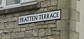 Pratten Terrace street sign, on former site of Prattens factory.JPG 701 × 333 ; 78 Ko
-
 Prattens Carnival Club 1988 no 2.jpg 561 × 315 ; 37 Ko
-
 Prattens Carnival Club 1988 no 3.jpg 960 × 539 ; 64 Ko
-
 Prattens Carnival Club float 1988.jpg 960 × 539 ; 69 Ko
-
 Private Strip - geograph.org.uk - 93986.jpg 640 × 480 ; 43 Ko
-
 Purn Hill.jpg 3 264 × 2 448 ; 1,39 Mo
-
 Pyra99.jpeg 362 × 393 ; 25 Ko
-
 Rapeseed Field (33496955840).jpg 4 000 × 6 000 ; 15,82 Mo
-
 Ready for sowing - geograph.org.uk - 1636657.jpg 640 × 184 ; 34 Ko
-

.jpg)


.jpg)


.jpg)

.jpg)


.jpg)
.jpg)
_-_geograph.org.uk_-_1016589.jpg)


.jpg)


_-_geograph.org.uk_-_1593613.jpg)


.jpg)


.jpg)


.jpg)

.jpg)
.jpg)


.jpg)
.jpg)
.jpg)
,_Somerset.jpg)
.jpg)


.jpg)


.jpg)

.jpg)


.jpg)
.jpg)


.jpg)


.jpg)
.jpg)


.jpg)


.jpg)
,_Higher_Marsh_-_geograph.org.uk_-_1379145.jpg)

.jpg)


.jpg)


.jpg)


,_view_from_West_Buckland_church.jpg)


.jpg)


.jpg)


.jpg)
_-_geograph.org.uk_-_863159.jpg)
.jpg)