Category:Aberdeenshire
Aller à la navigation
Aller à la recherche

Council areas (municipalités) d’Écosse : Aberdeen · Aberdeenshire · Angus · Argyll and Bute · Clackmannanshire · Dumfries and Galloway · Dundee · East Ayrshire · East Dunbartonshire · East Lothian · East Renfrewshire · Edinburgh · Falkirk · Fife · Glasgow · Highland · Inverclyde · Midlothian · Moray · North Ayrshire · North Lanarkshire · Outer Hebrides · Orkney Islands · Perth and Kinross · Renfrewshire · Scottish Borders · Shetland Islands · South Ayrshire · South Lanarkshire · Stirling · West Dunbartonshire · West Lothian
Comtés traditionnels (shires) d’Écosse : Aberdeenshire · Angus · Argyll · Ayrshire · Banffshire · Berwickshire · Buteshire · Caithness · Clackmannanshire · Cromartyshire · Dumbartonshire · Dumfriesshire · East Lothian · Fife · Inverness-shire · Kincardineshire · Kinross-shire · Kirkcudbrightshire · Lanarkshire · Midlothian · Moray · Nairnshire · Orkney Islands · Peeblesshire · Perthshire · Renfrewshire · Ross-shire · Roxburghshire · Selkirkshire · Shetland Islands · Stirlingshire · Sutherland · West Lothian · Wigtownshire
région (council area) d'Écosse    | |||||
| Téléverser des médias | |||||
| Nature de l’élément | |||||
|---|---|---|---|---|---|
| Partie de |
| ||||
| Lieu | Écosse | ||||
| Capitale | |||||
| Population |
| ||||
| Superficie |
| ||||
| À ne pas confondre avec | |||||
| site officiel | |||||
 | |||||

- Images relating to Aberdeenshire the county in Scotland.
Sous-catégories
Cette catégorie comprend 30 sous-catégories, dont les 30 ci-dessous.
A
C
- Cromar (2 F)
E
G
H
I
N
- Night in Aberdeenshire (2 F)
P
- Panoramics of Aberdeenshire (9 F)
R
S
- Sculptures in Aberdeenshire (21 F)
- Snow in Aberdeenshire (192 F)
T
V
- Views of Aberdeenshire (63 F)
Média dans la catégorie « Aberdeenshire »
Cette catégorie comprend 964 fichiers, dont les 200 ci-dessous.
(page précédente) (page suivante)-
 A fading memory, but one we have to remember (Explored 15-07-23) - Flickr - jkiscycling.jpg 7 952 × 5 304 ; 22,38 Mio
-
 A Flock of Gulls - geograph.org.uk - 1945413.jpg 640 × 427 ; 256 kio
-
 A Fold Hinge - geograph.org.uk - 6280024.jpg 640 × 427 ; 447 kio
-
 A northerly view from Rorandle - geograph.org.uk - 1047368.jpg 640 × 480 ; 67 kio
-
 A steep beach, Craigewan - geograph.org.uk - 6577296.jpg 1 024 × 768 ; 154 kio
-
 A view east - geograph.org.uk - 412079.jpg 640 × 480 ; 85 kio
-
 A view of the coast from Warburton - geograph.org.uk - 635089.jpg 640 × 480 ; 106 kio
-
 Abandoned - geograph.org.uk - 6562164.jpg 1 024 × 683 ; 79 kio
-
 Aberdeenshire roundel.svg 2 253 × 1 788 ; 34 kio
-
 Aberdeenshire shortlisted design A.svg 3 000 × 1 800 ; 122 kio
-
 Aberdeenshire shortlisted design B.svg 2 953 × 1 772 ; 31 kio
-
 Aberdeenshire shortlisted design D.svg 620 × 372 ; 44 kio
-
 Aberdeenshire shortlisted design E.svg 3 000 × 1 800 ; 217 kio
-
 ABERDEENSHIRE.png 70 × 67 ; 12 kio
-
 Aberdeenshire (IA aberdeenshire01mack).pdf 677 × 1 041, 220 pages ; 9,8 Mio
-
 Above the Tide - geograph.org.uk - 6280021.jpg 640 × 427 ; 393 kio
-
 Active dune system, Foveran Links - geograph.org.uk - 5642668.jpg 1 024 × 683 ; 221 kio
-
 An unhewn granite boulder - geograph.org.uk - 867734.jpg 480 × 640 ; 100 kio
-
 Another rabbit-trap - geograph.org.uk - 879944.jpg 640 × 480 ; 128 kio
-
 Are they Folds^ - geograph.org.uk - 6279649.jpg 498 × 640 ; 448 kio
-
 Artloch Trout Fishery. - geograph.org.uk - 266841.jpg 640 × 426 ; 82 kio
-
 Back Bar Shoreline - geograph.org.uk - 2117547.jpg 3 072 × 2 304 ; 670 kio
-
 Backhill of Oldwhat - geograph.org.uk - 1298953.jpg 640 × 427 ; 263 kio
-
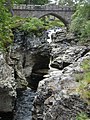
 Balmoor Bridge.jpg 3 488 × 2 616 ; 4,32 Mio
-
 Balvenie Stone - geograph.org.uk - 1204281.jpg 640 × 480 ; 156 kio
-
 Balvenie Stone - geograph.org.uk - 1204282.jpg 640 × 480 ; 139 kio
-
 Beacon on Cairnbulg Briggs - geograph.org.uk - 2635736.jpg 2 048 × 1 536 ; 1,31 Mio
-
 Benholm Burn - geograph.org.uk - 5818365.jpg 4 272 × 2 848 ; 2,54 Mio
-
 Benholn Estuary - geograph.org.uk - 5818378.jpg 4 272 × 2 848 ; 2,86 Mio
-
 Beside the Hide - geograph.org.uk - 6019719.jpg 640 × 427 ; 435 kio
-
 Big sea off Hackley Bay - geograph.org.uk - 6565818.jpg 1 024 × 683 ; 140 kio
-
 Bird rock by Needle Eye, Forvie - geograph.org.uk - 6565460.jpg 1 024 × 683 ; 355 kio
-
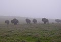 Bison enclosure - geograph.org.uk - 1398582.jpg 640 × 440 ; 35 kio
-
 Black Water meets the sea - geograph.org.uk - 6578343.jpg 1 024 × 578 ; 194 kio
-
 Bogton tractor - panoramio.jpg 1 600 × 1 200 ; 260 kio
-
 Boundary Marker - geograph.org.uk - 1286399.jpg 640 × 480 ; 158 kio
-
 Boundary stone - geograph.org.uk - 1323914.jpg 640 × 480 ; 160 kio
-
 Boundary stone - geograph.org.uk - 1323918.jpg 640 × 480 ; 150 kio
-
 Breaking Waves - geograph.org.uk - 1945604.jpg 640 × 414 ; 254 kio
-
 Broad Haven, north of Collieston - geograph.org.uk - 6503914.jpg 1 799 × 1 199 ; 349 kio
-
 Brown boat in tarlair.jpg 861 × 444 ; 37 kio
-
 Burn outflow, Balmedie - geograph.org.uk - 5643581.jpg 1 024 × 683 ; 255 kio
-
 Burn, Drums Links - geograph.org.uk - 5642689.jpg 1 024 × 683 ; 258 kio
-
 Cairnbulg Point - geograph.org.uk - 6334680.jpg 4 000 × 3 000 ; 3,25 Mio
-
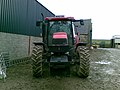
 Case tractor - panoramio.jpg 1 600 × 1 200 ; 687 kio
-
 Causewayend from the air - geograph.org.uk - 5264863.jpg 1 024 × 682 ; 172 kio
-
 Clean camping at Hackley Bay - geograph.org.uk - 6565813.jpg 1 024 × 683 ; 219 kio
-
 Cleary Wood sawmill - geograph.org.uk - 1615018.jpg 640 × 480 ; 60 kio
-
 Cliff Face - geograph.org.uk - 1946859.jpg 640 × 424 ; 258 kio
-
 Cliffs near Bruce's Haven - geograph.org.uk - 1946141.jpg 640 × 427 ; 257 kio
-
 Cliffs near Portsoy - geograph.org.uk - 1998082.jpg 640 × 410 ; 257 kio
-
 Clifftop path at Hackley Bay - geograph.org.uk - 6323822.jpg 6 000 × 4 000 ; 5,82 Mio
-
 Cloudy evening (29054264577).jpg 5 175 × 2 911 ; 7,25 Mio
-
 Coastline towards East Head - geograph.org.uk - 6465142.jpg 1 600 × 1 067 ; 371 kio
-
 Coat of arms of Aberdeenshire County Council 1890-1975.svg 346 × 408 ; 703 kio
-
 Colliding waves at Scotstown Head - geograph.org.uk - 2399973.jpg 3 648 × 2 736 ; 4,74 Mio
-
 Colorful evening (43943101082).jpg 6 490 × 4 327 ; 23,08 Mio
-
 Conglomerate Ridge - geograph.org.uk - 4442768.jpg 640 × 413 ; 441 kio
-
 Conglomerate rocks at Todhead point - geograph.org.uk - 6107828.jpg 6 000 × 4 000 ; 5,78 Mio
-
 Corbie Holes - geograph.org.uk - 6588927.jpg 5 031 × 3 353 ; 1,47 Mio
-
 Cormorant at Sunnyside - geograph.org.uk - 6509184.jpg 1 024 × 768 ; 115 kio
-
 Cottage by Mill of Towie - geograph.org.uk - 1750783.jpg 640 × 480 ; 78 kio
-
 Coull Morthouse - geograph.org.uk - 867717.jpg 640 × 480 ; 99 kio
-
 Cove near The Veshels - geograph.org.uk - 1946838.jpg 640 × 437 ; 286 kio
-
 Crags, Forvie - geograph.org.uk - 6565349.jpg 1 024 × 683 ; 256 kio
-
 Craigendarroch - viewpoint indicator plate - geograph.org.uk - 847869.jpg 640 × 415 ; 106 kio
-
 Craigeven Bay - geograph.org.uk - 6282814.jpg 640 × 320 ; 248 kio
-
 Craigeven Bay - geograph.org.uk - 6282849.jpg 640 × 420 ; 348 kio
-
 Craiglethy - geograph.org.uk - 6218775.jpg 640 × 427 ; 82 kio
-
 Crovie by Cabro Aviation.jpg 4 000 × 2 250 ; 3,42 Mio
-
 Crovie, Aberdeenshire, Moray Firth, Scotland.jpg 2 000 × 1 500 ; 2,5 Mio
-
 Cruden Bay, Stranded moon jelly - geograph.org.uk - 2003243.jpg 1 800 × 1 576 ; 2,95 Mio
-
 Culblean battle memorial stone.jpg 415 × 640 ; 60 kio
-
 Dandelion 'clock' - geograph.org.uk - 821846.jpg 480 × 640 ; 145 kio
-
 Death at Lazyfold farm - geograph.org.uk - 451354.jpg 480 × 640 ; 186 kio
-
 Deer Jump - geograph.org.uk - 1340730.jpg 640 × 480 ; 112 kio
-
 Deserted beach at Menie - geograph.org.uk - 6426606.jpg 6 000 × 4 000 ; 6,7 Mio
-
 Devil's Study - geograph.org.uk - 1945419.jpg 640 × 417 ; 257 kio
-
 Diney Burn Waterfall - geograph.org.uk - 5773886.jpg 2 432 × 4 320 ; 5,13 Mio
-
 Dinnet Oakwood 1.jpg 320 × 240 ; 25 kio
-
 Doonies Point - geograph.org.uk - 6279552.jpg 1 280 × 348 ; 448 kio
-
 Downie Bay - geograph.org.uk - 6561785.jpg 1 024 × 683 ; 793 kio
-
 Drumblade School, i went there when is was about 7 or 8 years old - panoramio.jpg 3 888 × 2 592 ; 3,94 Mio
-
 Drums Links - geograph.org.uk - 5642703.jpg 1 024 × 683 ; 112 kio
-
 Duff's Hill Forest - geograph.org.uk - 141584.jpg 640 × 475 ; 88 kio
-
 Entrance to an industrial storage facility - geograph.org.uk - 1615035.jpg 640 × 480 ; 98 kio
-
 Entrance to vault in Leochel old churchyard, Aberdeenshire. Wellcome L0012143EA.jpg 2 848 × 4 022 ; 4,82 Mio
-
 Erlegte Hirsche (Schottland).JPG 2 046 × 1 364 ; 832 kio
-
 Esk Estuary - geograph.org.uk - 5129730.jpg 4 272 × 2 848 ; 2,72 Mio
-
 Excelsior of Laurwig - geograph.org.uk - 2310705.jpg 3 648 × 2 736 ; 3,58 Mio
-
 Excelsior of Laurwig, Rattray - geograph.org.uk - 6578791.jpg 1 024 × 578 ; 133 kio
-
 Fahrt von Aberdeen zu Dunnotar Castle (38584800162).jpg 1 920 × 1 275 ; 443 kio
-
 Fahrt von Aberdeen zu Dunnotar Castle (38584881412).jpg 1 920 × 1 275 ; 450 kio
-
 Fahrt von Aberdeen zu Dunnotar Castle (38584881602).jpg 1 920 × 1 275 ; 357 kio
-
 Fahrt von Aberdeen zu Dunnotar Castle (38584881892).jpg 1 920 × 1 275 ; 325 kio
-
 Feed Trough near Hill of Blackford - geograph.org.uk - 1126510.jpg 640 × 480 ; 74 kio
-
 Fence posts, Johnshaven - geograph.org.uk - 2139466.jpg 3 648 × 2 736 ; 2,35 Mio
-
 Feughside Caravan Park - geograph.org.uk - 1382846.jpg 640 × 432 ; 79 kio
-
 Finella Mouth - geograph.org.uk - 5334002.jpg 4 272 × 2 848 ; 3,24 Mio
-
 Fishing boat (43078094685).jpg 6 637 × 4 425 ; 12,13 Mio
-
 Fishing hut on the River Bogie. - geograph.org.uk - 266878.jpg 640 × 426 ; 96 kio
-
 Fishing, River Ythan - geograph.org.uk - 6565289.jpg 1 024 × 683 ; 198 kio
-
 Five Mile Filling Station - geograph.org.uk - 1061248.jpg 640 × 417 ; 55 kio
-
 Flag of Aberdeenshire.svg 3 000 × 1 800 ; 19 kio
-
 Flowers 2008 February - Trip to Castle Gight (4001012146).jpg 2 272 × 1 704 ; 1,58 Mio
-
 Fold Hinge - geograph.org.uk - 2541955.jpg 640 × 427 ; 457 kio
-
 Fold in Cliffs near Bruce's Haven - geograph.org.uk - 1946173.jpg 640 × 446 ; 244 kio
-
 Folding the other way - geograph.org.uk - 2541962.jpg 640 × 402 ; 406 kio
-
 Foreshore with Seaweed - geograph.org.uk - 4442720.jpg 640 × 427 ; 498 kio
-
 Foreshore, Johnshaven - geograph.org.uk - 2139473.jpg 3 648 × 2 736 ; 2,39 Mio
-
 Formartine and Buchan Way (geograph 2733434).jpg 640 × 480 ; 88 kio
-
 Fornety - geograph.org.uk - 1174117.jpg 640 × 480 ; 257 kio
-
 Forvie, the view along the beach to Rockend - geograph.org.uk - 2342097.jpg 1 389 × 1 600 ; 2,44 Mio
-
 Fowls Heugh - geograph.org.uk - 6210583.jpg 640 × 427 ; 130 kio
-
 Fowlsheugh - geograph.org.uk - 6210598.jpg 640 × 427 ; 149 kio
-
 Fowlsheugh RSPB reserve - geograph.org.uk - 6454736.jpg 1 600 × 1 067 ; 406 kio
-
 Fraserburgh Bay from the air - geograph.org.uk - 5264690.jpg 1 024 × 682 ; 119 kio
-
 Freshwater Pools - geograph.org.uk - 1945609.jpg 427 × 640 ; 276 kio
-
 From Findon Quarry towards Red Mantle - geograph.org.uk - 5773875.jpg 4 320 × 2 432 ; 4,51 Mio
-
 Frosty gate - geograph.org.uk - 99621.jpg 640 × 427 ; 112 kio
-
 Garron Point - geograph.org.uk - 6282877.jpg 640 × 424 ; 318 kio
-
 Gazebo at Findrack - geograph.org.uk - 1389161.jpg 640 × 480 ; 111 kio
-
 Gazebo in Walla Kirkyard - geograph.org.uk - 1215291.jpg 640 × 480 ; 116 kio
-
 Geo at Garron Point - geograph.org.uk - 6210710.jpg 640 × 427 ; 112 kio
-
 Giant sand dune, Foveran Links - geograph.org.uk - 6411664.jpg 3 958 × 3 065 ; 3,03 Mio
-
 Gillybrands - geograph.org.uk - 1742980.jpg 640 × 427 ; 237 kio
-
 Glas-allt-Shiel, Glen Muick - geograph.org.uk - 927578 (cropped).jpg 466 × 330 ; 63 kio
-
 Glas-allt-Shiel, Glen Muick - geograph.org.uk - 927578.jpg 466 × 640 ; 131 kio
-
 Glas-allt-Shiel, Loch Muich - geograph.org.uk - 927575.jpg 640 × 429 ; 125 kio
-
 Go-cart Track - geograph.org.uk - 998124.jpg 640 × 427 ; 259 kio
-
 Graded Bedding - geograph.org.uk - 6280000.jpg 640 × 427 ; 505 kio
-
 Green Craig and The Veshels - geograph.org.uk - 1946365.jpg 640 × 425 ; 242 kio
-
 Green Kaims and Strabackie - geograph.org.uk - 6137410.jpg 640 × 427 ; 297 kio
-
 Grey seals - geograph.org.uk - 2894220.jpg 1 600 × 1 060 ; 492 kio
-
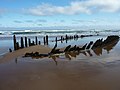
 Guillemot and wreck, Rattray - geograph.org.uk - 6578365.jpg 1 024 × 578 ; 132 kio
-
 Ha-ha at Morven Lodge - geograph.org.uk - 849886.jpg 640 × 427 ; 107 kio
-
 Hackley - geograph.org.uk - 6565804.jpg 1 024 × 768 ; 256 kio
-
 Hackley Bay - geograph.org.uk - 6323810.jpg 5 995 × 3 897 ; 5,42 Mio
-
 Hackley Bay - geograph.org.uk - 6565465.jpg 1 024 × 683 ; 250 kio
-
 Hackley Bay - geograph.org.uk - 6566885.jpg 1 024 × 683 ; 265 kio
-
 Hackley Bay - geograph.org.uk - 6566887.jpg 1 024 × 683 ; 227 kio
-
 Hackley Bay - geograph.org.uk - 6588945.jpg 4 585 × 3 057 ; 2,54 Mio
-
 Hackley Bay near Collieston - geograph.org.uk - 6503909.jpg 1 799 × 1 199 ; 213 kio
-
 Hackley Head - geograph.org.uk - 6588979.jpg 5 183 × 3 455 ; 3,29 Mio
-
 Hackley Stacks - geograph.org.uk - 6588961.jpg 5 184 × 3 456 ; 4,29 Mio
-
 Haughs Bridge - geograph.org.uk - 5818374.jpg 4 272 × 2 848 ; 3,34 Mio
-
 Heading south on Foveran Links - geograph.org.uk - 6412260.jpg 6 000 × 4 000 ; 5,86 Mio
-
 Heavy seas at Scotstown Head - geograph.org.uk - 2399955.jpg 3 648 × 2 736 ; 4,15 Mio
-
 Herring Gulls (Larus argentatus) - geograph.org.uk - 1946319.jpg 640 × 442 ; 257 kio
-
 Herring Gulls (Larus argentatus) - geograph.org.uk - 1946924.jpg 640 × 405 ; 285 kio
-
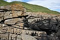
 Highland Boundary Fault - geograph.org.uk - 6282829.jpg 640 × 388 ; 284 kio
-
 Highland Boundary Fault - geograph.org.uk - 6282859.jpg 640 × 422 ; 307 kio
-
 Icicles Glistening at a Window - geograph.org.uk - 1724350.jpg 3 488 × 2 616 ; 4,25 Mio
-

-
 Inside the N part of the Long Gallery - geograph.org.uk - 6419161.jpg 1 024 × 768 ; 163 kio
-
 Intertidal Rocks - geograph.org.uk - 6137836.jpg 640 × 427 ; 365 kio
-
 Intertidal Rocks - geograph.org.uk - 6137843.jpg 640 × 427 ; 420 kio
-
 Intertidal Rocks - geograph.org.uk - 6137854.jpg 640 × 427 ; 379 kio
-
 Intertidal Rocks - geograph.org.uk - 6137857.jpg 640 × 427 ; 362 kio
-
 Jamie Fleeman plaque.JPG 1 632 × 1 224 ; 1,45 Mio
-
 Kayakers inside the Long Gallery - geograph.org.uk - 6342108.jpg 1 024 × 768 ; 76 kio
-
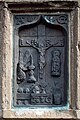 Kinkell Crucifixion.jpg 3 155 × 4 748 ; 6,79 Mio
-
 Kinkell Plaque Drawing 1832.jpg 612 × 759 ; 1,01 Mio
-
 Kirkton Head - geograph.org.uk - 6576361.jpg 1 024 × 576 ; 297 kio
-
 Kissing Gate, Johnshaven to Gourdon - geograph.org.uk - 2139533.jpg 3 648 × 2 736 ; 2,39 Mio
-
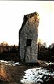
 Lang Stane of Auquhollie.jpg 480 × 640 ; 86 kio
-
 Level crossing (disused), Johnshaven to Gourdon - geograph.org.uk - 2140239.jpg 3 648 × 2 736 ; 2,38 Mio
-
 Lightning Strike - geograph.org.uk - 1800155.jpg 479 × 639 ; 138 kio
-
 Linn of Dee Bridge - panoramio.jpg 2 112 × 2 816 ; 1,45 Mio
-
 Lion's Head - geograph.org.uk - 6209951.jpg 640 × 360 ; 90 kio
-
 Long Craig, Rattray Head - geograph.org.uk - 6579053.jpg 1 024 × 576 ; 124 kio
-
 Long Shadows - geograph.org.uk - 6019755.jpg 640 × 392 ; 358 kio
-
 Looking at Dunnimaol from under Maiden Kaim - geograph.org.uk - 6418516.jpg 1 024 × 768 ; 103 kio
-
 Looking northwards to Broad Haven and beyond... - geograph.org.uk - 6551243.jpg 6 000 × 4 000 ; 4,41 Mio
-
 Louden Woods Stone Circle - panoramio.jpg 32 444 × 2 484 ; 24,25 Mio
-
 Loups bridge - panoramio.jpg 4 506 × 2 912 ; 7,15 Mio
-
 Luxury Car^ - geograph.org.uk - 440192.jpg 480 × 640 ; 151 kio
-
 Maiden Kaim 'on the nose' - geograph.org.uk - 6418564.jpg 1 024 × 768 ; 200 kio
-
 Mass Launch - geograph.org.uk - 5132381.jpg 4 113 × 2 743 ; 2,03 Mio
-
 Mathers Beach - geograph.org.uk - 5333921.jpg 4 272 × 2 848 ; 2,2 Mio
-
 May Craig - geograph.org.uk - 1361495.jpg 640 × 450 ; 288 kio
-
 Meikle Pap from Cac Carn Beag summit - panoramio.jpg 2 048 × 1 536 ; 1,84 Mio
-

-
 Menie Burn - geograph.org.uk - 5642975.jpg 1 024 × 683 ; 294 kio
-
 Menie links, Flotsam - geograph.org.uk - 820310.jpg 640 × 426 ; 558 kio
-
 Mid to upper reach of Ythan Estuary looking west, Aberdeenshire.jpg 2 816 × 2 112 ; 2,89 Mio
-
 Mill of Woodston, St Cyrus, Montrose DD10 0DQ, UK - panoramio (1).jpg 1 600 × 1 200 ; 526 kio
-
 Mill of Woodston, St Cyrus, Montrose DD10 0DQ, UK - panoramio (2).jpg 1 600 × 1 200 ; 544 kio
-
 Mill of Woodston, St Cyrus, Montrose DD10 0DQ, UK - panoramio.jpg 1 200 × 1 600 ; 645 kio
-
 Minnonie - geograph.org.uk - 560617.jpg 640 × 427 ; 253 kio
-
 Mole Fortress near Newburgh - geograph.org.uk - 704665 (without artefact).jpg 640 × 480 ; 476 kio
-
 Mole Fortress near Newburgh - geograph.org.uk - 704665.jpg 640 × 480 ; 532 kio
-
 More Head - geograph.org.uk - 4020510.jpg 640 × 417 ; 350 kio
-
 More sea-spray at Scotstown Head - geograph.org.uk - 2400010.jpg 3 648 × 2 736 ; 4,36 Mio
-
 Morgan's Hill - geograph.org.uk - 1001817.jpg 640 × 427 ; 38 kio
-
 Mortsafe used as a cattle trough, Aberdeenshire. Wellcome L0012140EB.jpg 4 028 × 2 806 ; 4,89 Mio
-
 Moss of Crombie - geograph.org.uk - 474176.jpg 640 × 427 ; 248 kio
-
 Mount Keen - panoramio.jpg 5 312 × 2 988 ; 5,71 Mio
-
 Mountain Bike Track - geograph.org.uk - 477848.jpg 640 × 478 ; 93 kio
-
 Mouth of the Water of Philorth - geograph.org.uk - 6583195.jpg 1 024 × 683 ; 218 kio
_-_Flickr_-_jkiscycling.jpg)


.jpg)


.jpg)


.JPG)


.jpg)
.jpg)
.jpg)
.jpg)


.jpg)


.jpg)


.jpg)


.jpg)


_-_geograph.org.uk_-_1946319.jpg)
_-_geograph.org.uk_-_1946924.jpg)


,_Johnshaven_to_Gourdon_-_geograph.org.uk_-_2140239.jpg)


.jpg)
.jpg)


.jpg)


