Category:Berwickshire
Zur Navigation springen
Zur Suche springen
Traditional counties (shires) of Scotland: Aberdeenshire · Angus · Argyll ≈ Argyllshire · Ayrshire · Banffshire · Berwickshire · Buteshire · Caithness · Clackmannanshire · Cromartyshire · Dumbartonshire · Dumfriesshire · East Lothian · Fife · Inverness-shire · Kincardineshire · Kinross-shire · Kirkcudbrightshire · Lanarkshire · Midlothian · Moray · Nairnshire · the Orkney Islands ≈ Orkney Islands · Peeblesshire · Perthshire · Renfrewshire · Ross-shire · Roxburghshire · Selkirkshire · the Shetland Islands ≈ Shetland Islands · Stirlingshire · Sutherland · West Lothian · Wigtownshire
Traditional districts (lordships, provinces etc) of Scotland: The Aird · Annandale · Atholl · Boyne · Buchan · Badenoch · Breadalbane · Carrick · Clydesdale / Lanark · Cowal · Cunninghame · Eskdale · Fothriff · Galloway · Garioch · Garmoran · The Glenkens · Gowrie · Kintyre · Knapdale · Kyle · Lauderdale · Lennox · Liddesdale · Lochaber · Lorn · Lothian · Mar · Mearns · Menteith · Merse · Nithsdale · The Rhinns · Ross (Easter · Wester) · Stormont · Strathavon · Strathbogie · Strathearn · Strathgryfe · Strathnaver · Strathspey · Teviotdale · Tweeddale ·
English: Berwickshire is a registration county and lieutenancy area, in the Scottish Borders, southeastern Scotland; its name persists as a registration area and in the name of some local organisations.
traditionelle Grafschaft in Schottland    | |||||
| Medium hochladen | |||||
| Ist ein(e) | |||||
|---|---|---|---|---|---|
| Ort |
| ||||
| Einwohnerzahl |
| ||||
| Fläche |
| ||||
| offizielle Website | |||||
 | |||||
Unterkategorien
Es werden 7 von insgesamt 7 Unterkategorien in dieser Kategorie angezeigt:
In Klammern die Anzahl der enthaltenen Kategorien (K), Seiten (S), Dateien (D)
B
- Berwickshire Coastal Path (12 D)
C
- Carolside, Scottish Borders (1 D)
H
M
P
T
- The birds of Berwickshire (1889) (14 D)
Medien in der Kategorie „Berwickshire“
Folgende 19 Dateien sind in dieser Kategorie, von 19 insgesamt.
-
 Berwickshire badge.svg 162 × 247; 236 KB
-
 Bottlenose dolphins off the Berwickshire Coast - geograph.org.uk - 6391112.jpg 1.024 × 683; 546 KB
-

-
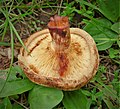 Brown Roll Rim. Paxillus involutus (45888983434).jpg 2.092 × 1.903; 914 KB
-
 Coat of Arms of Berwickshire County Council 1890-1975.svg 500 × 640; 225 KB
-
 Coat of Arms of Berwickshire District Council 1975-1996.svg 709 × 934; 369 KB
-
 Duns Market Garden, Berwickshire , After (4389181787).jpg 2.048 × 1.536; 2,19 MB
-
 Duns Market Garden, Berwickshire, Before (4389181789).jpg 640 × 480; 196 KB
-
 Flag of Berwickshire.svg 1.000 × 600; 33 KB
-
 Hazel catkins - Flickr - S. Rae.jpg 3.542 × 2.784; 3,07 MB
-
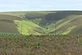 Heart Law and Short Crib Burn from Monynut Forest - Flickr - S. Rae.jpg 5.472 × 3.648; 8,66 MB
-
 Mimulus - Flickr - S. Rae.jpg 2.128 × 1.776; 1,13 MB
-
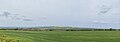 Panoramic Halidon Hill.jpg 5.415 × 1.917; 1,38 MB
-
 Proposed flag of Berwickshire (2023) - Design A.svg 1.000 × 600; 44 KB
-
 Proposed flag of Berwickshire (2023) - Design B.svg 1.000 × 600; 3 KB
-
 Proposed flag of Berwickshire (2023) - Design C.svg 1.000 × 600; 91 KB
-
 Proposed flag of Berwickshire (2023) - Design E.svg 1.000 × 600; 10 KB
-

-
 Upsettlington, Berwickshire - geograph-2029779.jpg 640 × 359; 75 KB


.jpg)


.jpg)
.jpg)


_-_Design_A.svg)
_-_Design_B.svg)
_-_Design_C.svg)
_-_Design_E.svg)

