Category:Maps of Angola
Jump to navigation
Jump to search
Countries of Africa: Algeria · Angola · Benin · Botswana · Burkina Faso · Burundi · Cameroon · Cape Verde · Central African Republic · Chad · Comoros · Democratic Republic of the Congo · Republic of the Congo · Djibouti · Egypt‡ · Equatorial Guinea · Eritrea · Eswatini · Ethiopia · Gabon · The Gambia · Ghana · Guinea · Guinea-Bissau · Ivory Coast · Kenya · Lesotho · Liberia · Libya · Madagascar · Malawi · Mali · Mauritania · Mauritius · Morocco · Mozambique · Namibia · Niger · Nigeria · Rwanda · São Tomé and Príncipe · Senegal · Seychelles · Sierra Leone · Somalia · South Africa · South Sudan · Sudan · Tanzania · Togo · Tunisia · Uganda · Zambia · Zimbabwe
Limited recognition: Ambazonia · Azawad · Puntland · Sahrawi Arab Democratic Republic · Somaliland – Other areas: Canary Islands · Ceuta · Madeira · Mayotte · Melilla · Réunion · Saint Helena, Ascension and Tristan da Cunha · Scattered Islands in the Indian Ocean · Western Sahara
‡: partly located in Africa
Wikimedia category | |||||
| Upload media | |||||
| Instance of | |||||
|---|---|---|---|---|---|
| Category combines topics | |||||
 | |||||
Subcategories
This category has the following 27 subcategories, out of 27 total.
!
B
- Maps of borders of Angola (5 F)
- Biogeographical maps of Angola (16 F)
C
D
E
- ECHO Daily Maps of Angola (16 F)
F
H
K
- Kunene-Sambesi-Expedition (1 F)
L
- Location maps of Angola (2 F)
M
O
- OpenStreetMap maps of Angola (1 F)
P
R
S
T
W
Pages in category "Maps of Angola"
The following 2 pages are in this category, out of 2 total.
Media in category "Maps of Angola"
The following 48 files are in this category, out of 48 total.
-
Admiralty Chart No 3206 Baie de Loango to Rio Lucunga, Published 1958.jpg 11,335 × 16,371; 42.33 MB
-
Angola Cassinga.svg 1,266 × 1,388; 618 KB
-
Angola Hydrogeology3.png 630 × 870; 37 KB
-
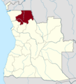
Angola Uige Province.png 547 × 600; 99 KB
-
Angola unita.png 326 × 351; 22 KB
-
Angola-Namibia-Border Locator.png 550 × 304; 68 KB
-
AngolaLanguageMap.png 5,837 × 6,023; 1.89 MB
-
Angolamap.png 497 × 522; 15 KB
-
Angolamap2.JPG 475 × 605; 13 KB
-
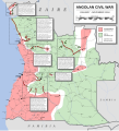
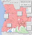
Angolan Civil War (December 12, 1975).svg 1,266 × 1,388; 762 KB
-
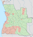
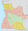
Angolan Civil War (December 1989 - May 1991).svg 2,500 × 2,740; 956 KB
-
Angolan Civil War (December 1992 -June 1993).svg 2,500 × 2,740; 950 KB
-
Angolan Civil War (February - August 1986).svg 2,500 × 2,740; 940 KB
-
Angolan Civil War (February 1980 - September 1981).svg 2,500 × 2,740; 889 KB
-
Angolan Civil War (January - March 1976).svg 2,500 × 2,740; 989 KB
-
Angolan Civil War (January - November 1994).svg 2,500 × 2,740; 987 KB
-
Angolan Civil War (January - October 1984).svg 2,500 × 2,740; 937 KB
-
Angolan Civil War (January 13, 1984).svg 1,266 × 1,388; 750 KB
-
Angolan Civil War (July - December 1993).svg 2,500 × 2,740; 947 KB
-
Angolan Civil War (March 8, 1993).svg 1,266 × 1,388; 789 KB
-
Angolan Civil War (May 1985 - February 1986).svg 2,500 × 2,740; 960 KB
-
Angolan Civil War (May 1987 - June 1988).svg 2,500 × 2,740; 973 KB
-
Angolan Civil War (October - December 1975).svg 2,500 × 2,740; 1,014 KB
-
Angolan Civil War (October 14, 1975).svg 1,266 × 1,388; 767 KB
-
Angolan Civil War (September 1981 - January 1984).svg 2,500 × 2,740; 958 KB
-
Angolan Civil War (September 2, 1981).svg 1,266 × 1,388; 751 KB
-
Base Map of Southern Africa.png 1,344 × 871; 381 KB
-
Battle of quifangondo.JPG 1,654 × 1,164; 229 KB
-
Benguela 13.40719E 12.57829S.jpg 1,280 × 958; 169 KB
-
Cabinda, R. Congo, D.R. Congo, Angola.png 380 × 370; 18 KB
-
Coffee in Angola.png 800 × 877; 162 KB
-
Huambo 14.24895E 12.54976S.jpg 1,280 × 958; 147 KB
-
Location Bié.PNG 361 × 363; 97 KB
-
Location of Angola - Benguela front.jpg 3,264 × 2,400; 2.19 MB
-
Map iona undp 2013.png 842 × 1,179; 1.55 MB
-
Mapa da Província Moxico.jpg 474 × 409; 21 KB
-
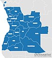
Mapa de Angola (OCHA).svg 255 × 255; 337 KB
-
Mapa de Angola representando a Aangosif.png 2,085 × 2,360; 241 KB
-
Mapa ferroviário de Angola.png 451 × 458; 32 KB
-
MAPAANGOLAv3.jpg 625 × 703; 57 KB
-
Planta Topográfica da Catumbela 1965.jpg 1,235 × 1,210; 165 KB
-
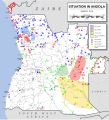
Situation in Angola (January 1975).svg 2,500 × 2,740; 907 KB
-
Situation in Angola (March 1975).svg 2,500 × 2,740; 970 KB
-
Soviet-supplied air defence systems in Angola.png 784 × 1,051; 78 KB
-
Taubenpost Kongo.jpg 1,813 × 1,193; 343 KB
-
Un-angola.png 2,349 × 2,947; 1.69 MB
-
WDspam@mapCats.png 226 × 652; 91 KB


