Category:Maps of South Sudan
Jump to navigation
Jump to search
Countries of Africa: Algeria · Angola · Benin · Botswana · Burkina Faso · Burundi · Cameroon · Cape Verde · Central African Republic · Chad · Comoros · Democratic Republic of the Congo · Republic of the Congo · Djibouti · Egypt‡ · Equatorial Guinea · Eritrea · Eswatini · Ethiopia · Gabon · The Gambia · Ghana · Guinea · Guinea-Bissau · Ivory Coast · Kenya · Lesotho · Liberia · Libya · Madagascar · Malawi · Mali · Mauritania · Mauritius · Morocco · Mozambique · Namibia · Niger · Nigeria · Rwanda · São Tomé and Príncipe · Senegal · Seychelles · Sierra Leone · Somalia · South Africa · South Sudan · Sudan · Tanzania · Togo · Tunisia · Uganda · Zambia · Zimbabwe
Limited recognition: Ambazonia · Azawad · Puntland · Sahrawi Arab Democratic Republic · Somaliland – Other areas: Canary Islands · Ceuta · Madeira · Mayotte · Melilla · Réunion · Saint Helena, Ascension and Tristan da Cunha · Scattered Islands in the Indian Ocean · Western Sahara
‡: partly located in Africa
Wikimedia category | |||||
| Upload media | |||||
| Instance of | |||||
|---|---|---|---|---|---|
| Category combines topics | |||||
 | |||||
This category includes maps of South Sudan.
Many other maps of Sudan including South Sudan – reflecting the state prior to the formal declaration of independence of South Sudan – can be found in Category:Maps of former Southern Sudan states.
Maps that need to be updated to include South Sudan borders are at Category:Maps needing South Sudan political boundaries
Subcategories
This category has the following 25 subcategories, out of 25 total.
B
D
E
- ECHO Daily Maps of South Sudan (40 F)
- Election maps of South Sudan (3 F)
F
G
H
I
L
M
O
R
- Recognition of South Sudan (9 F)
S
T
W
Pages in category "Maps of South Sudan"
This category contains only the following page.
Media in category "Maps of South Sudan"
The following 69 files are in this category, out of 69 total.
-
 SouthSudanOMC.png 1,083 × 800; 63 KB
-
 20150120 South Sudan Neighbouring Refugees IDPs Landscape A2.pdf 3,508 × 2,479; 333 KB
-
 20160412 ECHO SouthSudanCrises OK.pdf 1,754 × 1,239; 482 KB
-
 20160412 ECHO SouthSudanCrises OK.png 1,123 × 794; 419 KB
-
 20161111 Uganda Refugees from SouthSudan Final.pdf 1,754 × 1,239; 644 KB
-
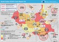
 20170403 SouthSudan Crisis v4.pdf 1,754 × 1,239; 698 KB
-
 20170403 SouthSudan Crisis v4.png 1,123 × 794; 943 KB
-
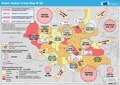
 20180116 SouthSudan CrisisRep55.pdf 1,754 × 1,239; 779 KB
-
 20180116 SouthSudan CrisisRep55.png 1,123 × 794; 963 KB
-
 20181120 SouthSudan Crisis Map59 II.pdf 1,754 × 1,239; 834 KB
-
 20181120 SouthSudan Crisis Map59 II.png 1,123 × 794; 956 KB
-
 20231108 GHoA Complex Humanitarian Crisi v5.pdf 1,754 × 1,239; 5.06 MB
-
 20231108 GHoA Complex Humanitarian Crisi v5.png 1,123 × 794; 1.05 MB
-
 AT0711 map.png 752 × 829; 29 KB
-
 AT0721 map.png 868 × 811; 29 KB
-
 Base Map of South Sudan.png 1,108 × 694; 197 KB
-
 Congo-Nile Divide3.jpg 1,399 × 669; 267 KB
-
 Dél-Szudán uralkodó vallásai.png 800 × 604; 167 KB
-
 ECDM 20130625 ECHOflash World Events.pdf 1,625 × 1,125; 294 KB
-
 ECDM 20131218 World Events.pdf 1,625 × 1,125; 323 KB
-
 ECDM 20131223 World Events.pdf 1,625 × 1,125; 337 KB
-
 ECDM 20140211 CentralAfrica ConflictsFloods.pdf 1,625 × 1,125; 960 KB
-
 ECDM 20140312 CAR SouthSudan.pdf 1,625 × 1,125; 912 KB
-
 ECDM 20140506 World Events.pdf 1,625 × 1,125; 422 KB
-
 ECDM 20140603 World Events.pdf 1,625 × 1,125; 400 KB
-
 ECDM 20140606 World Events.pdf 1,625 × 1,125; 501 KB
-
 ECDM 20140819 World Events.pdf 1,625 × 1,125; 377 KB
-
 ECDM 20140909 World Events.pdf 1,625 × 1,125; 389 KB
-
 ECDM 20140923 World Events.pdf 1,625 × 1,125; 322 KB
-
 ECDM 20140924 World Events.pdf 1,625 × 1,125; 718 KB
-
 ECDM 20141111 World Events.pdf 1,625 × 1,125; 792 KB
-
 ECDM 20150210 World Events.pdf 1,625 × 1,125; 446 KB
-
 ECDM 20150424 World Events.pdf 1,625 × 1,125; 514 KB
-
 ECDM 20150624 World Events.pdf 1,625 × 1,125; 495 KB
-
 ECDM 20150929 Worldevents.pdf 1,625 × 1,125; 459 KB
-
 ECDM 20160712 World events.pdf 1,625 × 1,125; 893 KB
-
 ECDM 20160718 World events.pdf 1,625 × 1,125; 870 KB
-
 ECDM 20160812 Uganda Refugees.pdf 1,754 × 1,239; 626 KB
-
 ECDM 20180322 DRC IDPs-Refugees.pdf 1,754 × 1,239; 1,017 KB
-
 ECDM 20180917 Ethiopia South-Sudanese-Refugees.pdf 1,754 × 1,239; 511 KB
-
 ECDM 20181011 Sudan Crisis.pdf 1,754 × 1,239; 912 KB
-
 ECHO South Sudan Editable A4 Landscape.pdf 1,754 × 1,239; 226 KB
-
 ECHO South Sudan Editable A4 Landscape.png 1,123 × 794; 201 KB
-
 Etnias de Sudán del Sur.jpg 2,000 × 1,511; 516 KB
-
 FLII SouthSudan.png 1,219 × 868; 465 KB
-
 Karte Südsudan Bundesstaaten.png 1,500 × 1,133; 189 KB
-
 Map of Sudanese Bishoprics.png 330 × 353; 26 KB
-
 Mapa Sudan del Sud.jpg 248 × 204; 19 KB
-
 Namoronhang dins lo Sodan del Sud.png 423 × 315; 5 KB
-
 Oil fields and infrastructure in Sudan and South Sudan.png 576 × 764; 82 KB
-
 Pojulu Tribe location.png 918 × 524; 107 KB
-
 Priznaniye nezavisimosti Yujnogo Sudana.png 1,425 × 625; 64 KB
-
 Railways in Southern Sudan.svg 600 × 330; 173 KB
-
 Ruweng State Map.jpg 556 × 720; 118 KB
-
 Shilluk land area in South Sudan.svg 282 × 363; 224 KB
-
 South Sudan - Displacement snapshot as of March 2017.png 2,000 × 1,545; 2.41 MB
-
 South Sudan Oil Concessions.svg 609 × 459; 92 KB
-
 South Sudan sat.jpg 1,464 × 1,099; 349 KB
-
 South Sudan Unity State - Detailed Transport Map Jan 2013.pdf 3,506 × 4,966; 6.82 MB
-
 South-sudan-political-map.jpg 4,000 × 2,967; 2.93 MB
-
 Southern Sudanese independence referendum, 2011.jpg 637 × 825; 83 KB
-
 Southsudan states by HDI.png 1,127 × 775; 49 KB
-
 SouthSudan-ar.jpg 1,273 × 901; 278 KB
-
 SouthSudan.jpg 1,273 × 901; 227 KB
-
 Sudan and South Sudan.png 1,500 × 1,195; 92 KB
-
 Twic East County map.jpg 810 × 553; 106 KB
-
 UNMISS September 2020.pdf 1,650 × 1,275; 748 KB
-
 AT0705 map.png 1,336 × 844; 54 KB
-
 AT0712 map.png 1,355 × 764; 46 KB


