Category:Maps of Sudan
Jump to navigation
Jump to search
Countries of Africa: Algeria · Angola · Benin · Botswana · Burkina Faso · Burundi · Cameroon · Cape Verde · Central African Republic · Chad · Comoros · Democratic Republic of the Congo · Republic of the Congo · Djibouti · Egypt‡ · Equatorial Guinea · Eritrea · Eswatini · Ethiopia · Gabon · The Gambia · Ghana · Guinea · Guinea-Bissau · Ivory Coast · Kenya · Lesotho · Liberia · Libya · Madagascar · Malawi · Mali · Mauritania · Mauritius · Morocco · Mozambique · Namibia · Niger · Nigeria · Rwanda · São Tomé and Príncipe · Senegal · Seychelles · Sierra Leone · Somalia · South Africa · South Sudan · Sudan · Tanzania · Togo · Tunisia · Uganda · Zambia · Zimbabwe
Limited recognition: Ambazonia · Azawad · Puntland · Sahrawi Arab Democratic Republic · Somaliland – Other areas: Canary Islands · Ceuta · Madeira · Mayotte · Melilla · Réunion · Saint Helena, Ascension and Tristan da Cunha · Scattered Islands in the Indian Ocean · Western Sahara
‡: partly located in Africa
Wikimedia category | |||||
| Upload media | |||||
| Instance of | |||||
|---|---|---|---|---|---|
| Category combines topics | |||||
 | |||||
Maps of Sudan.
Subcategories
This category has the following 27 subcategories, out of 27 total.
+
-
- Blank maps of Sudan (8 F)
B
C
- CIA World Factbook maps of Sudan (12 F)
D
E
- ECHO Daily Maps of Sudan (35 F)
G
- Geological maps of Sudan (4 F)
H
I
- Insolation maps of Sudan (3 F)
L
M
O
- OpenStreetMap maps of Sudan (1 F)
P
R
S
T
- Transport maps of Sudan (7 F)
W
Pages in category "Maps of Sudan"
The following 2 pages are in this category, out of 2 total.
Media in category "Maps of Sudan"
The following 119 files are in this category, out of 119 total.
-
 SudanAfterSplitOMC.png 1,360 × 1,255; 120 KB
-
 2013 DOR Map via ID 300 dpi.pdf 1,752 × 1,239; 3.6 MB
-
 20150120 South Sudan Neighbouring Refugees IDPs Landscape A2.pdf 3,508 × 2,479; 333 KB
-
 20151015 Sudan Partners 2015.pdf 1,754 × 1,239; 591 KB
-
 20151015 Sudan Partners 2015.png 1,123 × 794; 670 KB
-
 20170608 SouthSudan Crisis.pdf 1,754 × 1,239; 712 KB
-
 20180118 DailyMap SouthSudan.pdf 1,754 × 1,239; 792 KB
-
 20201020 Sudan Intervention Oct2020.pdf 1,754 × 1,239; 817 KB
-
 20201020 Sudan Intervention Oct2020.png 1,123 × 794; 755 KB
-
 20210129 Sudan Ongoing ECHO interventions.pdf 1,754 × 1,239; 698 KB
-
 20210129 Sudan Ongoing ECHO interventions.png 1,123 × 794; 602 KB
-
 20231108 GHoA Complex Humanitarian Crisi v5.pdf 1,754 × 1,239; 5.06 MB
-
 20231108 GHoA Complex Humanitarian Crisi v5.png 1,123 × 794; 1.05 MB
-
 20240110 Sudan pop displ since 15Apr 23.png 3,508 × 2,481; 6.35 MB
-
 24th meridian Sudan.png 330 × 260; 46 KB
-
 Affiche 7 À jamais, pour toujours Fr.jpg 500 × 750; 95 KB
-
 Al-Bahr al-ahmar, Sudan districts consecutively numbered.png 3,198 × 3,510; 532 KB
-
 Anglo-Egyptian Sudan - DPLA - 29439fea23b23b60ceaea37e2c012da2.jpg 8,412 × 12,633; 12.61 MB
-
 ARCHAEOLOGICAL MAP OF SUDAN -SUDAN NATIONAL MUSEUM.jpg 1,944 × 2,592; 1.36 MB
-
 Baedeker1914EgyptSudan OmdurmanAbuRuf.jpg 398 × 553; 194 KB
-
 Base Map of Sudan.png 1,112 × 704; 645 KB
-
 BawCrater.png 4,810 × 4,810; 12.4 MB
-
 Bir Tawil Satmap.png 1,185 × 383; 431 KB
-
 Butana area of Sudan.jpg 3,203 × 2,805; 6.39 MB
-
 ChadSudanCARtripoint.png 4,725 × 4,725; 16.58 MB
-
 Darfur, Sudan - Confirmed Damaged and Destroyed Villages, February 2003 - August 2009.png 1,100 × 1,419; 2.36 MB
-
 Dongola palace.png 765 × 966; 62 KB
-
 ECDM 2013 09 10 World ECHOFlashEvents.pdf 1,625 × 1,125; 556 KB
-
 ECDM 2013 12 03 World ECHOFlashEvents.pdf 1,625 × 1,125; 366 KB
-
 ECDM 20131204 World Events.pdf 1,625 × 1,125; 556 KB
-
 ECDM 20140221 CentralandHornAfrica ConflictDisplacement.pdf 1,625 × 1,125; 713 KB
-
 ECDM 20140304 World FLASHEvents.pdf 1,625 × 1,125; 566 KB
-
 ECDM 20140603 World Events.pdf 1,625 × 1,125; 400 KB
-
 ECDM 20140701 Sudan SouthSudan HumanitarianSituation.pdf 1,625 × 1,125; 787 KB
-
 ECDM 20140814 World Events.pdf 1,625 × 1,125; 386 KB
-
 ECDM 20140909 World Events.pdf 1,625 × 1,125; 389 KB
-
 ECDM 20140923 World Events.pdf 1,625 × 1,125; 322 KB
-
 ECDM 20150210 World Events.pdf 1,625 × 1,125; 446 KB
-
 ECDM 20150211 SouthSudan.pdf 1,625 × 1,125; 824 KB
-
 ECDM 20150624 World Events.pdf 1,625 × 1,125; 495 KB
-
 ECDM 20150709 SouthSudanCrisis.pdf 1,754 × 1,239; 355 KB
-
 ECDM 20150820 World Events.pdf 1,625 × 1,125; 453 KB
-
 ECDM 20151210 SouthSudan.pdf 1,625 × 1,125; 822 KB
-
 ECDM 20180601 SouthSudan Crisis.pdf 1,754 × 1,239; 827 KB
-
 ECDM 20220719 CE ECHO Sudan.pdf 1,754 × 1,239; 638 KB
-
 ECDM 20230505 DM Sudan Conflict.pdf 1,752 × 1,239; 1.03 MB
-
 ECHO Sudan Editable A4 Landscape.pdf 1,754 × 1,239; 469 KB
-
 ECHO Sudan Editable A4 Landscape.png 1,123 × 794; 686 KB
-
 Falasha migration (german).png 900 × 791; 330 KB
-
 Flag map of Sudan (With disputed territories).svg 2,237 × 1,991; 67 KB
-
 FLII Sudan.png 1,319 × 804; 26 KB
-
 Gallabat and Metemma Map.jpg 284 × 177; 10 KB
-
 Kafouri.JPG 3,782 × 2,048; 792 KB
-
 Konfliktregion Sudan.png 1,000 × 1,182; 279 KB
-
 Map Equatoria-Sudan.png 431 × 512; 59 KB
-
 Map of Abyei Area en.png 1,534 × 871; 218 KB
-
 Map of Abyei Area ru.png 1,534 × 871; 219 KB
-
 Map of East Africa and the approximate locations of eight populations.jpg 926 × 1,116; 91 KB
-
 Map of Kafia Kingi Area en.png 1,534 × 871; 217 KB
-
 Map of Kafia Kingi Area ru.png 1,534 × 871; 217 KB
-
 Map of Sudan (New).jpg 646 × 583; 355 KB
-
 Map of Sudanese Bishoprics.png 330 × 353; 26 KB
-
 Map-Escape route.png 2,550 × 3,300; 345 KB
-
 Marrah Mountains.png 3,240 × 3,240; 8.23 MB
-
 Meidob volcanic field.png 4,895 × 4,895; 32.99 MB
-
 Mellit field (SUDAN).png 6,393 × 4,016; 28.94 MB
-
 Migración de tribus árabes hacia Sudán, siglos XIV-XV.jpg 818 × 674; 260 KB
-
 Oil fields and infrastructure in Sudan and South Sudan.png 576 × 764; 82 KB
-
 Population density of Sudan provinces (2012) - per square kilometer.png 5,604 × 4,873; 689 KB
-
 Sodan - Clima.png 752 × 767; 146 KB
-
 Sodan - Periòde coloniau (1920).png 751 × 777; 117 KB
-
 Sodan - Segonda Guèrra Civila (1997-1998).png 721 × 894; 154 KB
-
 Southern Sudanese independence referendum, 2011.jpg 637 × 825; 83 KB
-
 States of Sudan.PNG 599 × 535; 41 KB
-
 Sudan - DPLA - 60840f52758b25ca5207195d84f410ae.jpg 2,558 × 3,284; 5.6 MB
-
 Sudan - DPLA - 75d8b7074e7bb4c657c2c41131ac2a1f.jpg 2,556 × 3,276; 6.46 MB
-
 Sudan - DPLA - 863966b1119900c42761f47caac0e785.jpg 2,552 × 3,274; 5.35 MB
-
 Sudan - DPLA - c3f0905320ffda69f4d0c060359235af.jpg 2,460 × 3,126; 6.16 MB
-
 Sudan and South Sudan.png 1,500 × 1,195; 92 KB
-
 Sudan Hydrogeology4.png 642 × 923; 40 KB
-
 Sudan map.jpg 2,848 × 4,288; 1.3 MB
-
 Sudan- Population and Administrative Divisions - DPLA - 0e0fc53648af68bb562257c8a8b66e29.jpg 2,538 × 3,256; 6.28 MB
-
 Sudan-karte-politisch-1991.png 539 × 652; 217 KB
-
 Sudan-karte-politisch-aali-an-nil.png 624 × 411; 190 KB
-
 Sudan-karte-politisch-aequatoria.png 624 × 411; 198 KB
-
 Sudan-karte-politisch-al-bahr-al-ahmar.png 624 × 411; 155 KB
-
 Sudan-karte-politisch-al-buhairat.png 624 × 411; 199 KB
-
 Sudan-karte-politisch-al-chartum.png 624 × 411; 172 KB
-
 Sudan-karte-politisch-al-dschadzira.png 624 × 411; 172 KB
-
 Sudan-karte-politisch-al-dschazira.png 624 × 411; 172 KB
-
 Sudan-karte-politisch-al-istiwaiyya-al-wusta.png 624 × 411; 199 KB
-
 Sudan-karte-politisch-al-wahda.png 624 × 411; 199 KB
-
 Sudan-karte-politisch-an-nil-al-abyad.png 624 × 411; 190 KB
-
 Sudan-karte-politisch-an-nil-al-azraq.png 624 × 411; 190 KB
-
 Sudan-karte-politisch-asch-schamaliyya.png 624 × 411; 155 KB
-
 Sudan-karte-politisch-bahr-al-ghazal.png 624 × 411; 199 KB
-
 Sudan-karte-politisch-dschanub-kurdufan.png 624 × 411; 190 KB
-
 Sudan-karte-politisch-dschunqali.png 624 × 411; 199 KB
-
 Sudan-karte-politisch-gharb-al-istiwaiyya.png 624 × 411; 199 KB
-
 Sudan-karte-politisch-gharb-darfur.png 624 × 411; 190 KB
-
 Sudan-karte-politisch-gharb-kurdufan.png 624 × 411; 190 KB
-
 Sudan-karte-politisch-kassala.png 624 × 411; 172 KB
-
 Sudan-karte-politisch-kurdufan.png 539 × 652; 261 KB
-
 Sudan-karte-politisch-nahr-an-nil.png 624 × 411; 155 KB
-
 Sudan-karte-politisch-sannar.png 624 × 411; 190 KB
-
 Sudan-karte-politisch-schamal-bahr-al-ghazal.png 624 × 411; 199 KB
-
 Sudan-karte-politisch-schamal-darfur.png 624 × 411; 172 KB
-
 Sudan-karte-politisch-schamal-kurdufan.png 624 × 411; 172 KB
-
 Sudan-karte-politisch-warab.png 624 × 411; 199 KB
-
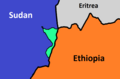 The al-Fashaga Triangle.png 832 × 546; 14 KB
-
 Tofrek Map.jpg 290 × 381; 40 KB
-
 USAID 2001 SudanOil&GasConcessionsMap UTexLib.jpg 1,093 × 1,379; 401 KB
-
 Uweinat de.png 3,600 × 2,400; 1.43 MB
-
 Uweinat en.png 9,894 × 9,894; 51.82 MB
-
 Uweinat fr.png 3,600 × 2,400; 1.43 MB
-
 Uweinat.png 3,600 × 3,600; 7.08 MB
-
 War in Sudan (2024).svg 1,654 × 1,453; 874 KB
-
 AT0705 map.png 1,336 × 844; 54 KB
-
 苏丹石油图.jpg 2,550 × 2,835; 757 KB


.png)
.svg)


.jpg)


.png)


_-_per_square_kilometer.png)

.png)
.png)


.svg)

